Parking can be found near the causeway that leads to Eriskay and luckily for me as I headed west the tide was out. Unfortunately I had on mountain boots, wellingtons would be a far better option here.
The island nearest the causeway is supposed to have a cairn, sadly after a good look on the small grass area I found nothing that looked prehistoric.
Further west is another island which does have a cairn, which can be seen. Between the two islands is a sea of seaweed and mud, I had on the completely wrong footwear so didn't chance going further on.
What can be seen is a grass covered cairn that is nearly 7m wide, being almost 0.5 tall.
I made my way back to car via climbing up the side of the causeway. Long legs are a great help.
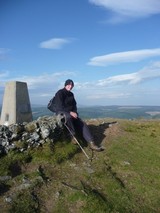
Visited 06/08/2023.
|
Also known as The Limpet Hammers, these two fallen standing stones can be found by simply walking straight south and uphill from the The Witches Grave chamber cairn. (or aim for the turbine)
The stone on the west is almost 4m long, the stone on the east nearly 3.5m long. There is also another stone which resembles a small boat, Canmore suggests it might possibly be a capstone, rocking stone or along with the other two stones formed part of the stone circle. Seems unlikely as no cairn material can be seen.
However, the two stones that stood might have been outliers for The Witches Grave and the chamber cairn at Dun Trossary.
Worth a visit if only for the view, and to see incoming rain squalls.
Visited 06/08/2023.
|
The Witches Grave is a beautiful site in a beautiful location and came as a complete surprise, I'd expected another Trossary. Walking from the church I headed south on B888 and jumped the fence when just about level with the turbine. Head east up the hill, jump a few fences and the remains of the chamber will soon be visible.
To the north east is Loch Aisebhat, straight north is Dun Trossary (near the odd shaped church) and to the east is Coire Bhienn.
Almost all of the cairn material has been removed, a sizeable footprint remains with one or two stones suggesting kerbs. As for the chamber four uprights remain and they are impressive, to me, despite its reasonably small size.
Well worth a look.
Visited 06/08/2023.
|
I also headed for the odd shaped church and head up the small hill to the badly trashed cairn. Very dry on my visit.
One real feature remains, a standing stone which looks like it will one day as it stands at a precarious angle. Other stones might belong to the site, they might not. Sadly the site has been houked, built on and damaged almost beyond recognition.
However, one thing they couldn't remove was the view to Eriskay, and perhaps more importantly Barra as the prehistoric folks, like islanders nowadays, rely heavily on water transport. Probably the older methods lasted longer than the mechanics of their modern counterparts.
A pity, but worth a wee look.
Visited 06/08/2023.
|
A much smaller crannog that its near neighbour this crannog is only 10m wide and has also been called a low cairn crannog.
No visible causeway so short walk heading west, through a wee bog, jump a couple of fences / dry stane dykes to get a better view.
Visited 06/08/2023.
|
An early morning start and the beautiful calm waters of the loch at South Baghasdal. The crannog, also called Loch An Eilean, nearest the shore has a decent causeway, 20m in length, poking through the water.
Being 30m wide later peoples used the crannog for probable sheep pens and a possible blackhouse. However a survey carried out in 2022 suggests that this site is much older, probably neolithic.
Heading south on the B888 from Daliburgh take the fourth minor road heading west, just before Trossary and stop at the first loch. (I approached from the north from North Baghasdal, our base camp so to speak)
Beautiful morning, great start to the day.
Visited 06/08/2023.
|
Taking the coastal route on the A855 from Portree to Uig we stopped to give the the souterrain at Kilvaxter another visit. It appears the entrance has narrowed as it seemed a tighter squeeze than my last visit.
The only thing to add to previous fieldnotes is that the site and surrounding area, including the nut circle, needs a good tidy up if it is to pull in a fair number of visitors.
Anyway, onto Uig and ferry to Lochmaddy.
Visited 05/08/2023.
|
Of the four sites this one probably has the best views of the dun, chamber cairn, cave, naust / canal, loch, mountains and sea. On our visit the sea, Camas a Mhurain - Gulf of the Sea, was an astonishing colour of blue.
The cairn sits at nearly 13m wide and is 1.1m tall. Lots of stonework can be seen poking through the well manicured turf, local greenkeepers do an excellent job. Decent kerbs can be seen situated around the site. Probably a lot of stones have been used in the building of the dyke which seperates the two cairns.
Now we made our way back to the main track via a route suggested by a site that promotes highland treks / walkways. This led us around the west of Carn Mor, there is no path of any kind, it goes near the top of cliffs and in parts is an ankle breaker. Take the main track back, we were mightily relieved to emerge unscathed back to the track along with the dog. That site will never be used again.
Apart from track malfunction everything at Rubh An Dunain was as perfect as perfect could be.
Great weather, great place.
Visited 04/08/2023.
|
From the dun we crossed the Viking-made canal via handily placed causeway and made our way round the sound side of Loch na h'Airde before heading north towards the cairns that are located in front of the small hill, Carn Mor.
As Mr G said this is an isolated place nowadays but it once appeared to be reasonably populated with the nearby dun, medieval townships and various Nordic visitors. Now the closest people are at Glen Brittle, the most regular visitors being sheep and cows along with people making the trek to the various sites.
The chambered cairn still sits at 20m wide and a good gentle tidy would reveal that a lot of it is still in place. Large slabs and some well built dry stanes remain in place. A gentle restoration would be wonderful to see but given the location, highly unlikely.
The view as ever remains glorious and we're lucky that we have made it on a beautiful clear day day which seemed unlikely given the previous nights dreich stuff.
Not far to the next site, a wee jump over a wall.
Visited 04/08/2023.
|
Following almost in Les's footsteps, diversions via a cave and the dog trying to find alternative routes, we eventually made it to the superb galleried dun at Rubh an Dunain.
With A being interested in nausts, this was a superb opportunity to closely look at both, with the cairns afterwards.
The Sound of Soay, Loch Brittle, The Cuillins and Loch na H'Airde along with the island of Rum provide wonderful backdrops to this lonely, but obviously not that lonely in past times, place.
The dun is galleried within its large wall along with a door check, rivalling those near Tayvallich. Sadly erosion will play a role here and perhaps has done so in the past, any surrounding wall has gone.
Entrance to the site is via a small climb up from the Viking canal. Turn round to see the the mountains - stunning.
Visited 04/08/2023.
|
First stop on our way to the famous dun, cairns and naust was the cave at Creag A' Chapuill. Parking is available near the Glen Brittle camp site. We were lucky, a beautiful day for a wonderful walk.
Discoveries have placed occupation or use of the cave around the same time as the cairns were built, finishing around the the completion of the dun. To me it had an appearance of a shop as flat topped rock at the entrance resembled a shop counter. It certainly had good views as the nearby prehistoric monuments as well as Loch na h'Airde can be seen to the west.
The shop idea might be close as various pottery and later iron slag were found at the site. Also found was an oar shaped piece of wood, to me it looked like the shape of a wooden tool I'd seen used at a demonstration at Archeolink beside Oyne, sadly now closed.
An interesting place. I headed south west from the path at the medieval MacAskill township, heading across a surprisingly dry valley, only a small stream to jump. The cave be seen from here so reasonably easy to find with the ascent to the site being fairly easy. However, cut across back to the main path as south of the cave is boggy when heading to the dun and cairns.
Wonderful views.
Visited 04/08/2023.
|
In what has been described as an old church, the remains of a stone circle is instead the remains of a much disturbed cairn some 17m wide and 0.5m high. Parts of the cairn can be spotted as a small bank in which several kerbs still remain. The large stone may have stood or it might simply have always been there.
From the standing stone at Clach Na h'Annait, I circled round Kilbride House in an anti clockwise direction, climbing one wall, then jumping the Allt Na Leth-Pheighinne stream, which by this time because of heavy rain seemed to be getting deeper and wider. Walk into the field, head straight west and look for the small trees. The site is most definitely next to edge of a former loch which I can verify is now very boggy.
After a good splash around it was back over the burn to walk back up the road to the car.
A bit of a 'what' if but a nice wee stop despite the dreich conditions.
Visited 03/08/2023.
|
Parking is available just beyond the track to Ashbank, near the minor road that leaves the B8083. From there I walked towards Kilbride House and simply opened a gate to walk to the standing stone, slightly to the east.
Clach na h'annait means 'Stone Of The Mother Church' and it stands at nearly 2.4m. The stone has faired much better than the church, it has long since vanished.
An impressive stone with atmosphere added by low clouds and rain.
Visited 03/08/2023.
|
Mr G's meandering sheep were visiting the cairn at the same time we meandered up to the same site. Still impressive amongst some of Scotland's best and rugged scenery.
There is something about driech misty days that seem to age a site, almost like in very old forests - the whole atmosphere changes.
The remains of the chamber, like dodgy teeth in a kerb cairn, are still in place and the impressive width, regardless of who put it there, shows how clever the builders were - they took advantage of what was there.
Happily I took more in than my last visit - playing at the 1986 Broadford Music Festival at the airstrip. A nice walk to clear the head.
I've been to Skye many times since so it was nice to go back down the Elgol road.
Visited 03/08/2023.
|
Plenty room to park to the north east of the cairn near the A890. As you come through the woods heading south, keep an eye on the west side of the road for remnants of the old single track main road. Park near the Allt Gleann Udalain Burn at a gate, this is indicated on the OS map.
From here its a sometimes boggy, sometimes a path but mainly turf covered route to the site, heading south west. Basically follow the main road.
The cairn is grass covered but stonework can be felt underfoot. It must have been huge as the footprint is at least 27m, despite the covering different levels can just about be seen. I thought it resembled a Wessex type cairn.
If you look back up the A890 you can see where to park. Spaces are further south but a deer fence and locked gates get in the way. Further up the gate can be opened.
Despite a murky day, great views of the nearby dam and surrounding hills.
Visited 03/08/2023.
|
After an unexpected email / phone call I was kindly invited to take a closer look at the cairn on Bervie Brow, gaining access onto the site. Previously high fences blocked the way as the cairn was in a military site, records show it was built in the 1930s remaining in use until 1985. Luckily there is a new owner. Luck was also on my side as the weather conditions were much improved than my last visit.
It still survives at approximately 16m wide and 1m high, there appears to be a decent footprint, plenty of cairn material underneath the vegetation. As usual the centre has been 'houked'. There also appears to be a hint of a kerb on the east. What a pity a concrete shelter clips the north side of the site.
Climbing onto the concrete shelter also gives superb views to Middle Know (fort) and Gourdon Hill (Long Cairn) to the south, to the west cairns, forts, RSCs standing stones etc etc etc, to north the coastline heads to Aberdeen and to the east, the North Sea.
However, the cairn might be in for a major change as it might be about to get a tidy up and perhaps some excavation work might happen.
Info will, of course, appear here.
Re-visited 15/06/2023
|
Long forgotten, Ellon Stone Circle is still 'on the go' but has been moved 50m south thanks to the building of houses.
Parking is no problem as you can park at the supermarket, one that rhymes with Baldi. Walk west a few meters west along the path until the first bench, no teddy bear sitting on my visit. (Canmore had a helpful teddy) Then walk south, if you can, only a few meters.
This was difficult to find because of head high weeds, grass etc etc. After a good 30 minutes of tramping and passers by thinking I'd gone mad, the circle was revealed.
Apparently there was 5 stones in the original circle, there are suggestions that even two of these might be from somewhere else, just to add to the confusion another stone has been added.
It's amazing to think that many people passing knew nothing about the site, but three people did know about the stones and were delighted to see them. Most knew about Pinkie Park, the name of the area along this stretch of the River Ythan, also the area gives the alternative name to the site - The Pinkie Stones.
Weed killing on a very hot day.
Visited 13/06/2023.
|
Right next to the road, just north east from Glennan and its various sites. Fantastic stones, oh for the re-erection of the very tall fallen stone.
Plenty cairns nearby, so my feet will visit this area again in the reasonably near future.
Visited 07/04/2023.
|
A wee jump from the bigger next door cairn will see you land on a cairn that is over 6.5m wide and almost 1m in height. Also like its neighbour there has been some houking to the centre. Hints of a kerb remain.
Overlooked by most, but another part of this countryside's jigsaw.
Visited 07/04/2023.
|
Straight up the track from the road and you'll walk straight into the standing stone. It appears to have been included in a ruined dry stane dyke, which will be very old as well.
Superb views for this 2.2m tall stone, plenty sites nearby for the next visit.
Visited 07/04/2023.
|
|
Still doing the music, following that team and getting lost in the hills! (Some Simple Minds, Glasvegas, Athlete, George Harrison, Empire Of The Sun, Riverside, Porcupine Tree, Nazareth, The Avalanches, Public Service Broadcasting on the headphones, good boots and sticks, away I go!)
Turriff, Aberdeenshire
https://www.thedeleriumtrees.com/
|