|
Friday 27/8/04
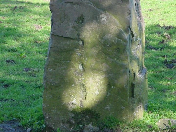
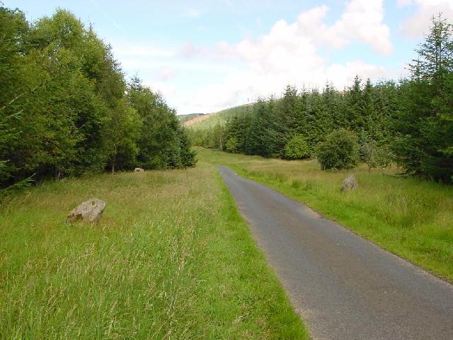
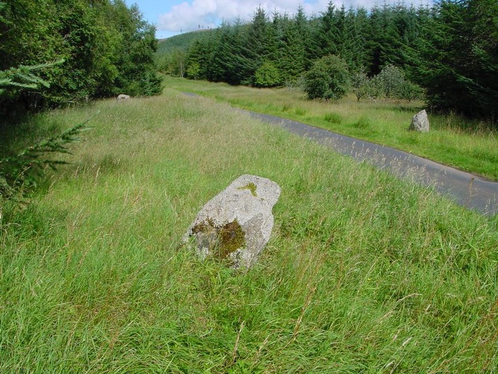
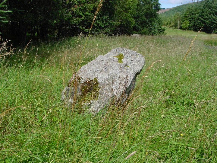
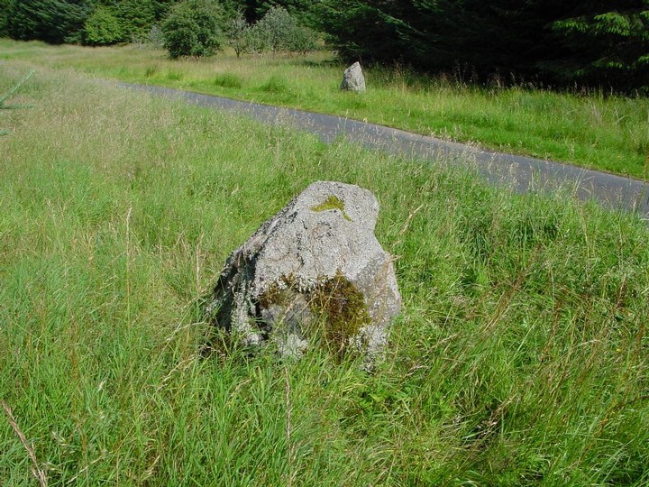
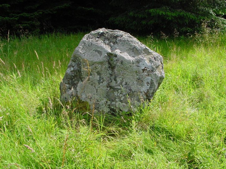
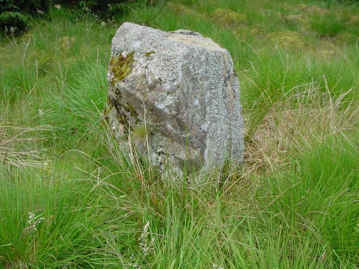
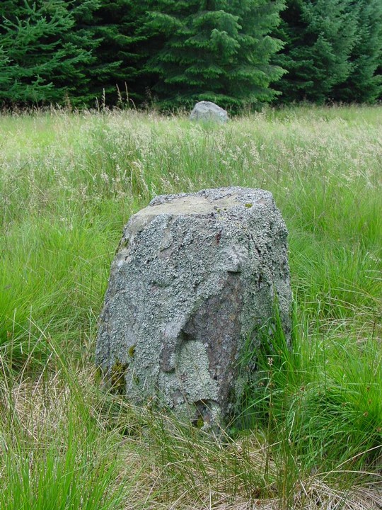
A kilometre SW from Bruntaburn standing stone is another- but this one is not marked on the 1:25000 OS map- dunno why- it's a big as Bruntaburn. Almost square in section the sides are aligned approximately NE/SW. It's 1.8 m high and about 1 m square. The W side has two holes drilled as it looks like it was used as a fence post sometime in the past. There is no note in the RC notes though of a series of four vertical holes/hollows on the E side. Making my way back to the road I meet with two women on horseback who stay here. They tell me about the other stones in the vicinity and note that they feel this place to be magickal- 'it's as if someone is watching you all the time you are out here'. It's true- this tiny lane and the country about it has a certain forgotten otherworldliness feel to it.
|
    
|
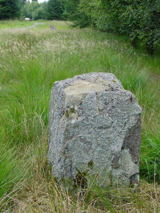
Friday 27/8/04
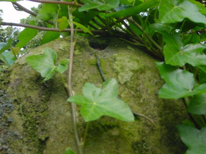
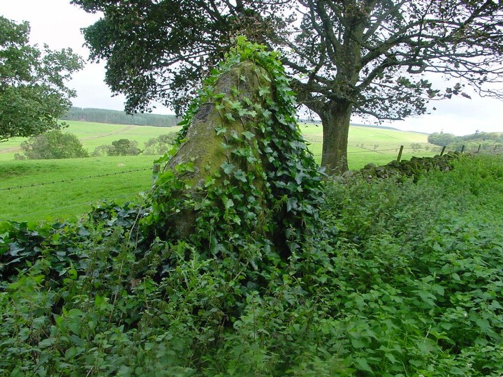
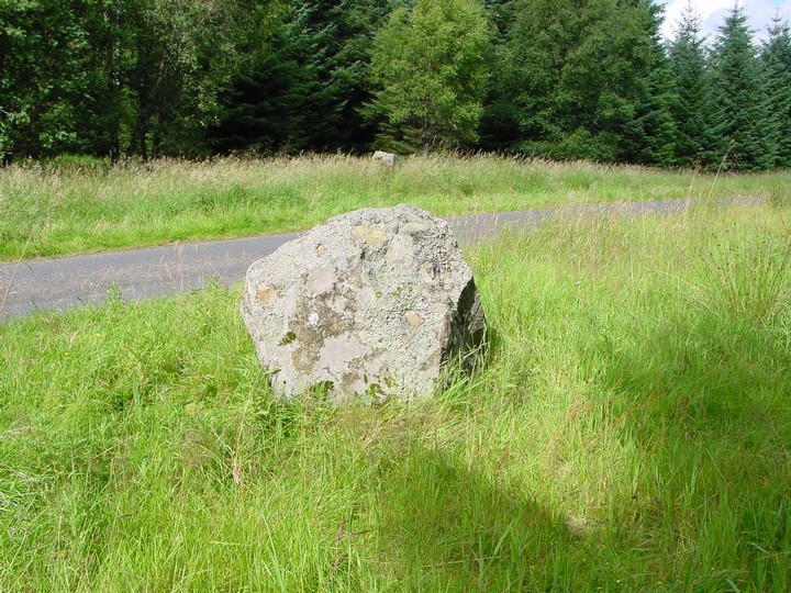
A great country road leads you to this stone- there are elaborate stone arches across the road in two places- one almost completely covered in ivy. As is this standing stone- especially the NE side. According to the notes from the RCAHMS I have with me this stone was not noted by RC surveyors in 1980. It may be partly ivy covered, but they couldn't have looked very far as it's about 2 m high and almost 1.5 m wide at base (and about 55 cm thick). It's aligned NE/SW and there's a natural cup mark on the top. The E face of the stone is almost flat, the W side is curved slightly.
|
          
|
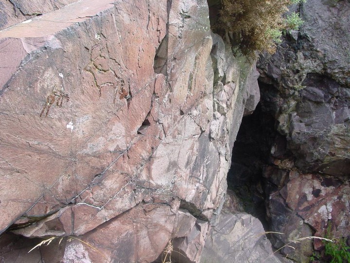
Tuesday 24/8/04
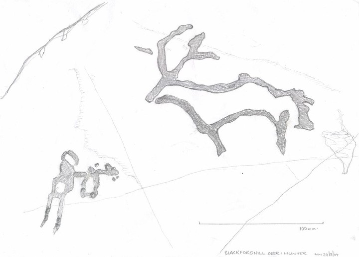
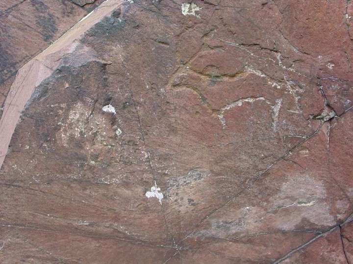
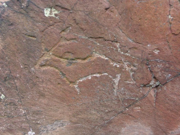
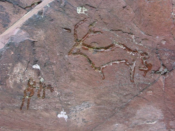
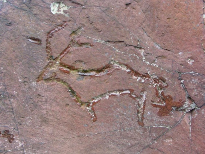
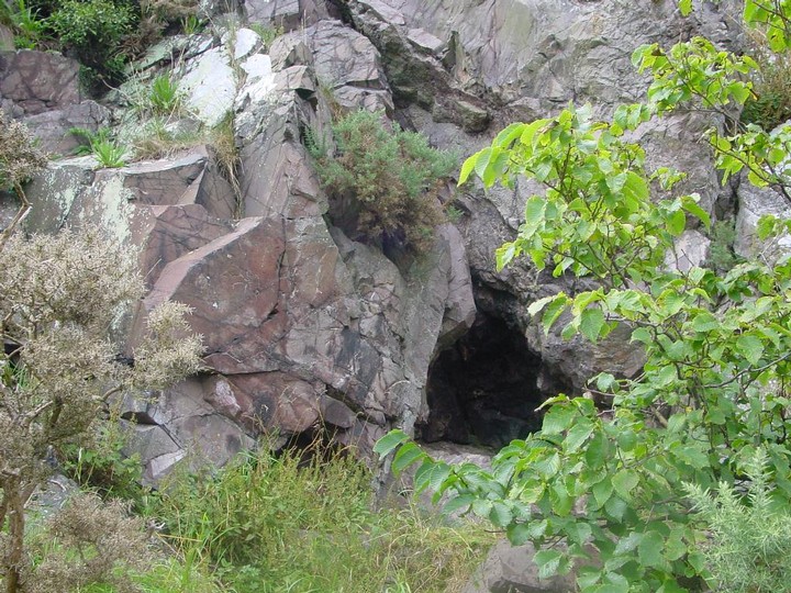
Another steep and tricky cliff face- another site! It's a bit of a scramble up here over slippy grass, scree, through gorse and stinging nettle. I'm back up here with the digi cam to take some decent pics and also some measurements- especially of the 'hunter' figure. The deer was only rediscovered in 1996, but no mention was made of the human figure only 3 cm to the left of it. To be fair- the deer is very prominent compared to the human, but the latter is definitely pecked from the rock using the same technique as the deer. The deer is 145 mm long by 107 mm high. The horns are 47 and 45 mm long. The human 'hunter' figure (which is 21 mm to the left of the nose of the deer) is 17 mm wide by 68 mm high with legs 30 mm long. It appears to be holding a weapon of sorts on its left side- possibly a representation of a bow and arrow, this being 37 mm long.
Just about 1.1 m to the right of the carving there's a crevice in the cliff face and a crack forming a natural chimney- indeed the rocks in the crevice are blackened with carbon and soot. At the base of the rock with the carving is a horizontal slab approximately 80 cm by 1 m to sit perched on the cliff. I guess it's impossible to date such a carving, but this place has a very ancient feel to it- the deer and hunter carving, the fire shelter, the perch high up on a cliff…
|

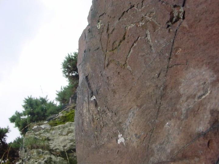
18/7/02
On an extremely muggy and warm lunchtime I find myself on the stone perch next to the deer having lunch and admiring the fantastic view. I took the path round the base of the hill this time and straight up to here- very tricky as it's mostly slidy scree. Only stopped on my way up here to sample the very good wild raspberries growing all over the place. I was having a re-check of the carving- it's on an almost lozenge shaped rock about 75X32 cm forming part of a small cliff rising to about 2 m by about 1.5 m wide. The deer is pecked from the rock and in recognising this I notice something so obvious that I missed it on my last visit- just to the left there is what appears to be a humanoid figure- bloody hell! It's not as deeply carved as the deer though. I have a good survey of all the rock faces around the cliff- but no more carvings.
|
7/7/02
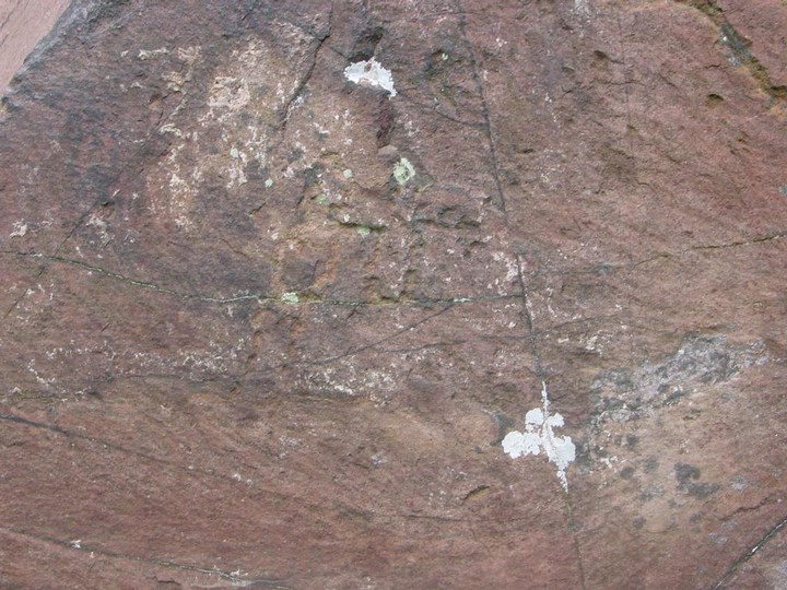
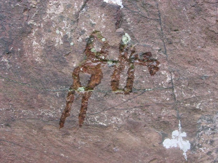
Not the easiest to find- the GPS was about 6 m off, but I found the tiny creature on a slab of red rock looking SW across the Braid Hills. I was expecting something Pictish, but this looks far, far more primitive. There's lichen growing in the actual carving so it's definitely not recent (not that it looks in any way modern).
|
    
|
It has been reported that the present position of this stone is not the original, but it may possibly have been removed from the adjacent field which is locally known as the "Stannin' Stane Field".
(RCAHMS 1956)
|
Friday 20/8/04
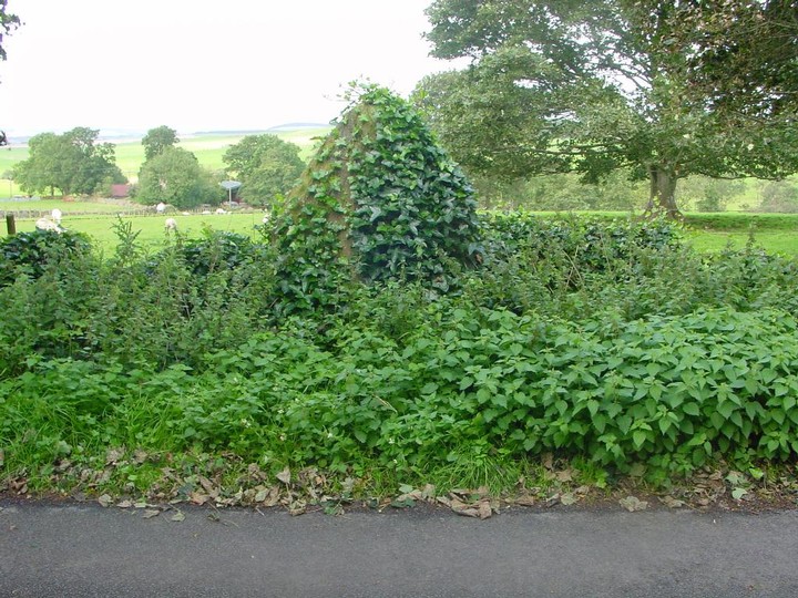
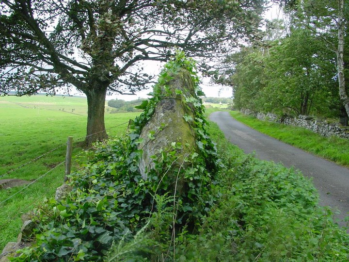
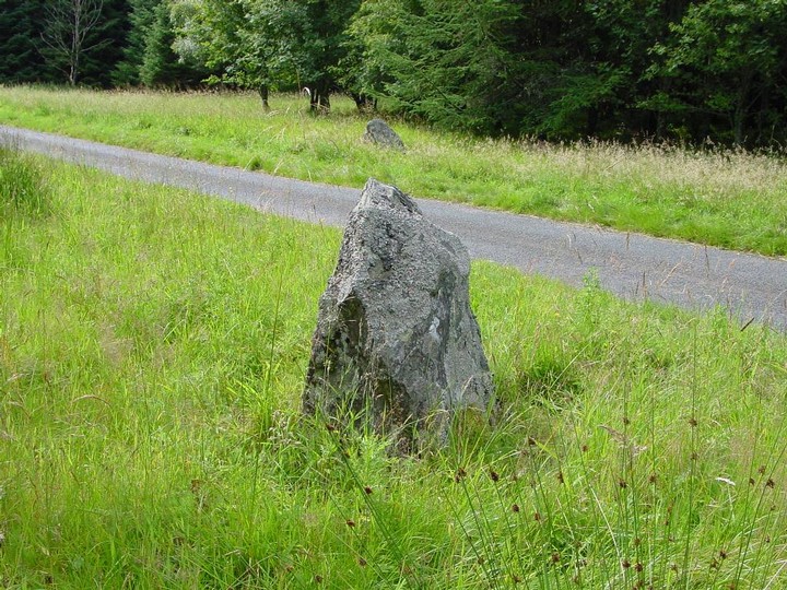
Just a short walk from the rather good Harestanes visitors centre and just off the St. Cuthbert's Way path. A drive leads off from the country road up to Woodside house and the standing stone is apparently in the small wood on the left- we walk up the drive, but no sign, down again and I spot, just peaking out through the thick vegetation- the top of the monolith. It ain't gonna be easy getting to it though- the plant life is thick and nasty looking, but I think I see a line through it. Well- between me and the stone there's a small burn and the sides drop down into it- it's down there that the stinging nettles are over 6 foot tall and the brambles are around waist height. They are also old which means the thorns are thick and real sharp- it's slow going but I keep pressing on through it- my legs are ripped to shreds and stung to bits- mebbe a bad idea to attempt this in shorts! Eventually I am beside a thick and bulky stone. It's almost 90 cm square and not much higher at about 1.3 m.
After all that- turns out that there's an easier way to get here- through a gate off the drive and up through a field to the west of the stone- I return to the road this way…
|

|
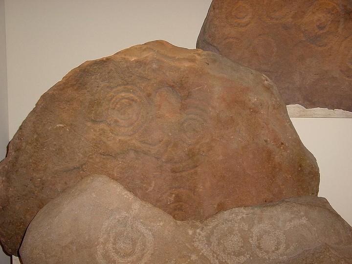
Now in the National Museum of Scotland.
From the RCAHMS 1967;
A ring-marked slab of red sandstone, 2ft 6ins by 1ft 10ins by c.4ins thick, discovered in a bank of gravel (J Y Simpson 1868) (gravel pit (Proc Soc Antiq Scot 1870)) at Lamancha, was presented to the National Museum of Antiquities of Scotland (NMAS Accession no: IA6) in 1867.
Some other large stones found nearby suggested to Simpson that the site may have been sepulchral but there is no evidence that it formed part of a Bronze Age cist (E McWhite 1946). The stone bears an unusual group of markings, all pecked, including single and double rings and an area of punch-marks.
|

|
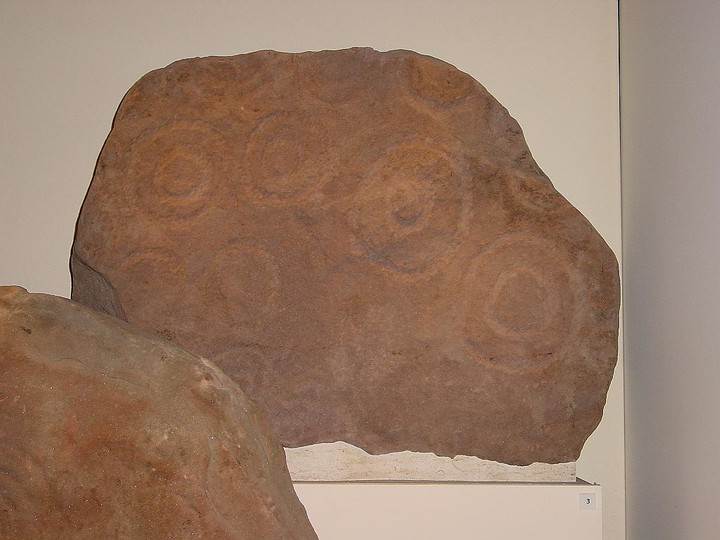
Description of original cairn from which the cup and ring marked slab formed the capstone;
RCAHMS 1978
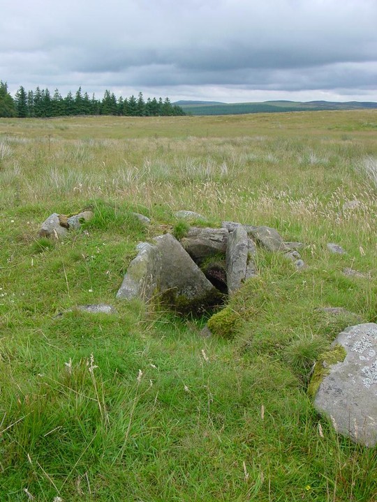
A small cairn which formerly stood a short distance N of the steading of Wester Yardhouses was destroyed about 1870. It is said (D R Rankin 1875) to have measured about 6.4m in circumference, and would thus appear to have been close to the average size of cairns in the concentrations noted in the vicinity.
The cairn contained a short cist, aligned N-S, which was constructed of four slabs and had a capstone decorated on its underside. No traces of any skeletal remains were observed, the only recorded find being a beaker, of ? N 2 (L) type (D L Clarke 1970), which was broken soon
after removal. The capstone measures about 1.2m by 1.0m, and bears a remarkable series of curvilinear and triangular designs. These motifs belong to what has become known as the 'Passage-grave' style, which was in use in Ireland by the middle of the third millenium BC. The carvings were not executed by those who erected the cairn, for portions of some of the designs were destroyed when the stone was trimmed for re-use in the cist. The capstone and a fragment of the beaker are preserved in the National Museum of Antiquities of Scotland (NMAS Accession nos EQ 165, 166).
Some time before the destruction of the above cairn, a number of cairns were removed, apparently from the same general area, without any artifacts being found although it was noted that the earth beneath the cairns was red in colour. This discoloration was said not to occur anywhere else in the vicinity and was probably the result of burning, evidence for which has frequently been found during the excavation of broadly similar small cairns elsewhere.
OS 1971;
No traces of any cairns were seen in the area N of Wester Yardhouses.
|

|
| |