The Modern Antiquarian. Stone Circles, Ancient Sites, Neolithic Monuments, Ancient Monuments, Prehistoric Sites, Megalithic MysteriesThe Modern Antiquarian

Get the TMA Images feed
David Raven's Latest Posts

Latest Posts
Showing 1-50 of 92 posts. Most recent first | Next 50

Wade's Stone (South) (Standing Stone / Menhir) — Images (click to view fullsize)

<b>Wade's Stone (South)</b>Posted by David Raven<b>Wade's Stone (South)</b>Posted by David Raven<b>Wade's Stone (South)</b>Posted by David Raven

Witch's Stone (Standing Stone / Menhir) — Fieldnotes

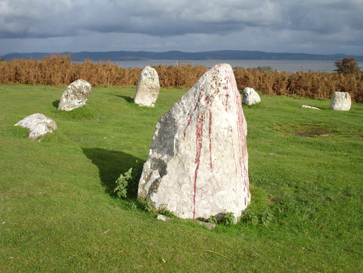
The local historian Arthur Hopwood told me about this stone.

It's his opinion that this is one of the many stones erected around the beckside by Edward Oates, who bought this land in 1834.

Mr. Oates put up the large stones around the pond just north of this, and also installed the 'clapper' bridges found there. It seems he had a thing about having 'ye olde looking stones' on his estate.

Edward Oates was a member of the Mill Hill Chapel, in Leeds City Centre, and apparently brought some of the stone from there, including the two rough stone 'pillars' that are to be found near the pond, a little further up the beck from here.

Cowper's Cross (Christianised Site) — Images

<b>Cowper's Cross</b>Posted by David Raven

Catstones Ring (Ancient Village / Settlement / Misc. Earthwork) — Images

<b>Catstones Ring</b>Posted by David Raven

Thornborough Henge Central — Images

<b>Thornborough Henge Central</b>Posted by David Raven

Backstone Beck Enclosure (Ancient Village / Settlement / Misc. Earthwork) — Images

<b>Backstone Beck Enclosure</b>Posted by David Raven

The Druid's Circle of Ulverston (Stone Circle) — Images

<b>The Druid's Circle of Ulverston</b>Posted by David Raven<b>The Druid's Circle of Ulverston</b>Posted by David Raven<b>The Druid's Circle of Ulverston</b>Posted by David Raven

Great Urswick (Burial Chamber) — Images

<b>Great Urswick</b>Posted by David Raven

Middle Barrow (Standing Stone / Menhir) — Images

<b>Middle Barrow</b>Posted by David Raven

Sunkenkirk (Stone Circle) — Images

<b>Sunkenkirk</b>Posted by David Raven

Hellclough (Stone Circle) — Images

<b>Hellclough</b>Posted by David Raven

Hambledon Pasture (Round Barrow(s)) — Images

<b>Hambledon Pasture</b>Posted by David Raven

Delf Hill (Stone Circle) — Images

<b>Delf Hill</b>Posted by David Raven

Thornborough Henge Central — Images

<b>Thornborough Henge Central</b>Posted by David Raven<b>Thornborough Henge Central</b>Posted by David Raven

Tathwell Long Barrow — Images

<b>Tathwell Long Barrow</b>Posted by David Raven

Grim's Mound (Round Barrow(s)) — Images

<b>Grim's Mound</b>Posted by David Raven

Burgh Top 3 (Round Barrow(s)) — Images

<b>Burgh Top 3</b>Posted by David Raven<b>Burgh Top 3</b>Posted by David Raven

Burgh Top 3 (Round Barrow(s)) — Fieldnotes

Very odd site! I wondered at first if I'd found the right place, as the barrow seems to have been built on/into...
Further research showed that there was a Royal Observer Corps monitoring post inserted into the barrow in 1959, which was de-commissioned in 1976.
(Many thanks to Chris Collyer for the info!).

Donington on Bain (Round Barrow(s)) — Fieldnotes

There are two mounds here on the O.S. map.
Unfortunately both seem to be obliterated. The one east of the farm track is barely discernable; a very, very slight 'hump' in the field. The one to the west of the track appears to have had an underground reservoir complex built on it.

Rudston Monolith (Standing Stone / Menhir) — Images

<b>Rudston Monolith</b>Posted by David Raven<b>Rudston Monolith</b>Posted by David Raven

Horsforth Milestone (Cup Marked Stone) — Miscellaneous

Listed in Boughey and Vickerman's 'Prehistoric Rock Art of the West Riding', no. 204. The cut and dressed stone is prism-shaped, possibly a milestone.

On its upper surface are three distinct depressions, called 'cups' in the PRAWR book, and it is listed on the Leeds UDP website under 'Class 1 Scheduled Ancient Monuments'. The Leeds City Council website lists the stone as being 440m south east of the roundabout at Horsforth on the A65. The book sites it 320m from the roundabout at Horsforth, outside house number 142. I found it to be outside this house, on a very narrow pavement. It must be a pain in the ass for folks with pushchairs!

There is a O.S. stud and benchmark present, and Boughey & Vickerman suggest the marks may actually be to support a surveying instrument.

Horsforth Milestone (Cup Marked Stone) — Images

<b>Horsforth Milestone</b>Posted by David Raven<b>Horsforth Milestone</b>Posted by David Raven

Barmishaw Stone (Cup and Ring Marks / Rock Art) — Images

<b>Barmishaw Stone</b>Posted by David Raven

Little Badger Stone (Cup and Ring Marks / Rock Art) — Images

<b>Little Badger Stone</b>Posted by David Raven

Willy Hall's Wood Stone (Cup and Ring Marks / Rock Art) — Images

<b>Willy Hall's Wood Stone</b>Posted by David Raven

Cowper's Cross (Christianised Site) — Images

<b>Cowper's Cross</b>Posted by David Raven

Silver Hill (Round Barrow(s)) — Images

<b>Silver Hill</b>Posted by David Raven

Thornborough Henge Central — Images

<b>Thornborough Henge Central</b>Posted by David Raven

Backstone Beck West (Cup and Ring Marks / Rock Art) — Images

<b>Backstone Beck West</b>Posted by David Raven

Castlestead Ring (Enclosure) — Images

<b>Castlestead Ring</b>Posted by David Raven

Rivock Edge — Images

<b>Rivock Edge</b>Posted by David Raven

Bradup (Stone Circle) — Images

<b>Bradup</b>Posted by David Raven

Rivock Edge — Images

<b>Rivock Edge</b>Posted by David Raven<b>Rivock Edge</b>Posted by David Raven

Wade's Stone (North) (Standing Stone / Menhir) — Images

<b>Wade's Stone (North)</b>Posted by David Raven

Avebury (Circle henge) — Images

<b>Avebury</b>Posted by David Raven

Thornborough Henge South — Images

<b>Thornborough Henge South</b>Posted by David Raven

The Devil's Arrows (Standing Stones) — Images

<b>The Devil's Arrows</b>Posted by David Raven

Castlestead Ring (Enclosure) — Fieldnotes

I was quite impressed by this, but then anything like this impresses me!

The ditch and remains of two raised banks either side of it were clearly evident. There also appeared to be an 'entrance' to the enclosure in the middle of the ring.

The track probabley cut the circle in two, if it was a circle, which seems likely to me. The field opposite must've been worked enough in the past to leave little trace of it discernable to my untrained eye.

Shame the light was too grim to take many pics!

Hollin Tree Hill (Ancient Village / Settlement / Misc. Earthwork) — Images

<b>Hollin Tree Hill</b>Posted by David Raven

Hitching Stone (Keighley Moor) (Natural Rock Feature) — Images

<b>Hitching Stone (Keighley Moor)</b>Posted by David Raven

The Swastika Stone (Cup and Ring Marks / Rock Art) — Images

<b>The Swastika Stone</b>Posted by David Raven
Showing 1-50 of 92 posts. Most recent first | Next 50
Currently between teenage angst and mid-life crisis!

Landscape gardener by trade.
Seem to spend most of my 'spare' time wandering about looking for the weird and the wonderful...

[email protected]

My TMA Content: