|
|

|
|
Tobar na DabhaichSacred Well
|
||||||||||||||||||||||||
|
|
|
Images (click to view fullsize) |
|
|
Fieldnotes |
|
|
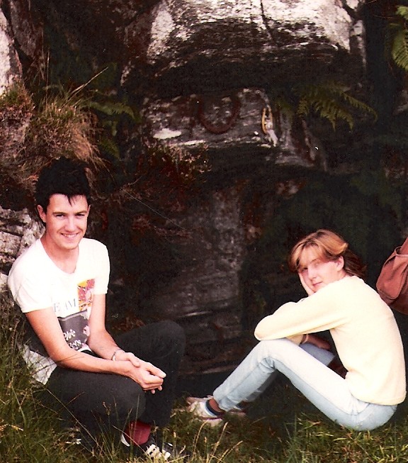
This well is located around 2km north west of Ardbeg. It is marked on the OS map as Tobar na Dabhaich. The name probably means 'Well of the Hollow' - Tobar=Well, Dabnaich='vatlike hole or hollow' (Watson, 1926). This would fit, as the well is set in a hollow in the side of a small hill. It appears to be a natural spring, with a shallow pool in the rock. An alternative name seems to be St Michael's Well, perhaps linked to the fact that immediately to the south is Druim Claiggean Mhicheil which is "ridge of Michael's good field" (Domhnall MacEacherna). It is close to the ruins of what is reputed to be the remains of a plague village (see folklore). My father (who grew up nearby) told me that it was a place where people visited for good luck when they got married, and indeed there at least two horseshoes above in the rock when we found it, one old and rusted and one seemingly fairly recent with ribbon attached. I believe there were also coins in the water. The antiquity of the site's human use is unknown, but it is some distance from the nearest house (and a difficult journey) so it is clearly not a modern (re)invention. It is close to a hut circle, so at the very least could have been a water source in ancient times. It would certainly bear checking out by people more knowledgeable in the archaeology of well-sites. Now the difficult bit – getting there. My father took me there in 1984 (see photo) from Callumkill, a journey involving going over several hills and getting wet feet in the bog in between, and getting lost (hence teenage sister's fed up expression in the photo). Last year (2005) I attempted to revisit it with 'clear' directions from my uncle Jim, who used to live at Callumkill. This time I headed via a public footpath marked on the OS map heading north east from Ardbeg and passing close to the well. Let's just say it is not as easy as it looks – I got lost in bracken over head height, caught in a sudden storm, lost my map climbing over a fence and stumbled over a dead cow in a stream. A reminder of taking care when you are looking for sites in more remote locations – you won't be able to get reception on your phone to call for help! I didn't find it, but hope that someone else will have more luck. Sources: Domhnall MacEacherna, The Lands of the Lordship (1976), Argyll Reproductions. WJ Watson, History of the Celtic Place Names of Scotland (1926) http://www.st-andrews.ac.uk/institutes/sassi/spns/watsdg.htm |
Posted by Neil-NewX 26th November 2006ce Edited 27th November 2006ce |
Folklore |
|
|
"The hardships suffered by some people in Kildalton Parish were, if oral tradition is to be believed, brought to an end by an outbreak of "The Plague", which is said to have wiped out the entire population of a settlement of some nine houses still known as "The Plague Village". The ruins of the village can still be seen near St. Michael's well, some 2 kilometres northwest of Ardbeg. According to local tradition, a young man from the village, who had travelled the world, came back to Ardbeg as a crew member of a ship. On a brief visit to his native village he fell ill and died of the plague. The villagers immediately put themselves into quarantine. people from the surrounding area brought food each day to a rock near the infected village. When the food was no longer taken away, they knew that the last of the villagers had died. In due course the houses were burned, leaving only the stone walls and a corn kiln to mark the spot where the village had stood. The story, which is referred to in a guide to Islay published by the Isle of Islay Federation, Scottish Women's Rural Institutes in 1968, has such a ring of truth about it that it deserves a place in history." (Source: Clifford N. Jupp "The History of Islay, 1994, p. 214) This clearly relates to this site – the well is the requisite distance north west of Ardbeg, and the name St Michael's Well makes sense in view of its proximity to Druim Claiggean Mhicheil - "ridge of Michael's good field". There are ruins of the deserted habitation of Solon immediately to the north east of the well – whether the plague story is true is unknown. I believe that Solon itself was lived in within living memory. There is also a nearby hut circle marked on the map. |
Posted by Neil-NewX 26th November 2006ce |
Links |
|
RCAMHSThe name Callumkill (formerly Kilcallumkill or Kilcholmkill) suggests a chapel dedicated to St Columba there and local accounts state that nearby was a well into which offerings were dropped. RCAMHS found no trace of the chapel site - could the well have been Tobar na Dabhaich, with the village/chapel site nearby rather than where the Callumkill farm buildings now stand (this well is, I believe, on land farmed by Callumkill). |
Posted by Neil-NewX 4th December 2006ce |
Peat FreakTo get a general sense of the landscape in the vicinity of the well check out this series of four excellent panoramic photographs, taken by single malt whisky enthusiasts on a pilgrimage to nearby Loch Uigeadail, a source of water used in Ardbeg distillery. If you follow the arrow marked Solam in the first photo you will be on your way. The site sensibly advises 'If you make this walk in person: ignore the "path" the OS Landranger map is showing that follows the glen up to the loch. It does not exists, and will only lead you through wet boggy land with high grass'. |
Posted by Neil-NewX 1st December 2006ce Edited 1st December 2006ce |
Armin Grewe's walk through Callumkill and SolamArmin Grewe and friends had more luck than me in their walk through this area, finding the well (described as a wishing well in which coins are thrown), the ruined village and some modernish carved stones - a reminder that not everything in stone is ancient |
Posted by Neil-NewX 1st December 2006ce |