This site is of disputed antiquity. If you have any information that could help clarify this site's authenticity, please post below or leave a post in the forum.
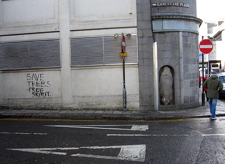
I noticed this stone after I had staggered out the pub on the opposite side of the road to it.
I returned the next dayto make sure I hadn't dreamt it.
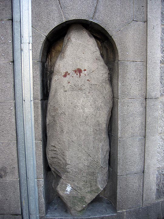
The stone is approximately 2.5 metres tall and 1 metre across at its broadest point. The stone has been mounted into a recess on the corner of the road. The stone has 'Langstane' carved into it and is situated in Langstane Place.
What makes me think the stone may be prehistoric is that the base has been carved into a keel shape or a "rough beak" as Burl calls it. This is a common feature of the stones erected in Aberdeenshire Recumbent Stone Circles.
The stone isn't featured in Canmore and I browsed through the local history sections of the nearby bookshops but could find no reference to the stone.
Accordiang to "Grampian Battlefields" some believe that it is this which is the actual Craibstane rather than the massive square boulder near the junction of Harfgate and Bon Accord Terrace (the crest of Clay Hill). In which case it was probably a march stone for Rubislaw.
Here's the RCAHMS entry for the stone, Fitz. It's not much more detailed than your own observations, but it does say that a chap called Wyness took a photo of it in the 1960s at c.NJ938060, where it was before being 'built into the niche at the rear of Messrs. Watt and Grant's building' where you saw it. That can't be far away though, because the street would hardly be called 'Langstane Place' otherwise? He thinks it was part of a stone circle, but RCAHMS are hedging their bets. It is apparently marked on a plan of Aberdeen by Paterson from 1746.
(F Wyness, 'City by the grey North Sea: Aberdeen', p280 and 292 - 1965).

 Posted by fitzcoraldo
 Posted by Rhiannon