Go out of town on the South Isles road past the Highland Park distillery and before reaching the Tradespark junction enter the field on the downhill side of the road opposite. Cut diagonally across this to the gap at the corner behind Hillhead (of Scapa) House.
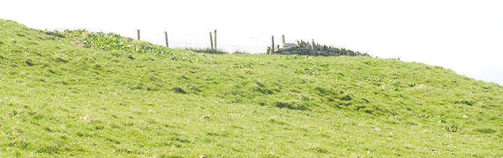
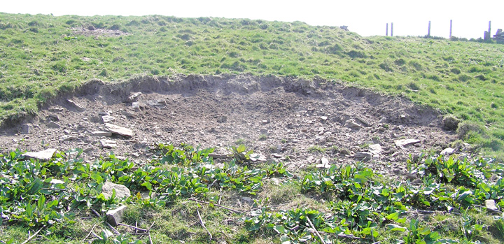
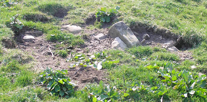
Striking off right downhill on another diagonal takes you to the site of the long-gone well in front of whose vanished place a decorated stone ball was found almost as long ago. You have to wonder what yet remained to mark it out - was it demolished ruins or simply (like Crossiecrown) filled in with rubble ? Could it be that the 'new' well of 20th century vintage does occupy the self-same site hidden from view. Unfortunately this has an airtight seal at the top of the circular concrete 'plug', overlying a symmetric well of drystane walling the same diameter. In the same hollow the hut has been removed to expose the concrete foundation below (hopefully nothing destructive is intended for this place). Connecting this and the well are flags that go under the former hut's foundation. About the modern constructions lie many stones of older times, but are they from here or brought in from elsewhere? One I am struck by is a dark slab with a rectangular section out of one corner that reminds me of a re-usable form of cist. The exposed section of hollow above the modern stuff seems curiously empty (like bared parts of the enclosure), only a few protruding stones with an earthfast boulder at the back of curious colouration.
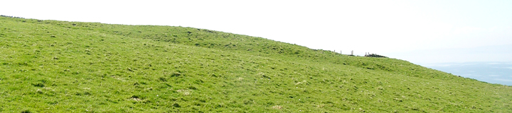
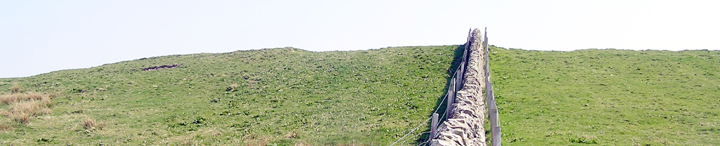
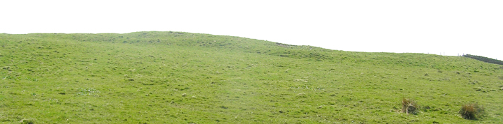
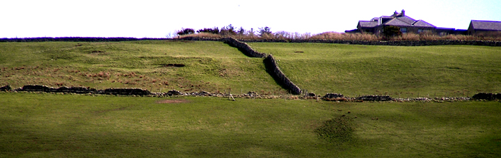
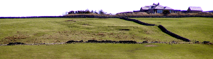
Looking across the hill with your back to Kirkwall you can see the nearby enclosure, once considered a fort by those who saw it a little better than we. Standing a little above the well hollow provides the best view of the Hillhead site's profile, better detail at least than that of the half below the house. Is one looking at two banks and a ditch or a bank and two ditches, no-one is totally convincing and if any excavation was done it was way back and very slight.
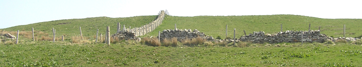
Near the drystane wall you are conscious of a wide flattened section on either side that goes downhill without seeming to break the enclosure otherwise. One assumes that this came about when the original Well Park was divided up, and further that material from the enclosure would have been robbed to form the wall itself. To see the other half of the site you have to go back up beside the wall to the house and down into next field. It appears to be a smaller 'half', and as mentioned before presents a much less detailed appearance. Also there are only a couple of bared areas. Similar to the bank/ditch dichotomy we cannot tell if the relative 'smoothness' represents more of the original form surviving or, conversely, the greater subsequent subjection to the hand of man.
I wonder if the Hillhead of Crantit was a similar site to Hillhead - between that tidgy hollow the old O.S. miscalls a quarry and the distillery there is a curve to the hill that looks suspiciously regular and the earthwork at the ruined steading's uphill side could be where a bank has been cut by the road ?
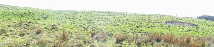
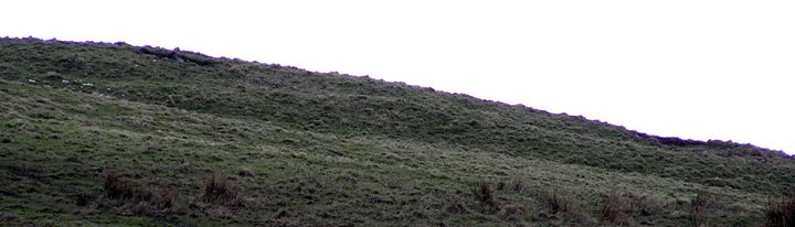
Finally good enough light to properly see the site's extent - today my new digital camera easily made out the oval banks mentioned by the O.S. (still from way over on the Orphir road). These do extend both sides of the wall, though most visible to the eye in The Well Park. Which latter presumably explains why the site was first seen as a large fragment of a circle (note to self, must post Sandaiken soon), I had thought of sideways displacements to explain the later reports but I can see no such evidence. Could still be that this is a multi-period site and we are dealing with two seperate creations, one nestling within/upon the other.
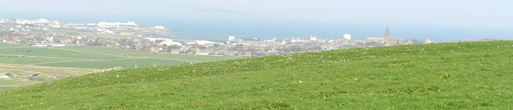
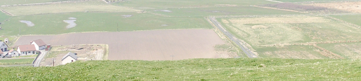
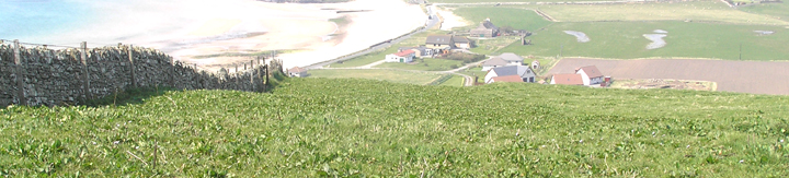
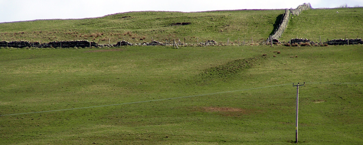
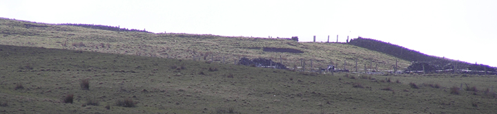
Using a map I was finally able to identify the site from way over on the Old Scapa Road. Much further up the slope than I had imagined, just under the farm almost. Made it out with the digicamcorder on full telephoto and it looks fairly impressive in parts, good bank height in the 'Hill Park' section still. Definitely has all the appearance of a hillfort to me. Of course we ?don't have proper hillforts in Orkney and the present view is not high up enough for a full 360 panorama, though you can see over to Kirkwall and all the way up Scapa Flow. Observed the site from most of Scapa beach, at a distance, but couldn't see it from the road below, alas. Going around from the coastguard station there is the edge of the hill and at the top at the town end of this section there is what could be plough-out. The site is in that direction as you look up. One day I shall go onto the site for some proper photography (leaving Kirkwall on the South Isles road the farm is on the top of the hill just past the Tradespark junction, the fieldwall beside the drive cutting across the site behind it). A little further along there is a dark triangle of land on the hill that indicates 'Well Park' above.
Another site where there is uncertainty over the form is Newhouse in Holm (HY50SW 16) - it is either two concentric banks or one with a palisade trench. Newhouse is thought to be a northern outlier of the ring-enclosures. At 27m across it is slightly bigger than Hillhead or the circle geofizzed near Bu in Orphir.
In 1859 Petrie reports that at the start of the 19th century near Papdale farm there was a very large double ring surrounded by ditches, which can only refer to this.