The Modern Antiquarian
Log in
|
Register
Home
Latest Posts
Forums
Maps
Help
Browse Sites
News
Blog
Contributors
The Books
Select
-
Belgium
Denmark
Eire
France
Germany
Greece
Italy
The Netherlands
Norway
Portugal
Republic of Malta
Spain
Sweden
Switzerland
United Kingdom
Scotland
Highland (Mainland)
Salscraggie Cairn
Cairn(s)
Salscraggie Cairn (Cairn(s)) on The Modern Antiquarian, the UK & Ireland's most popular megalithic community website. 8 images, 1 fieldnote, plus information on many more ancient sites nearby and across the UK & Ireland.
Image © Lianachan
Nearest Town:
Dornoch (35km SSW)
OS Ref (GB):
ND001180 /
Sheet: 17
Latitude:
58° 8' 23.11" N
Longitude:
3° 41' 49.14" W
Added by
Lianachan
Images (8)
Fieldnotes (1)
0 discussions
Start a topic
Show |
Hide
Web searches for Salscraggie Cairn
Flickr
Google
Google Images
MAGIC
The Megalithic Portal
Bing
Stone Pages
Streetmap.co.uk
Wikipedia
Show map
(inline Google Map)
- Sites within 20 km -
-
Kilphedir (0.89km WNW) (9 posts)
Kilphedir (1.14km WNW) (16 posts)
Caen Burn, Strath of Kildonan (1.15km E) (35 posts)
Eldrable (1.8km W) (1 post)
Carn Laggie (2.65km E) (12 posts)
Torrish Burn (3.37km W) (8 posts)
Torrish Burn (3.66km W) (5 posts)
Strath of Kildonan (4.62km W) (4 posts)
Gailiable (5.18km W) (4 posts)
Balvalaich (5.67km W) (7 posts)
Green Table (5.75km E) (0 posts)
Clach Mhic Mhios, Glen Loth (6.77km WSW) (24 posts)
Ousdale Burn (7.05km ENE) (22 posts)
Kilearnan Hill (7.22km W) (1 post)
Ben Uarie (7.56km WSW) (18 posts)
Craig Halligarry (7.94km W) (8 posts)
Kilearnan (7.96km W) (10 posts)
Carn Bran (8.18km SW) (17 posts)
Glen Loth (8.22km SW) (10 posts)
Carn Liath, Strath of Kildonan (8.67km W) (6 posts)
Lothbeg Bridge (9.28km SW) (13 posts)
Allt Preas Bhealaich (9.46km N) (3 posts)
Clach Na H-Uaighe (9.54km W) (1 post)
Langwell (9.96km ENE) (7 posts)
The Craggan (10.06km WSW) (3 posts)
Borgue Langwell (10.73km ENE) (9 posts)
Suisgill Lodge (11.08km W) (1 post)
Ach An Fhionnfhuraidh (11.54km W) (0 posts)
Learable Hill (12.12km W) (20 posts)
Learable Hill (12.2km W) (6 posts)
Learable Hill (12.21km W) (4 posts)
Kintradwell (12.22km SW) (20 posts)
Carn Nam Buth (12.33km W) (7 posts)
Cos Ceumach (13.27km SW) (1 post)
Suisgill (13.49km W) (14 posts)
Upper Borgue (15.18km ENE) (5 posts)
Upper Borgue (15.26km ENE) (4 posts)
Kinbrace Burn (16.17km W) (7 posts)
Kinbrace Hill (17.02km WNW) (22 posts)
Feranach (18.19km W) (1 post)
Creag Nan Caorach, Kinbrace (18.43km WNW) (10 posts)
Balantrath (19.07km NE) (4 posts)
Carrol (19.24km SW) (32 posts)
Loedebest Wood (19.43km NE) (5 posts)
Leadoch (19.43km SW) (8 posts)
Loedebest West (19.45km NE) (8 posts)
Dunbeath Broch (19.71km NE) (15 posts)
Carn Liath (19.73km NE) (13 posts)
Loedebest (19.74km NE) (2 posts)
Dunbrae (19.81km NE) (2 posts)
Cnoc Na Maranaich (19.93km NE) (6 posts)
Cnoc Na Maranaich (19.96km NE) (15 posts)
Cnoc Na Maranaich (19.97km NE) (6 posts)
Duchary Rock (19.99km SW) (10 posts)
- Add -
-
Add news
Add an image
Add fieldnotes
Add folklore
Add miscellaneous
Add a link
-
Add a site
Add a nearby facility
Add an alternative name/spelling
Images
(click to view fullsize)
Add an image
Fieldnotes
Add fieldnotes
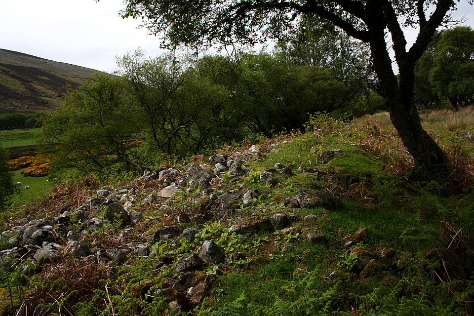
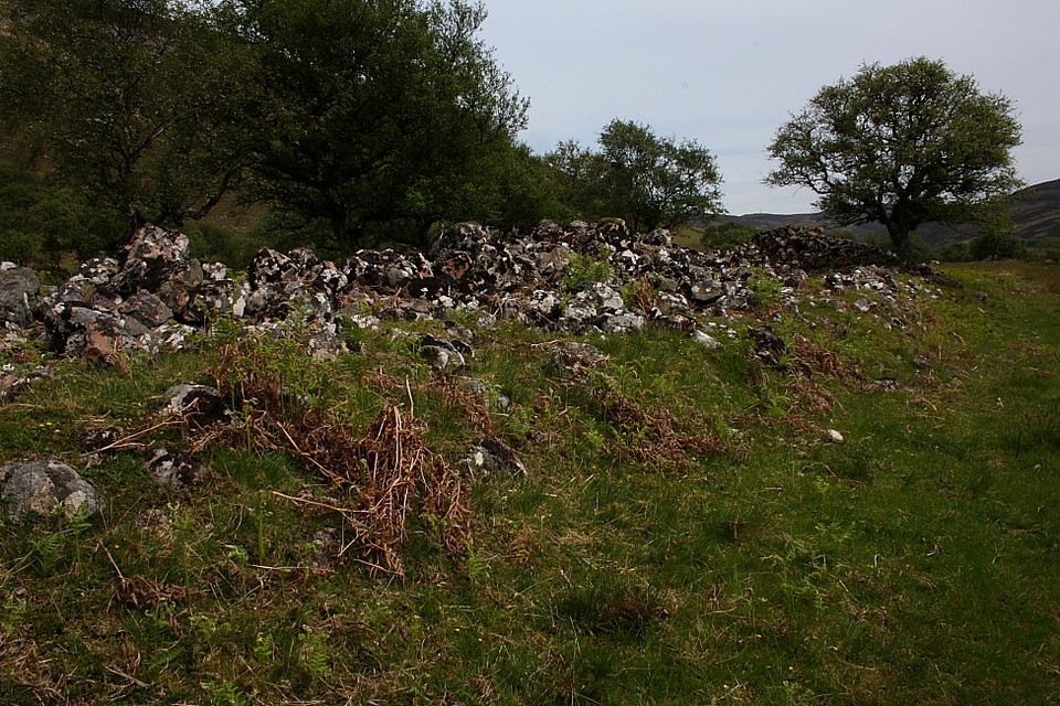
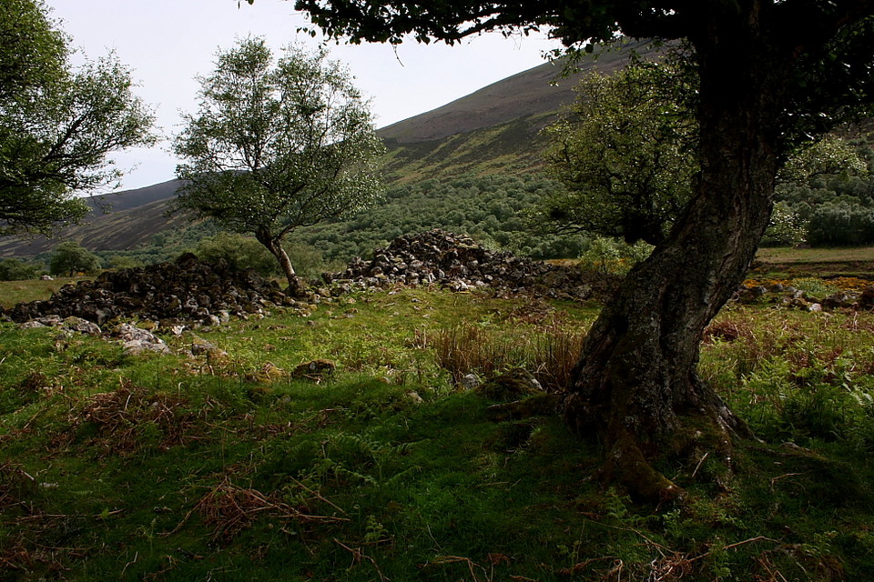
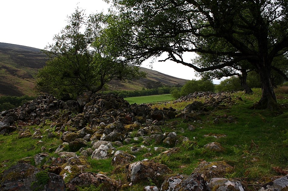
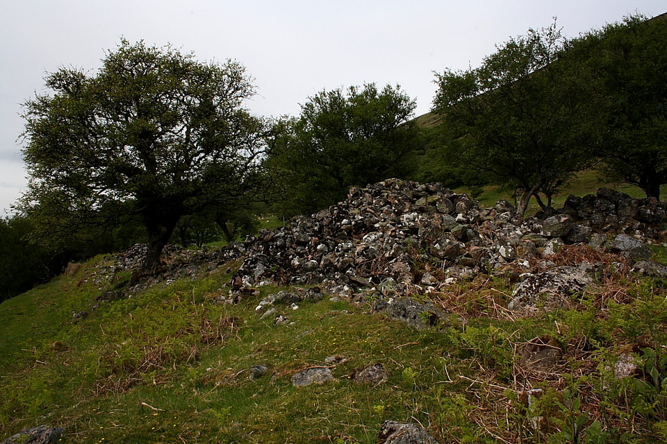
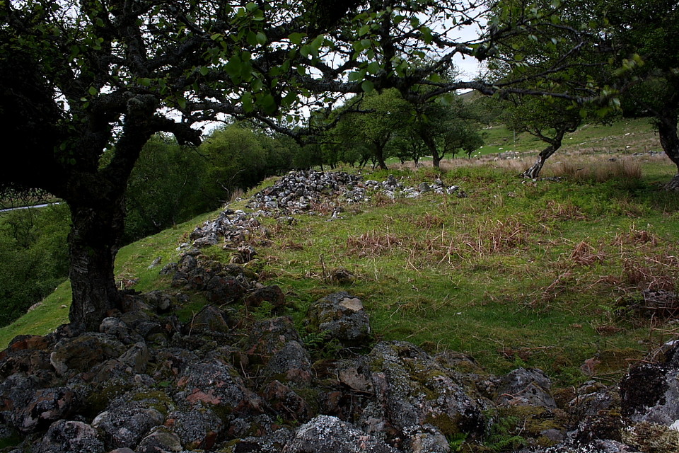
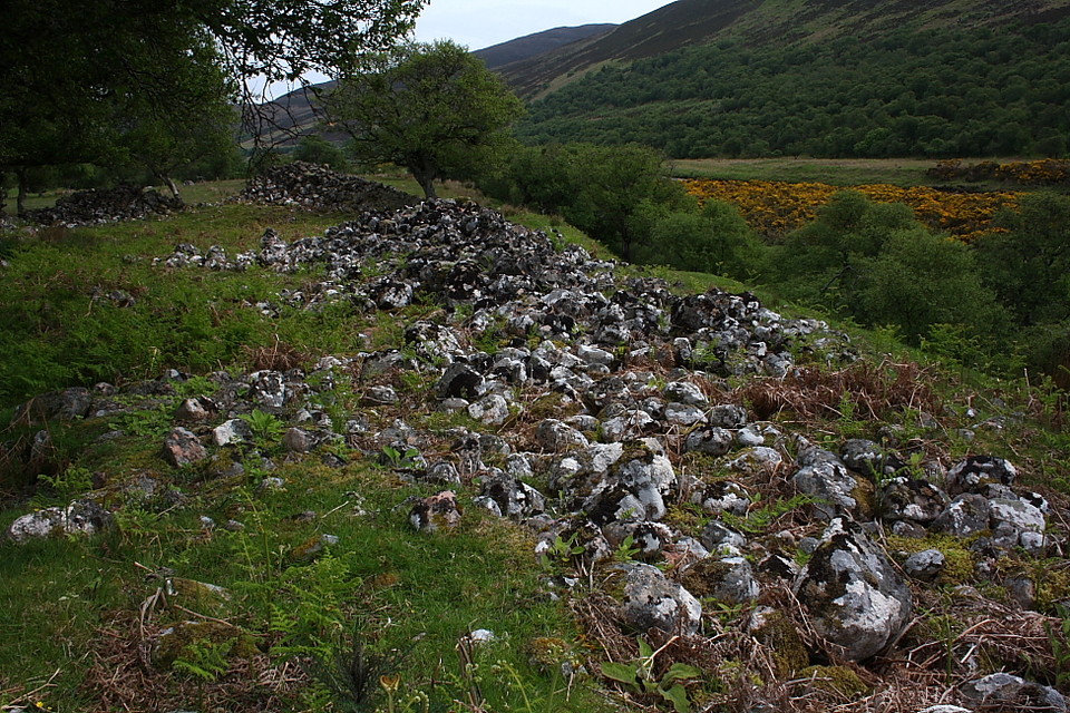
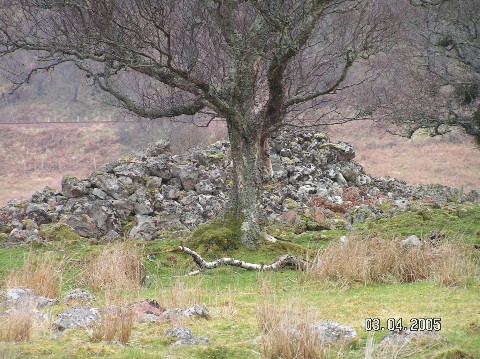
Pretty much across the road from one of the easiest approaches to Kilphedir broch. Not much more than a pile of rubble, as it has long since been robbed out, but it's likely to be a chambered cairn - possibly one with the Caithness "horns".
Comments (0)
|
Add a comment
|
Permalink
Posted by
Lianachan
5th April 2005ce