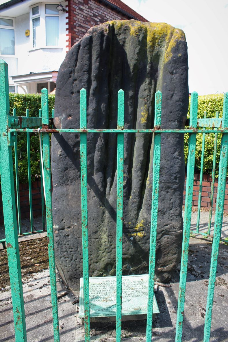
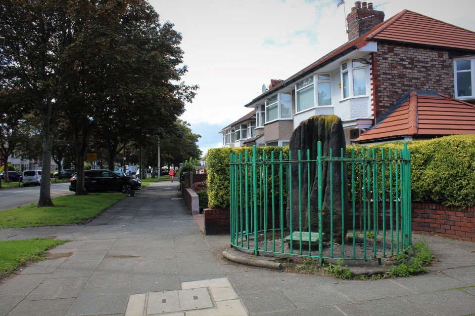
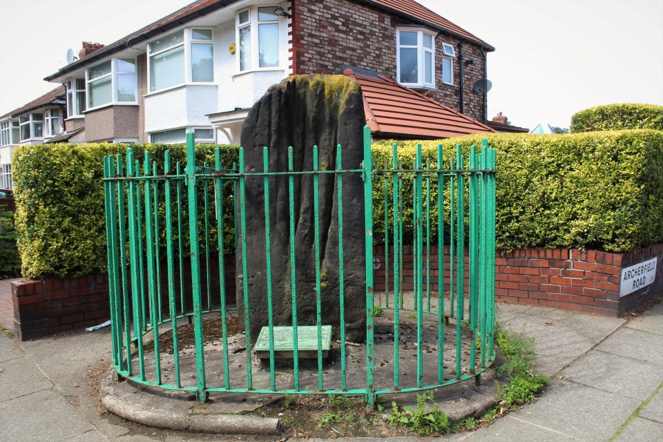
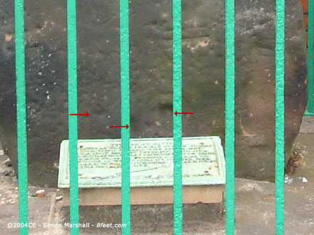
Visited 28th August 2003: Robin Hood's Stone is no longer in its original position, having been moved to accommodate housing development in 1928. It now stands behind railings on the corner where Archerfield Road meets Booker Avenue (the grid reference is less accurate than this description). An accompanying plaque explains the stone's origins (see below).
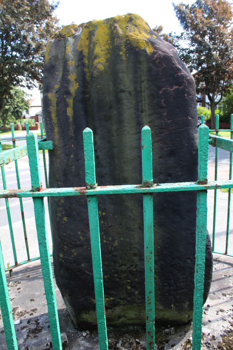
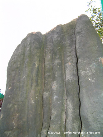
The side of the stone that originally faced south now faces south east. It originally stood approximately 60 meters away to the north, presumably inconveniently situated where a nice 'modern semi detached house was planned (otherwise it would have made a lovely garden feature). The top of the stone is weathered into vertical grooves.
MAGIC (Record No.: 33891) states that Robin Hood's Stone was originally part of the 'the complex of stone monuments known as the Calderstones', but it doesn't suggest it was part of a stone circle.
The stone was formerly erected during the Bronze Age and was originally part of the complex of stone monuments known as the Calderstones, which lie approximately 150m to the north east. These have been protected as a separate monument (SM 23692).
The record goes on to describe the cupmarks and give dimensions for the stone:
An early photograph shows that the stone had been decorated with several cup marks, similar to those recorded on the Calderstones. These marks are now at the base of the stone, buried in the soil beneath the concrete plinth. The standing stone is approximately 2.4m high, 0.9m wide and 0.4m thick. It is set in an oval concrete plinth, 0.2m above the surrounding pavement, which is 3.2m long and 2.6m wide.
Interestingly the 'plinth' is part of the scheduled site. The eight digit grid reference for this site is SJ39978638.
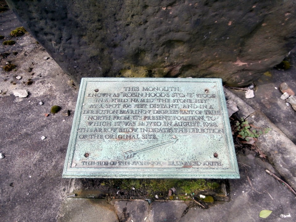
The sorry looking bronze plaque in front to the stone reads:
THIS MONOLITH KNOWN AS "ROBIN HOODS STONE" STOOD IN A FIELD NAMED THE STONE HEY AT A SPOT 19 FEET DISTANT, AND IN A DIRECTION BEARING 7 DEGREES EAST OF TRUE NORTH FROM ITS PRESENT POSITION, TO WHICH IT WAS MOVED IN AUGUST 1928. THE ARROW BELOW INDICATES THE DIRECTION OF THE ORIGINAL SITE.
THIS.SIDE.OF.THE.STONE.FORMERLY.FACED.SOUTH
Pretty informative for something so old, and at least they recognised that the stone's orientation was potentially important.


 Posted by Kammer