|
|

|
|
Roulston ScarHillfort
|
||||||||||||||||||||||||
|
|
|
News |
|
Guided tour: Yorkshire's Giant Hillfort at Sutton Bank - 22nd May 2004From English Heritage website - "Sutton Bank is well known as the home of Kilburn White Horse, created in 1857, and of the Yorkshire Glider Club, founded in 1933... continues... |
 Posted by pure joy
8th January 2004ce Edited 8th January 2004ce |
Images (click to view fullsize) |
|
|
Fieldnotes |
|
|
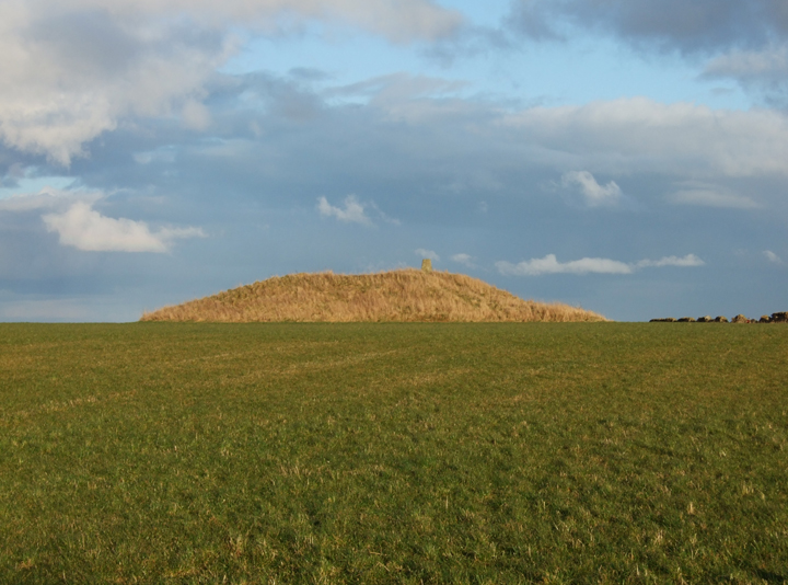
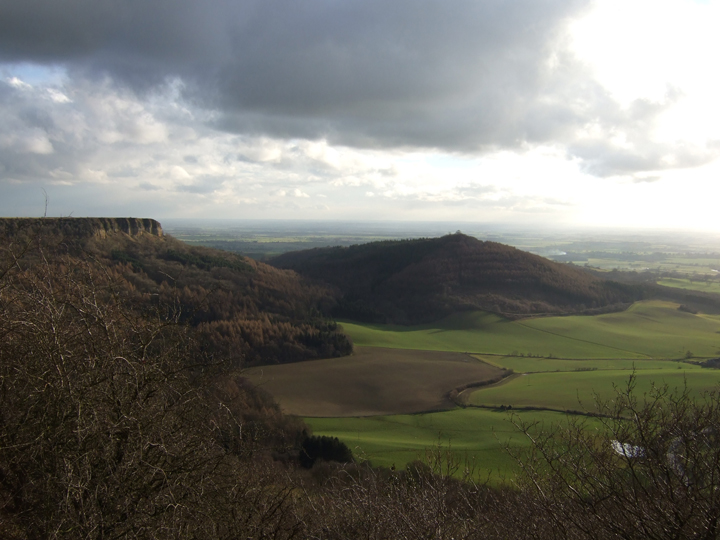
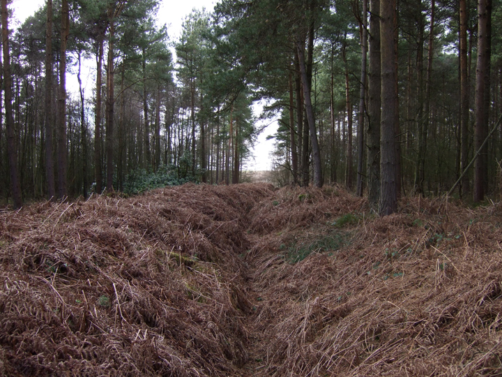
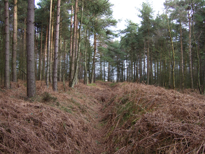
Setting out for the day I had written down points of interest and had an idea where i was going, and to make things a little easier, foolishly forgot to pick up all my grid reference details from the kitchen table! I hadn't on this occasion read around the subject as fully as i could have done, and only when I returned home did i realise the whole area is Roulston Scar (I have always known it as Sutton Bank). We parked at the top, near the gliding club and headed roughly NEE to the fortification as marked on the OS map. Crossing a small valley we scrabbled up the sides and headed into the woods. I all honesty, an easier way would have been to park at the top of High Town Bank Road and walk down. In any case the length and size of the fortification was quite impressive, and surrounded by woodland. Its termination point seems a little odd and I wonder if it maybe ran at some point to the top of Hell Hole SE523816. It certainly seems like this now wooded stretch is all that remains of the fortification. Walking along it's ditch West to East with it's Southerly side being easily 5 feet high in places, it wasn't difficult to imagine what it once looked like, and when you look out over the flat land that Roulston Scar rises from, it isn't difficult to imagine why fortifications where built there. The thing that is a little tricky though, is that information about the Hillfort suggests that it's perimeter terminates before the small valley we crossed. Maybe this was an additional fortification. The OS map shows a tumulus in the fields near by, although all signs of this are now gone. |
Posted by robokid 10th March 2008ce Edited 10th March 2008ce |
Folklore |
|
|
A little more on Gormire, the lake beneath the bank, which you can see here in Robokid's fine photo: http://www.themodernantiquarian.com/post/66262/images/hood_hill_stone_kilburn.html The village oracles relate that this awful abyss was produced by a tremendous earthquake, which ingulphed a populous town and its secure inhabitants, in a moment of unexpected calamity, leaving behind it a body of waters unfathomable and bottomless.From 'A brief description of public interest in the county of York' by Alfred E Hargrove, p128 (1843). http://books.google.co.uk/books?id=NrgHAAAAQAAJ&pg=PA128 |
 Posted by Rhiannon
3rd April 2008ce Edited 3rd April 2008ce |
Roulston Scar, Hambleton Hills. In some parts the rock is perpendicular, and has the appearance of an irregularly built castle. The foreground of this for fifty or one hundred yards is covered with massive blocks of stone, evidently thrown off by some convulsion of nature. On the side of the rocky wall is a fissure opening into a small, narrow cavern, called the Devil's parlour, from the common disposition to attribute what is at once gloomy and marvellous to infernal agency, especially when in any way connected with heathen worship, of which there are not wanting traditions in the immediate vicinity. Vallis Eboracensis : comprising the History and Antiquities of Easingwold and its Neighbourhood. By Thomas Gill. London 1852. Blagged from County Folk-Lore. Publications of the Folk-lore Society 1899. |
 Posted by fitzcoraldo
7th December 2007ce Edited 7th December 2007ce |
It's a bit confusing up here - there's a lot going on.[Kilburn lies] immediately below the precipitous south-west corner of the Hambleton Hills, and not far from the supposedly bottomless lake called Gormire. The hill-end bears the figure of a White Horse, 300 feet long and 200 feet high. It was cut in 1857, and it is said to commemorate a legendary individual mounted on a white horse who fell off the cliff, possibly into Gormire. Since that date, it has been scoured about once in seven years.*This might be true, but the name actually refers to somewhere further along Sutton Bank, above the Gormire lake. There are various 'tumuli' and cairns in the vicinity, and a cave called the 'Fairies Parlour'. The above is from Kilburn Feast and Lord Mayor N. A. Hudleston Folklore, Vol. 69, No. 4. (Dec., 1958), pp. 263-265. More horsish stuff. Surely why the creator of the white horse was inspired to create it? Gormire.-Additions to "Yorkshire Local Rhymes and Sayings" E. G. The Folk-Lore Record, Vol. 3, No. 2. (1880), pp. 174-177. You will notice the 'Devil's Parlour' cave at Roulston Scar - as Paulus mentions, the Devil leapt from here to Hood Hill, carrying a stone. |
Posted by Rhiannon 21st September 2007ce Edited 21st September 2007ce |
Links |
|
Brigantes Nation - Roulston ScarInformation about Roulston Scar, plus old OS map of the area. |
Posted by robokid 10th March 2008ce |
English HeritageEnglish Heritage's Landscape Investigation Team. Excellent page on the Sutton Bank Hillfort |
Posted by pure joy 8th January 2004ce Edited 21st September 2007ce |