|
|

|
|
GwernvaleChambered Tomb
|
|
|
|
Images (click to view fullsize) |
|


|
Fieldnotes |
|
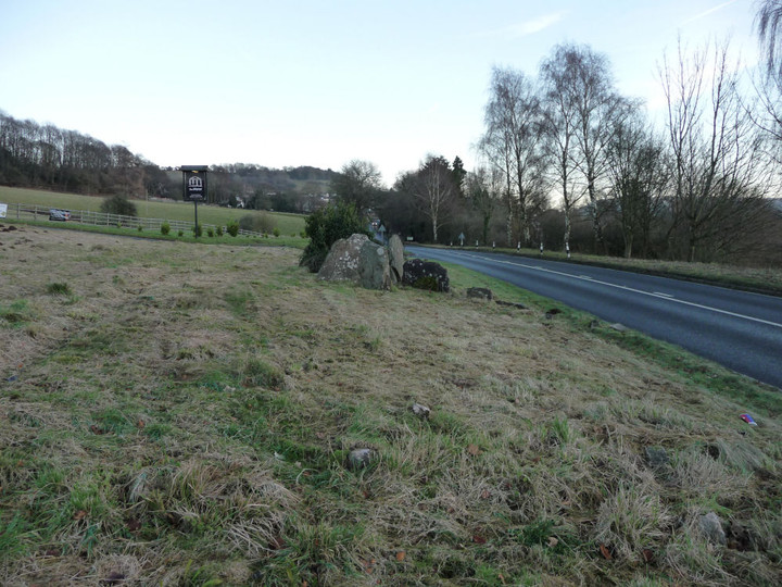
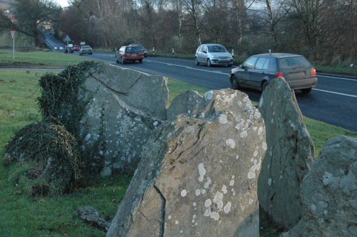
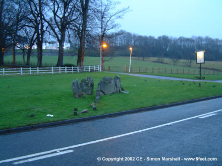
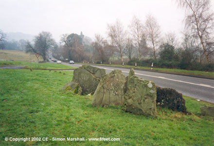
| Sadly the busy road robs the site of its atmosphere, but the chamber is still worth a visit. You get plenty of odd looks from passing motorists while taking pictures too! Ignoring the road, there are good views towards Myarth and Tor y Foel to the west and the lower slopes of Pen Cerrig-calch to the north. The passage itself faces Mynydd Llangatwg to the SW, which was itself later crowned with an assortment of bronze age cairns. |
 Posted by thesweetcheat
16th April 2010ce |
| Crickhowell is a lovely little town and is surrounded by prehistoric sites. These range from very easy sites to visit such as Gwernvale and the Growing Stone to harder sites such as the Fishstone. I have visited Crickhowell on many occasions and always manage to find a new site to visit. |
Posted by CARL 16th March 2010ce |
|
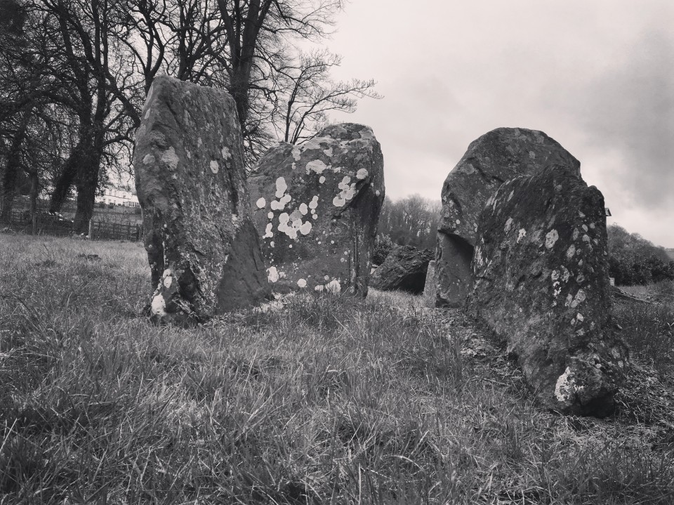
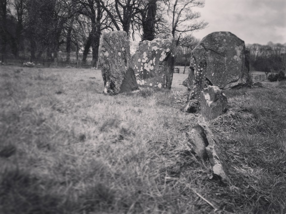
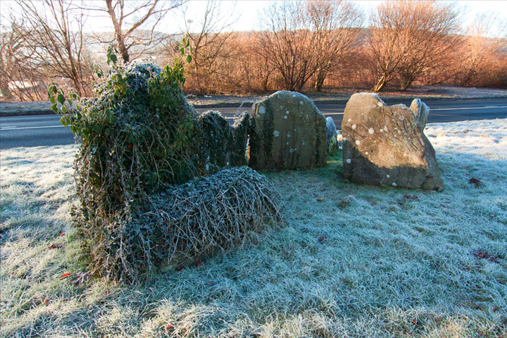
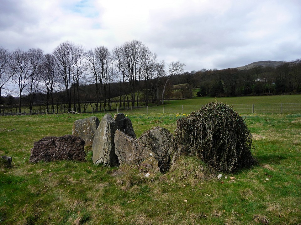
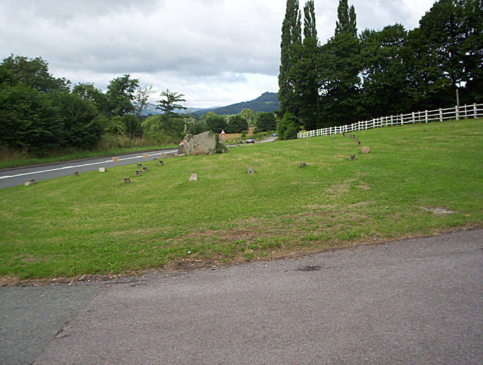
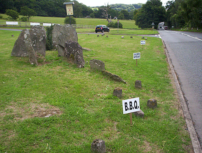
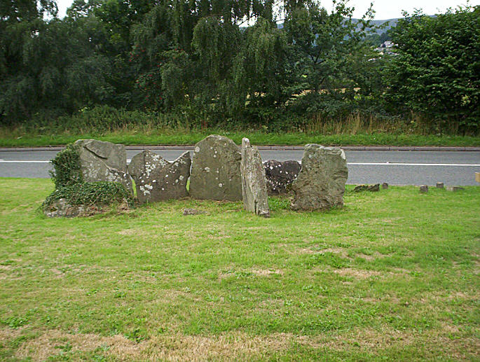
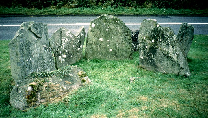
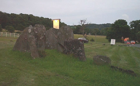
It is scarily close to the road! It now signals the entrance to a posh hotel. The stones, all about 2 feet tall and 2 feet across, clearly mark out a main chamber and entrance passageway, but the rest of the tomb is long gone. No mound, no rubble, no nothing. The only thing to indicate the tomb's original size and scale is a number of marker stones. Once, it might have been as big and impressive as Belas Knap or Stoney Littleton. My guess is that much of the cairn material was used to build and repair the road. This post appears as part of the weblog entry South Wales Getaway
|
 Posted by Jane
29th December 2005ce Edited 30th December 2005ce |
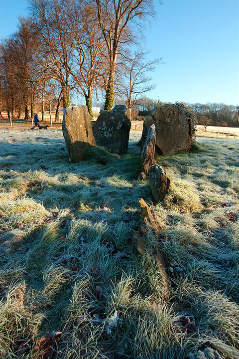
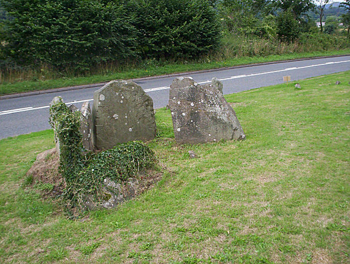
| I have been meaning to stop here for a closer look for a long time.I am usually traveling too fast here. It must have been a very large barrow at one time. It was 50mtrs long and 17mtrs wide, there were three chambers one of which is exposed. |
 Posted by hamish
16th August 2005ce |
|
Saturday 22nd November, 1545 hrs - dusk is looming over the surrounding mountains and Gwernvale lies coldly at the side of the main Bwlch to Crickhowell road. Parking at the entrance to the hotel we wonder back and weep at what was once a beautiful site, its back now broken by progress. As cars whoosh by I study the restored stones that trace the ghost of the previous tomb. Is it right? is it correct? All we can safely say is that a road passes through it, the rest remains conjecture. This is a lonely highway, with more than a fair share of accidents. My companion shivers, she feels that anyone who builds a road through such a location is asking for trouble. I feel that a photograph is asking too much of this place, and leave a blessing, hoping that one day it will find peace. Great disturbance and energy lie buried deep here. We drive on, into the welcoming lights of Crickhowell, where we stop for a needed drink, before continuing on, home to the borders. The site is within 10 feet of the main road, parking is easy as long as you are the only visitor, and access is good. Not a safe place for children or animals to visit due to proximity of the road. |
 Posted by Dominic_Brayne
24th November 2003ce Edited 24th November 2003ce |
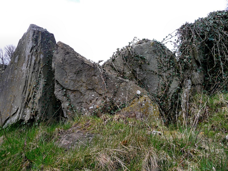
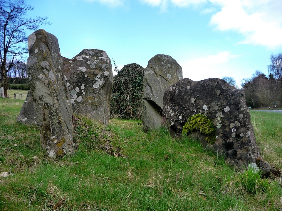
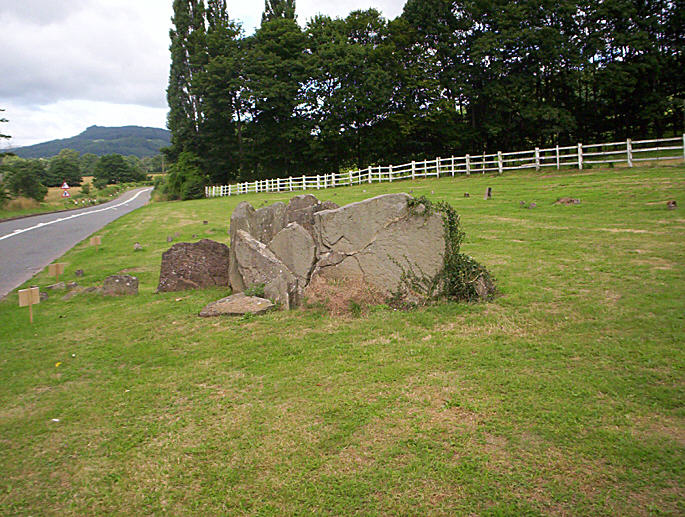
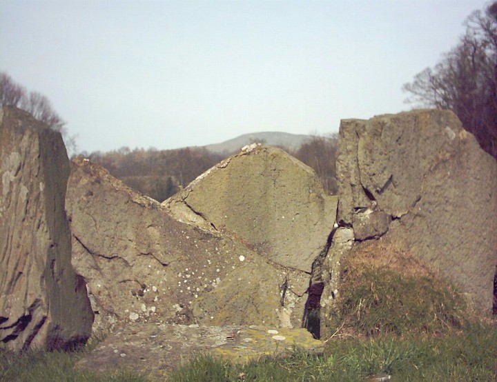
| I went here today, 20/3/03, nearly drove past it! It's a polygonal chamber, looking like it has been restored some time ago, perhaps 200 years, and concrete posts indicate where outher parts where found. It is unbelievably close to the A40, with the road literally carving its way through a part of the cairn. Not a place for kids, or the faint-hearted! It is hard to feel any ambience at all here, the road dominating the area, be careful not to fall on the road in an attempt to get good photos!! |
Posted by chumbawala 21st March 2003ce Edited 21st March 2003ce |
|
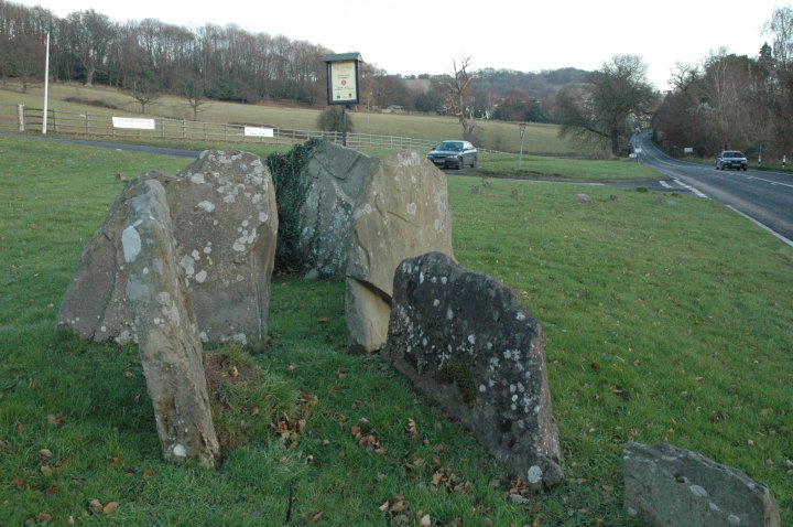
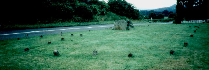
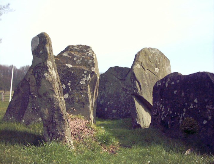
OS 161 SO 211192 From Crickhowell, take A40 towards Brecon, take the right for the Manor Hotel (large white building up on the hill). There is a single parking space, site is practically on the road. 'The Illustrated History and Biography of Brecknockshire' Poole, E, 1886, mentions the destruction of the 'finest cromlech in Breckonshire' by Sir Richard Hoare and others in 1804. Dr Nicholas said of the capstone which was removed '...magnificent..., fourteen feet long and eighteen inches thick, with an average breadth of nearly seven feet, standing on four supporters'. All that remains is a single chamber (minus the capstone mentioned above) and parts of its entrance chamber. The extent of the site is marked out with miserable concrete markers, which reveal it as a chambered long cairn of the Severn-Cotswald type, with a horned fore-court (imagine Belas Knap). One of the horns is now under the A40. What remains reveals a polygonal chamber and that the entrance passage to it has a bend, another two chambers discovered in the 1978 excavation (because of road widening) are also indicated by markers. An unfortunate site, the proximity of the main road sealed its fate, although now fully excavated and in the care of Cadw, the busy road makes it rather forlorn, but easily accessible. The 1804 destruction of the capstone resulted in neglible finds: 'charcoal and a few bones' (Cadw guide). |
Posted by elderford 22nd December 2002ce |
|
What the Romans started, Powys County Council roads department finished There's lots of little wooden stakes patterned around, like at Woodhenge. |
Posted by RiotGibbon 23rd August 2001ce Edited 3rd January 2003ce |
Miscellaneous |
|
|
From Clwyd-Powys Archaeological Trust - http://www.cpat.org.uk/cpat/past/meso/meso.htm Excavations were undertaken between 1977-78 on the Neolithic chambered tomb just outside Crickhowell in advance of improvements to the A40. The buried soil beneath the cairn produced evidence of Mesolithic activity in the period between about 5900-5600 BC represented by characteristic flint points or microliths. This activity appears to have been superseded in about 3750 BC by a small settlement represented by a number of pits and traces of a timber structure, probably a house. Cereal grains recovered from the buried soil provide evidence of early agriculture. The Neolithic tomb which overlay the earlier settlement appears to have continued in use for a period of about 500 years, between about 3750-3200 BC. The monument took the form of a long trapezoidal mound, about 45 metres in length, which contained four stone chambers entered from the sides of the mound (one of which is visible in the photograph right), with a ceremonial forecourt at the eastern end. This type of tomb is well known from other sites in the Cotswolds and the Breconshire Black Mountains, together with a number of outliers in North Wales. Evidence from other sites suggests that the chambers were used for communal burial possibly by different family groups. Excavations were funded by the Welsh Office. |
Posted by RiotGibbon 23rd August 2001ce Edited 24th June 2004ce |
Links |
|
Digital DiggingPlan, photo and Timothy Darvill's description of the barrow. |
Posted by cerrig 20th January 2011ce Edited 20th January 2011ce |