|
|

|
|
Black HowesBarrow / Cairn Cemetery
|
||||||||||||||||||||||||
|
|
|
Images (click to view fullsize) |
|
|
Fieldnotes |
|
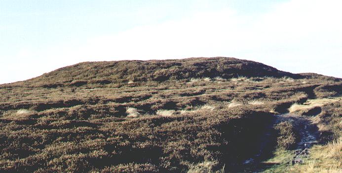
| If anyone is up at Black Howes in the coming months, please note that heather burning has rendered the main mound truly black (and howe), along with half of the second mound. The structures are, as a result, much clearer than I've seen them before, and more kerbstones are evident. Interesting stones are also newly in view on the small burnt-off area south and west of the Howes. |
 Posted by brackenberry
6th October 2007ce |
|
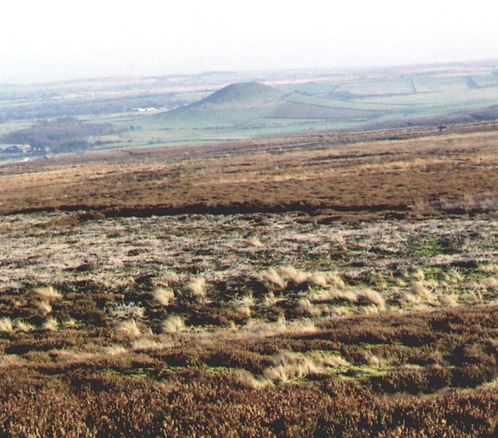
The Black Howes are a very prominent group of barrows and can easily been seen from Smeathorns road. Access is along the ancient path, or trod, known as Quakers' Causeway. The path runs from Aysdale Gate to Brown Hill. We approached it from Brown Hill, the main Howe is about 1km from the road. The first thing you notice is the wonderful views from this point, you can see the coast and lockwood Beck reservoir, but best of all are the views of Freebrough Hill. There are also a group of prominent barrows running along a ridge on the western horizon one of these barrows is Hob on the Hill. The first barrow you come to is large and low, approximately 1 metre high and 12 metres in diameter. The main group of three barrows are another half a kilometer along the track. The first one you encounter is the largest. It is over 2m high and about 18 metres in diameter. There are traces of a kerb around the barrow and the southern edge is cut by a drainage channel. The barrow itself resembles many of out local barrows and has a deep depression in the top probably caused by the excavation by the prolific barrow digger, Canon Atkinson. There are three barrows in this group and they grade in size with the largest in the east. The other two show no signs of a kerb. The group are aligned NNW-SSE. The question is which came first, the track or the barrows? are the barrows aligned to the track or to some other object? Whilst up there I had a look for Elgee's stone triangle, not for the first time. Elgee reports the triangle to be north of the Howes. I spent a good hour scouring the hill side between the path, Lockwood Beck and Spindle Bogs and came up with nothing. The hillside here is part of an intensly managed grouse moor. There are many drainage cuts, pools and shooting butts so although the moor has an outwardly natural appearence, it most definitely isn't. I suspect any decent stone on the moor, including kerb stones and possible any standing stones have ended up in one of the many shooting butts, drainage channels or dams on the moor. |
 Posted by fitzcoraldo
30th November 2003ce |
Miscellaneous |
|
|
"This is the more northerly of two mounds known collectively as the Black Howes. They are prominently sited on a north-west/south east ridge in open moorland at 280m O.D. The mound is largely of earth, and is 18m in diameter and 2.2m high, with traces of a megalithic kerb round it's outer edge. One kerbstone has a benchmark. A modern marker cairn has been constructed on the highest point (now gone - fitz). The Black Howes were opened by Atkinson, who found that both had been previously disturbed and their centres excavated. Atkinson excavated this mound extensively, and probably left very little untouched. Within the kerb he came upon 'an imperfect barrier of stonework' - an internal revetment wall - and at the centre he found a central cairn. On the north-west edge of the cairn he found inurned cremation which is now lost. 2.7m east of the centre was a large tripartite urn 'quite full of bone' accompanied by a bone pin." Bronze Age Burial Mounds in Cleveland G.M. Crawford 1980 |
Posted by fitzcoraldo 30th November 2003ce |