|
|

|
|
Brent KnollHillfort
|
||||||||||||||||||||||||
|
|
|
Images (click to view fullsize) |
|

|
Fieldnotes |
|
|
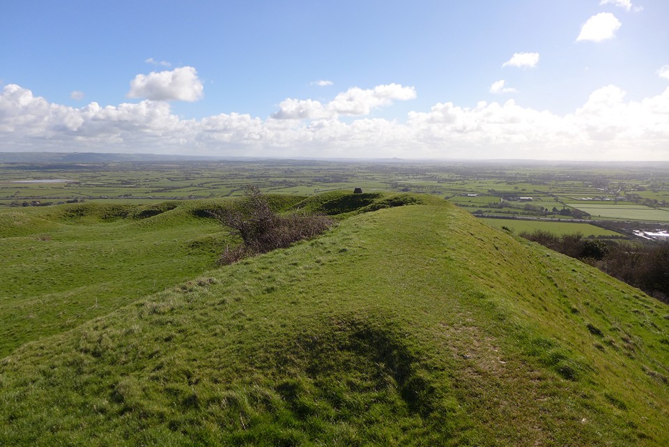
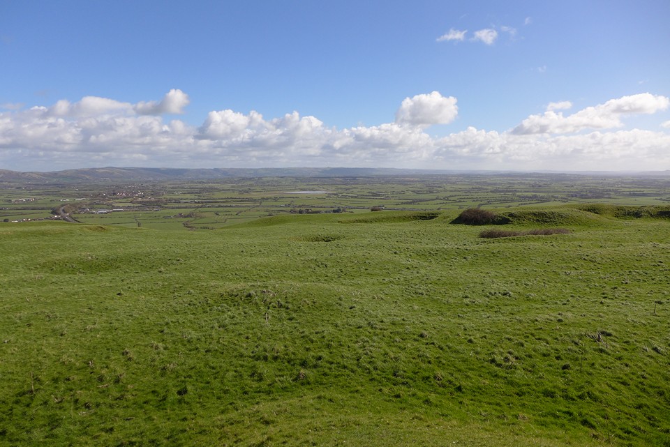
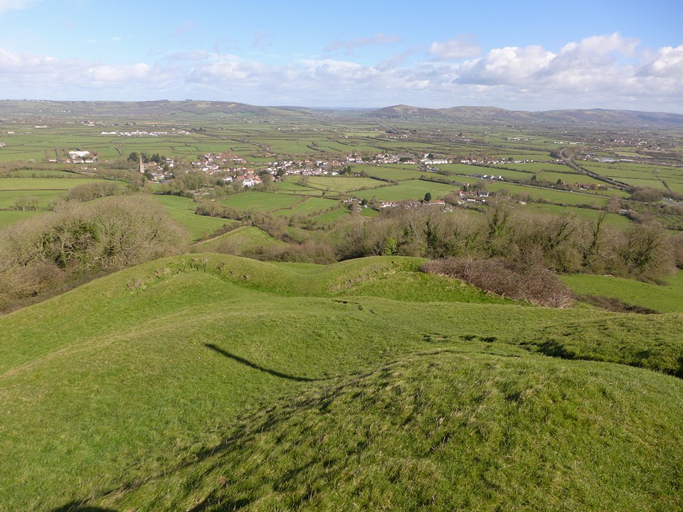
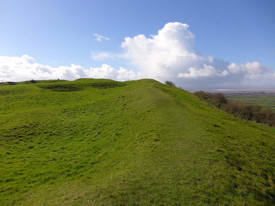
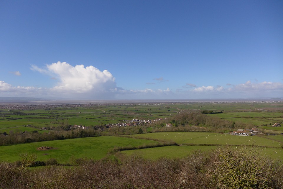
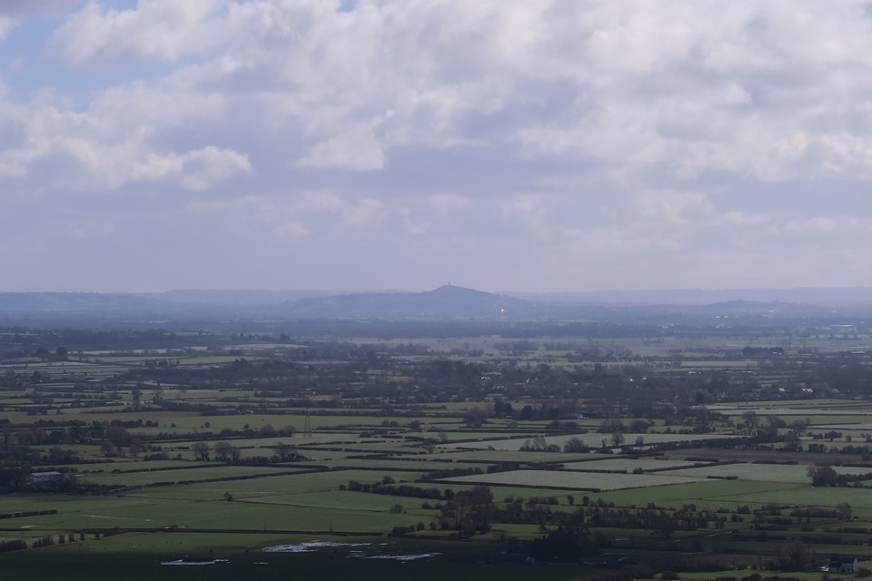
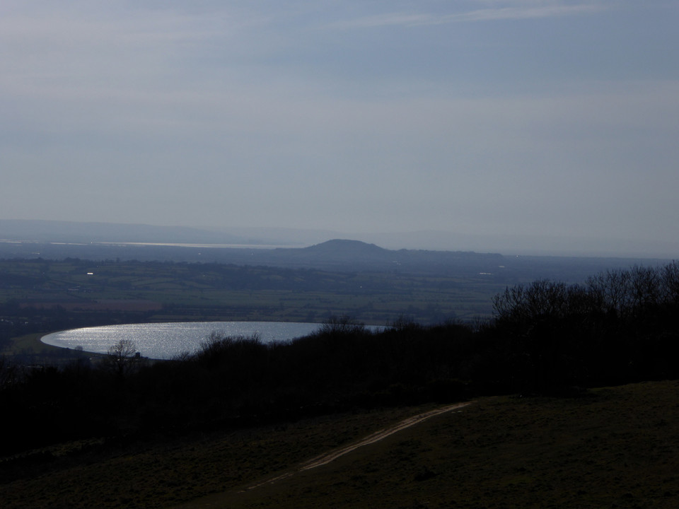
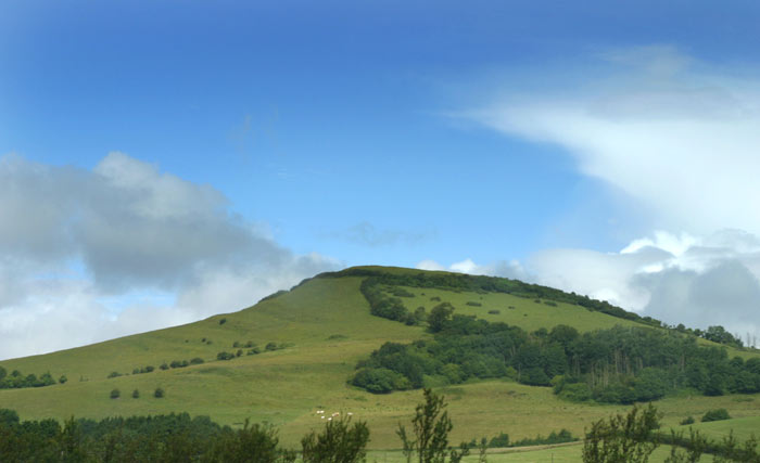
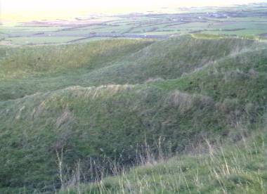
17/03/2019 – Staying in Bristol for a few days we decided to take the Stagecoach Falcon bus south past Bristol airport to visit Brent Knoll. The bus stops on the A38 at White Cross just south of the hill. It’s a shortish walk to Brent Knoll from here. We took the marked footpath up from behind the church, there’s parking for cars here too. The sun was shinning and the sky was blue (very windy though). Visibility was very good. Brent Knoll might be a small hill but wow what a position it has. Full 360 views for miles. We could easily make out Dunkery Hill in Exmoor and the wonderful Glastonbury Tor to the east. The large univallate fort itself is very good. Nice big ramparts and the interior is a good size. We tucked down just east of the topograph that occupies the position now of the long gone trigpoint to shelter from the wind to have our sandwiches. Just lovely to sit and gaze out across the landscape. Really good hillfort and well worth a visit. We made the slow walk back down to catch the bus north to Wavering Down (nice hill here too for walking, anyone know if the trig sits on an old cairn?) |
 Posted by thelonious
25th March 2019ce |
|
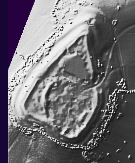
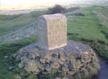
Visited 22.8.10. On many occasions I have driven past this Hillfort along the M5, looked up and thought 'I am going to visit you one day'. Well, today was the day! Access is easy as long as you are mobile and fairly fit! I parked next to St Michael's Church in the village of Brent Knoll and went through the kissing gate to the right of the church (public footpath sign). The gravel path loops around the back of the church and makes its way up towards the Hillfort. You then go through a second metal kissing gate and the climb becomes a bit less strenuous. Once you reach a third wooden kissing gate the climb becomes very stiff. You then come to a wooden stile with a National Trust sign bolted to it. This is the final part of the assent – and the steepest. Luckily the N.T. has put steps into the hill and the whole path is gravelled to make things a bit easier. The views from the top are excellent – you can see for miles all around. In fact, you can even see Glastonbury Tor over 20 miles away! There is one of those markers on the top which shows you what to look out for and how far away they are – I like these. There is also a stone monument stating that beacons were lit on the Hillfort to celebrate the Queen's Silver Jubilee in 1977 and various Coronations. The centre of the Hillfort has been quarried and has large 'dips' in it. It is very difficult to work out what is what. The ditch / rampart running around the top is quite well preserved in some places although difficult to spot in others. There seems to be a additional ramparts near the northern edge which could possibly mark the site of an entrance? It took me 20 minutes to walk from the church to the top and a further 10 minutes to walk right around the Hillfort. Luckily Dafydd was asleep in the car and Karen stayed with him. If I had to carry him up here I would have probably required resuscitation half way up!! Well worth a visit if you are physically able. The views are great. |
Posted by CARL 23rd August 2010ce |
Folklore |
|
Of the coming of the Danes the battle traditions have much to say, if nowadays they are growing misty. But here it must be noted that every tale of ancient warfare in the Quantock country, and probably in the rest of Somerset, is assigned to the time of the Danes in a way which is not wonderful when one considers that Athelney itself lies on the edge of the Quantock land, and that from 835 to 1010 the North Somerset coast was constantly ravaged by the Viking fleets. I have known even Sedgemoor fight ascribed to the Danes.Battleborough is on the south flank of Brent Knoll. From p38 in Local Traditions of the Quantocks C. W. Whistler Folklore, Vol. 19, No. 1. (Mar. 30, 1908), pp. 31-51. |
 Posted by Rhiannon
25th November 2006ce |
|
A bit more about the legends connected with Brent Knoll, as explained in Geoffrey Ashe's 'Landscape of King Arthur' (1987). Occultist Dion Fortune wrote about the hill in her novel 'The Sea Priestess' - she called it Bell Knowle and Ashe says she described it as 'modelled by colonists from Atlantis'. Whilst this is Rather fanciful, you can't help but admit that Brent Knoll has a decidedly impressive presence in the landscape, rising as an isolated bump at the edge of the utterly flat Somerset Levels. Its previous occupants gave it a single bank and ditch at the top, and may have steepened some of its slopes. It used to belong to Glastonbury Abbey - indeed you can see it from Glastonbury Tor. A chronicler of the 13th century tells how King Arthur was holding court at Caerleon one Christmas (or should that be Midwinter?). He knighted a bold young man called Ider, who was the son of King Nuth. Ash reminds us that a Gwyn ap Nudd was the lord of the underworld, and he lived in Glastonbury Tor*, and had a run in with St Collen, if you recall. So it seems likely that King Nuth could refer to the same man? As a new knight, Ider had to pass a test. He was told when at Glastonbury that three giants, 'notorious for their wickedness', lived on Brent Knoll, then known as the Mount of Frogs (Mons Ranarum). King Arthur intended to march against them, and Ider would be required to join him. Young and enthusiastic, Ider galloped ahead and slew all three giants singlehandedly. But unfortunately he was wounded himself, and by the time Arthur arrived Ider lay unconscious and dying. The King returned to Glastonbury blaming himself. He gave the lands around the hill to the abbey and asked the monks to pray for Ider's soul. Ider also appears as 'Yder son of Nut' in a French medieval romance by Chrétien de Troyes. [*assuming this is the correct location of the St Collen story (see the Tor page).] |
Posted by Rhiannon 23rd January 2006ce Edited 23rd January 2006ce |
| According to tradition it was formed from a shovel full of earth thrown down by the Devil when he was digging out Cheddar Gorge. In Arthurian legend it was the Mount of Frogs, and three giants lived there. The knight Ider, who had the task of challenging them, galloped off and killed all three without waiting for Arthur and the knights who were going to help him. |
 Posted by pure joy
19th March 2003ce |