|
|

|
|
Dinas (Blaenrheidol)Hillfort
|
|
|
|
Images (click to view fullsize) |
|


|
Fieldnotes |
|
|
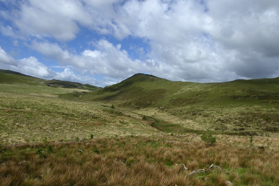
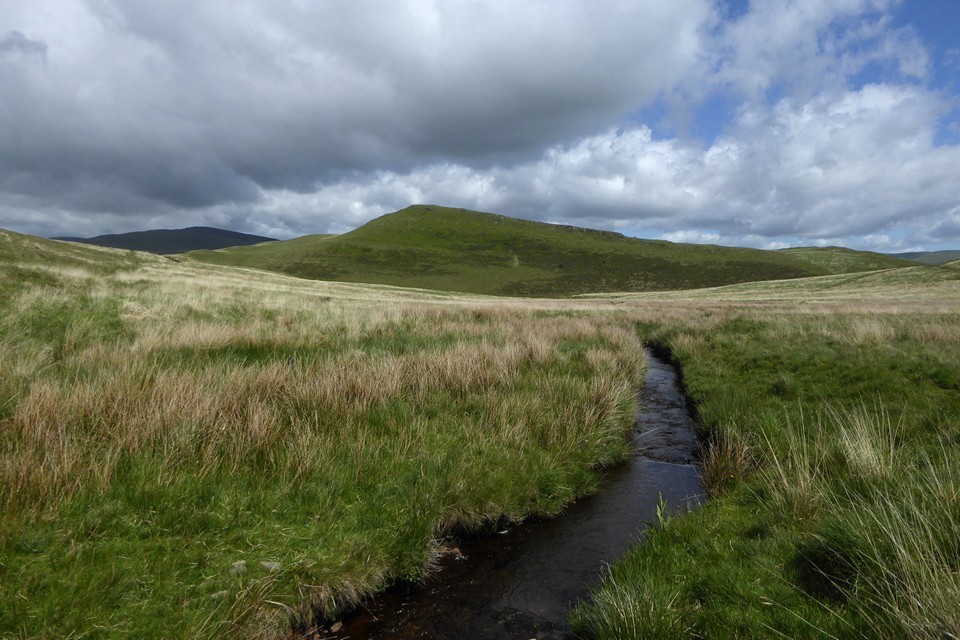
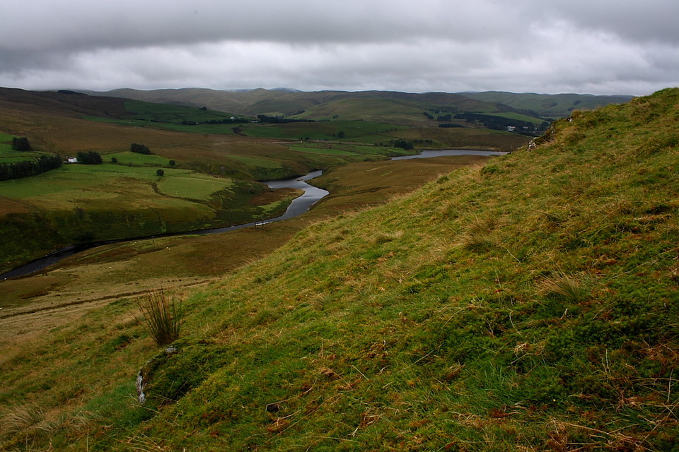
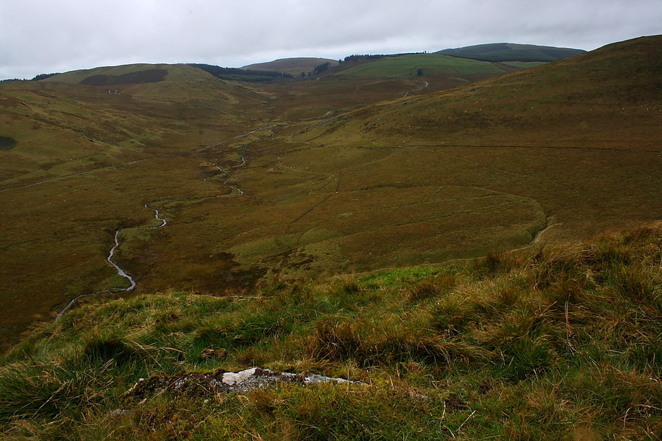
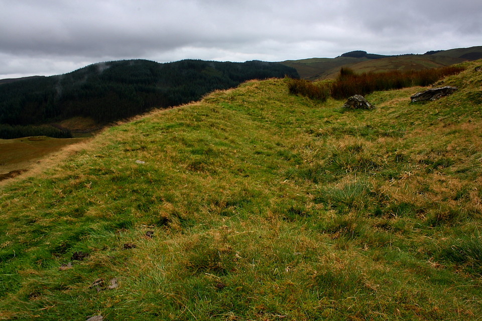
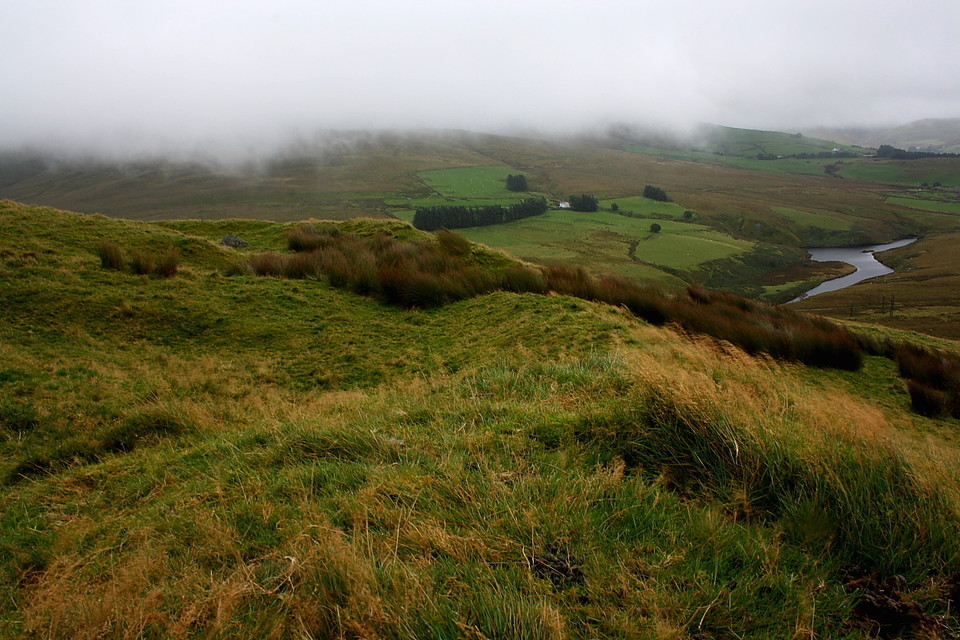
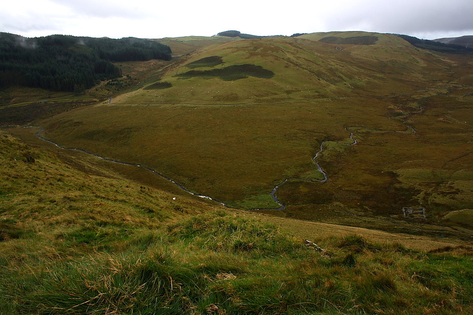
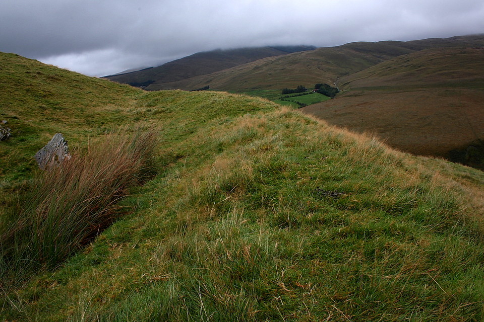
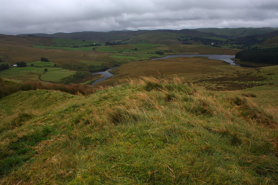
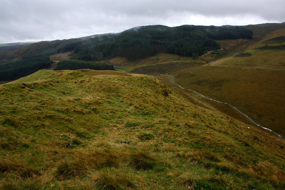
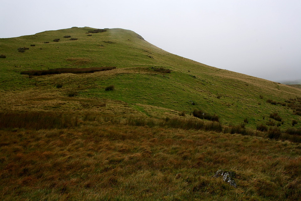
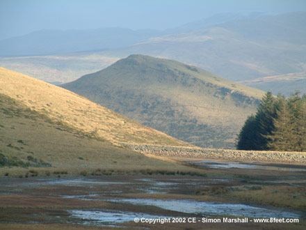
Now I'd been saving a visit to this prosaically named hillfort for a spell of clear weather in order to do justice to the views it obviously possessed. Nevertheless today I find myself leaving the sanctuary of the car to ascend to the ancient fortress, perched at the northern apex of a rocky ridge... in pouring rain. Eh, how did that happen? Yeah, as John le Mesurier might well have laconically observed ...'Do you think this is wise, sir?' He'd have had a point, too, since mist swirling around summit crags surely does not promise great vistas. However my ageing waterproofs begin to 'wet-out' as soon as I step outside and the climb from the bridge to the south, as Kammer notes, is not overly taxing relative to Pumlumon. Besides, I can always come back. The single rampart defining this enclosure is not particularly powerful but, to be fair, it had no need to be, not with topography such as this to provide overwhelming natural defence. Coflein reckons the hillfort is: "...pear-shaped, 107m N/S by 51m E/W. Hogg (Cardiganshire County History 1994, 270) described the rampart as `'a stony bank, about 5.5m wide and just over a metre high externally.'... The original entrance, an unelaborated gap, is centrally placed in the rampart on the south side and commands panoramic views to the south. T Driver, RCAHMW, 15 September 2004." Ah, 'panoramic views to the south'; not that these are immediately apparent, of course. However as I undertake my usual (ritualistic?) circuits of the banks the 'unseen hand' of Mother Nature clearly takes pity on the sodden traveller, quickly dispersing the annoyingly opaque vapour along with its residual aqueous cargo. Ah, that's better. Always good to be able to see what one's doing. The Afon Rheidol, it goes with out saying keeping its reservoir duly 'topped up' in the circumstances, provides the water feature to the east and south-east. That lying below to the west is the Nant Dinas, as you might expect from the general nomenclature utilsed in the area. To the north-west Disgwylfa Fach watches (appropriately enough) over the site, its Big Sister, complete with massive round cairn (the source of those enigmatic 'dugouts'), looming to the right. Below to the north-east, across the Rheidol, sits the excellent little cairn circle at Hirnant; whilst the main Pumlumon massif dominates the northern horizon. Yeah, it would have been a shame to miss all this... let's just say I had an inherent feeling I wouldn't. Or else was just plain jammy, for once? Coflein cites the existence of a number of possible hut 'platforms', a certain example located near the centre of the enclosure. Other points of interest include the incorporation of the summit crags upon the western flank in the defences, as well as a possible original cross bank. But wait; this being Pumlumon, there's more. Controversial, too. It short it seems that during 1938 - the year after THOSE excavations upon Disgwylfa Fawr - what has been described as a 'hurried burial' [R.S. Jones, Cambrian Archaeological Projects, 2004] was discovered here featuring 'human bones and 'plate armour'' within a stone cist... as reported within the Western Mail of 6th Sept. 1938 ('Historical Finds on Welsh Mountains'). 'Plate armour'? As with the 'dug-outs' located further north, guess it's all a question of interpretation. Was it an Iron Age inhumation, with a slab of the new 'stuff' as grave goods... or that of a medieval knight fallen in the battle local legend attributes to the site... a warrior who, by all accounts, must have been deemed quite a dude?' Hey, the cloud may have left Dinas today.... but the nebulosity, it seems, remains.... |
 Posted by GLADMAN
1st December 2012ce Edited 2nd December 2012ce |
|
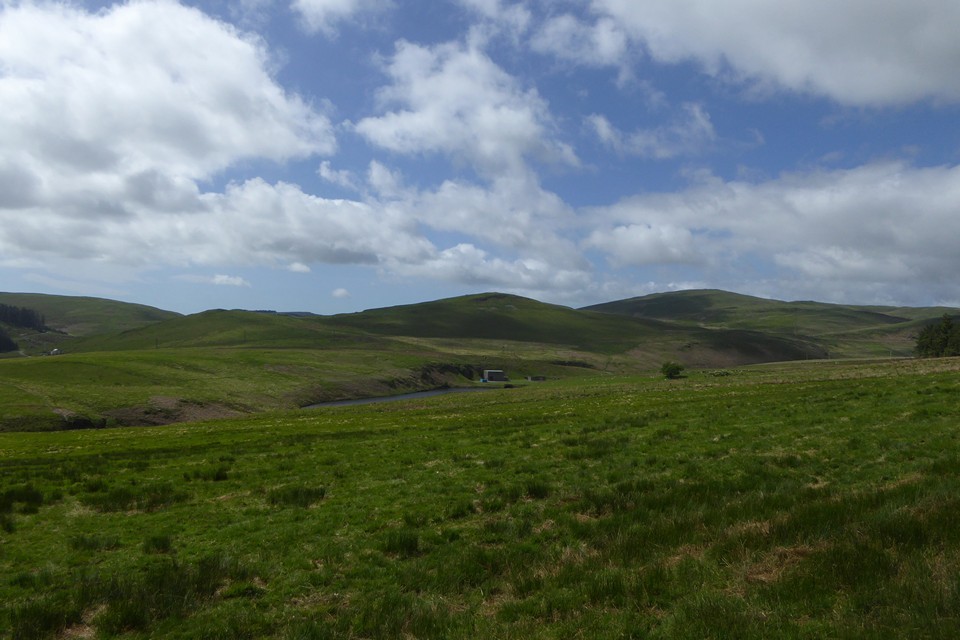
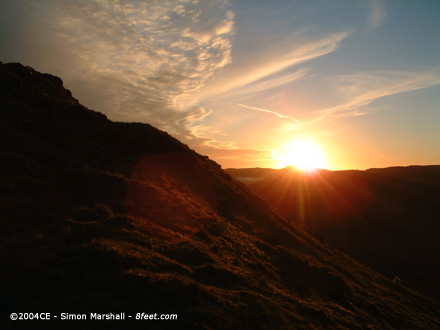
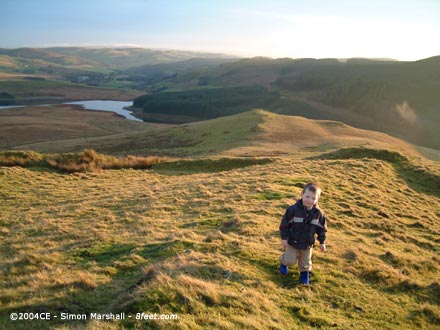
Visited 22nd November 2003: William and I climbed Dinas, me with Alfie on my back. The plan was to get the boys out of the house so that Louise could work. Will coped well with the gradient (genuinely enthusiastic), especially as he was only four. Alfie slept most of the time (no enthusiasm there). By the time we got to the top there wasn't much sunshine left. The oblique light worked to emphasize the contours of the fortifications, so it was easy to take photos. The views of the surrounding hills and Dinas Reservoir were as stunning as I remembered from the last time I climbed up to the fort. It got chilly as the sun set, and with the light fading we headed back downhill to the car, making it before it got dark. |
 Posted by Kammer
3rd June 2004ce |
|
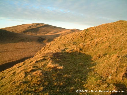
Visited Winter 1999 (I think): The climb up to Dinas isn't quite as bad as it looks, but you'd be hard pressed to get a pushchair up there. Approaching from the south you can park at the gate just to the north of the bridge (SN741827) and there's a public footpath that goes east, then north, passing to the east of the hillfort. Obviously there's no point in sticking to this path because you'll miss the views to the west, and any chance of identifying the ramparts of the fort itself. Up at the top the views are spectacular, especially to the west and east (towards Pumlumon Fawr). The climb is worth it just for the feeling of splendid isolation, and knowing that you're slap bang in the middle of an excellent cluster of upland Bronze Age sites. |
Posted by Kammer 14th January 2003ce Edited 27th May 2004ce |
Miscellaneous |
|
|
Dinas is visible from most of the Bronze Age sites that surround it, so inevitably it's ended up in the photos I've posted up for them. Rather than post the same images up twice, here are some links to those photos: Buwch a'r Llo Garn Lwyd Stone Garn Lwyd Stone Y Garnedd Lle'r Neuaddau Circle |
Posted by Kammer 14th January 2003ce Edited 10th November 2003ce |