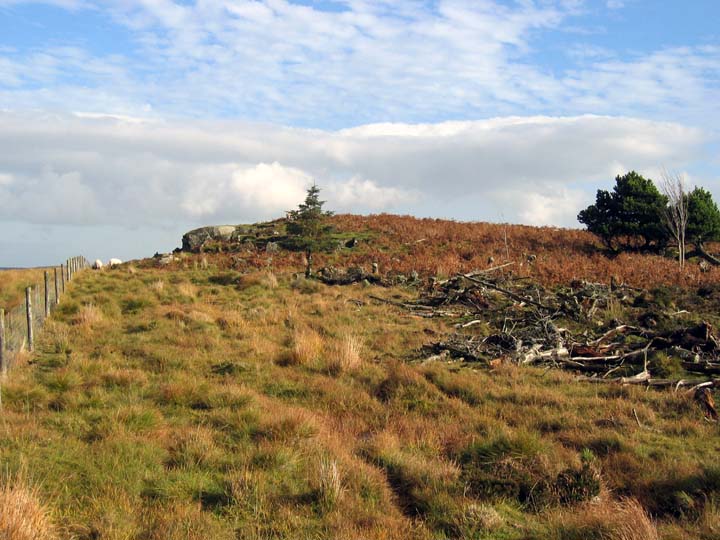
It's a lot easier to find the outcrop now that the trees have gone. You don't need a gps for this one anymore.
However, the shortest route from the main road is deceptive on the map. The footpath cutting through the old plantation looks nice and straightforward on the map, but in reality, it's seriously difficult to walk over. Half buried, rotten tree stumps and branches combine with heather to form a rather irritating obstacle course. And that's on a good day, I shudder to think how awkward crossing this would be if it were wet, when the bogginess would add to the fun.
All of this can be easily avoided by skirting the edges of the old plantation, it's now got an open access sign, so whilst it seems a bit like going out of your way, it's much quicker.
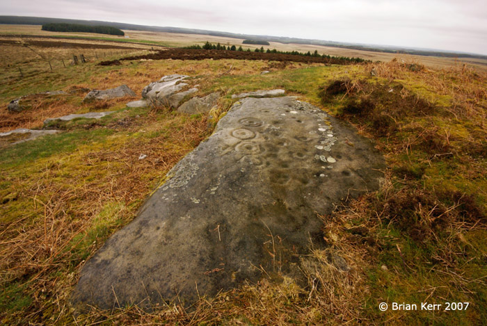
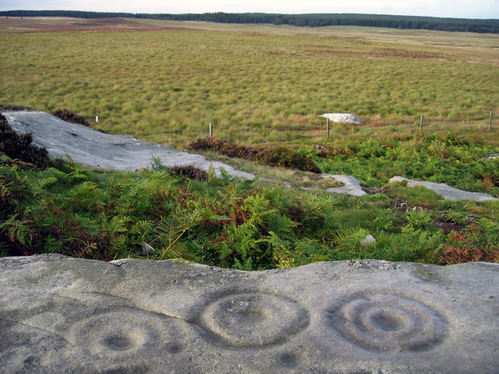
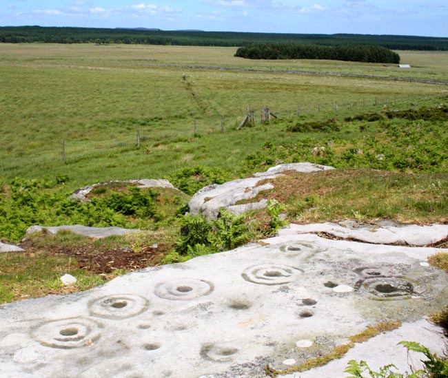
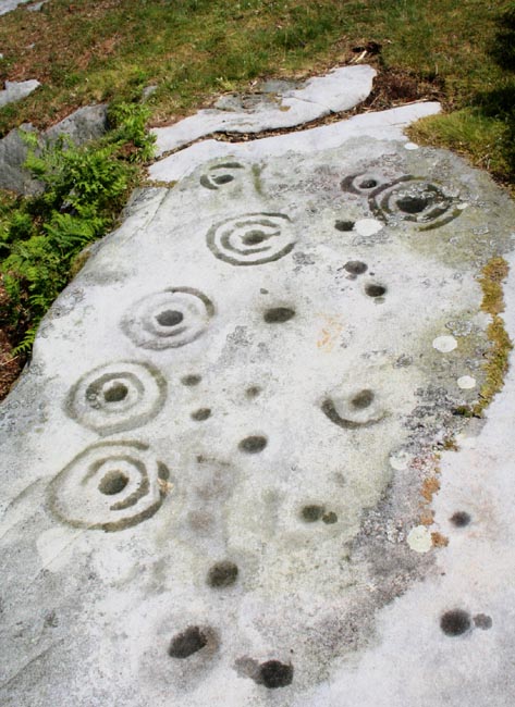
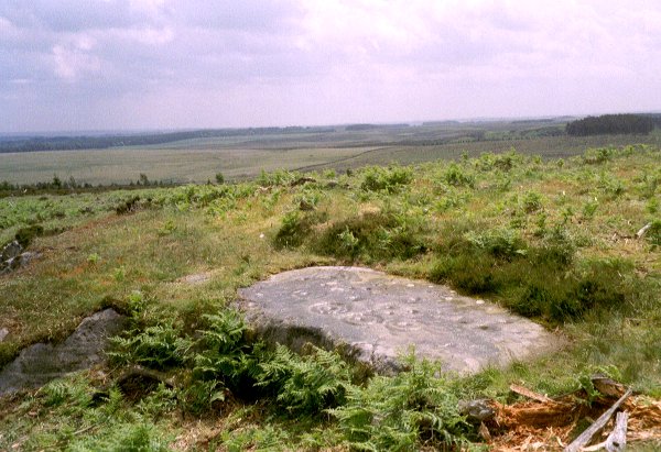
When you get to the outcrop, just keep heading to the furthest edge, and the carvings are easily found.
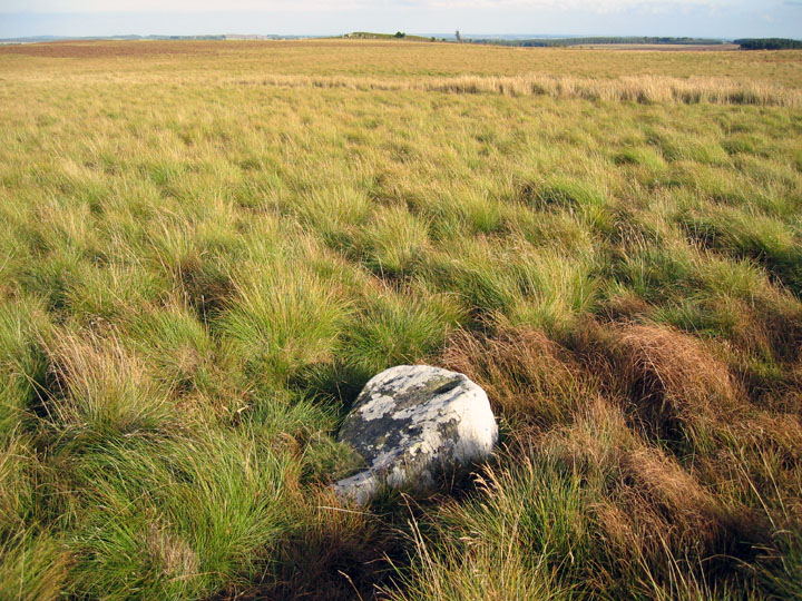
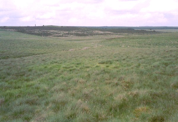
There are at least two overgrown cairns between the outcrop and the road, they don't look like they've been mucked about with, though they are low, so may have been robbed out. They're not marked on maps or recorded on databases as far as I know.
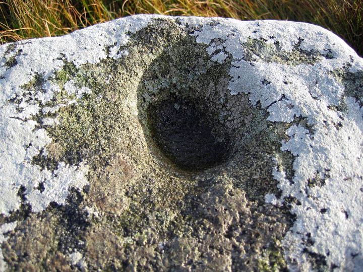
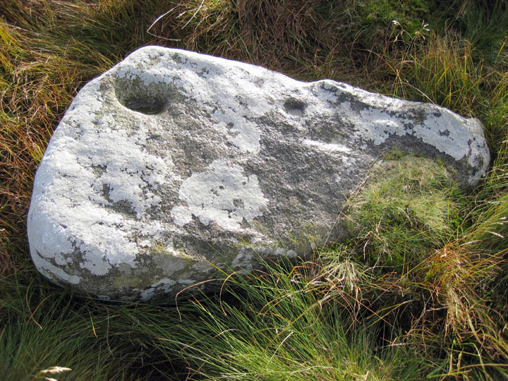
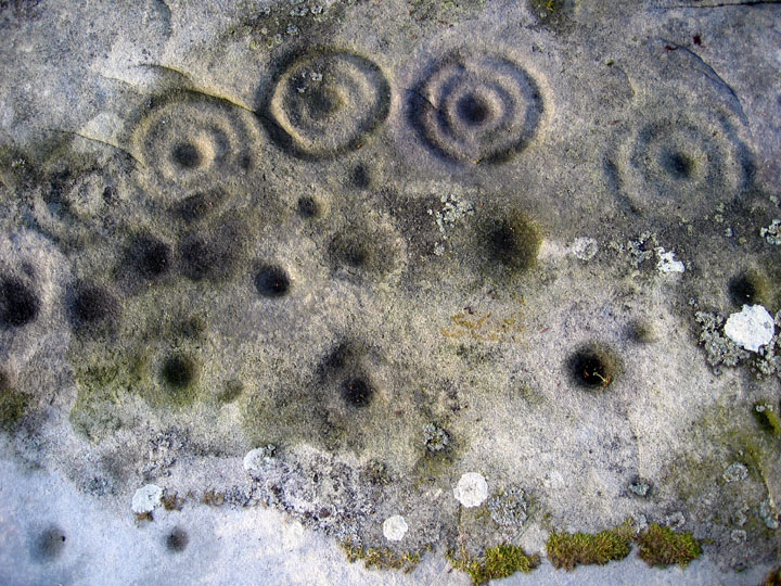
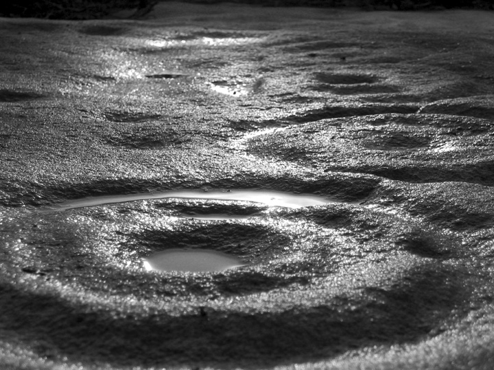
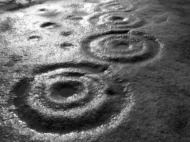
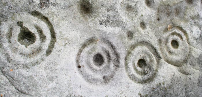
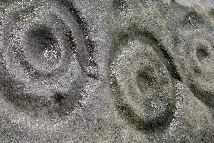
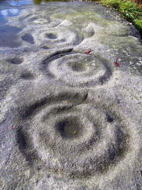
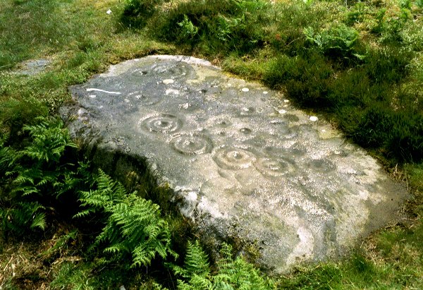
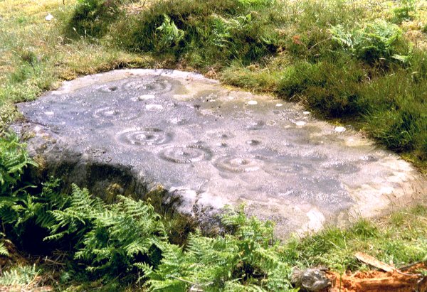
With it's cups and multiple rings, nearby cairns and the obligatory view of Simonside, Tod Crag is a nice example of Northumberland Rock art. A bit out on a limb, but it sort of links the more complex motifs found in the north of the county, with the simpler ones found to the southern end of Northumberland. It's halfway in between, both geographically and stylistically.
I thought I'd just pop along and see what was here, there was a path nearby, I thought, should be easy. Wrong!
It was over boggy ground (thankfully mostly frozen), up a hill, fighting over a fence, all the time with some rather menacing-looking sheep watching! In the end, got where I wanted but inside the tree plantation the ground was, as you would expect, littered with needles to quite a depth. I tried a few exposed rocks, but they were loose and bare. I think any carved outcrop here would be well-and-truly hidden, and worst-case may be even damaged by the planting.
I didn't find anything anyway :-( and I won't be coming back unless the trees go!!

 Posted by Hob
 Posted by pebblesfromheaven