The Modern Antiquarian
Log in
|
Register
Home
Latest Posts
Forums
Maps
Help
Browse Sites
News
Blog
Contributors
The Books
Select
-
Belgium
Denmark
Eire
France
Germany
Greece
Italy
The Netherlands
Norway
Portugal
Republic of Malta
Spain
Sweden
Switzerland
United Kingdom
Northern Ireland
County Fermanagh
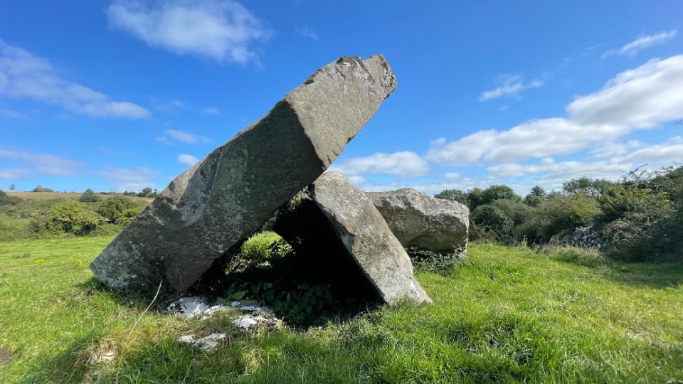
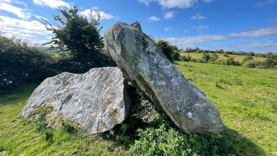
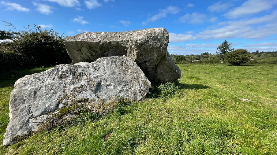
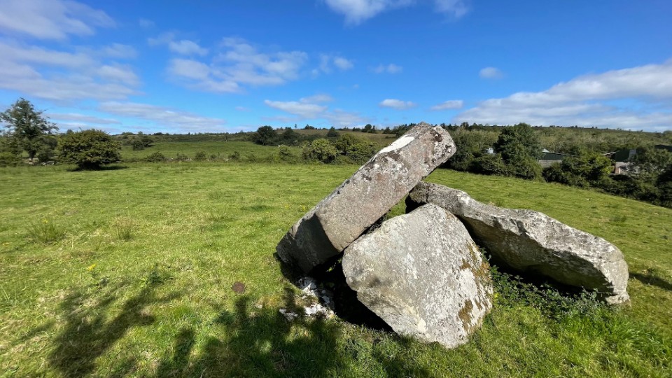
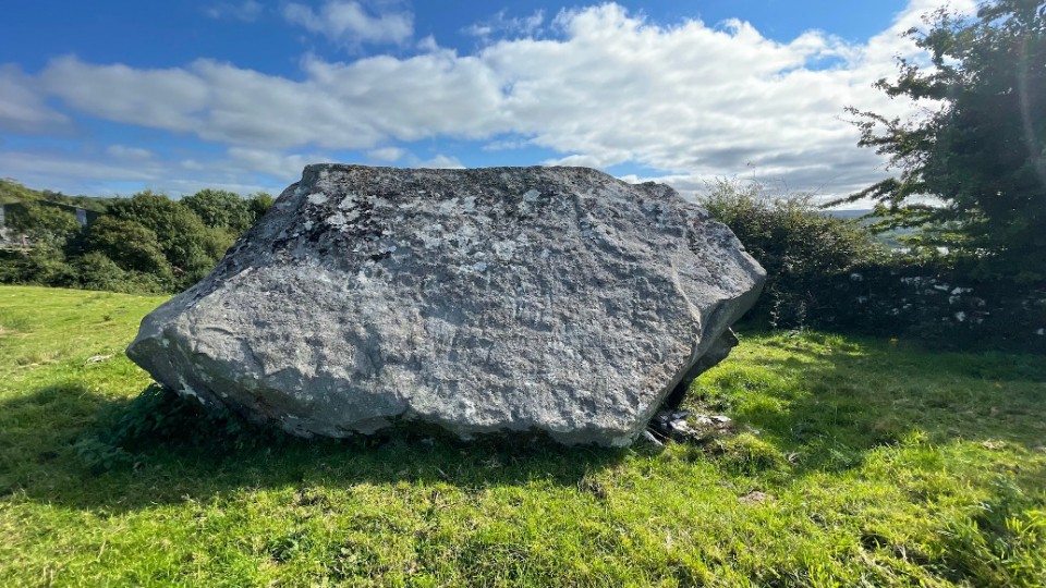
Kilrooskagh
Portal Tomb
Kilrooskagh (Portal Tomb) on The Modern Antiquarian, the UK & Ireland's most popular megalithic community website. 5 images, plus information on many more ancient sites nearby and across the UK & Ireland.
Image © ryaner
OS Ref (GB):
Latitude:
54° 18' 30.56" N
Longitude:
7° 54' 23.21" W
Added by
ryaner
Images (5)
0 discussions
Start a topic
Show |
Hide
Web searches for Kilrooskagh
Flickr
Google
Google Images
Megalithomania
Bing
Stone Pages
Wikipedia
Show map
(inline Google Map)
- Sites within 20 km -
-
Rushin (1.46km E) (2 posts)
Cavancarragh (1.49km E) (5 posts)
Killinagh (1.98km S) (10 posts)
Templenaffrin (4.07km E) (6 posts)
Cullentragh (4.57km ESE) (5 posts)
Burren (N) (4.73km SE) (2 posts)
Lanliss (4.82km SE) (12 posts)
Burren (Central, W) (4.86km SE) (13 posts)
Burren (Central II) RA (4.88km SE) (4 posts)
Burren (Central II) (4.88km SE) (8 posts)
Aghanaglack (4.95km NE) (16 posts)
Burren (Central) (4.98km SE) (12 posts)
Burren (E) (5.11km SE) (24 posts)
Burren Central (III) (5.27km SE) (3 posts)
Brockagh Lower (5.33km WSW) (2 posts)
Legalough (5.44km SE) (2 posts)
Legalough (5.44km SE) (4 posts)
Legalough (5.44km SE) (4 posts)
Burren (SW) RA (5.51km SSE) (2 posts)
Burren (SW) (5.61km SSE) (9 posts)
The Rocking Stone (5.68km SE) (1 post)
Moneygashel (5.98km S) (6 posts)
Moneygashel (6.08km S) (7 posts)
Duckfield (6.24km SE) (4 posts)
Manragh Upper (6.27km SE) (1 post)
Clyhannagh (6.36km ESE) (12 posts)
Manragh Upper (6.37km SE) (0 posts)
The Shaking Stone (6.38km NNW) (0 posts)
Kilnameel (6.6km SE) (0 posts)
Garvagh (7.08km SSE) (4 posts)
Mullaghboy (7.21km SSE) (3 posts)
Carrickmacsparrow (7.68km ENE) (6 posts)
Reyfad (8.03km NE) (14 posts)
Garvagh (8.11km SSE) (0 posts)
The Shannon Pot (8.31km S) (3 posts)
Drumgormly (10.46km NW) (0 posts)
Legland (10.52km N) (0 posts)
Corracloona (11.19km WNW) (12 posts)
Dog Little (11.45km NW) (0 posts)
Carrigeengeare (12.25km WSW) (2 posts)
Carrickbrannan (13.02km SSW) (5 posts)
Lisdarush (14.67km W) (0 posts)
Greenan (15.37km ESE) (9 posts)
Killy Beg Stone Circle (15.82km NW) (3 posts)
Meenymore (15.97km WSW) (1 post)
Killy Beg 1 (16.22km NW) (5 posts)
Killy Beg 2 (16.22km NW) (3 posts)
Killy Beg 4 (16.27km NW) (0 posts)
Tullyskeherny (16.3km WSW) (7 posts)
Killy Beg 3 (16.41km NW) (0 posts)
Larkfield (18.06km WSW) (1 post)
Tawnymanus (18.07km WSW) (5 posts)
Druminalass (18.33km SSW) (1 post)
Cloonmeone Upper (18.89km SW) (5 posts)
Kilnagarns Lower (18.92km SW) (0 posts)
Kilnagarns Upper (18.92km SW) (0 posts)
Shasgar (19.27km W) (0 posts)
Gortaloughan (19.51km ENE) (2 posts)
- Add -
-
Add news
Add an image
Add fieldnotes
Add folklore
Add miscellaneous
Add a link
-
Add a site
Add a nearby facility
Add an alternative name/spelling
Images
(click to view fullsize)
Add an image
 Image © ryaner