The Modern Antiquarian
Log in
|
Register
Home
Latest Posts
Forums
Maps
Help
Browse Sites
News
Blog
Contributors
The Books
Select
-
Belgium
Denmark
Eire
France
Germany
Greece
Italy
The Netherlands
Norway
Portugal
Republic of Malta
Spain
Sweden
Switzerland
United Kingdom
Scotland
Highland (Mainland)
Ben Uarie
The Craggan
Cairn(s)
The Craggan (Cairn(s)) on The Modern Antiquarian, the UK & Ireland's most popular megalithic community website. 3 images, plus information on many more ancient sites nearby and across the UK & Ireland.
Image © thelonious
Nearest Town:
Dornoch (29km S)
OS Ref (GB):
NC9009816573 /
Sheet: 17
Latitude:
58° 7' 28.78" N
Longitude:
3° 51' 58.03" W
Added by
thelonious
Images (3)
0 discussions
Start a topic
Show |
Hide
Web searches for Craggan
Flickr
Google
Google Images
MAGIC
The Megalithic Portal
Bing
Stone Pages
Streetmap.co.uk
Wikipedia
Show map
(inline Google Map)
- Sites within 20 km -
-
Ben Uarie (2.61km E) (18 posts)
Kilearnan (3.07km NE) (10 posts)
Kilearnan Hill (3.56km NE) (1 post)
Carn Liath, Strath of Kildonan (4.07km NNE) (6 posts)
Clach Mhic Mhios, Glen Loth (4.2km E) (24 posts)
Craig Halligarry (4.5km NE) (8 posts)
Clach Na H-Uaighe (4.54km N) (1 post)
Balvalaich (5km ENE) (7 posts)
Gailiable (5.05km ENE) (4 posts)
Glen Loth (5.21km ESE) (10 posts)
Strath of Kildonan (5.72km ENE) (4 posts)
Carn Bran (6.05km ESE) (17 posts)
Suisgill Lodge (6.62km NNW) (1 post)
Learable Hill (6.86km NNW) (20 posts)
Torrish Burn (6.89km ENE) (5 posts)
Learable Hill (6.99km NNW) (4 posts)
Torrish Burn (7.06km ENE) (8 posts)
Ach An Fhionnfhuraidh (7.4km NNW) (0 posts)
Learable Hill (7.47km NNW) (6 posts)
Lothbeg Bridge (7.58km ESE) (13 posts)
Eldrable (8.33km ENE) (1 post)
Carn Nam Buth (8.4km NNW) (7 posts)
Suisgill (8.81km NNW) (14 posts)
Kintradwell (8.95km SE) (20 posts)
Cos Ceumach (9.12km SSE) (1 post)
Kilphedir (9.55km ENE) (16 posts)
Kilphedir (9.65km ENE) (9 posts)
Salscraggie Cairn (10.06km ENE) (9 posts)
Caisteal na Coille (11.06km WSW) (17 posts)
Caen Burn, Strath of Kildonan (11.15km ENE) (35 posts)
Carrol (11.47km SSW) (32 posts)
Kinbrace Burn (11.96km NW) (7 posts)
Feranach (12.11km WNW) (1 post)
Carn Laggie (12.16km ENE) (12 posts)
Leadoch (12.29km SSW) (8 posts)
Duchary Rock (12.8km SSW) (10 posts)
Kinbrace Hill (12.88km NW) (22 posts)
Altanduin (13.05km WNW) (0 posts)
Creag Nan Caorach, Kinbrace (14.68km NW) (10 posts)
Carn Liath (15.46km S) (36 posts)
Backies (15.48km SSW) (21 posts)
Allt Preas Bhealaich (15.53km NE) (3 posts)
Green Table (15.69km ENE) (0 posts)
Dunrobin (16.05km SSW) (8 posts)
Harvieston (16.3km NW) (9 posts)
Carn Richard (16.89km NW) (15 posts)
Ousdale Burn (17.11km ENE) (22 posts)
Ach'na H-uai' (17.22km NW) (2 posts)
Kinbrace (17.25km NW) (5 posts)
Benbhraggie Wood (17.44km SSW) (6 posts)
Beinn A' Bhragaidh (17.87km SSW) (5 posts)
Cnoc An Liath-Bhaid (18.39km WSW) (26 posts)
Blairmore (19.78km SW) (1 post)
Langwell (19.8km ENE) (7 posts)
- Add -
-
Add news
Add an image
Add fieldnotes
Add folklore
Add miscellaneous
Add a link
-
Add a site
Add a nearby facility
Add an alternative name/spelling
Images
(click to view fullsize)
Add an image
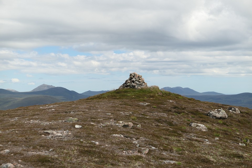
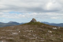 Image © thelonious
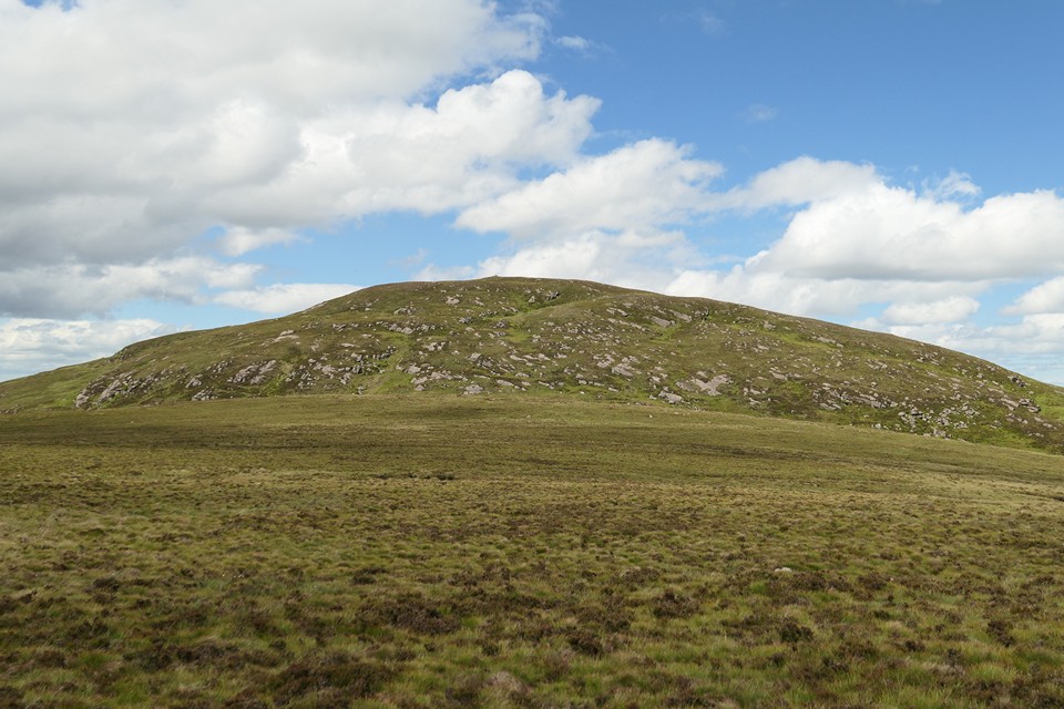