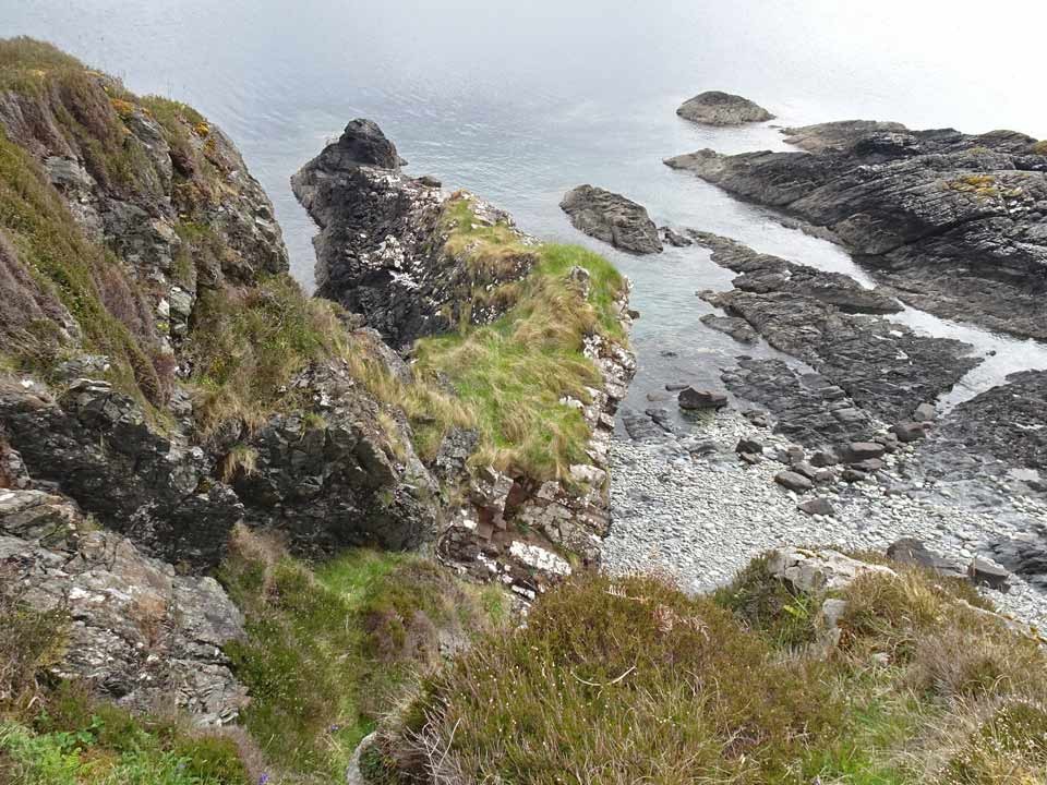
Five miles south of Broadford, on the A851 road to Armadale, is the Forestry Commission's Leitir Fura woodland (signed from the roadside), which provides an enjoyable two mile walk to the ruins of a township that was deserted in the early 18th century. On the coast, due south of the township and about 200 metres west of Rubha Guail on the Sound of Sleat—flanked by shingle beaches—stands a rugged headland atop which can be found the remains of Leitir Fura Promontory Fort. To reach the fort, start from the car park close to Kinloch Lodge (blue marker on the map below) and follow the path marked "Leitir Fura Historic Township". The path is circular so you have two options, the low path which is flanked by woodland all the way (white line on map) or the upper path (yellow line), signed "Drover's Path", which climbs above the tree-line and gives superb vistas across the Sound of Sleat to Glenelg and Knoydart. Either way, you end up at the Township (green marker).
Immediately south of the zig-zag path that leads down from the township is a large cleared turning area for Forestry vehicles. It is from here that you make the push for the fort. The terrain I crossed commenced with a thickly vegetated area of bracken and brambles which leads to birch woodland towards the right: in summer, reinforcments of bracken render the way all but impenetrable! Since the fort cannot be seen from here, a compass is a useful aid to reaching the fort (red marker), which stands due south of the turning area.
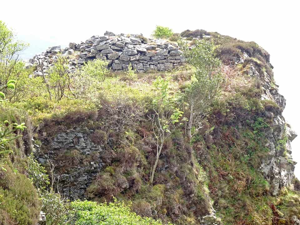
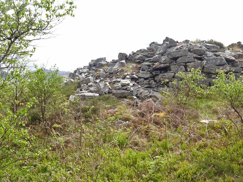
The going was hard until I came across a rough path at half distance, which eased my route to the trees. Once amongst the trees the walking is easy. Bear right through the woodland until you reach a stream (the Allt Achadh an t-Sabhail), and cross it. Although the terrain here slopes easily down to the coast (which is easily accessed), you will soon see the formidable vertical cliffs of the Promontory ahead. Carry on till you reach the neck of the promontory, by which time you will see the northeast wall of Leitir Fura Fort on the cliff top ahead. The promontory is choked by rampant birch scrub so a direct ascent is not possible, but I found I could outflank this by keeping close to the cliff edge.
An easy alternative is to make your way down to the shingle beach northeast of the fort from where there is an easy rising path to the summit that follows close to the cliffs.
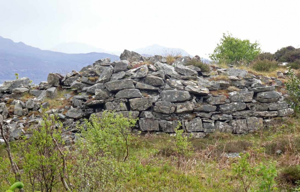
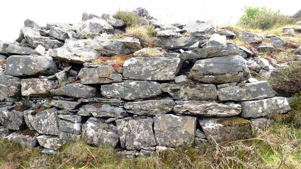
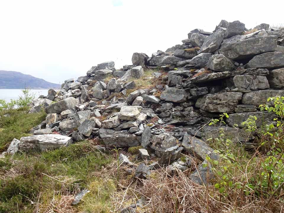
Of the fort itself, little remains apart from a significant stretch of slightly curving wall face on its northwest. The wall is well built, measures three metres in width by two metres in height and rises to six or seven courses. And that's about all there is of note. Canmore states that: "At the E end of this terrace, a massively constructed entrance can be seen, measuring about 2m in width by 3.7m in length and approached by ramp leading up from the beach on the NE and providing the only easy access to the top of the promontory".
Although I easily found my way up the "ramp leading up from the beach", I saw no evidence of the "massively constructed entrance". Maybe I'll return another day and check this out!
Possible easier route
After leaving the fort and returning to the car park by the lower path, I noted, just a few metres along, a rough track entering the woodland and apparently following the aforementioned stream. If it is possible to follow the stream from this point, you would have to cover relatively easy wooded terrain all the way to the fort. I may investigate in future.


 Posted by LesHamilton