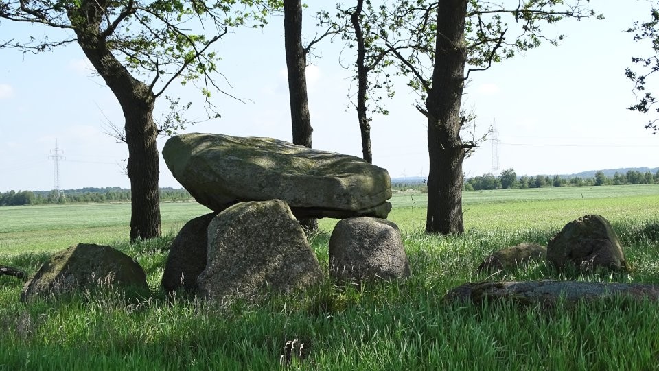
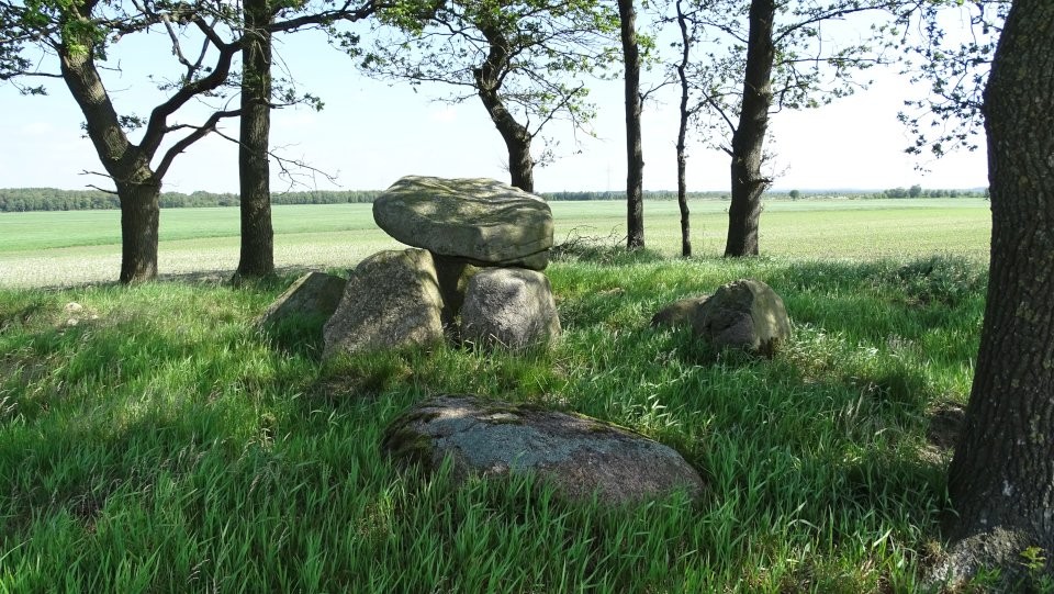
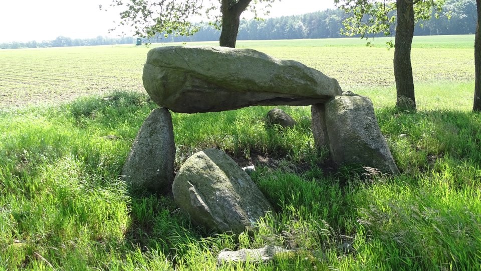
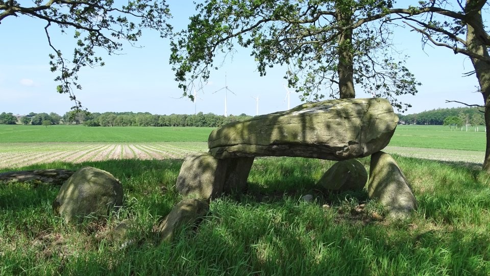
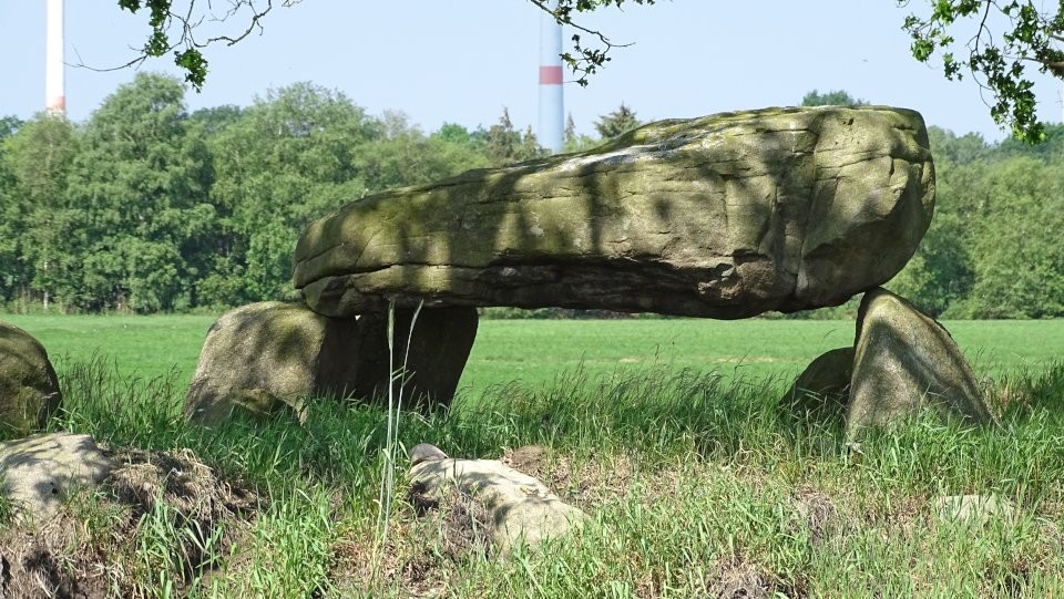
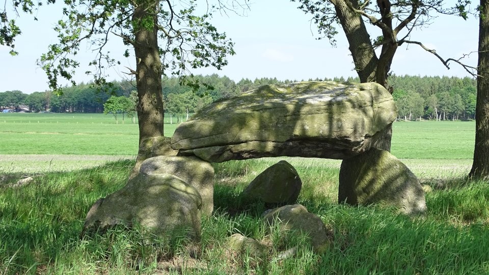
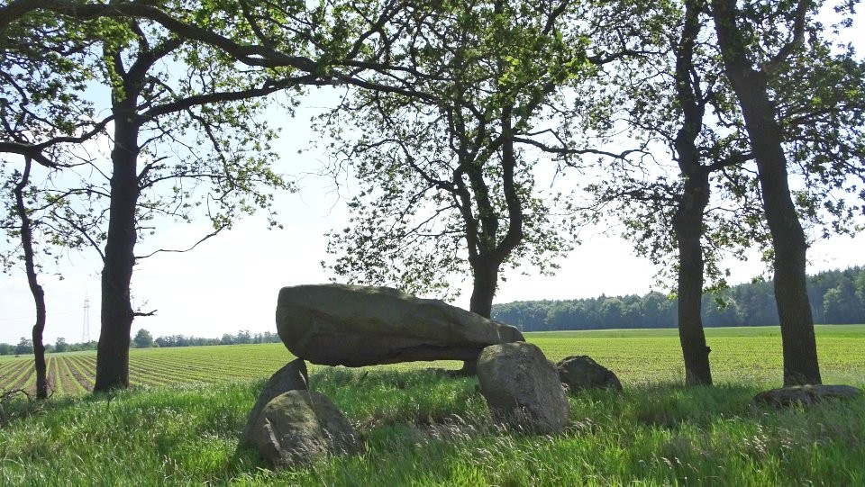
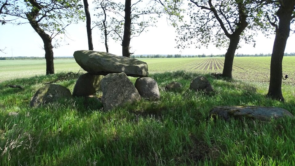
The tomb is unfortunately heavily destroyed, so its kind of tomb or its original appearance can not be reconstructed. The burial chamber is oriented approximately northwest-southeast. Only two wall stones of the southwest long side and one of the northwest long side are preserved in situ. On these three stones rests a large capstone with a length of 2.6 m, a width of 1.7 m and a thickness of 0.7 m.
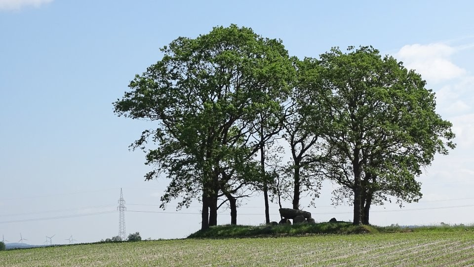
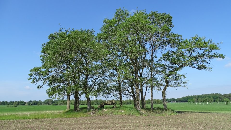
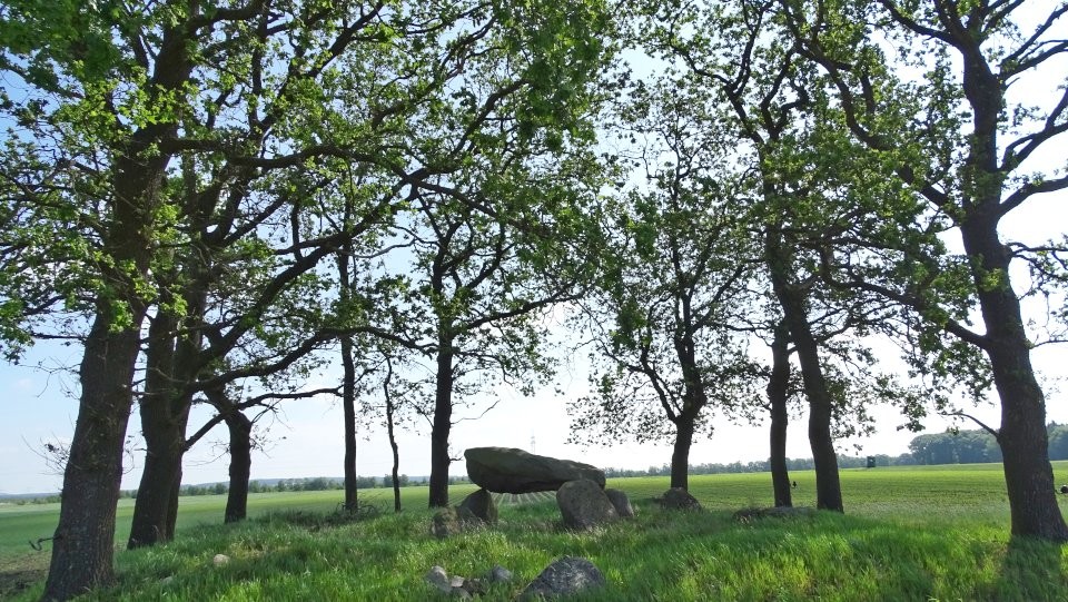
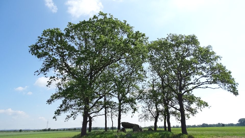
Großenhain, also called Dansenstein (Low German for dancing stone) is located about 2 km north of Großenhain at the highest point under a grove of trees in the midst of fields, so that you can see the picturesque tomb already from a distance. Although pretty much destroyed and only of average size, the tomb is one of the kind that which surrounds a special aura.
Drive on the L119 from Großenhain towards Meckelstedt. Around 2 km afte you leave Großenhain, the road Neue Siedlung branches off to the right. Follow this road for approximately 575 m and park your car here where the road bends right. Walk along the road for another 50 m, then take the field track to the left, which leads along bushes on the right straight into a northern direction. Follow this track for about 400 m, you should already see the tomb on the highest point of the fields to the right side.