|
|

|
|
Deinste 1Passage Grave
|
||||||||||||||||||
|
|
|
Images (click to view fullsize) |
|
Photographs: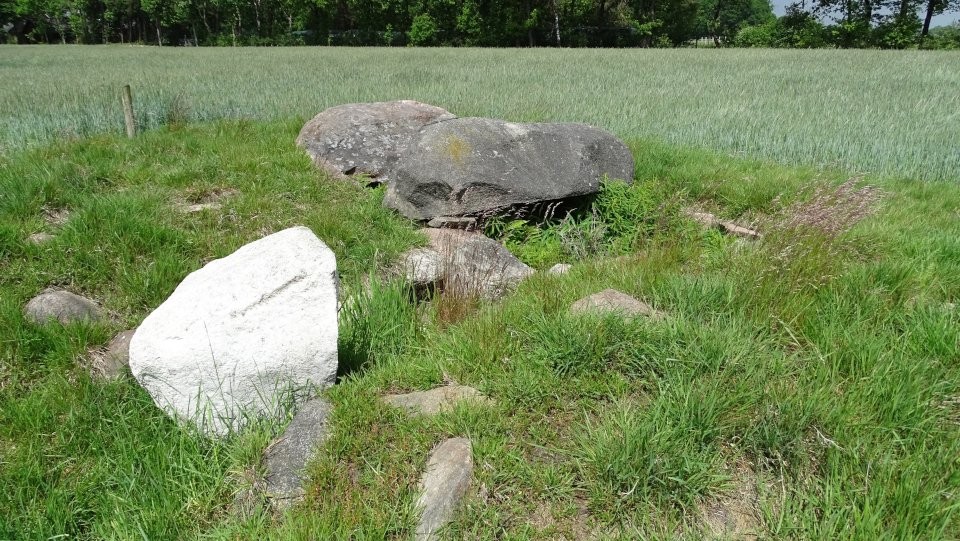

 Maps / Plans / Diagrams:
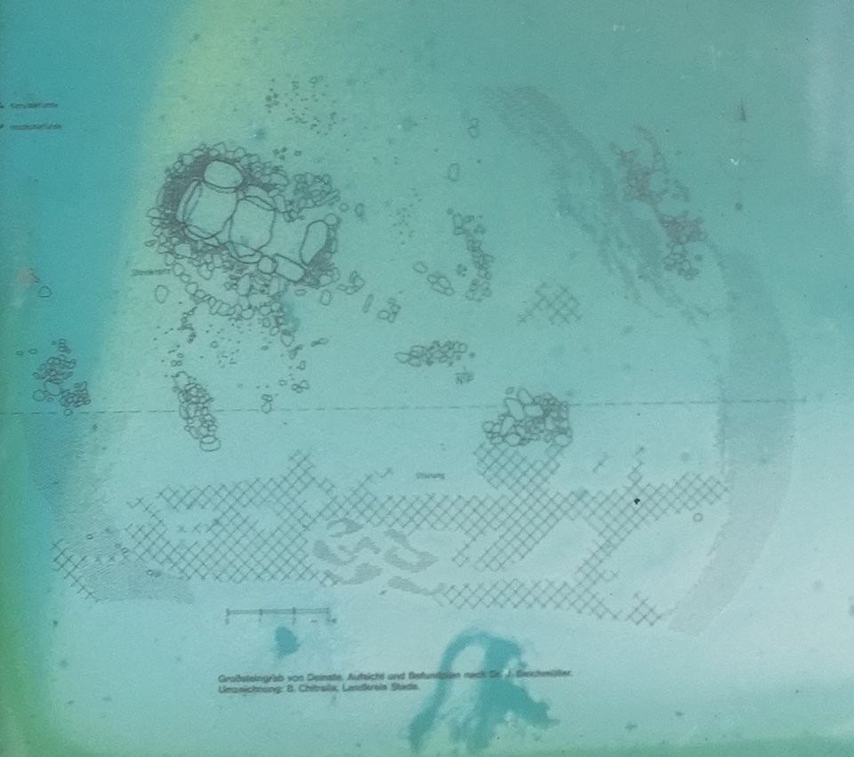

|
Fieldnotes |
|
|
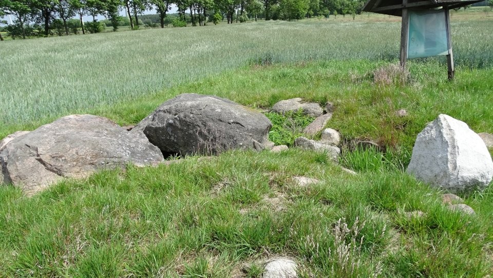
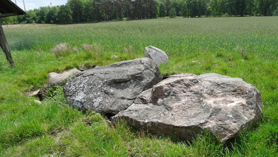
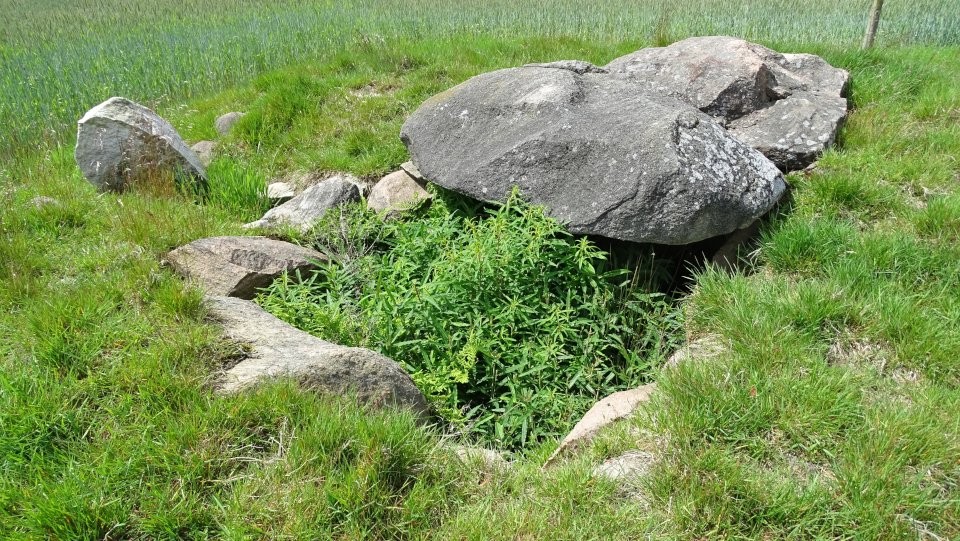
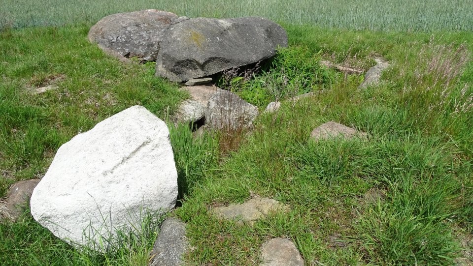
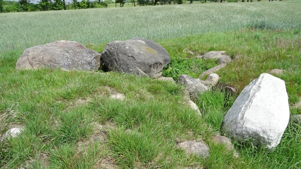
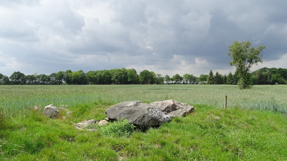
Deinste 1 is a passage grave, which was sunk into the underground in the manner of the simple dolmen (Urdolmen). Until the 1930s there was a field consisting of 43 barrows in the heath around a now silted lake. In the remainder of a once large round mound, which contained two tree-coffin burials, lay a small chamber, whose easr end is strongly disturbed. Of the formerly three capstones only two are present. The third fell victim to stone seekers in the mid-19th century. In the first quarter of the 20th century, the open chamber was the target of robberies. The site could be restored and protected from further destruction. The big mound with a diameter of 25 meters was completely dug up. The support stones had been placed in a 90-centimeter deep pit and stand out only about 50 centimeters above the surface. The spaces between the stones were filled with stone slabs. On the south side was a narrow entrance. In front of it lay staircase stones and a door sill stone. A wedge-shaped stone closed the entrance. The grave is located about eight kilometers south of Stade and 1.5 kilometers southeast of Deinste. At the train station in Deinste you drive on the Hauptstraße to the south. The Hauptstraße turns into the Kirchweg. After about 2 km you'll reach the private road Bei den Hünengräbern, which branches off to the left. Park your car here and walk about 350 m on this road, the tomb is then on the right, about 70 m in a field. Visited May 2019 |
7th July 2019ce |
|
taken from the on-site megalithic board: The megalithic tomb of Deinste is located in the middle of a large burial ground. As late as 1930, the burial ground lay in a heath landscape and comprised 43 hills. At a survey in 1959, 23 tombs were counted. Tomb raiders had partly destroyed the megelithic burials already in the 20's in the search for stones, which were desired as building material. In 1928/29 the burial chamber was examined for the first time. The remains of the grave mound remained untouched, it should be preserved as a monument. But after the former heathland was converted into farmland and pasture and the mound was partly cleared, in 1959 an archaeological investigation of the entire complex was necessary. The excavations have been financed by the district of Stade. The results of the investigation: The grave was erected at the highest point between two lowland areas. The supporting stones of the chamber are embedded in a pit excavated about 90 cm deep. On the narrow sides of the chamber is a supporting boulder; there are three boulders on the southern long side and two boulders on the northern side. Traces of the stolen northeastern support stone were detected. The boulders point with their glacier-ground smooth sides inside. The gaps between the support stones are closed in detail with flat struck stones. In the approximately 40 cm wide gap between the southeastern and the middle support stone on the southern end of the chamber a so-called sill stone is fitted; the granite block placed on top closes the chamber. Two approx. 1 m long stones flank the passage to the chamber; it is paved with elongated rubble like a stair case. The chamber floor is double-paved with two layers of head-sized boulders, between which there is a bed of small stones with gravel. On their outsides, the support stones are packed with fist-sized beaten debris. Of the three capstones originally present, only two remained: the northwestern one, from which parts were cut off, and the middle one, which had to be "redirected" back to its old position during the restoration. At about the lower edge of the capstone, a stone wreath of "bucket-sized" boulders surrounded the chamber. The stone wreath was halfway up the sand-hill, which had been so littered with the burial chamber that the capstones were scarcely covered. After 1928/29 a flint axe and two flint blades from the chamber as well as a small cup vessel from the filling sand of the chamber, which had been ejected during a robbery excavation, had been recovered in 1959, another flint axe and some ceramic discs could be excavated in the chamber. To the north, east, and south of the chamber lay ceramic slabs of old-fashioned broken vessels on the grown floor. The vessels were largely reconstructed. In the Bronze Age, the Neolithic grave site, which was used in funerary beaker culture and the single grave culture for burials, has been extended. Presumably, three tree-coffins have been made. As part of the expansion, a mound of turf was built over the entire system. The mound had a diameter of 24.5 m and was at least 2.1 m high. In places, a stone wreath could be excavated from grouped stones, which bordered the large hill. In the upper layers of the extended mound, the excavators found remains of destroyed urns and cremated bones. Probably in the late Bronze Age and the early Iron Age so-called urn burials took place at the same place. Through a lease agreement between the owner and the district of Stade, the Neolithic burial chamber was preserved and made accessible to the public. |
7th July 2019ce Edited 7th July 2019ce |