The Modern Antiquarian
Log in
|
Register
Home
Latest Posts
Forums
Maps
Help
Browse Sites
News
Blog
Contributors
The Books
Select
-
Belgium
Denmark
Eire
France
Germany
Greece
Italy
The Netherlands
Norway
Portugal
Republic of Malta
Spain
Sweden
Switzerland
United Kingdom
County Kilkenny
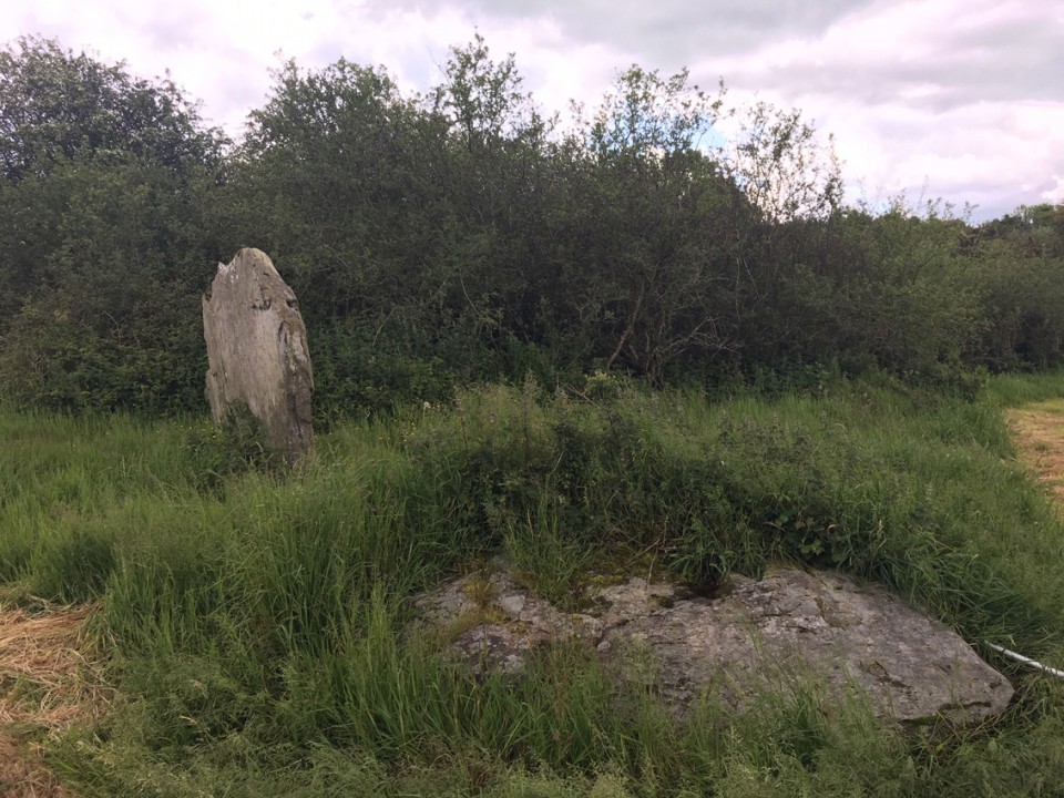
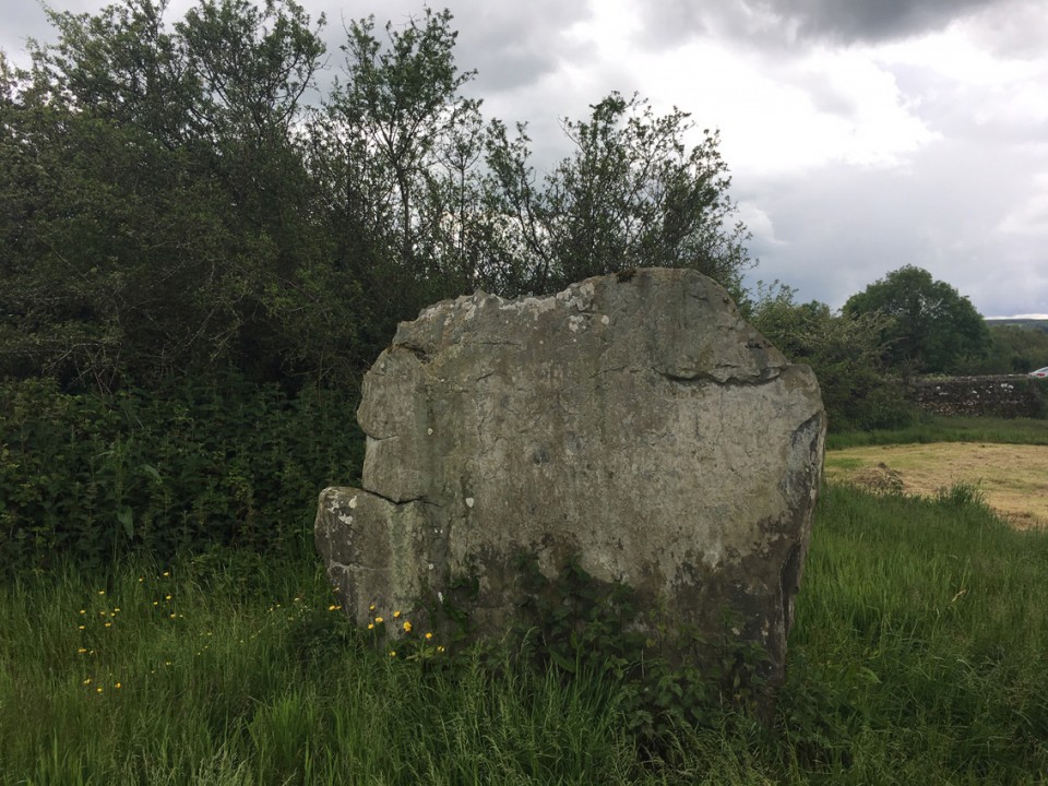
Knockroe (Kells By., Killamery ED)
Standing Stone / Menhir
Knockroe (Kells By., Killamery ED) (Standing Stone / Menhir) on The Modern Antiquarian, the UK & Ireland's most popular megalithic community website. 3 images, plus information on many more ancient sites nearby and across the UK & Ireland.
Image © ryaner
Nearest Town:
Mullinavat (17km ESE)
OS Ref (IE):
S408321 /
Sheet: 67
Latitude:
52° 26' 20.25" N
Longitude:
7° 23' 59.91" W
Added by
ryaner
Images (3)
0 discussions
Start a topic
Show |
Hide
Web searches for Knockroe (Kells By., Killamery ED)
Flickr
Google
Google Images
The Megalithic Portal
Bing
Stone Pages
Wikipedia
Show map
(inline Google Map)
- Sites within 20 km -
-
Kiltrassy (0km N) (3 posts)
Meallaghmore (0.63km E) (1 post)
Knockroe (0.9km S) (47 posts)
Ballinvir (4.11km WSW) (2 posts)
Templemichael (4.3km WSW) (2 posts)
Bawnfree Hill (4.38km SE) (16 posts)
Castletown (Iverk By.)/Kilkieran (4.8km SE) (3 posts)
Owning (6.76km ESE) (4 posts)
Garryduff (7.58km ESE) (4 posts)
Whitechurch (7.83km SSE) (5 posts)
Ballyhenebery (8.62km SE) (5 posts)
Mallardstown (9.82km NNE) (0 posts)
Newmarket (10.18km ENE) (3 posts)
Kilmogue Standing Stone (10.18km E) (1 post)
Kilmogue (10.23km E) (35 posts)
Sheegouna (10.27km WSW) (6 posts)
Ballypatrick (11.01km WSW) (3 posts)
Slievenamon (11.05km WSW) (7 posts)
Sheskin (12.52km SSW) (0 posts)
Kilree (12.7km NE) (3 posts)
Ballyquin (13.44km SSE) (4 posts)
Ballyquin (14.09km SSE) (10 posts)
Ballyquin (14.19km SSE) (2 posts)
Cloran Old (14.28km W) (3 posts)
Parkbeg (15km SW) (0 posts)
Drangan (15.54km W) (0 posts)
Jamestown (15.63km WSW) (3 posts)
Temple-etney (15.63km WSW) (1 post)
Ballylowra (15.68km ENE) (4 posts)
Mothel Stone (15.82km S) (5 posts)
Curraghkeily (16.84km SW) (0 posts)
Gurteen Lower (17.06km WSW) (0 posts)
Bawnard (17.06km WSW) (0 posts)
Ballyvaheen Tomb (17.12km E) (0 posts)
Ballyvaheen (17.33km E) (2 posts)
Whitestown (18.35km SSE) (0 posts)
Cloghadda (18.44km SW) (0 posts)
Graigavalla (19.06km SSW) (0 posts)
Crohane Lower (19.47km WNW) (2 posts)
Glenaphuca (19.59km S) (0 posts)
- Add -
-
Add news
Add an image
Add fieldnotes
Add folklore
Add miscellaneous
Add a link
-
Add a site
Add a nearby facility
Add an alternative name/spelling
Images
(click to view fullsize)
Add an image
 Image © ryaner