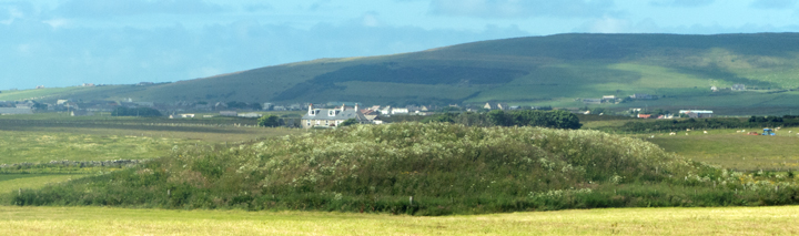
North of Harray Community Hall is the Netherbrough Road. Just past Yeldavale the knowe stands out boldly in the far corner of a field, at this time swamped by bright vegetation vegetation. If only I hadn't already been walking for miles I would have paid a visit despite the blooming plants. It sits on marshy ground thought to have been a lochan. Less than a kilometre further down is another broch, the Knowe of Gullow.From there I went as far as the turn for Ballarat House, where in the field opposite Gullow is what looked like a banked feature which looks equally Iron Age but must be modern as it is not noted anywhere. Burrian's underground structure brings to my mind two Orcadian sites, one where a broch was built over a tomb and another where the supposed broch was purely ceremonial/ritual
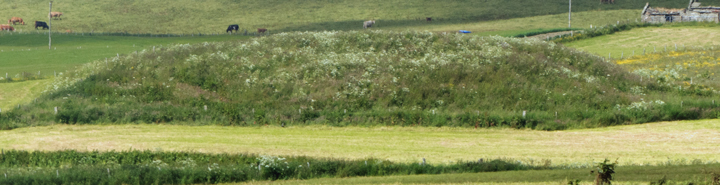
The Knowe of Burrian , NMRS record no. HY31NW 2, was once 60' in diameter and 17 high. A berm seperates south and west sides of broch remains 1.2m high on the flattened top of a steep natural hillock. On the east side are three courses of outer wall face and possible traces of the inner wall face, from which it is estimated that its external diameter is ~18.3m and internal 8.5m.
After several failed digs by other folk Robert Flett of Garth made a go of excavating it in 1936, when a trench found distinct layers of 'hearth-materials' - charcoal, pot-boilers, animal bones, etc - before almost at the other side a slight turn revealed an interior chamber floor. As well as the Pictish Symbol Stone he found some burnt wood, stone tools and ashes. Then came one of those myserious 'wells' . Of two excavations in the centre of the mound the more westerly is the now covered location of an underground chamber. From a vertical entrance approx. 2'6" square eleven steps led steeply down 12' to a 10'x5' flat-roofed figure-of-8 corbelled structure compared to the Gurness well then being dug, though the site was called an earth-house rather than a broch at the time.