|
|

|
|
Grey YaudsStone Circle
|
||||||||||||||||||||||||
|
|
|
Images (click to view fullsize) |
|

|
Fieldnotes |
|
|
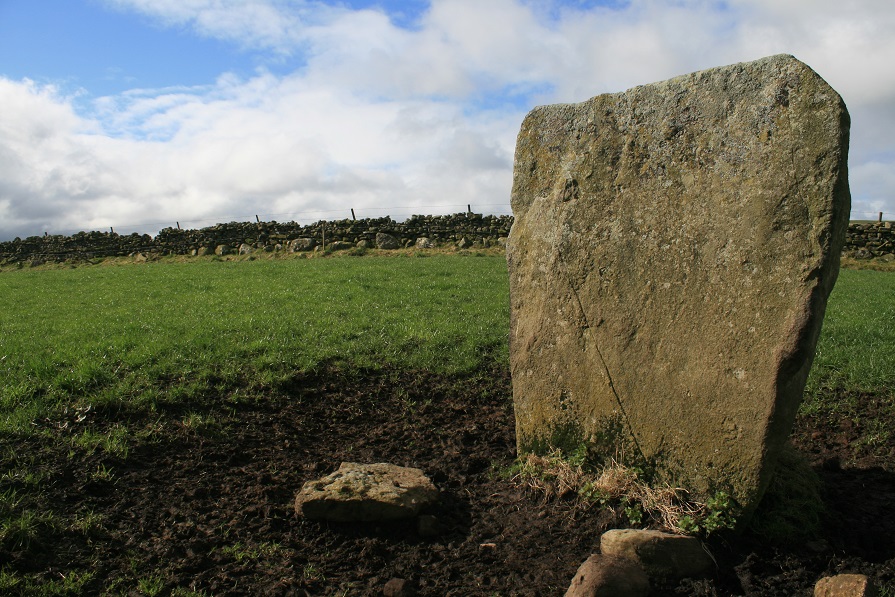
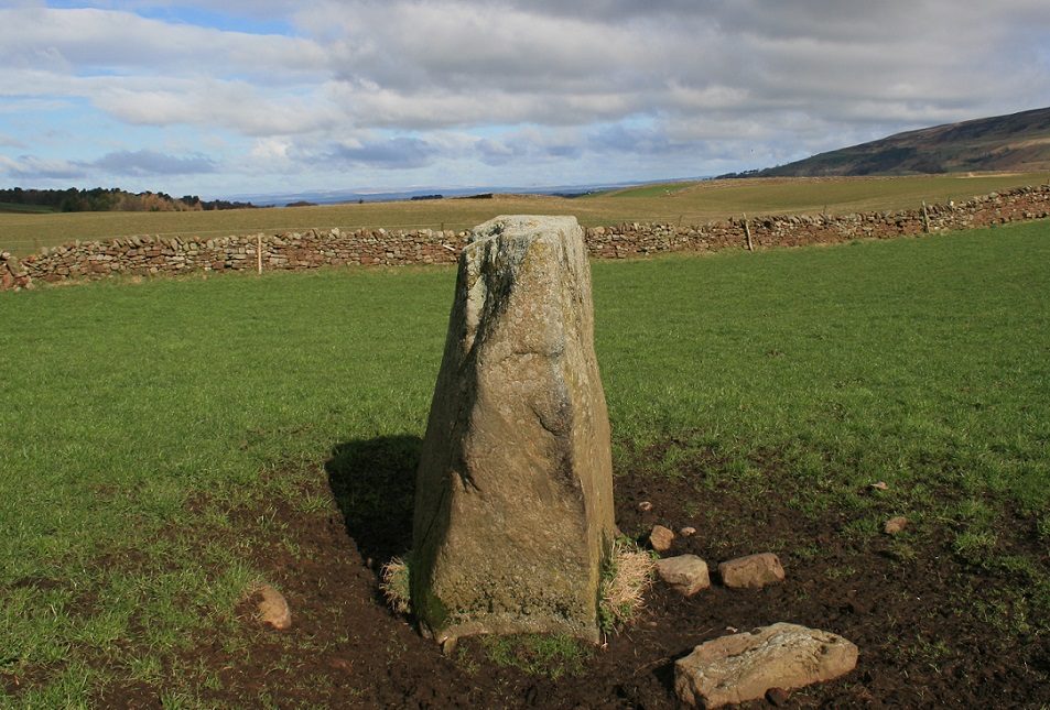
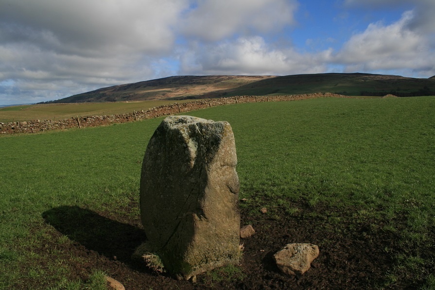
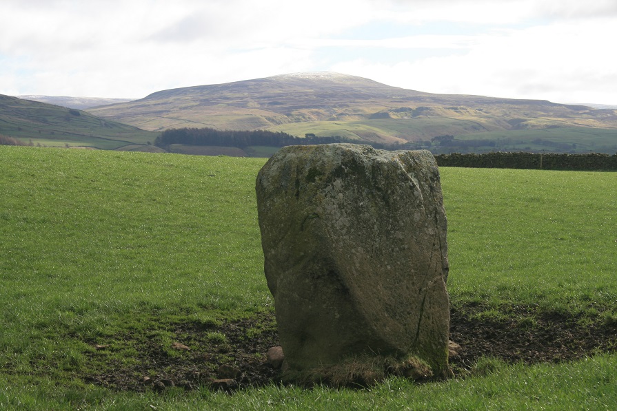
From Newbiggin, head west on a dead straight road and park at the T junction, there's enough room for a couple of cars to squeeze onto a grass verge. From this vantage point you cant see the stone, but if you can see the field with a small quarry at the bottom of it, then this is the field you want to be in as you get to the top of the hill. As I climb the hill, i'm acutely aware that this isn't following a footpath, so I try and get out of plain site as quick as I can, At the top of the hill a field wall bars the way a gate in the left corner is open so here is my point of entry. The stone and myself are now in the same field but because of it's being in the far corner I still cant see it. I'm almost on top of it now, but still nowt, I begin to wonder if ive got my wires crossed somehow. Then right there before me, in the bottom of a natural dip in the landscape is the stone, King Harry's stone. Cows from the next field come over for a bit of a moo at me over the wall, I sit down on the other side of the stone and they soon lose interest. A bit of a strange place this, the land is lifted in the air so it cant be seen from below, but further east and the ground rises further still, Thack moor has a sprinkle of snow upon its crown. But why in this dip here, almost invisible from just twenty yards away. But then this is no solitary standing stone, it's an outlier to a now lost stone circle, not one stone remains, except this outlying stone, King Harry's stone. One wonders where exactly in relation to this remainder was the circle, my guess would be south of it, there's a big open space, but so to is there one to the north, just not east or west. What a shame it's all gone, but then this one remainder is still worth the fifteen minute walk up hill. Come, and feel sorry for it, but, applaud it's survival. |
 Posted by postman
27th March 2014ce |
| You have to pluck up the courage to to go a long way into private land, and across a steep valley. There was a man on a quad bike hovering around so I cursed my bad luck as my friends and wife cycled on in the distance |
 Posted by daveyravey
2nd July 2003ce |
|
Destroyed when the area was enclosed. Only the outlier ' King Harry's Stone ' remains ( 5ft high and perhaps 4ft wide ), the stone was an outlier of what was a large circle of over 80 stones. No path as such... but hey. Make it part of your explorations of the ruined Broomrigg complexes. With Long Meg further to the south, the henges at Penrith even further, Grey Yauds stands in a long line of big circles and henges. |
21st January 2003ce Edited 21st January 2003ce |
Folklore |
|
The climate is cold but invigorating and healthy. In the southern part of the parish is a tract of dreary treeless waste, commonly called King Harry, where, according to tradition, one of the Kings of England who bore that name encamped with his army. Tradition has not preserved any distinguishing feature to enable us to indicate the king alluded to, but we know that the unfortunate Henry VI, after the battle of Hexham, fled into Cumberland, and may probably have had with him a remnant of his army, and encamped here. A stone is pointed out from which, it is said, King Harry mounted his charger.From Bulmer's "History and Directory of Cumberland", published in 1901, and online at Steve Bulman's website here http://www.stevebulman.f9.co.uk/cumbria/1901/cumwh_f.html |
 Posted by Rhiannon
13th September 2006ce |
Miscellaneous |
|
|
"A third circle of stones, of the same kind, called the Grey Yawd, is described by Nicolson and Burn, as being on the summit of the fell called King Harry, in the parish of Cumwhitton, consisting of about 88 stones, set in an exact circle of about 52 yards in diameter; one single stone, larger than the rest, standing out of the circle, about five yards to the northwest " From: 'Antiquities: Roman', Magna Britannia: volume 4: Cumberland (1816), pp. CXXVIII-CLXXXIX. URL: http://www.british-history.ac.uk/report.aspx?compid=50671.. |
 Posted by fitzcoraldo
30th October 2007ce |