The Modern Antiquarian
Log in
|
Register
Home
Latest Posts
Forums
Maps
Help
Browse Sites
News
Blog
Contributors
The Books
Select
-
Belgium
Denmark
Eire
France
Germany
Greece
Italy
The Netherlands
Norway
Portugal
Republic of Malta
Spain
Sweden
Switzerland
United Kingdom
County Louth
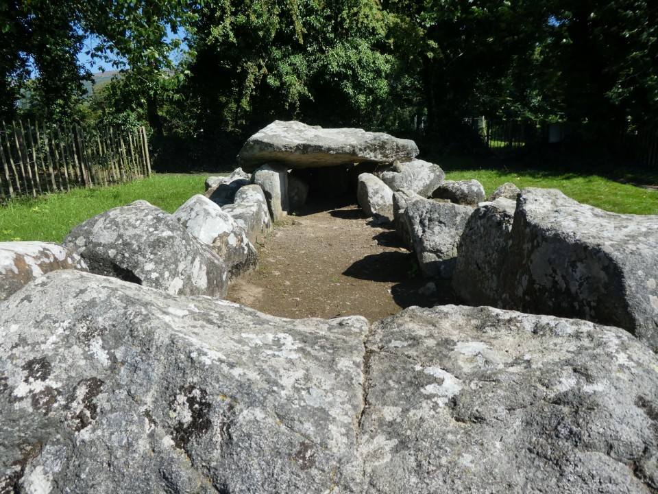
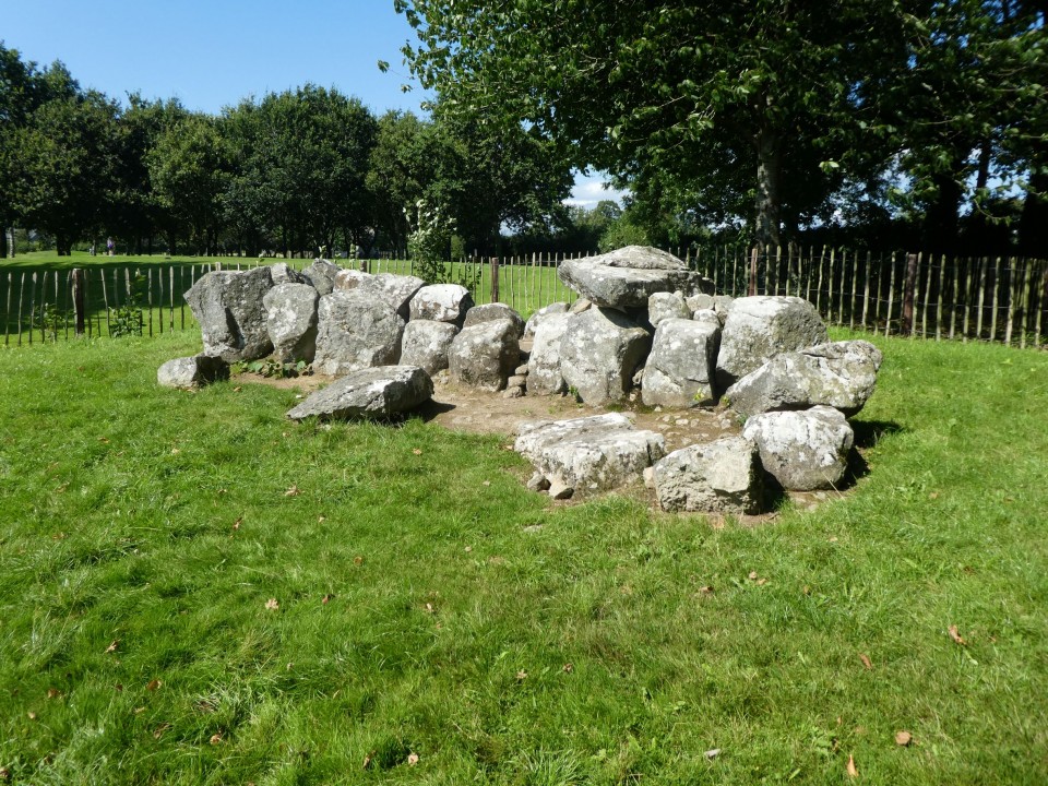
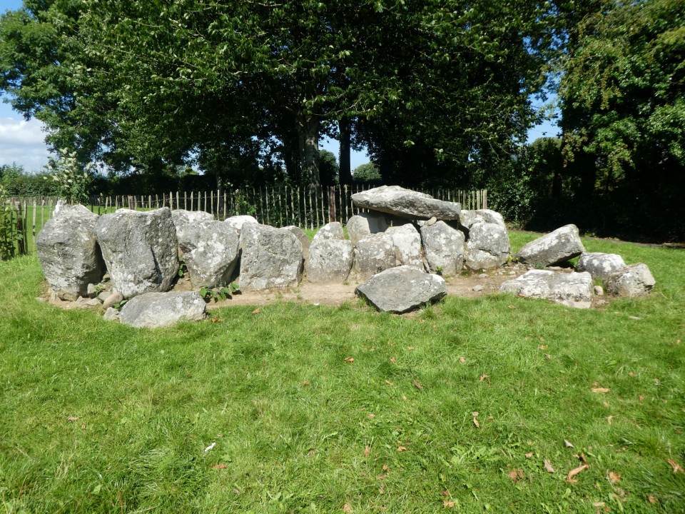
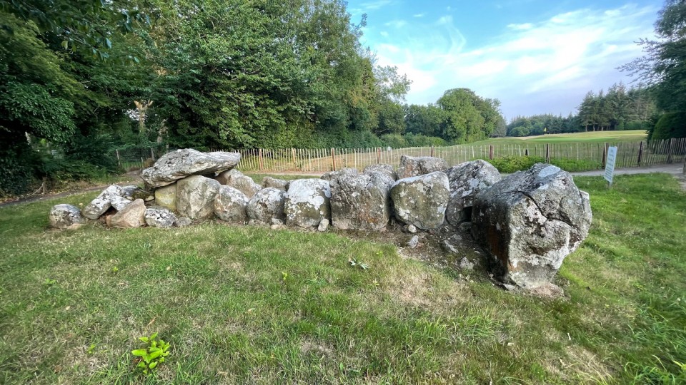
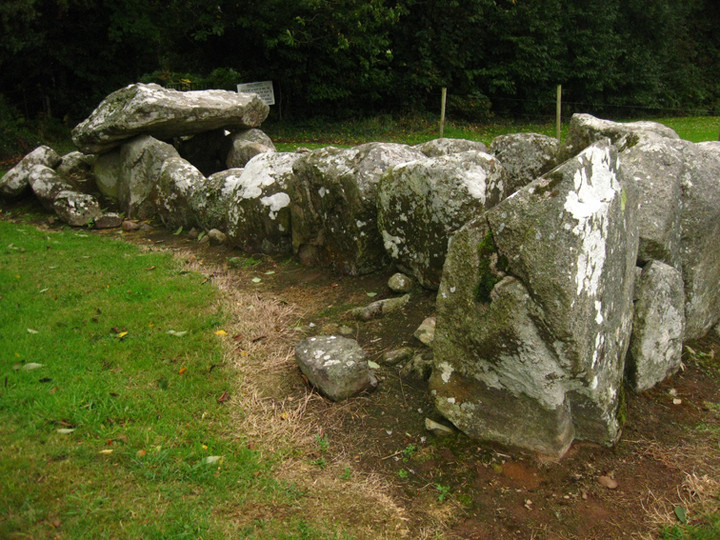
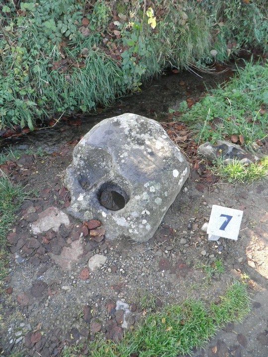
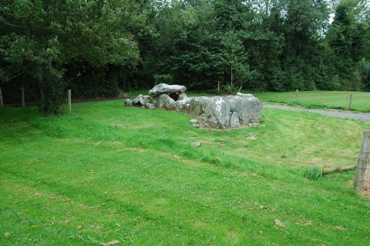
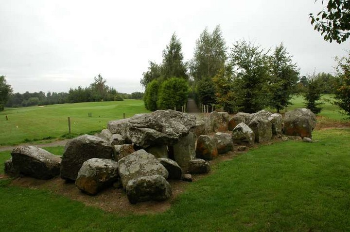
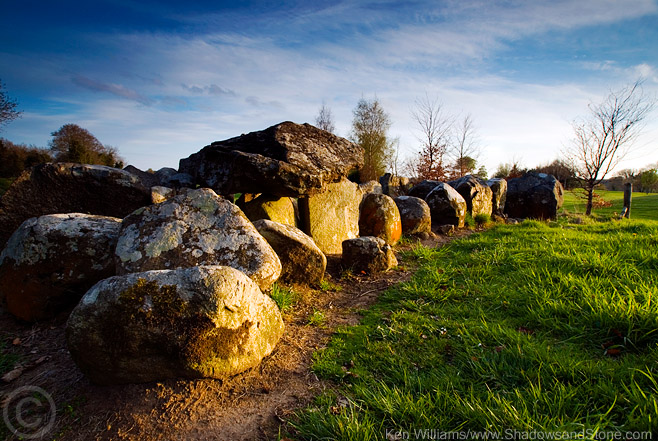
Proleek
Wedge Tomb
Proleek (Wedge Tomb) on The Modern Antiquarian, the UK & Ireland's most popular megalithic community website. 12 images, plus information on many more ancient sites nearby and across the UK & Ireland.
Image © ryaner
Nearest Town:
Dundalk (5km SSW)
OS Ref (IE):
J083110 /
Sheet: 29
Latitude:
54° 2' 12.26" N
Longitude:
6° 20' 48.43" W
Added by
FourWinds
Images (12)
0 discussions
Start a topic
Show |
Hide
Web searches for Proleek
Flickr
Google
Google Images
The Megalithic Portal
Bing
Stone Pages
Wikipedia
Show map
(inline Google Map)
- Sites within 20 km -
-
Proleek (0km NW) (31 posts)
Ballymakellet (1.62km ENE) (3 posts)
Ballymakellet Standing Stone (1.64km ENE) (1 post)
Drumnasillagh (2.23km NNW) (7 posts)
Aghnaskeagh Chambered Cairn (2.81km NW) (3 posts)
Aghnaskeagh (2.91km NW) (2 posts)
Faughart (3.7km W) (6 posts)
Carnawaddy (4.09km NE) (5 posts)
The Meadow (4.16km NE) (0 posts)
Carn Beg (4.3km WSW) (5 posts)
Kilnasaggart (4.47km NW) (0 posts)
Ballinloughan (4.81km SW) (1 post)
Clermont Cairn (4.92km NNE) (0 posts)
Ravensdale Park (5.05km NNE) (10 posts)
Balriggan (5.05km W) (1 post)
Rockmarshall (5.14km ESE) (7 posts)
Castletown - Standing Stone (5.88km WSW) (4 posts)
Lurgankeel (5.91km W) (0 posts)
Castletown - Souterrain (6.02km WSW) (0 posts)
Castletown (6.02km WSW) (0 posts)
Lurgankeel (6.12km W) (4 posts)
Corrakit (6.29km NE) (0 posts)
Killin (7.31km WSW) (0 posts)
Clontygora - Court Tomb (8.44km N) (38 posts)
Cortial (9.58km WSW) (5 posts)
Riverstown (9.84km ESE) (0 posts)
Commons (9.95km E) (4 posts)
Grange Irish (Court Tomb) (10.24km E) (0 posts)
Clonlum South (10.27km NW) (9 posts)
Grange Irish (Ruined Tomb) (10.3km E) (0 posts)
Cuchulains Stone (Rathiddy) (10.37km SW) (8 posts)
Souterrain (10.43km E) (0 posts)
Warrenpoint Standing Stone (10.46km NE) (4 posts)
Callaigh Berra's Lough (10.85km WNW) (6 posts)
Callaigh Berra's House (10.93km WNW) (39 posts)
Clonlum (11.09km NW) (3 posts)
Carranmore (11.19km E) (0 posts)
Grange Irish cairn (11.19km E) (3 posts)
Grange Irish bullaun (11.43km E) (4 posts)
Grange (11.53km E) (0 posts)
Slieve Gullion - North Cairn (11.91km NW) (10 posts)
Burren (12.59km NNE) (6 posts)
Drumsinnot (12.64km WSW) (8 posts)
Ballymacdermot (13km NNW) (27 posts)
Ballyedmond Cairn (13.1km ENE) (0 posts)
Mucklagh (13.22km E) (0 posts)
Rostrevor Standing Stone (13.27km NE) (6 posts)
Crannog (13.45km SSW) (0 posts)
Standing Stone (13.58km SSW) (0 posts)
Slieveemartin Cairn (13.61km ENE) (0 posts)
Drumgonnelly (13.86km WSW) (3 posts)
Latbirget (13.86km WNW) (5 posts)
Ballykeel (13.9km WNW) (24 posts)
The Ballard Longstone (14.06km NW) (7 posts)
Tullagee (14.06km WSW) (1 post)
Drumcah (14.4km WSW) (3 posts)
Cross (14.68km NNW) (8 posts)
Ballintur (14.72km ENE) (0 posts)
Knockshee (14.84km ENE) (3 posts)
Tamnaharry (15.13km NNE) (0 posts)
Kilfeaghan (15.48km ENE) (13 posts)
Aghmakane (15.59km NW) (6 posts)
Drumirril (15.75km WSW) (6 posts)
Mayo 2 (16.26km NE) (5 posts)
Tullynavall (16.32km W) (4 posts)
The Dorsey Entrenchment (16.66km WNW) (7 posts)
Miskish More (16.97km WSW) (1 post)
Crobane (17.29km NNE) (3 posts)
Mayo 1 (17.36km NNE) (4 posts)
Carnadranna (18.04km NE) (2 posts)
Belleek (18.35km NW) (5 posts)
Eshwary (18.43km NW) (3 posts)
Annaghmare (18.98km W) (27 posts)
Murphy's Fort, Mullaghmore (19.48km NE) (1 post)
Mullaghmore (19.53km NE) (0 posts)
Loughanhatten (19.56km ENE) (1 post)
Tullyvallan (Tipping) West (19.88km WNW) (5 posts)
- Add -
-
Add news
Add an image
Add fieldnotes
Add folklore
Add miscellaneous
Add a link
Add a nearby facility
Add an alternative name/spelling
Images
(click to view fullsize)
Add an image
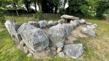 Image © ryaner