|
|

|
|
Garn GronBarrow / Cairn Cemetery
|
||||||||||||||||||||||||
|
|
|
Images (click to view fullsize) |
|
Photographs:
 Artistic / Interpretive:
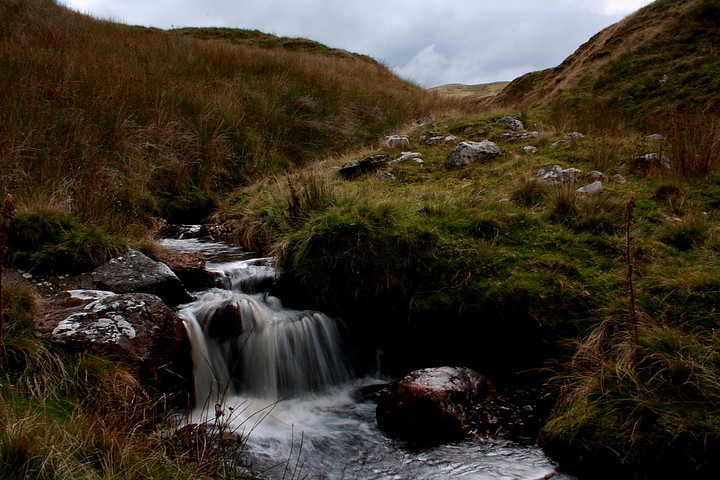
|
Fieldnotes |
|
|
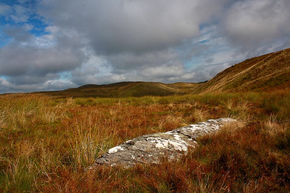
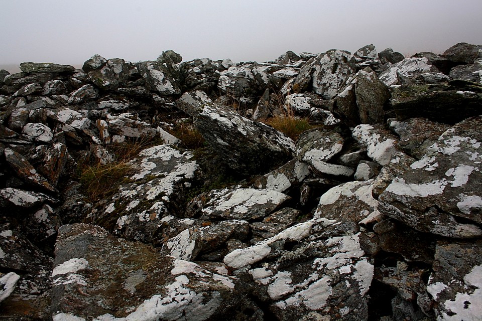
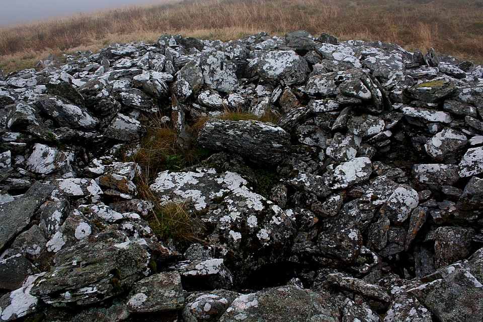
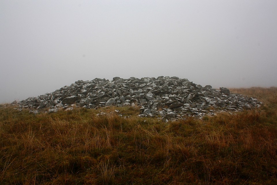
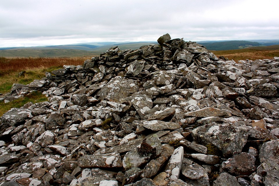
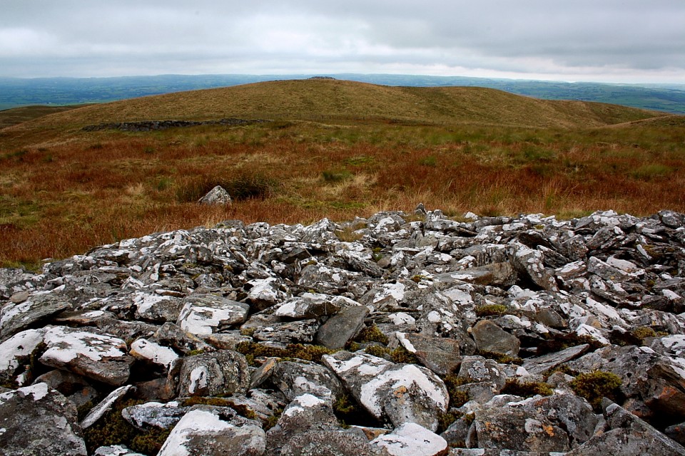
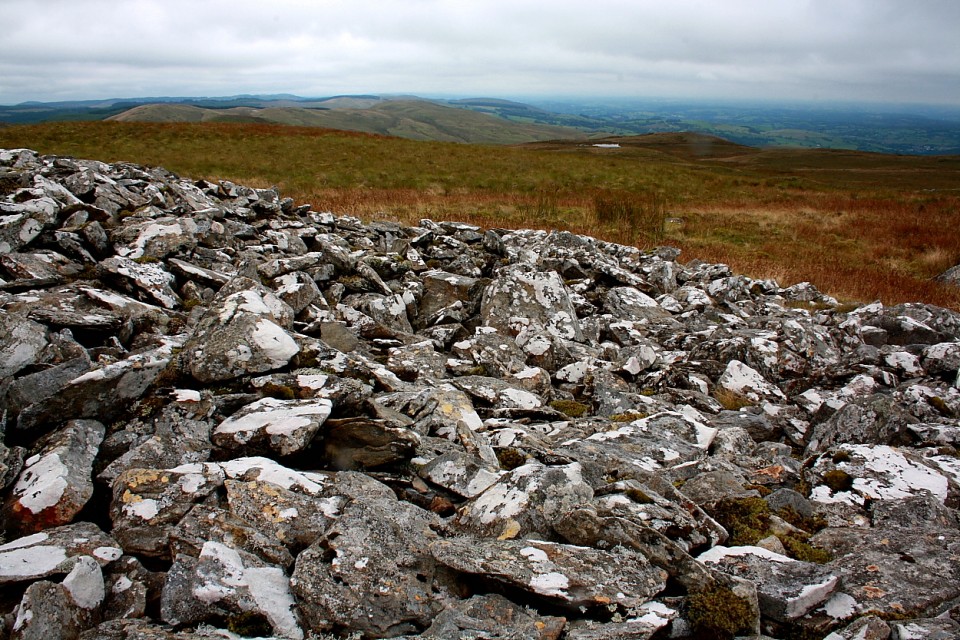
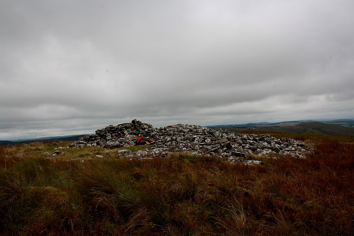
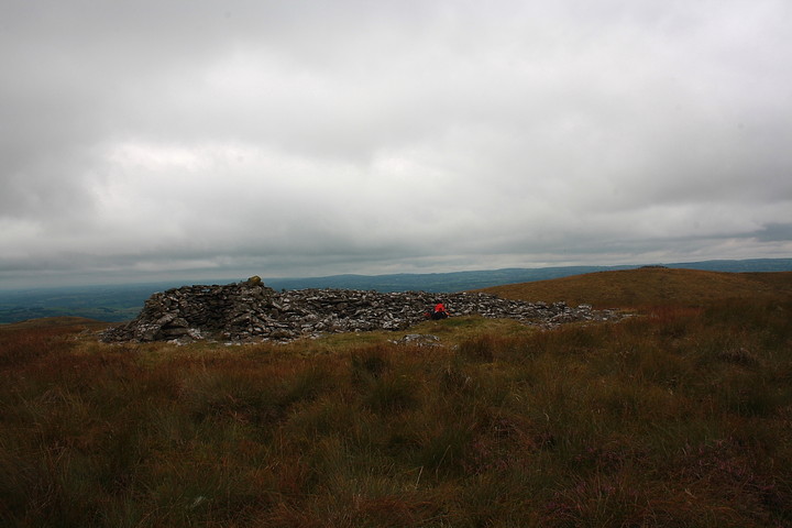
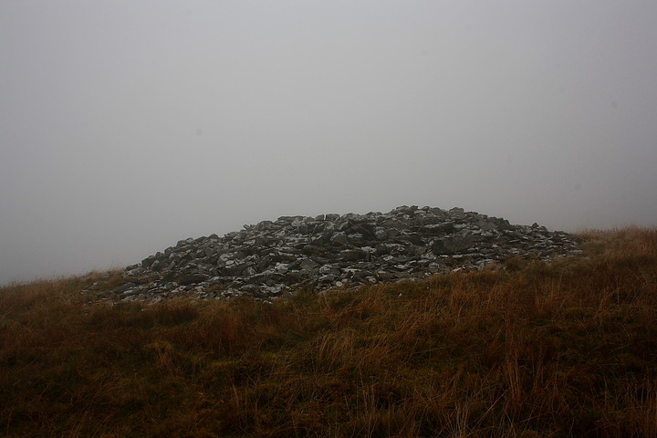
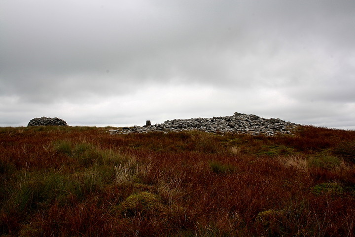
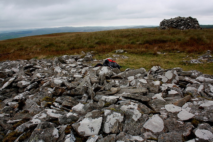
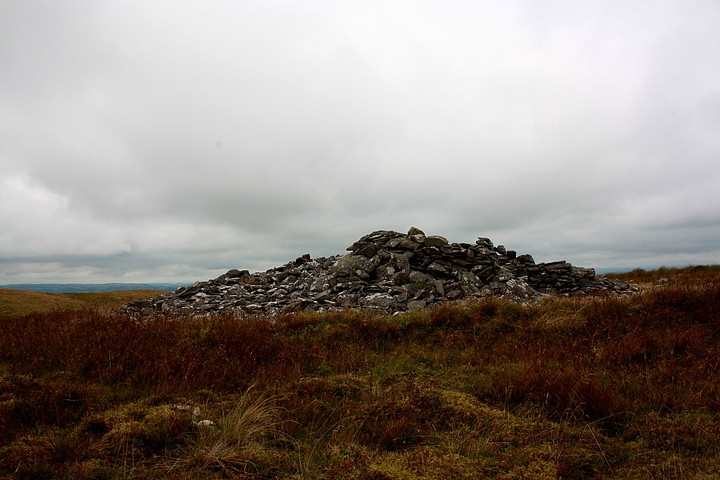
A low cloudbase precludes further exploration of the uplands of Y Elenydd prompting an onward drive through Cwm Ystwyth, a beguiling valley of extremes... part sublime natural beauty, part industrial wasteland; a landscape microcosm arguably analogous to Wales itself. But what to do next? Heading south at Pont rhyd-y-groes I eventually settle upon one of a myriad possible options, an ascent of Carn Gron, near Tregaron, in order to investigate Gwys-yr-Ychen-Bannog, an intriguing linear feature (stone row?.... er, actually, no) depicted upon the map, not to mention several cairns. Oh, and just for the hell of it, too. Orientating myself at Tregaron - after managing to avoid some psychopathic old bint trying to force me off the road, face contorted with unfathomable rage - I drive north on the B4343 and, taking the first turning on the right, incidentally pass below the Sunnyhill Camp.... some other day, perhaps? The road forks to the right and, passing Penffordd, arrives at the terminus where I manage to park in an appropriate manner. It'd be rude not to. A grassy track leads off to the south-east above the northern bank of the Groes Fawr. There are a number of cairns marked on the map in the river's locale; however my initial focus is Castell Rhyfel, an Iron Age hillfort dominating the valley from upon the ridge to my left. Although the enclosure's ramparts aren't that well defined - were they ever? - the siting, from an aesthetic perspective at least, is exquisite, according magnificent views only enhanced by an utterly unexpected interlude of fine weather. Carn Gron rises across the Groes Fechan to right of Y Garn, the latter, as the name suggests, also bearing an ancient cairn. I decide to go for it, the benign conditions promising a fine summit hang, duly circling the headwall of the cwm to the north. As I do so I encounter a suspiciously 'fallen standing stone-like' prostrate erratic at (very) approx SN735599. It certainly does look out of place, but then again I guess most erratics, by definition, do. My chosen route necessitates losing height before the final ascent... not ideal, but allowing the replenishing of the water bottle (from the Groes Fechan) as compensation. I arrive at the 1,774ft summit in surprisingly short order (for me) to discover that Carn Gron's cairns are the real deal. The OS trig pillar stands between two monuments.... a large, sprawling cairn at the actual summit of the peak... and a smaller, modern construct to the north-east, the latter almost certainly sourced from a significant 'bite' missing from the former. Despite the significant damage (including obligatory 'muppet shelter'), the summit cairn remains a substantial stone pile, morever with what appear to be remnants of central cist elements in situ. As for the smaller.... it appears Coflein reckon the modern erection stands upon an ancient base (steady now). Which is nice. And more than can be said about the weather, the warm sunshine of half an hour previously progressively - and irrecoverably - superseded by a vicious front sweeping in from the north-west. I head west to, appropriately enough, the western cairn and determine that this is by far the finest of the trio. Slightly smaller than the summit monument it is, to my eyes at least, much better defined. It also features the probable remains of a central cist, highlighting the apparent unfrequented nature of these seemingly obscure hills. In addition, the views are more expansive here although (sadly) I have little time to appreciate them before the full force of the weather front arrives... and I'm engulfed in thick, opaque vapour and assaulted by driving rain in the horizontal plane. In a curious way this claustrophobic 'world within the clouds' only serves to emphasise the ethereal vibe I often experience at upland cairns, the senses disorientated, the mind reeling at the relative unfamiliarity of it all, eyes attempting to focus upon something with no background. Oo-eer. Speaking of focus, I recall the Gwys-yr-Ychen-Bannog and go have a look. Whatever the feature represents, it certainly does not resemble a stone row [it appears, retrospectively, to form a boundary feature of indeterminable age (medieval?), the devil being in the translation]. Never mind, it brought me to Carn Gron. Enough said. I am forever in the 'furrow of the horned oxen's' debt. Anyway, I subsequently descend to Y Garn, courtesy of a compass bearing, this proving to be another fine cairn with the obligatory remnants of cist, finally dropping in on (yet) another beside the Groes Fawr, this 'un with a more-or-less intact cist. Jeez, what more has the day to offer? Back at the car I meet the old farmer and his mate, the former stating that he couldn't care less about the cairns himself.... 'but at least it isn't snowing'. Er, yeah. Whatever. With darkness approaching I set off to find somewhere to 'crash' for the night.... and thankfully avoid taking things way too literally, courtesy of a front near-side blow-out. Suffice to say it has been some day. |
 Posted by GLADMAN
21st November 2013ce Edited 22nd November 2013ce |
Miscellaneous |
|
|
There is a trio of cairns located upon the summit plateau of 1,774ft Carn Gron, a shapely large hill / mini-mountain a little under 4 miles to the approx north-west of Tregaron. According to Coflein:- Summit Cairn - SN73976106: "A round cairn, 16.5m in diameter & 1.2m high, set upon the highest point of Garn Gron, having a shelter constructed on the E side, with the NE segment having been cleared to ground level; possible cist elements are exposed at the centre" Cairn II - SN74006108: "A modern cairn, 5.0m in diameter & 1.8m high, is set upon the turf-covered base of an apparent earlier cairn, 9.0m in diameter" Western Cairn - SN73786114: "A subcircular cairn, 15m N-S by 14m & 1.2m high, set on the W summit of Garn Gron, apparently touched on its NE side by Gwys-yr-Ychen-bannog linear boundary feature; a central disturbance displays possible cist elements". [J.Wiles 23.07.04] |
Posted by GLADMAN 21st November 2013ce Edited 21st November 2013ce |