The Modern Antiquarian
Log in
|
Register
Home
Latest Posts
Forums
Maps
Help
Browse Sites
News
Blog
Contributors
The Books
Select
-
Belgium
Denmark
Eire
France
Germany
Greece
Italy
The Netherlands
Norway
Portugal
Republic of Malta
Spain
Sweden
Switzerland
United Kingdom
Scotland
Perth and Kinross
Milquhanzie Hill
Cairn(s)
Milquhanzie Hill (Cairn(s)) on The Modern Antiquarian, the UK & Ireland's most popular megalithic community website. 3 images, plus information on many more ancient sites nearby and across the UK & Ireland.
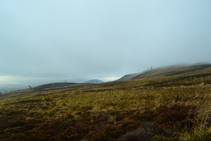
Image © thelonious
Nearest Town:
Crieff (5km SW)
OS Ref (GB):
NN89752465 /
Sheets: 52, 58
Latitude:
56° 24' 4.2" N
Longitude:
3° 47' 11.66" W
Added by
thelonious
Images (3)
0 discussions
Start a topic
Show |
Hide
Web searches for Milquhanzie Hill
Flickr
Google
Google Images
MAGIC
The Megalithic Portal
Bing
Stone Pages
Streetmap.co.uk
Wikipedia
Show map
(inline Google Map)
- Sites within 20 km -
-
Milquhanzie Hill Fort (0.42km WNW) (4 posts)
Cultoquhey (1.27km SSW) (4 posts)
Monzie Rock Art (1.73km WSW) (24 posts)
Monzie Circle (1.73km WSW) (30 posts)
Witches Stone (Monzie) (1.88km WSW) (26 posts)
Buchanty Hill (1.9km NE) (5 posts)
Fowlis Wester Standing Stones (2.46km E) (48 posts)
Braes of Fowlis (2.65km ENE) (49 posts)
Connachan (2.89km WNW) (5 posts)
Buchanty Hill (3.1km NE) (6 posts)
Crieff Golf Course / Ferntower (3.11km SW) (31 posts)
Fowlis Wester Cairn (3.23km E) (42 posts)
Cradle Stone (3.73km WSW) (7 posts)
Stroness Hill (4.21km NE) (3 posts)
Monzievaird (4.46km W) (0 posts)
Ochtertyre (4.81km WSW) (1 post)
Millhills (4.93km S) (1 post)
Duchlage (4.96km SW) (1 post)
Giant's Grave (Sma' Glen) (5km N) (12 posts)
St Serf's Water (5km WSW) (1 post)
Giant's Grave Cairn (5.1km N) (8 posts)
Broich (5.22km SW) (1 post)
Jock's Cairn (5.57km NNW) (16 posts)
Dun Mor (5.75km N) (7 posts)
Clach Ossian (5.94km NNW) (21 posts)
Crieff (5.95km SW) (8 posts)
Bennybeg Cursus (6.5km SSW) (2 posts)
Concraig (6.66km SW) (8 posts)
Rottenreoch (6.71km SW) (3 posts)
Strowan Cairn (8.62km WSW) (3 posts)
Clathick House (8.64km WSW) (0 posts)
Cairn Coinneachan (8.71km W) (25 posts)
The Kor Stone (9.23km ENE) (5 posts)
The Belted Stane (9.77km SE) (1 post)
Lawers (9.83km WSW) (23 posts)
Glascorrie (10.07km WSW) (53 posts)
Bachilton (10.43km E) (1 post)
Clach na Tiompan (10.48km WNW) (26 posts)
Clach na Tiompan (10.62km WNW) (23 posts)
Clach na Tiompan (10.62km WNW) (3 posts)
Corrymuckloch (10.83km NNW) (19 posts)
River Almond (10.96km WNW) (24 posts)
Belhie (11.22km ESE) (3 posts)
Dalchirla (11.31km SW) (13 posts)
Balmuick (11.32km W) (21 posts)
Belhie (11.35km ESE) (1 post)
Dalchirla (11.4km SW) (13 posts)
Belhie (11.43km ESE) (16 posts)
Belhie (11.5km ESE) (1 post)
Belhie (11.64km ESE) (1 post)
Belhie (11.64km ESE) (1 post)
Belhie (11.72km ESE) (1 post)
Braco (11.78km NE) (4 posts)
Auchingarrich Farm (12.11km WSW) (23 posts)
Dalginross (12.17km WSW) (33 posts)
Auchterarder (12.62km SE) (39 posts)
Dunruchan (12.88km SW) (85 posts)
Wester Cowden Farm (12.95km WSW) (28 posts)
Ballinreigh (12.97km N) (1 post)
Tom na Chessaig (12.97km WSW) (7 posts)
Wester Kinloch (13.17km NNW) (10 posts)
Loch Freuchie (13.31km NW) (6 posts)
Innercochill (13.48km N) (3 posts)
Carroglen (13.52km W) (10 posts)
Cultybraggan (13.58km WSW) (12 posts)
Lyndoch west stones (13.77km ENE) (4 posts)
Craggish (13.84km WSW) (1 post)
Lyndoch middle stone (14.37km ENE) (4 posts)
Corrody Burn (14.42km NNE) (11 posts)
Twenty Schilling Wood (14.45km WSW) (36 posts)
Lyndoch East Stone (14.57km ENE) (4 posts)
Clachan Aoradh (14.71km NNE) (14 posts)
Sack Stone (14.72km NE) (6 posts)
Leadketty (14.84km E) (0 posts)
Loaninghead (14.86km SSE) (13 posts)
Leadketty (14.99km E) (1 post)
Gleneagles B (15.06km SSE) (17 posts)
Airlich Hill (15.2km NNE) (3 posts)
Gleneagles A (15.21km SSE) (10 posts)
Meikle Findowie (15.21km NNE) (23 posts)
Rossie Law (15.76km ESE) (6 posts)
Dunning (15.87km ESE) (12 posts)
Turrerich (15.93km NW) (9 posts)
Druim Na Cille (16km WSW) (2 posts)
Tullybeagles Moor (16.29km NE) (7 posts)
White Cairn (16.34km N) (6 posts)
Little Tombane (16.45km NNE) (3 posts)
Garrow (16.5km NW) (4 posts)
Moneydie (16.61km ENE) (18 posts)
Huntingtower (17.09km ENE) (1 post)
Craig Tombane (17.12km NNE) (4 posts)
Clach a' Mhoid (17.21km NNE) (1 post)
Forteviot (17.23km E) (7 posts)
Little Trochry (17.39km NE) (16 posts)
Shian Burn (17.42km NW) (3 posts)
Kindrochet (17.46km WSW) (18 posts)
Shian Burn (17.49km NW) (0 posts)
The Boat Stone (17.51km S) (3 posts)
Ballinloan (17.7km NNE) (5 posts)
Gray Stone (17.84km ESE) (6 posts)
Perth Western Edge (18.11km E) (5 posts)
Pitmackie (18.26km WNW) (6 posts)
Craig Obney (18.39km NE) (5 posts)
Pitsundry (18.6km ENE) (6 posts)
Wester Biggs (18.83km S) (1 post)
Dundurn (18.93km WSW) (19 posts)
Meikle Logie (18.94km NNE) (6 posts)
The Roundel (18.99km SSW) (6 posts)
Witch's Stone (19.28km NE) (11 posts)
Gellybank Stone Row (19.54km ENE) (11 posts)
Loak (19.68km ENE) (7 posts)
Dundonnachie (19.72km NE) (5 posts)
Loak (19.73km ENE) (7 posts)
Pitlandie (19.9km ENE) (6 posts)
Denmarkfield Farm (19.93km ENE) (2 posts)
- Facilities within 20 km -
-
Famous Grouse Experience (Restaurant: 4.4 km WSW)
Collearn House Hotel (Hotel: 12.7 km SE)
Dunning Hotel (Hotel: 15.7 km ESE)
Kirkstyle Inn (Pub: 15.9 km ESE)
- Add -
-
Add news
Add an image
Add fieldnotes
Add folklore
Add miscellaneous
Add a link
-
Add a site
Add a nearby facility
Add an alternative name/spelling
Images
(click to view fullsize)
Add an image
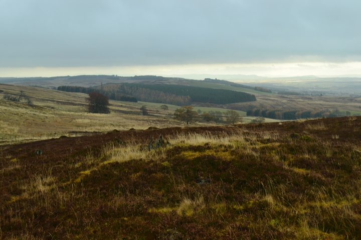
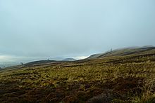 Image © thelonious
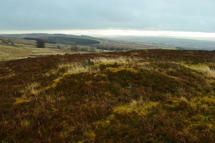