The Modern Antiquarian. Stone Circles, Ancient Sites, Neolithic Monuments, Ancient Monuments, Prehistoric Sites, Megalithic MysteriesThe Modern Antiquarian


Loch Morie

Crannog

<b>Loch Morie</b>Posted by theloniousImage © thelonious
Nearest Town:Dingwall (16km S)
OS Ref (GB):   NH54577517 / Sheet: 21
Latitude:57° 44' 33.88" N
Longitude:   4° 26' 36.32" W

Added by thelonious


Discussion Topics0 discussions
Start a topic


Show map   (inline Google Map)

Images (click to view fullsize)

Add an image Add an image
<b>Loch Morie</b>Posted by thelonious <b>Loch Morie</b>Posted by thelonious <b>Loch Morie</b>Posted by thelonious

Fieldnotes

Add fieldnotes Add fieldnotes
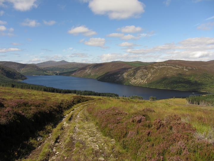
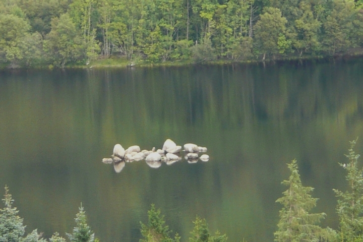
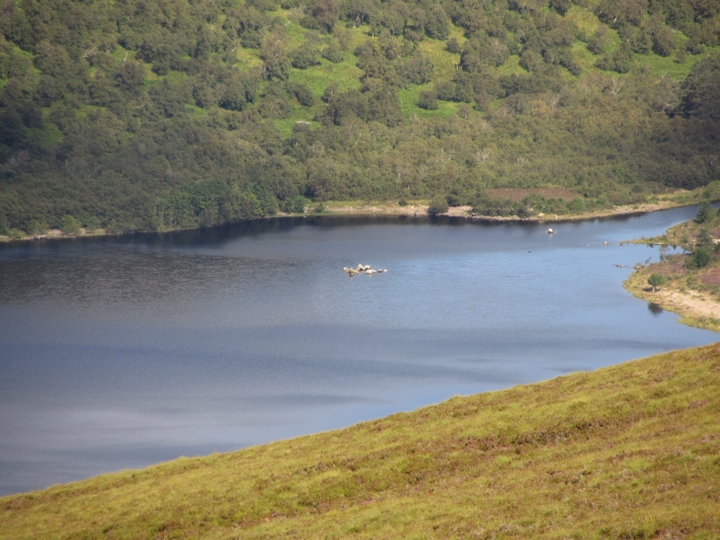
26/08/2012 - Parking area at end of public road to Boath (NH 5724 7410). Track heads west to shore of Loch Morie. Canmore have this as a crannog (possible). It's 50m from SE shore with a causeway visible on Bing aerial view leading towards it. Don't know if it is a crannog but it's a pretty nice area to visit.

Artificial Islands in the Highland Area by Rev. F. Odo Blundell from 1913 makes mention of this crannog. Quite interesting reading.
thelonious Posted by thelonious
28th August 2012ce
Edited 28th August 2012ce

Links

Add a link Add a link

RCAHMS archive


Site record for Loch Morie crannog
thelonious Posted by thelonious
28th August 2012ce