The Modern Antiquarian
Log in
|
Register
Home
Latest Posts
Forums
Maps
Help
Browse Sites
News
Blog
Contributors
The Books
Select
-
Belgium
Denmark
Eire
France
Germany
Greece
Italy
The Netherlands
Norway
Portugal
Republic of Malta
Spain
Sweden
Switzerland
United Kingdom
Wales
Powys
Montgomeryshire
Pen-y-Foel
Hillfort
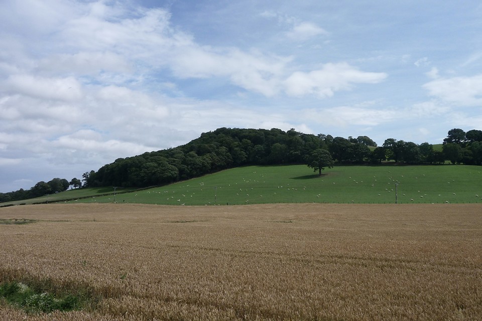
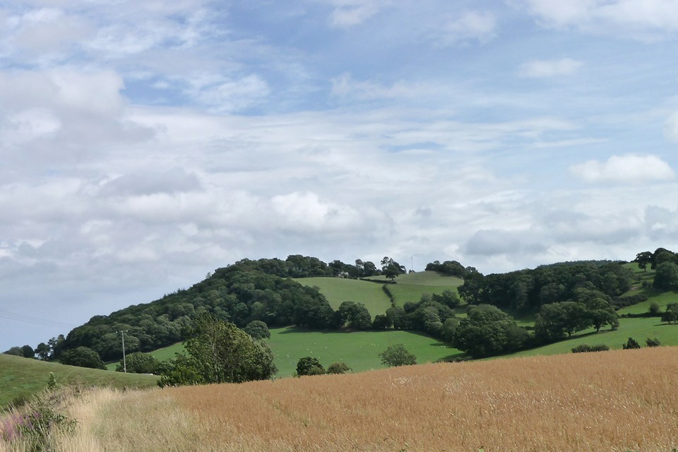
Pen-y-Foel (Hillfort) on The Modern Antiquarian, the UK & Ireland's most popular megalithic community website. 2 images, 1 weblink, plus information on many more ancient sites nearby and across the UK & Ireland.
Image © A. Brookes (10.8.2011)
Nearest Town:
Welshpool (5km NE)
OS Ref (GB):
SJ1784405920 /
Sheet: 125
Latitude:
52° 38' 39.72" N
Longitude:
3° 12' 51.77" W
Added by
thesweetcheat
Images (2)
Links (1)
0 discussions
Start a topic
Show |
Hide
Web searches for Pen-y-Foel
Flickr
Google
Google Images
The Megalithic Portal
Bing
Stone Pages
Streetmap.co.uk
Wikipedia
Show map
(inline Google Map)
- Sites within 20 km -
-
Golfa (0.96km NNW) (1 post)
Sarn-y-Bryn-Caled (4km E) (2 posts)
Sarn-y-Bryn-Caled (Destroyed) (4.17km E) (3 posts)
Cefn-Cyfronydd (4.26km W) (3 posts)
Cefn-yr-allt (4.29km SE) (1 post)
Maen Llog (4.93km ENE) (7 posts)
Dyffryn Lane (5.18km SE) (3 posts)
Maen Beuno (5.22km SE) (7 posts)
Pentre Camp (Llangyniew) (7.1km W) (1 post)
St Mary's Well (7.48km W) (4 posts)
Gaer Fawr (Welshpool) (8.32km NE) (20 posts)
Beacon Ring (8.63km ENE) (15 posts)
Black Bank (8.66km ENE) (4 posts)
Crowther's Camp (8.73km NE) (2 posts)
Ffridd Faldwyn (9.78km SE) (12 posts)
Y Gaer (Meifod) (9.92km N) (1 post)
Beechfield (12.16km ENE) (2 posts)
Collfryn (12.2km NNE) (1 post)
Moel Pentyrch (12.71km W) (1 post)
Long Hill (13.34km N) (1 post)
Llys-y-Cawr, Allt Dolanog (13.57km W) (9 posts)
The Rossett (14.23km SE) (5 posts)
New Pieces Enclosure, Breiddin Hill (14.35km NE) (4 posts)
Breiddin Hill Camp (14.38km NE) (11 posts)
Carreg Lwyd (14.45km SW) (3 posts)
Castle Ring (Rorrington) (14.52km E) (2 posts)
Mitchell's Fold (14.59km E) (117 posts)
Cefyn y Castell (14.61km ENE) (21 posts)
Bwlch y Gistfaen (14.69km W) (1 post)
Mitchell's Fold cairn (14.69km E) (5 posts)
The Cow Stone (14.78km E) (9 posts)
Whetstones (14.94km E) (5 posts)
Stapeley Hill (15km E) (17 posts)
Bryn Mawr (15km NNE) (3 posts)
Whetstones Cairn (15.08km E) (4 posts)
Soldier's Mount (15.1km N) (1 post)
Pant Brwynog (15.22km ESE) (2 posts)
Crosswood (15.27km NE) (6 posts)
Corndon Hill (15.62km ESE) (47 posts)
The Hoarstones (15.7km E) (58 posts)
Roundton (15.87km ESE) (3 posts)
Caus Castle (15.95km ENE) (14 posts)
Brynar and Riddle (16.06km S) (1 post)
Cwm Mawr Stone Axe Factory (16.67km ESE) (4 posts)
Llyn Y Tarw (17.35km WSW) (7 posts)
Pennerley Barrows (18.24km E) (10 posts)
Llanymynech Hill (18.27km NNE) (13 posts)
Upper Short Ditch (18.35km SSE) (1 post)
Lower Short Ditch (18.42km SE) (1 post)
Llyn Mawr (18.69km WSW) (3 posts)
Caer Din (18.71km SE) (1 post)
Carreg Hir (18.75km WSW) (15 posts)
Llwyn Bryn Dinas (18.77km NNW) (11 posts)
Y Capel (18.8km WSW) (12 posts)
Blodwel Rock (19.12km NNE) (7 posts)
Pen Cad Cymry (19.14km W) (1 post)
Glonc (19.28km WSW) (3 posts)
Lluest Uchaf (19.3km WSW) (18 posts)
Maes Mochnant (19.31km NNW) (15 posts)
Llyn Mawr (19.61km WSW) (9 posts)
Heath Mynd (19.63km ESE) (8 posts)
Shentons Tump (19.78km S) (2 posts)
Roveries Hill (19.82km ESE) (2 posts)
Foel Cairn (19.82km W) (1 post)
Castle Ring (Shelve) (19.98km E) (11 posts)
- Facilities within 20 km -
-
Welshpool Tourist Info... (Tourist Information: 5 km ENE)
- Add -
-
Add news
Add an image
Add fieldnotes
Add folklore
Add miscellaneous
Add a link
-
Add a site
Add a nearby facility
Add an alternative name/spelling
Images
(click to view fullsize)
Add an image
Links
Add a link
Coflein
Aerial photo of the site.
Description from Coflein:
A sub-rectangular enclosure, about 165m east-west by 124m, upon the summit of Pen-y-Foel; defined by a bank and ditch above steep slopes on the north and east, on the west is a further rampart and ditch, about 48m from the inner line.
Comments (0)
|
Add a comment
|
Permalink
Posted by
thesweetcheat
18th August 2011ce

 Posted by thesweetcheat