|
|

|
|
Sully IslandPromontory Fort
|
|
|
|
Images (click to view fullsize) |
|

|
Fieldnotes |
|
|
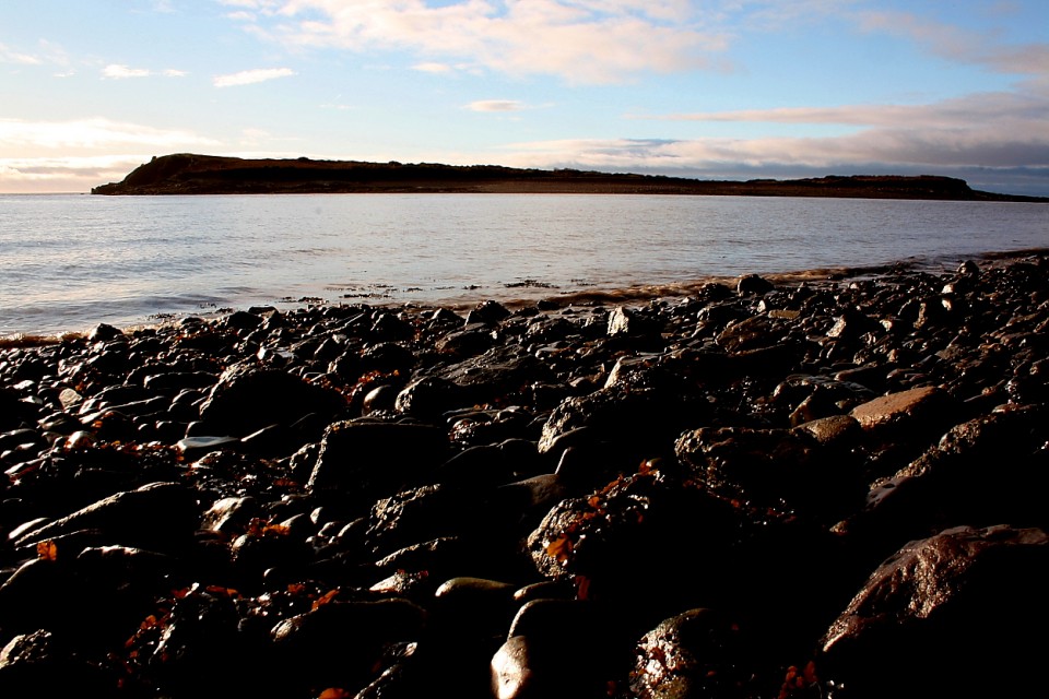
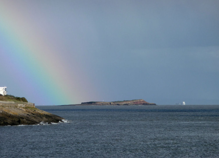
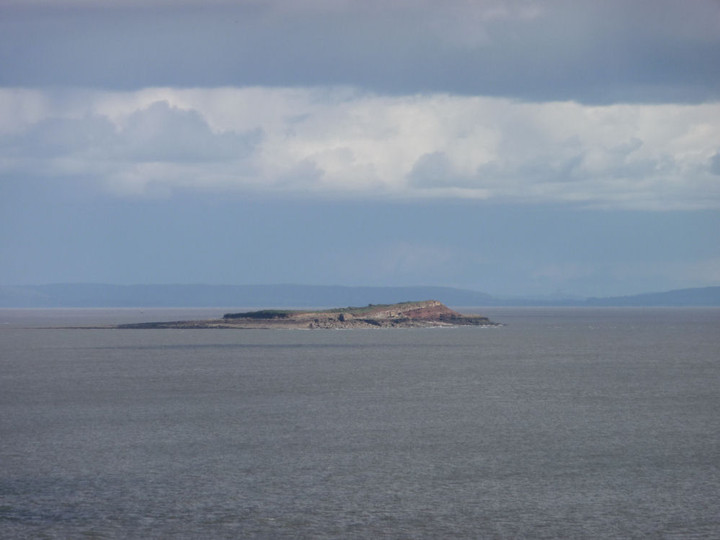
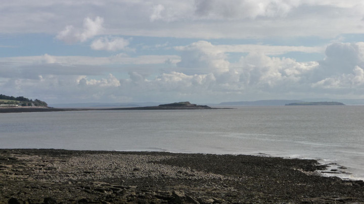
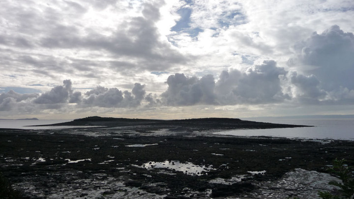
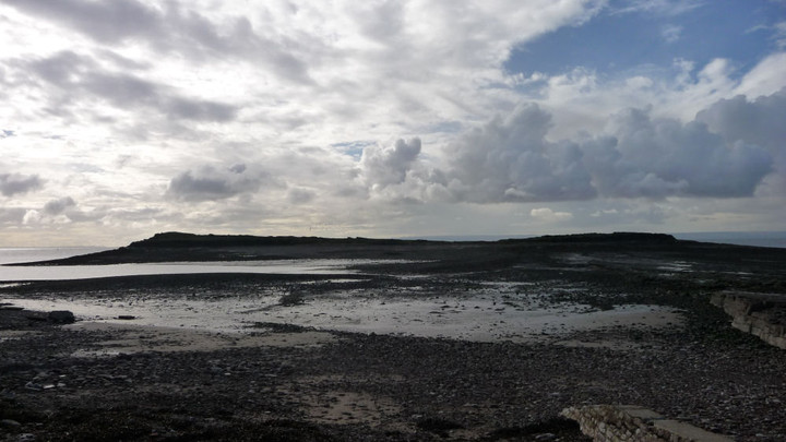
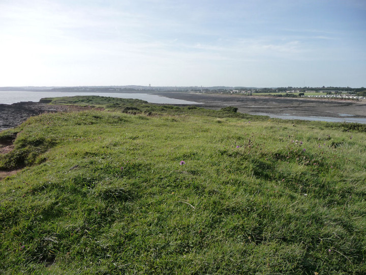
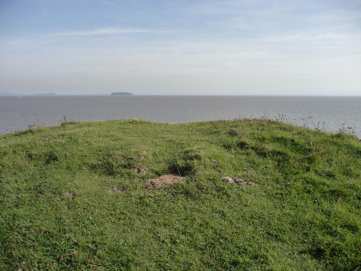
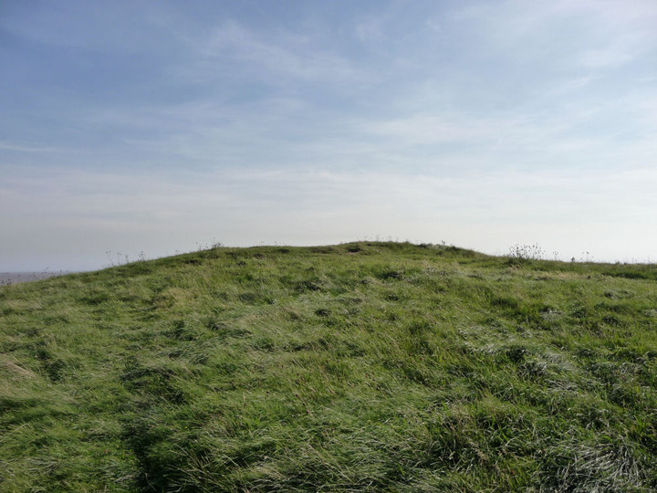
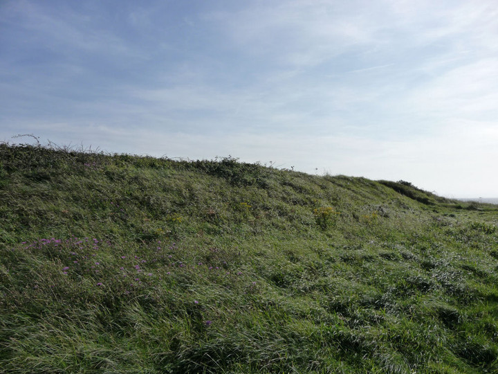
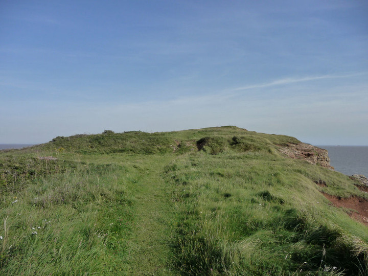
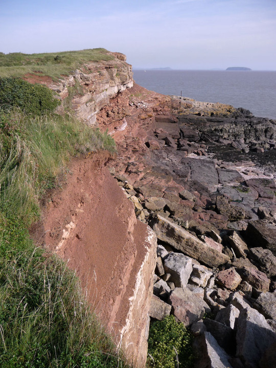
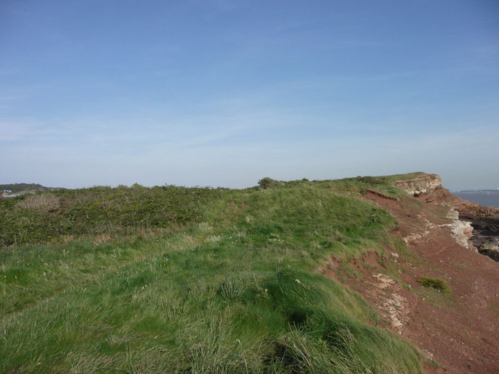
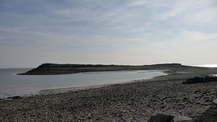
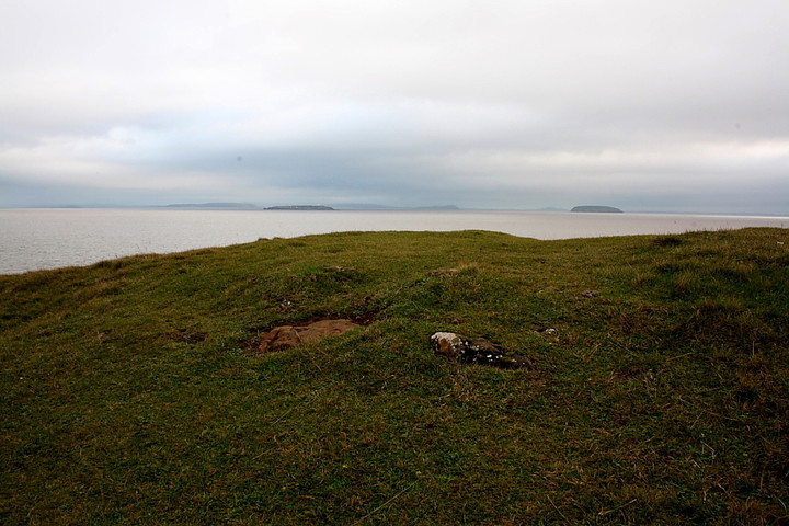
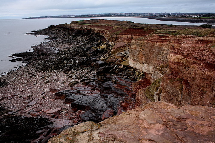
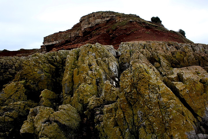
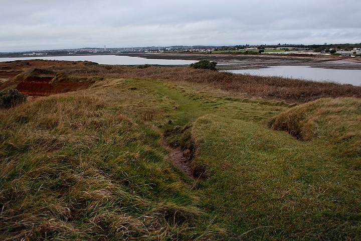
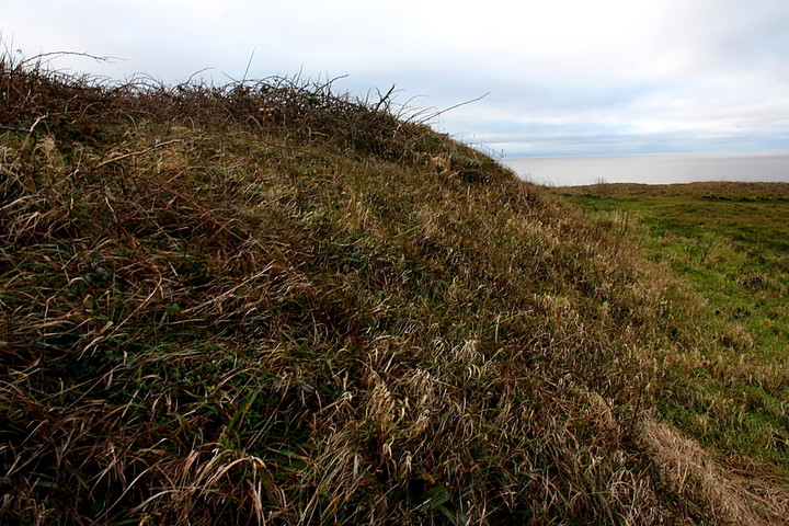
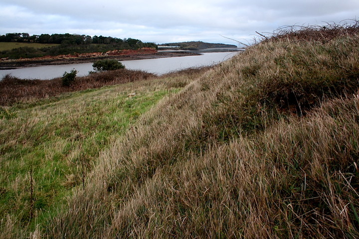
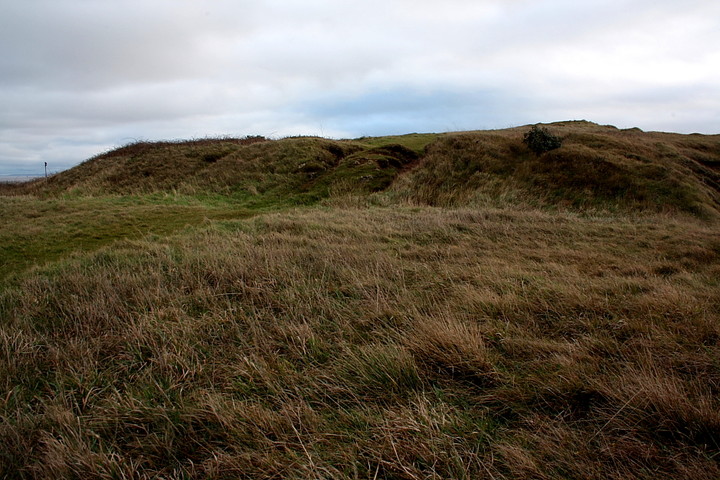
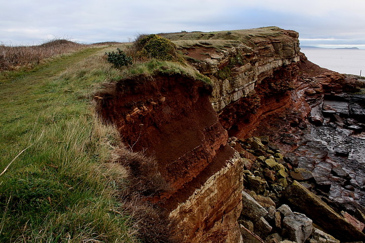
Boxing Day morning under a leaden, South Walian sky, with cloud base low enough to prevent fleeing to the hills, is not the most inspiring of times, it has to be said. Only one thing for it, then.... to paraphrase the lovely Cerys Matthews... 'Things are strange, I'm starting to worry. This could be a case of going to Sully'. Well, my mum's always said I'm a bit like Mulder from the X-Files. Not sure if that's a compliment or not, to be honest. Sully Island is another of those locations which may well take those unfamiliar with the delights of The Glamorgan coastline by surprise, set as it is between the capital city (to the north) and Barry Island (think Gavin and Stacy, if you must) to the west. With due respect to the locals, I'm sure they'd agree scenic beauty wouldn't be the first topic of conversation when mentioning the locality... nevertheless it is here. There is also danger for the unwary in the form of one of the highest tidal ranges in Britain (my thanks to the Mam C's husband - who works nearby - for that nugget of information, duly exposing my general ignorance of local marine matters). To be fair, the prominent signs round about make this crystal clear. People have drowned crossing to Sully Island. Simple as that. Initially there doesn't seem any chance of me getting more than a distant view of the 'promontory' fort occupying the left hand (eastern) portion of the island, as viewed from the quayside. Yeah, the tide is right in, the island, well.... an island. However the sun pokes from behind the cloud mantle, encouraging me to take a few shots from the beach. Then, wandering down the breakwater - as you do - I have the crazy (and no doubt suicidally dangerous) idea that it might be possible to wade. However, clearly, it would be impossible to venture further without coffee, so a return to the car is required. Several minutes later the decision is academic, a broad causeway of rock now linking island to shore. Jeez. That is fast. Passing Carl's skeletal boat, I head eastwards along the island, the far (southern) flank of which is being inexorably smashed to oblivion by the Bristol Channel.... fort 'n all. Guess the sea wants Sully Island back, then. Coflein reckons there are three cross-ramparts isolating the far eastern section of the island from the hinterland, although I can only positively identify two. These are quite substantial, relatively speaking, although considerably overgrown with brambles - and, sadly, featuring quite a bit of rubbish. The highest point of the enclosure is crowned by what I take to possibly be the remains of a Bronze Age round barrow. Surprisingly, Coflein (very) tentatively agrees. If we are correct, it is a suitable location for VIP burial, with the natural, craggy defences of the fort falling way sharply to the water, the sea views expansive towards Flat Holm etc. Looking to the south along the disintegrating, southern flank the view is more industrial, with Barry's factory chimneys lying beyond the sound. Yeah, times have changed since people actually occupied this spot. But it still remains an extraordinary place to eat Boxing Day lunch. And that's a fact. No need to get Mulder and Scully onto Sully to solve that one. Just make sure you keep one eye permanently upon that crazy tide! |
 Posted by GLADMAN
3rd January 2012ce Edited 5th January 2012ce |
|
Visited 20.2.11 This was an 'ad hoc' visit as the main reason I was in the area was to have a family meal in the attractive Captain's Wife pub which overlooks Sully Island. The pub is signposted off the main road (brown sign) and there is a fairly large free car park Following the meal I was pleasantly surprised to find the tide was still out and as luck would have it my wellies were in the boot! It is only a 15 minute stroll across the beach to the island and you pass the rotting remains of an old ship sunk into the sand. The wellies came in handy as parts of the walk were very muddy with that grey type sludge you sometimes find at the beach. The island is not very big and the remains of the ditches / banks can be found on the highest part of the island – left hand side when viewing from the beach. I spotted two definite banks/ditches, the first about 6ft high and the second about 5ft high. There was also a smaller bank on the outer edge but I do not know if this was man made or natural? Other than nice views over to Flat Holm and Steep Holme there is not much else I can add about my visit. Not very often I do an island field note! Coflein records the possibility of a Barrow on the highest point but I couldn't see any trace of it. Perhaps it has been worn away over the years? *** WARNING *** You do need to be careful of the tides when planning a visit. In this part of the world they come in very quickly and each year several people get caught out and the inshore lifeboat has to be called upon. Unfortunately people do occasionally drown when caught in an in-coming tide. It is perfectly safe to visit the island as long as you are sensible with tide times. If you happen to visit when it is not possible to walk out onto the island the larger ditch is easily seen from the beach. |
Posted by CARL 4th March 2011ce |
Miscellaneous |
|
|
Coflein has the following to say about this quite remarkably sited fort: 'The east end of Sully Island is defended by a succession of three ramparts. There has been erosion, particularly on the south, and the north half is thickly overgrown; the present area of the main enclosure is about 0.4 ha, but it may originally have been twice as much. The inner rampart, cutting off the subsidiary promontory at the point of contraction, was fronted by a ditch and is thought to have been revetted, or walled in stone. D.K.Leighton, RCAHMW, August 1987. RCAHMW AP955145/50-1' Note that the Mam C's husband works nearby (at time of posting) and reckon's the warning notices posted in the vicinity most certainly mean what they say.... the tides upon this coastline are not to be trifled with, so watch yourself please. |
Posted by GLADMAN 28th December 2011ce Edited 28th December 2011ce |