|
|

|
|
Clach a' CharraStanding Stone / Menhir
|
||||||||||||||||||||||||
|
|
|
Images (click to view fullsize) |
|

|
Fieldnotes |
|
|
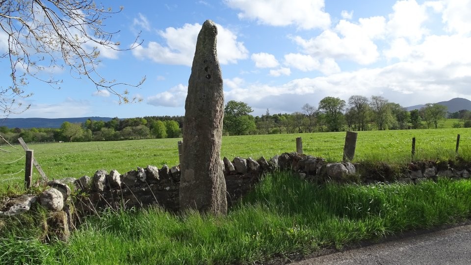
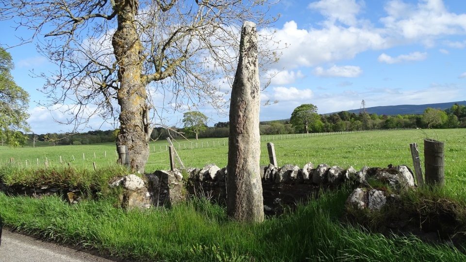
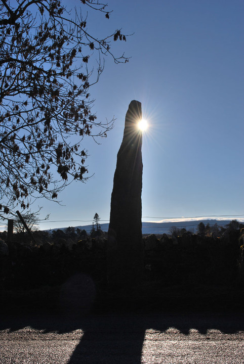
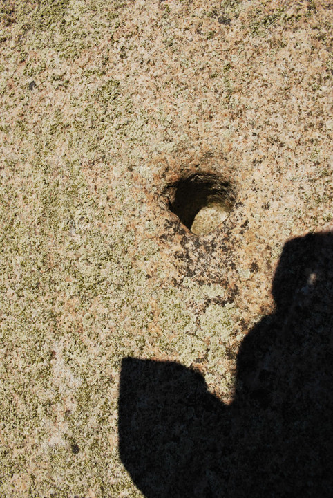
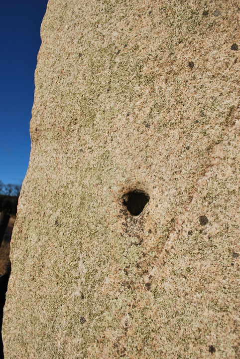
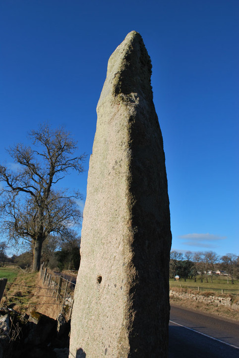
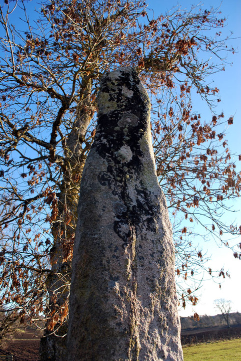
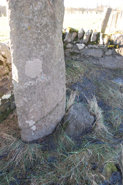
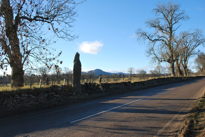
Not to be confused with the seemingly far more famous Clach a Charra near Ballachulush - listed in this saite at http://www.themodernantiquarian.com/site/4792/clachacharra.html The Clach a'Charra is situated right beside the A949, which links the A9 trunk road at Clashmore (near Dornoch) with Bonar Bridge. The stone is quite impressive at around 11ft tall, but surprisingly easy to miss as you travel past by car - it can easily be mistaken for a tree trunk in the verge. The road / field boundary wall has been built around the stone in a u-shape, rather than the stone being absorbed into the wall as often happens. The stone has obviously at some point been knocked down / fallen - there is a clear repair line a few inches from the ground, and I have added a link to the Dornoch Historylinks museum archieve, which shows the stone being resited in 1968 in some detail (and the stone previous to this in two halves). The stone has roughly four faces, becoming slightly pointed near the top. On the furthest face from the road (facing roughly south) is one 'hole' - too deep to be called a cup mark. It seems to have more of a functional purpose than be decorative. The hole is almost a couple of inches deep, and placed and about 5ft up from the ground. The Highland Council Archaeological Unit comment… "Local tradition says the stone marks the grave of a 'Danish' chief; and Joass calls the hole a staple-hole and notes an associated 'swinging chafe' as if a 'jougs' or iron collar had hung from it." It seems a bit odd however that the criminal would be chained on the side of the stone facing away from the road? Surely such punishment would involve the accused being as easily visible as possible? Unless the route of the road has changed, or we are missing some other part of the jigsaw? There seems to be some interesting stuff going on in fields immediately either side of the road and stone - recorded on the HER are cremations and urns, evidence of stone working, crop marks, a shell midden… If visiting there isn't really an obvious spot to stop in any where near by, and the nearest disused gateway is chained off. Best to plan to park further away where you can (safely) and incorporate the stone into a little walk. I was asking a Gaelic speaking friend about the name - Clach a' Charra - and to the best of our figuring it means 'stone of stone'! She did suggest charra may have a similar root to Carnac - or even cairn, but she's promised to do some research for me with the senior Gaelic speakers in her family... |
 Posted by summerlands
5th February 2011ce Edited 5th February 2011ce |
Links |
|
Highland Council HER Record |
Posted by summerlands 5th February 2011ce Edited 5th February 2011ce |
Dornoch Historylinks Image LibraryPhotos of the resiting of the stone in 1968. The stone seems to have fallen / been taken down at some point - note the separated base and detail of repair. |
Posted by summerlands 5th February 2011ce Edited 5th February 2011ce |