|
|

|
|
Merthyr Mawr Warren
|
||||||||||||||||||||||||
|
|
|
Images (click to view fullsize) |
|
|
Fieldnotes |
|
|
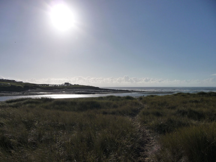
I visited this area a couple of years ago when paying a visit to Candleston Castle (ruin). There was a charge for the car park when I visited although I suspect they only bother to charge in the summer months? The dunes are large - similar to the ones at Kenfig Sands (which also has a ruined castle slowly being burried by the sand). There could be just about anything buried below the sand. As Gladman rightlt points out, the castle at Ogmore is better and the stepping stones are great! You can also get a cuppa and a bite to eat in the farm house next to the castle. |
Posted by CARL 4th January 2011ce |
|
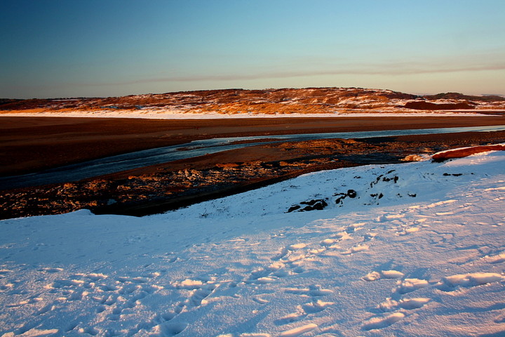
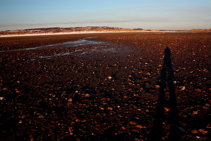
There are times, particularly during high summer, when this otherwise superb stretch of South Walian coastline can seem somewhat.... how can I put it?... 'Gavin and Stacey-like', I guess. What with the amusement arcades and rides of Porthcawl to the immediate west and local punters packing out the beaches of Ogmore-on-sea and Southerndown, it is best avoided. At other times, such as was the case upon Christmas Day 2010, it can be enchanting. It's difficult - if not impossible - to succinctly define what ensures a prehistoric site/location is 'enchanting' or 'evocative'. There are many contributary factors, usually involving an complex interplay of physical remains and landscape setting, together with prevailing weather conditions, lighting etc. Merthyr Mawr Warren relies exclusively upon the latter since there is very little, if any - from my experience anyway - physical remains of prehistoric structures to be seen amongst the great sand dunes. However the lack of people and, primarily, the exquisite colours generated by the low mid winter sun contrasting with a white mantle of snow, make the Warren appear postively 'otherwordly' this Christmas afternoon. Forget the gaudy seasonal decorations, this is artistic embellishment of the highest possible calibre. Nature knows best, methinks. According to the GGAT website (see miscellaneous) humankind has occupied this landscape since, well, forever. This is - in the most literal sense - 'The Sands of Time' personified. On occasions like this the landscape itself is overwhelming, short circuiting the human psyche with the sheer contrast in light. The Exmoor coast looms beyond little Tusker Rock as clear as I've ever seen it... but all too soon we must leave to further participate in that ritual we call 'Christmas'......... Merthyr Mawr Warren is most easily accessed by following signs for Merthyr Mawr village from the A48, there being a parking area at the terminus of Merthyr Mawr Road, near Candleston Castle. A much better alternative - for those with time - is to park at the Norman fortress of Ogmore Castle and cross the Afon Ogwr, via some wonderful stepping stones, followed by suspension bridge to the chocolate box village of thatched cottages; hence follow the road to the left (west), past the church. If you decide to visit keep your eyes peeled. Who knows? You may be perceptive enough - or lucky enough - to uncover the sand dunes' more tangible secrets that have eluded me to date? If not, the intangible attributes should see you alright regardless... |
 Posted by GLADMAN
2nd January 2011ce Edited 2nd January 2011ce |
Miscellaneous |
|
|
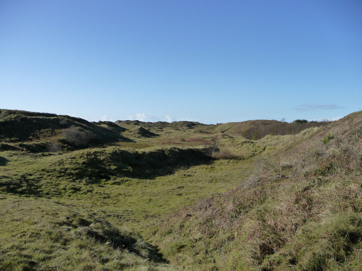
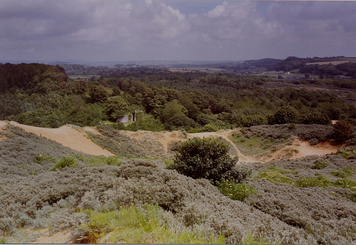
Merthyr Mawr Warren is a special place in a great position overlooking the Afon Ogwr. Yeah, even when judged in relation to the superb coastline of Glamorgan, of which it forms part - a coastline with majestic cliff lines bearing numerous Iron Age hillforts - it is stunning. Not only does it consist of some of the highest sand dunes in all Europe - rising up to some 200ft - but the continuity of human settlement here is staggering. No, really, it is. From Mesolithic to Medieval, with several Bronze Age cists discovered for good measure. Not to mention the substantial ruins of a fortified manor house (Candleston Castle) and a Norman fortress at nearby Ogmore Castle, the latter guarding exquisite stepping stones across the aforementioned river. Having said that, shifting sand doesn't make for good location/preservation of detail, so don't expect to 'see' a great deal of prehistory here in the normal sense. But if you are prepared to open your mind and walk the dunes.... I've no doubt a good day will be had. The Glamorgan-Gwent Archaeological Trust (GGAT) site accessed via http://www.archwilio.org.uk/ possesses a lot of information regarding the prehistoric, er, prehistory of the dunes. To whet the appetite, try these two for starters (I quote GGAT records, of course): ROBERTS'S CIST BURIAL - (PRN) : 00226m - SS85917704 "A stone cist on Merthyr Mawr Warren, uncovered by sand movement in 1948 and examined by staff of NMW who found sufficient other structural remains to postulate that it may have been part of a barrow of a type known elsewhere on the warren, composed of sand with a covering of stones. It was 0.5x0.3m and contained the skeleton of a child; to the S of it stones formed the segment of a circle 10.7m in diameter, and near them where two slabs of stone with fragments of burnt and unburnt bone (Savory 1953). Nothing is now visible at this NGR, which falls in a hollow in dunes at the foot of the high ground." CANDLESTON CASTLE CIST - (PRN) : 00227m - SS86727726 "A cist NW of Candleston Castle near the ruined windmill. This was oriented N-S and was roughly trapezoidal in shape; the internal length was 5ft (1.5m) and the internal width ranged from 13in to 17in (0.33-0.43m). It was entirely lined with stone slabs" There is much more where that came from..... not least a probable ploughed-out Neolithic causewayed enclosure upon the high ground to the south at Norton [SS87467578]. |
Posted by GLADMAN 30th December 2010ce Edited 3rd January 2011ce |