|
|

|
|
Oxen CraigCairn(s)
|
||||||||||||||||||||||||
|
|
|
Images (click to view fullsize) |
|

|
Fieldnotes |
|
|
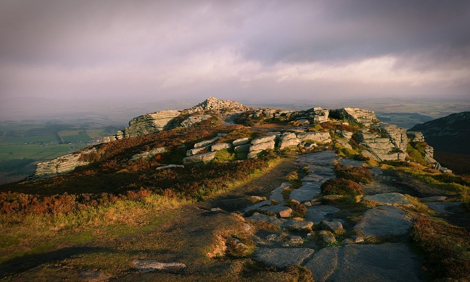
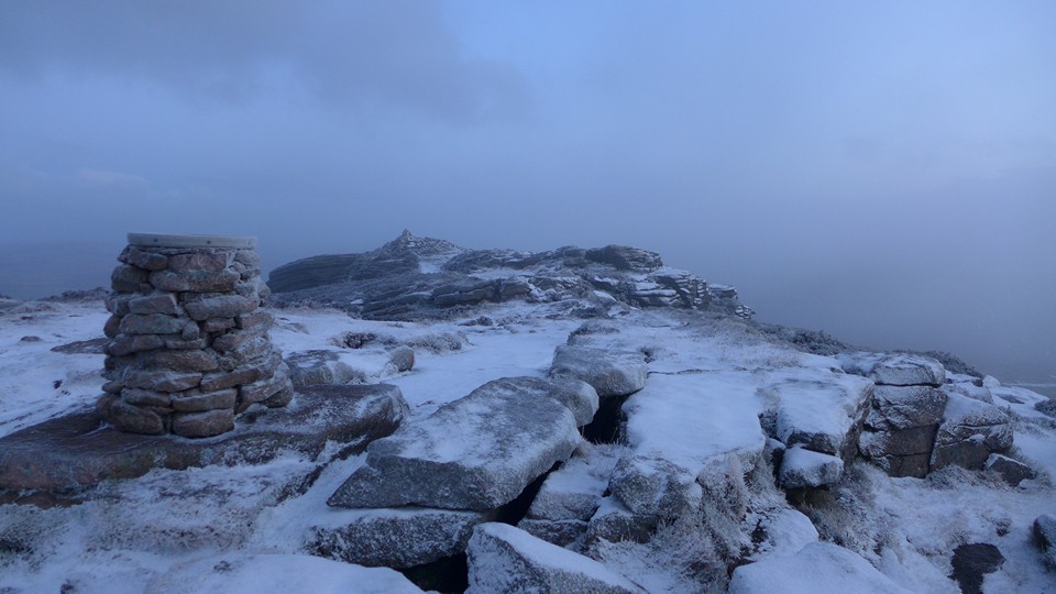
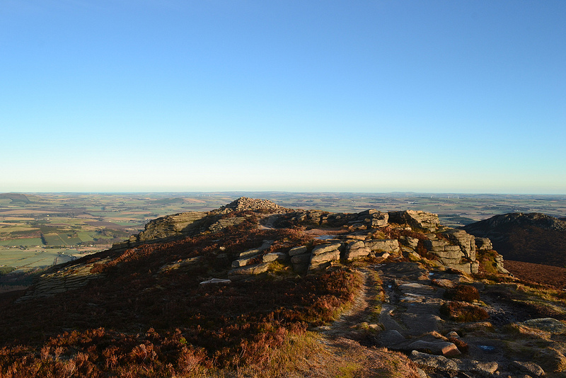
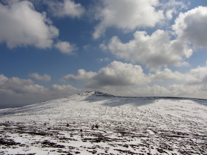
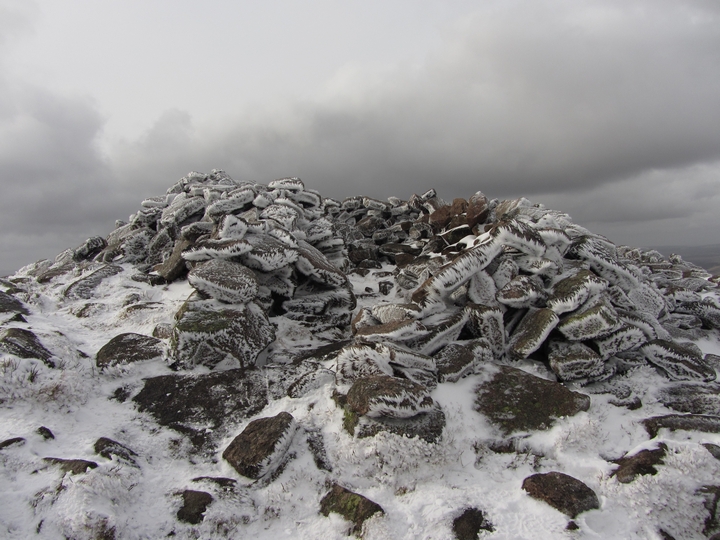
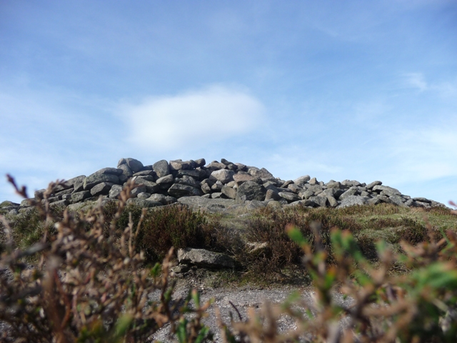
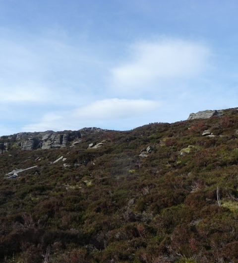
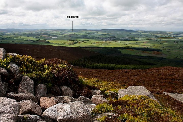
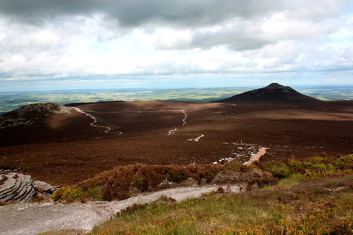
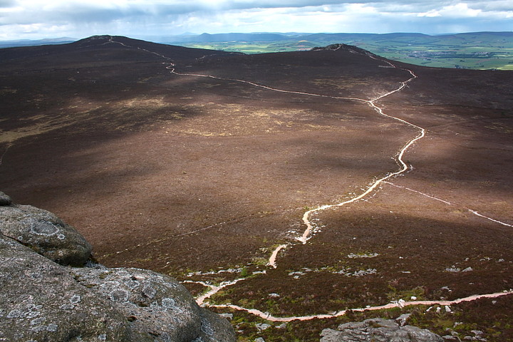
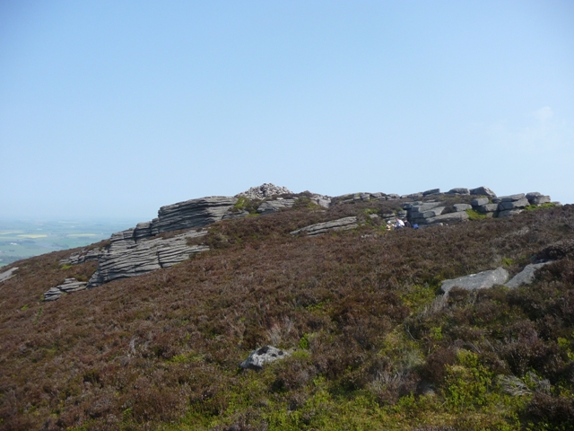
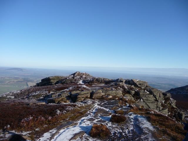
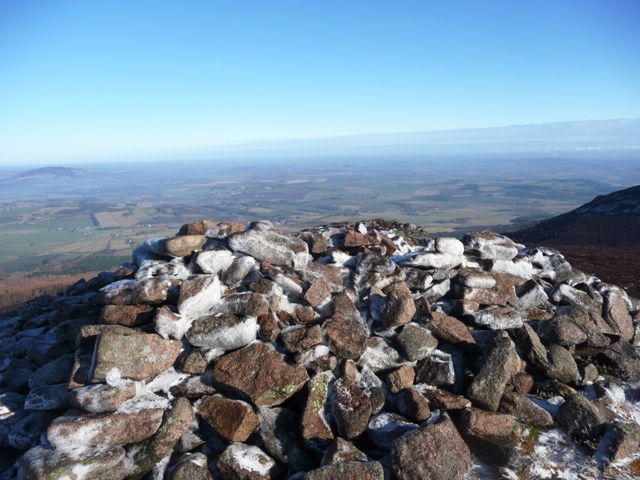
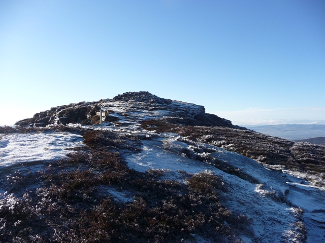
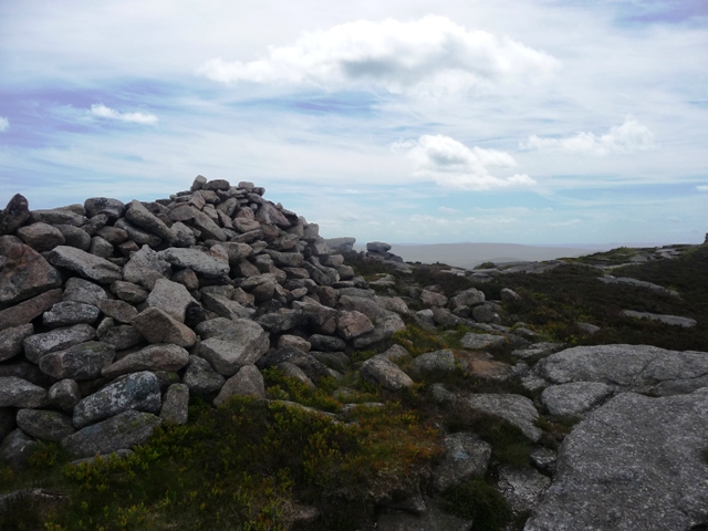
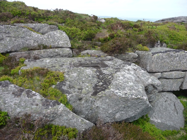
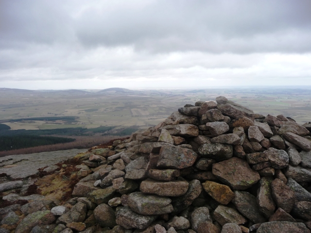
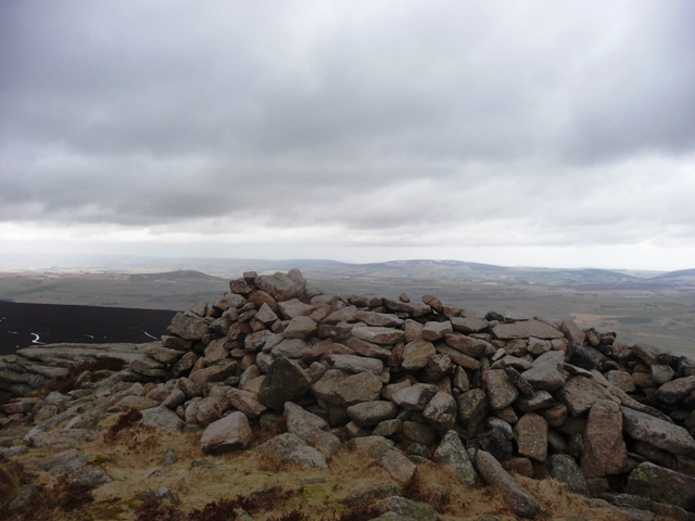
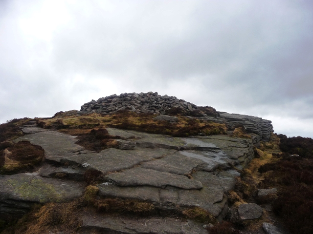
Here's a turn-up for the books, and no mistake. A large cairn crowning a mountain summit.... and I don't even ken it's the 'real deal' at the time, so comprehensively - not to mention expertly - has it been converted into a walker's shelter. Indeed, it could be said to represent the 'pinnacle' of muppetry! However Canmore is of the opinion it's probably of prehistoric origin, an assertion that is given credence both by the siting and size of the stone pile. Bonus! Oxen Craig, summit peak of Bennachie, lies more or less to the west of Mither Tap and is well seen from the top of the hillfort.. assuming an absence of cloud, that is. And hurricanes... Although the intervening landscape is crossed by specially constructed, signposted tracks - I assume to minimise erosion, albeit with an inevitable loss of upland aura - the walk is by no means easy this afternoon, being into the teeth of a pretty serious headwind, even in the lee of the mountain. Arriving at the summit I realise just how far conditions have deteriorated, even after leaving Mither Tap (the radio apparently reckoned the wind to be in excess of 100mph), it being more or less impossible to stand, let alone take any images of the cairn, upon the summit ridge. Ha! Perhaps that's why Aberdeenshire is famous for its recumbent stone circles? Wise to follow suite, then, before the wind does it for me. Nevertheless Oxen Craig is a good place to be, a fabulous vista towards the Dunnideer landscape probably the best on offer, although the image of Mither Tap in profile will no doubt stay with me for a long time. I make an attempt to find the 'socketed' stones, but I'm afraid Mother Nature has other ideas. Thoughts again turn to Mons Graupius and events which might have occurred upon the flanks of this windswept - hell yeah! - mountain in 84AD.... much like Harold at Senlac, what course might history have taken if things had have gone the other way? Bloody Romans. I return to Maiden Causeway by heading approx north-east towards Craigshannoch, the landscape comprised of deep heather and very hard going underfoot. Hmm, perhaps the paths are a good idea after all? Although a 'minature' mountain, don't take Bennachie lightly... in either the physical or metaphysical sense. It may well just blow you away. |
 Posted by GLADMAN
21st June 2011ce Edited 21st June 2011ce |
|
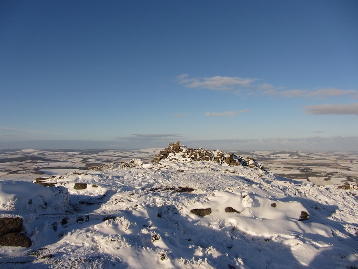
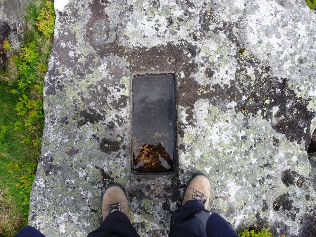
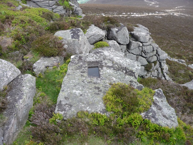
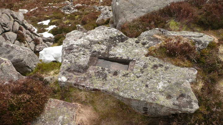
Whilst on Oxen Craig look out for a square-cut hole - see story below, near the cairn. from 'Bennachie' p41 Alexander Inkson McConnochie 1890 Oxen Craig has acquired quite a local history — and almost even a name, for sometimes it is spoken of as " Robbie Deson's Tap" — from a half-witted pauper, Robert Dawson, who was found dead on the Craig on 12th December, 1856, the sixteenth day after he had disappeared. Robbie lived with his mother at Goose- knowe, near'Ryehill, Oyne, and was last seen alive at Hillbrae. He had left Hillbrae on the 26th of the previous month, a snow-storm coming on rather un-expectedly after he had set out. Search parties were sent out after some delay, but no trace of poor Robbie could be found — indeed, it could hardly be expected that it would have been thought possible or probable that the body would be found on the highest point of Bennachie. Ultimately, the body was found by a young man of the district who was out " takin' a shot n at the white hares in the neighbourhood of Oxen Craig. Robbie had died while sitting on the Craig, so at first the " sportsman " took the dead body for some one watching his movements. The crows had picked out the right eye before the body was found, which was buried at night in Oyne Churchyard. The natives erected a commemorative stone, with an inscription, on the spot where the body was found, the stone being cut from the rock in the immediate vicinity. Robbie's mother, however, knocked it down and broke it into minute pieces, her idea being that she |
 Posted by thelonious
3rd April 2010ce Edited 3rd April 2010ce |
|
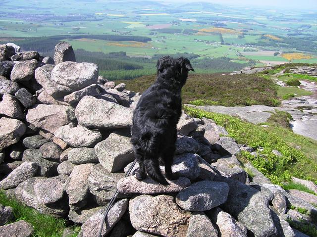
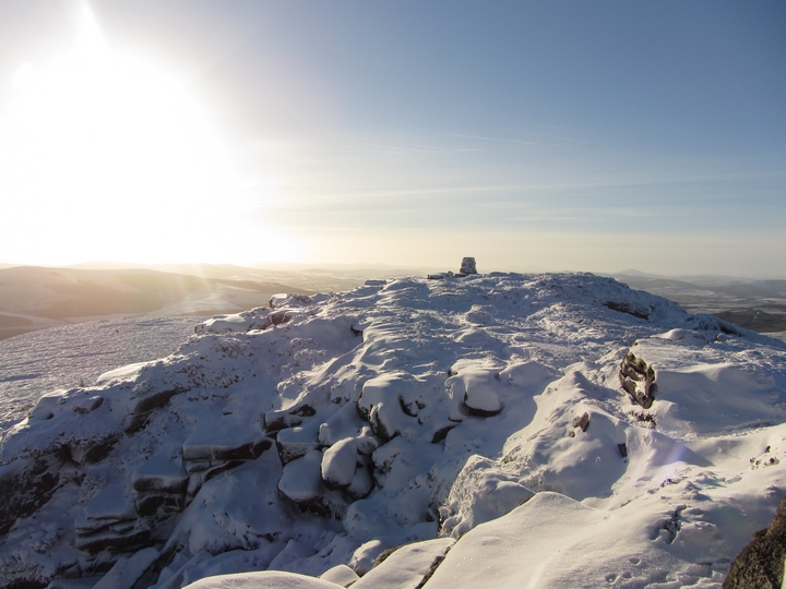
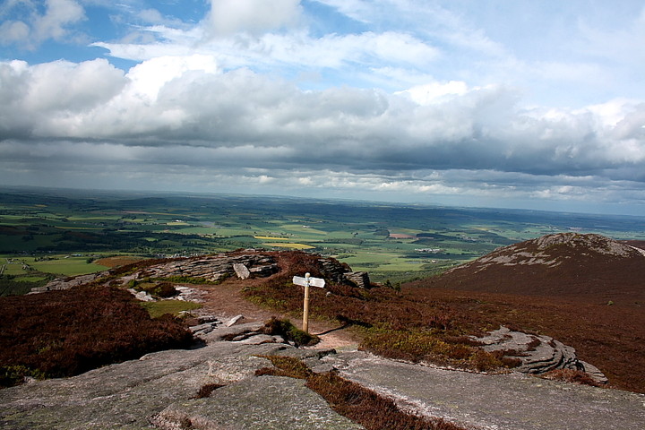
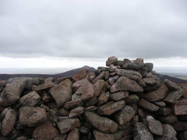
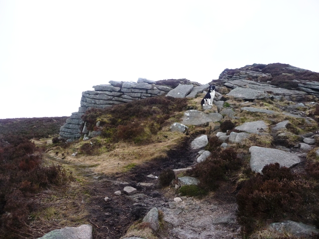
When you look at Bennachie the pointy shaped one (technical terms of the highest quality) Mither Tap at 1699 ft looks highest. However it isn't, Oxen Craig stands at 1733 feet and on its peak is a cairn with fantastic views especially of the Mither Tap but also all the way to Tap O Noth, Durn, Knock and the nearer hillforts. The cairn originally stood at 12 meters in width and was at least one meter high. Some of the stones have been used to make a shelter and who could blame these early shepherds/quarry workers. The weather can change quickly in these parts. Last week there was still over a foot of snow lying. From Tillymuick look up and follow your nose or use an OS map or Bennachie guide. The paths are fairly steep but quite well maintained. Wrap up tho, normally it is very cold and exposed at the top. Easy for Mel and George (who posed on Little Oxen Craig), they run up and down these hills for fun. Not me, I walk and then forget to stop! Visited 22/3/2010. |
24th March 2010ce Edited 24th March 2010ce |