25/03/2012 - Slightly different approach than Drew. I parked on B992 at NJ 61092171. Headed west on the Gordon Way which leads all the way to the cairn at summit of Knock Saul. Lovely sunny weather today and the walk is a good one. Better, I think, than the approach from the Suie carpark west of hill. Cairn is a good size and has a great view of Tap o Noth. It's worth mentioning the Gordon Way. A 11.5 mile linear walk from Bennachie Vistor centre, east of Mither Tap , over the Bennachie range then Knock Saul, Suie Hill to Suie Carpark. Nice walk but probably needs two cars unless you want to walk back again!
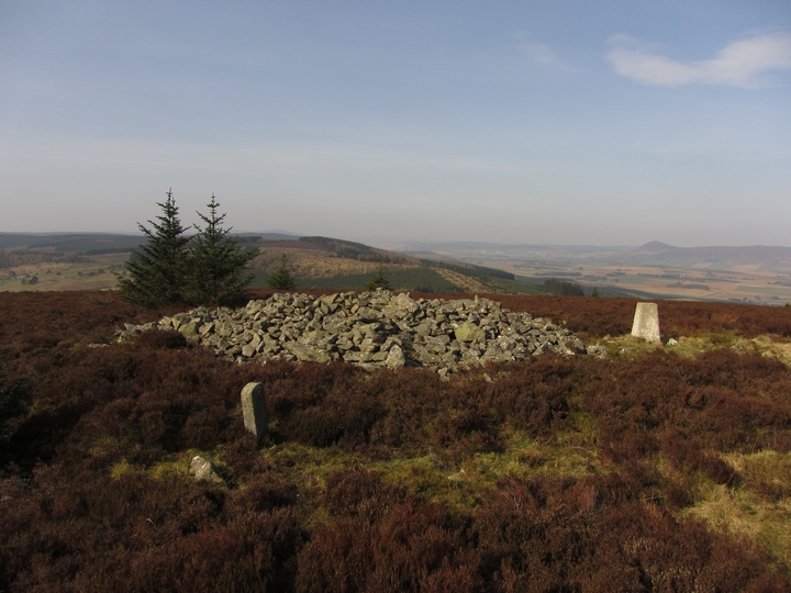
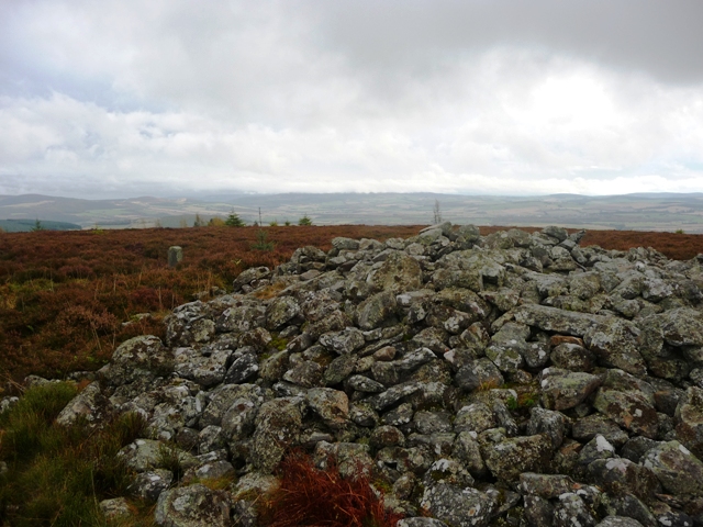
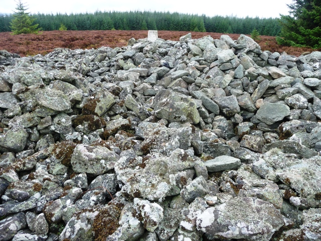
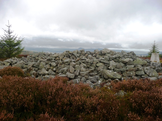
This site, fortunately hasn't been buried so I didn't get the unwanted hat trick, is found on top of the Knock Saul Hill which is part of the small Suie range between Leslie and Clatt, Tullynessle to the south. There is a boundary marker beside the cairn indicating this fact. Several shelters have been made in the 12 meter wide cairn. It stands at 1 meter in height. Some stones sit 2 meters out circling the cairn, they might be kerbs but are more likely to be randomly dropped stones.
The views up here are spectacular taking in good views of the Garioch, to the east, Alford to the south, Tap O Noth to the west leaving the north to be hidden by fir trees.
Leave the B992 at Auchleven (Premnay) heading west towards Leslie. At Leslie turn south at the church and keep going until the road ends. I parked before Saul Farm as it is on a private road. Follow the tree line for at least 11/2 miles, tricky stream jump on way, until the Gordon Way is reached. Turn right, west, following the directions to the hills summit, the cairn is beside the path. My walk time was over 2 hours and towards the end it is pretty steep. The path is ok in parts and boggy in others thanks to horses churning up the "dubs".

 Posted by thelonious