|
|

|
|
Fosbury CampHillfort
|
||||||||||||||||||||||||
|
|
|
Images (click to view fullsize) |
|
Photographs: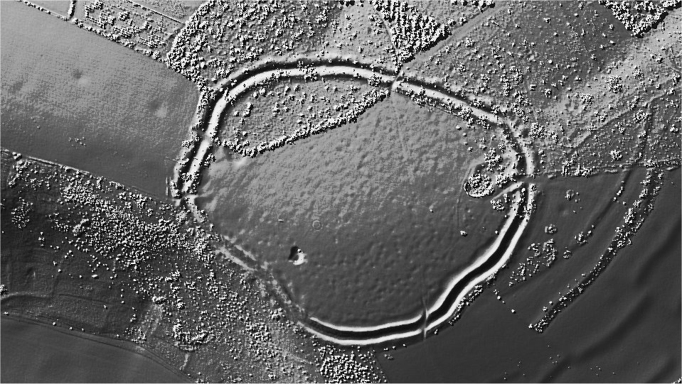

 Maps / Plans / Diagrams:
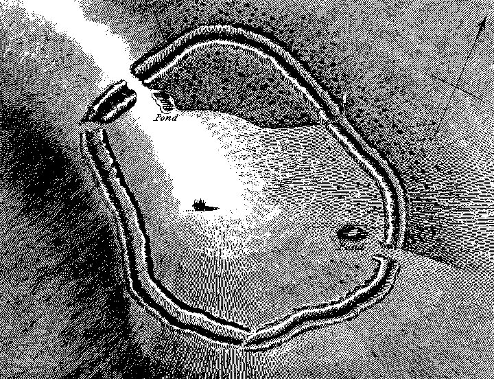 Artistic / Interpretive:
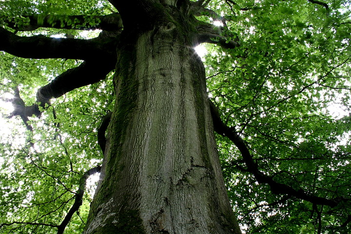
|
Fieldnotes |
|
|
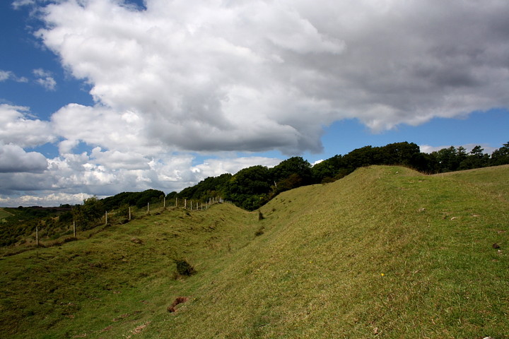
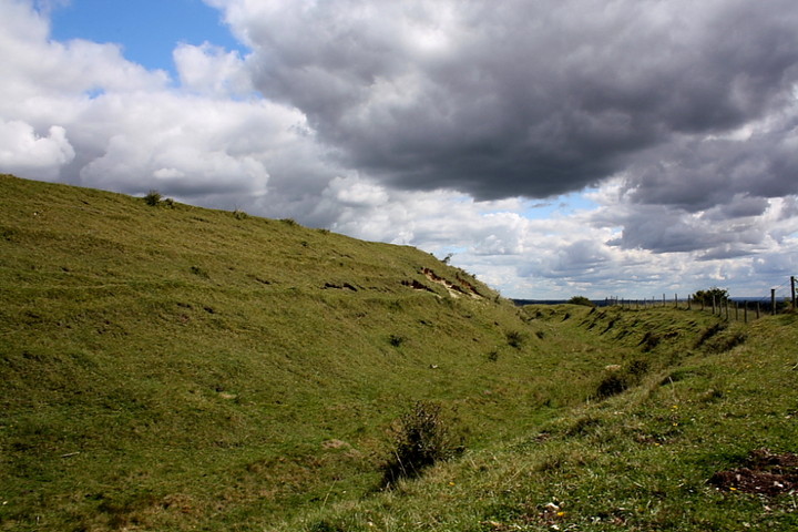
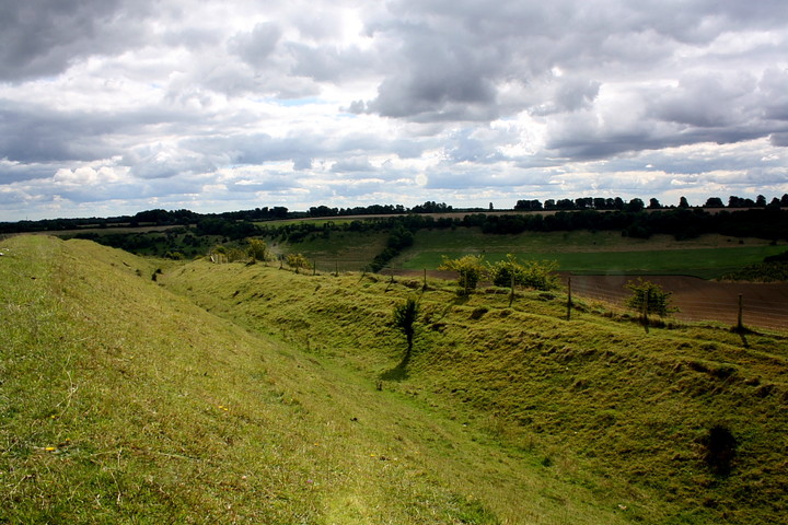
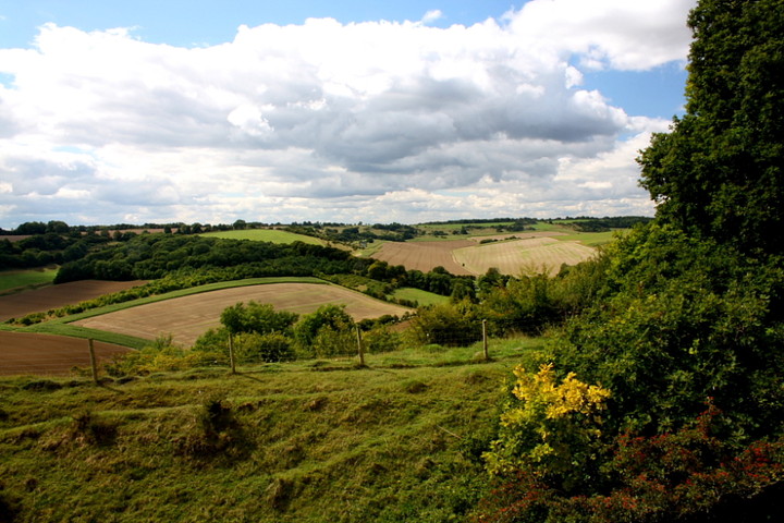
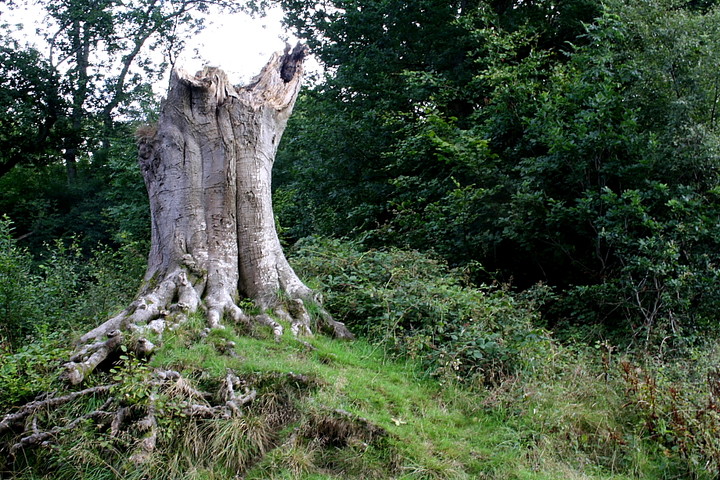
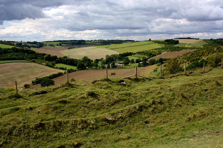
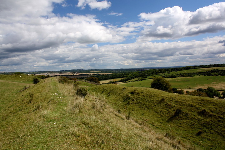
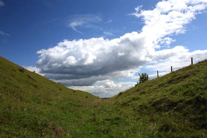
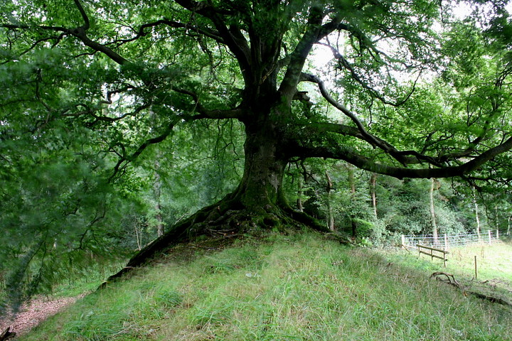
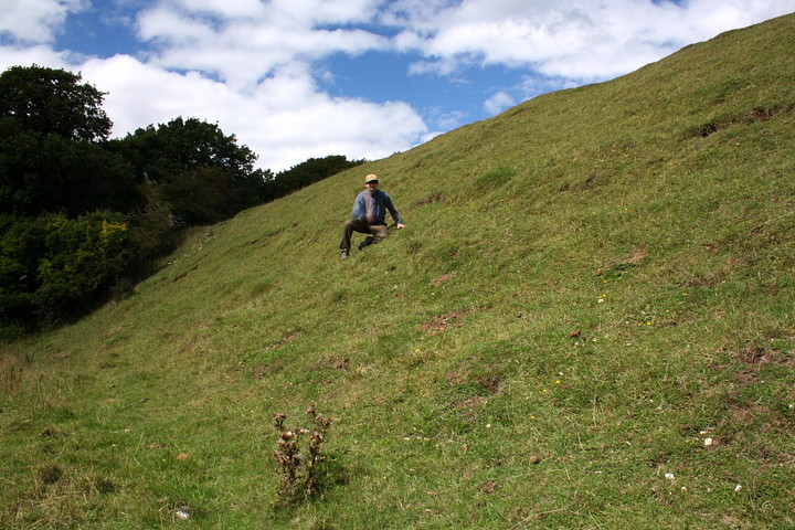
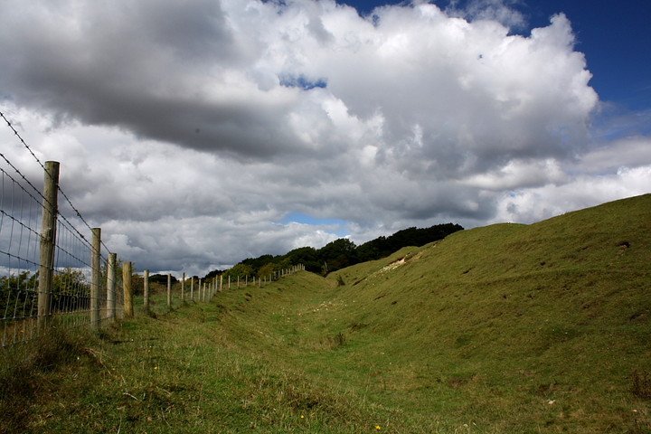
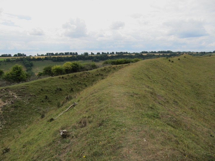
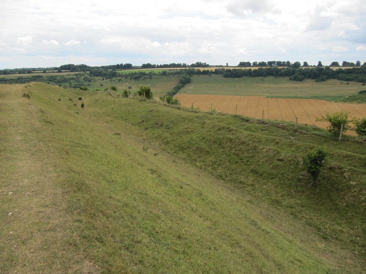
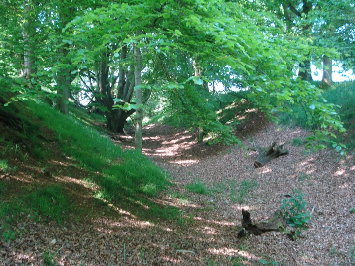
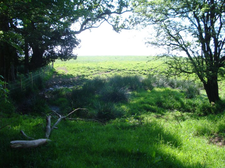
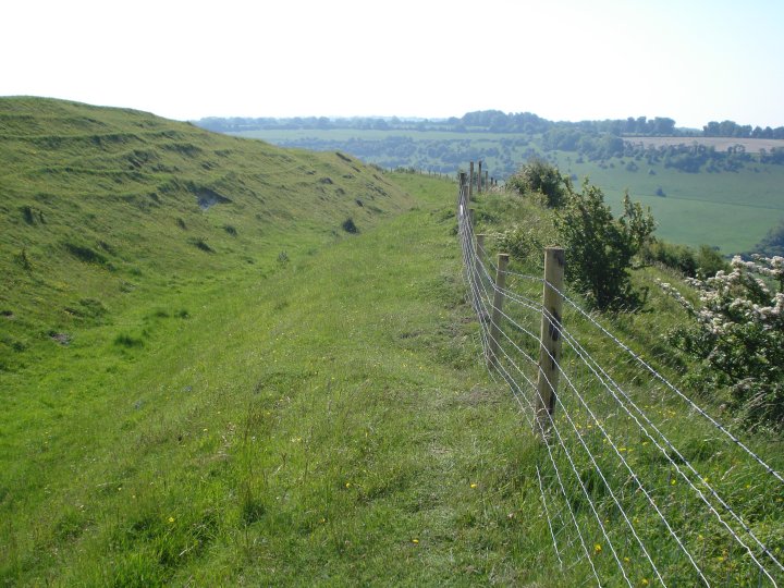
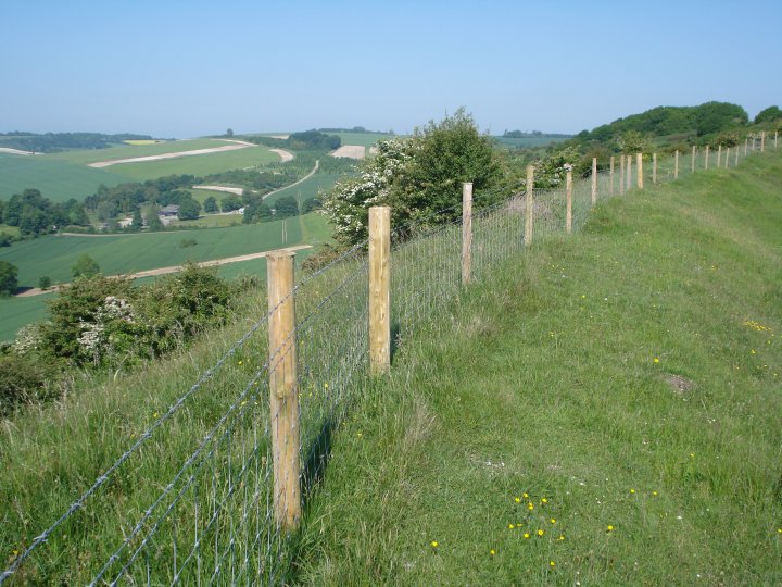
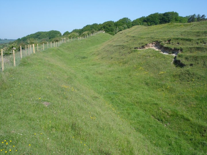
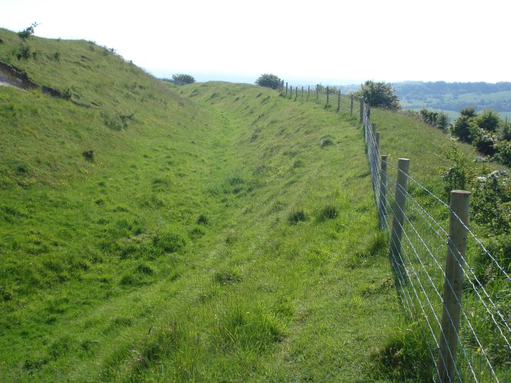
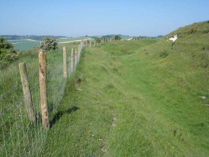
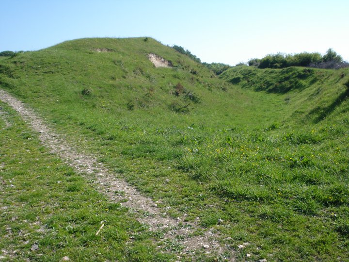
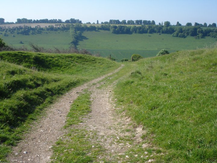
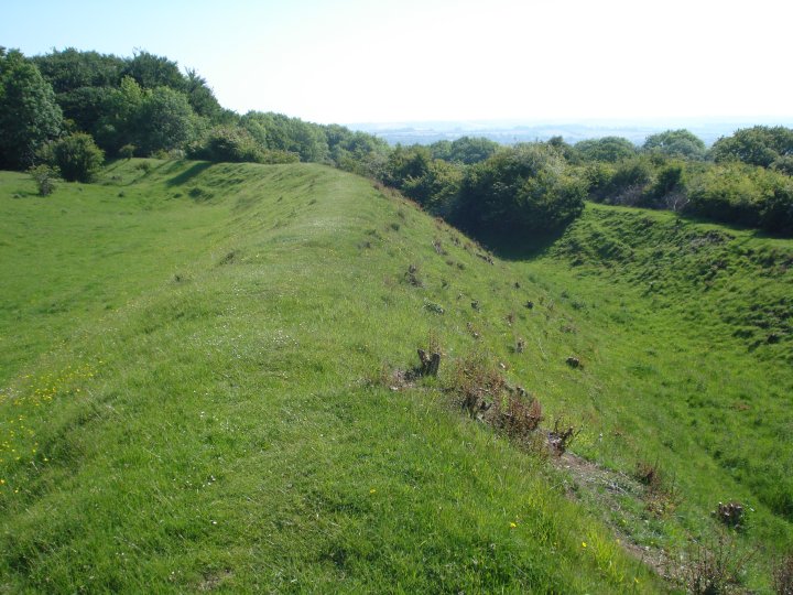
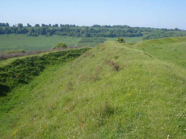
What a surprise this was... marvellous. Needing somewhere else to spend a few hours following a morning at Tow Barrow, Fosbury seemed to fit the bill nicely, judging by the 1:50K OS map. But reality often has a way of not living up to expectations, doesn't it? Not in this instance... Fosbury is very much a case of 'Ding dong!'... as the great Leslie Phillips might very well have said if he ever came here.... or even a 'Blimeus' uttered by a R*man legionnary tasked with storming the ramparts. After negotiating the maze of minor roads which criss-cross the area, I finally ascend from the east, near the Vernham Dean junction. To be honest I find it quite a slog in the heat of this sultry early afternoon, cloud beginning to roll in behind the morning's pristine blue skies. It is worth it since, upon arrival, the scale of the inner rampart is immediately apparent... much larger than I expected. The circumference is impressive in scope, too, the bivallate defences protecting what must clearly have been an extensive settlement in its day. Hell, yeah. According to the map the northern arc of the site is within foliage, investigation proving this to be correct. In fact the trees are some of the oldest, most handsome specimens I've seen in a long while, root systems encompassing the bank in a strangely beguiling manner. Then again I always did like woodland - feel at home in it .... perhaps the vestiges of some long held folk memory we all possess? Perhaps. Its then a little disappointing to find that appalling creation barbed wire in evidence in places. For me, the most impressive ramparts are upon the south western arc, these also boasting a superb view down into the valley of Hippenscombe. Nice. However the main entrance to the hillfort is, so it would seem, at the east, a typical affair of inturned parallel banks. I wouldn't be at all surprised if a nearby pond is an original feature specifically incorporated within the enclosure? Perhaps its just a reflection of my psyche today, but I reckon Fosbury has a 'special' aura about it, something that's heightened by the section of woodland. I glance at one of the massive trees and note a prominent piece of graffitti carved in the bark... 'Ha! Guy... unusual name for these parts. Then again it was the name of the leader of The Dambusters, so it was', I ponder. Suddenly - I kid you not - there is a low, deep roar as a World War 2 Avro Lancaster makes its way slowly up the valley.. the very type of aircraft the Dambusters flew, of course. I stand gobsmacked, for I am in the middle of reading the book. But then again, this IS Fosbury. |
 Posted by GLADMAN
4th September 2010ce Edited 4th September 2010ce |
|
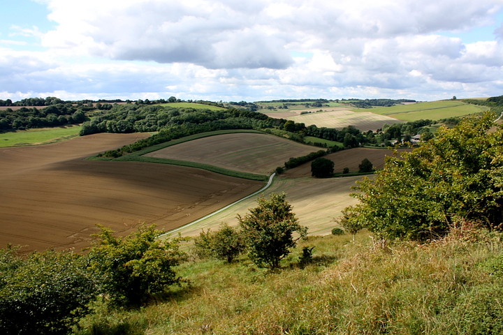
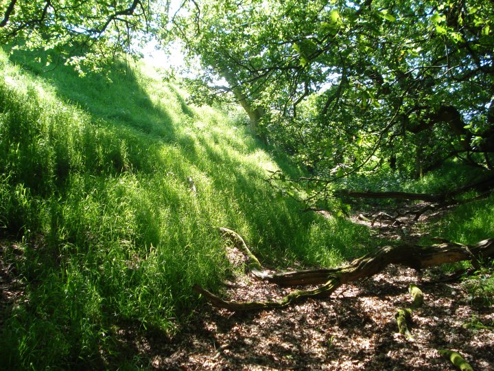
Today I decided to celebrate Lammas weekend by participating in a ten mile walk to Knolls Down, Tidcombe Down and Hippenscombe Bottom. Today's walking group were a lively mixture with a few of them in training for more strenuous hill walking at more exotic locations. Harvest time in Wiltshire and the crops are being gathered in; some of the fields already cut but most still golden with barley, wheat and oats. My favourite Wiltshire walks are the ones take in an Iron Age hill fort and this one took in one of the highest (at 950ft) and largest hill forts in the county. Fosbury overlooks Hippenscombe Valley on one side and the North Downs of Hampshire on the other. We stopped for lunch on the bank overlooking Hippenscombe before walking along to the wooded section with its massive much initialled beech tree and down into the valley |
 Posted by tjj
1st August 2010ce |
|
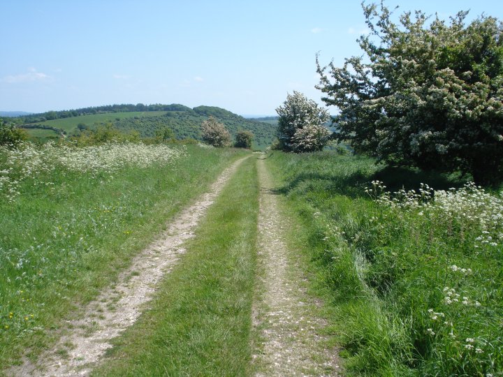
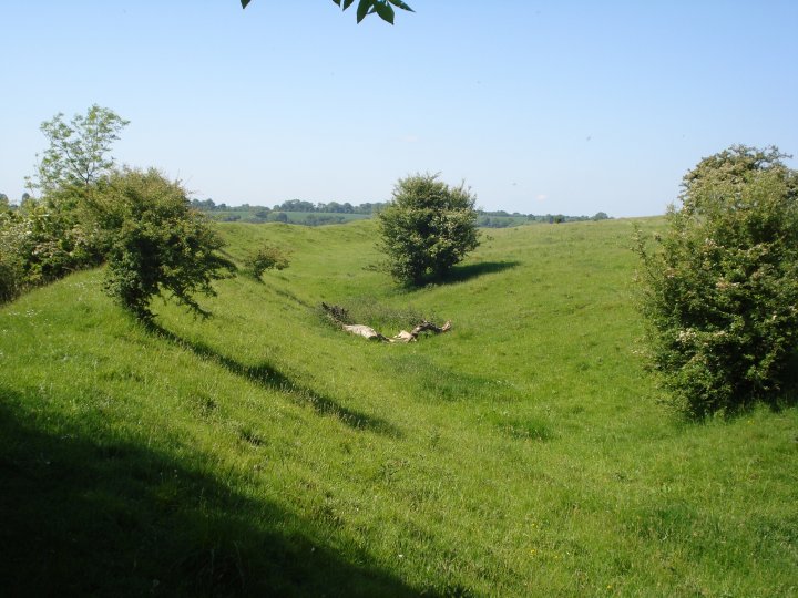
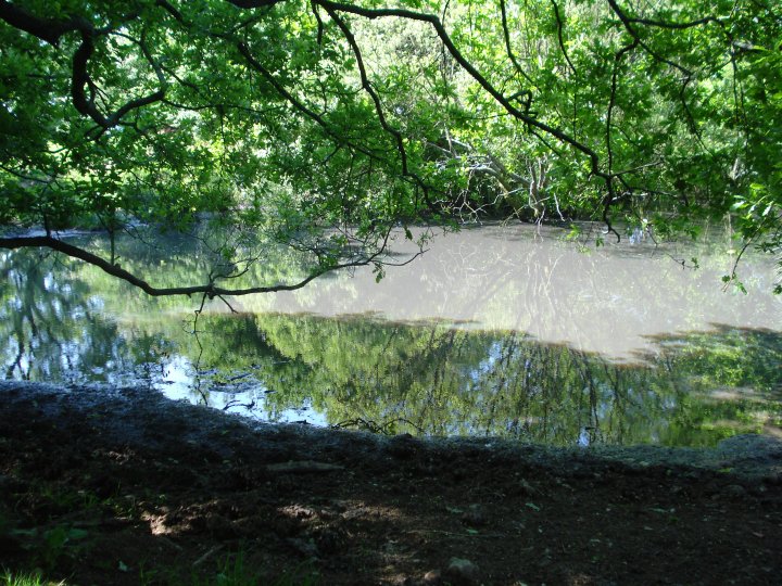
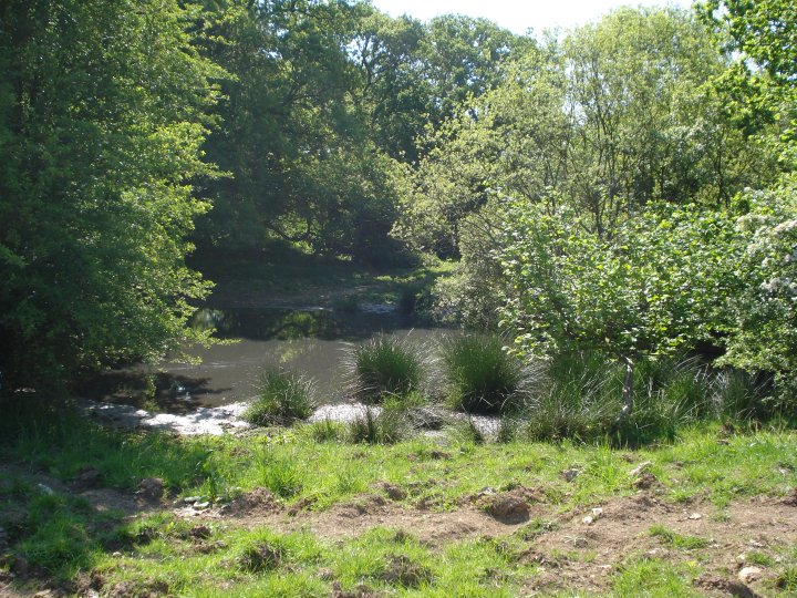
Site and Area Visit 30th to 31st May 2009 Although Fosbury is officially classified as an Iron Age bivallate hillfort, it's origins probably go back to the Neolithic, if not the Mesolithic. Haydon Hill, upon which Fosbury is constructed, is like a flattened volcano with natural deep ditches all the way around it. These would have formed ideal pens in which to trap wild animals when hunting and it is easy to imagine the hunter-gatherer culture being drawn to this site throughout the seasons. The hillfort encloses about 25 acres and has an in turned entrance on the eastern side. The Northern side is bordered by Oakhill wood and as the name suggests, contains the remains of some ancient sessile oaks. The area occupied by the hillfort itself is known as Knolls down and contains two natural ponds that were purposefully encompassed when the bivallate banks and ditches were created in the Iron age. When Colt Hoare writes about his visit to the hillfort in Ancient Wiltshire, he states that the ponds were reputed to "never run dry" and they certainly add to the general mood of the site. One could easily imagine offerings being made here in the distant past. The presence of so many Neolithic long barrows within the immediate vicinity would point to an advanced farming community using the natural landscape over many generations. The many pits would also point to a vast storage network of sustainable produce, be it grain, fruit or other food items. Fosbury would appear to have been occupied and possibly fought over, by many tribes and emigrational groups. The Belege would have been the major influence behind the creation of the nearby Grafton disc barrow group and for the Romans to have rebuilt and improved the causeway running around the fort, may also suggest it being a special site and worthy of the investment they made here. I travelled around the fort using the Roman road, the Chute causeway, from Scots poor. This was after field visits to the long barrows of Fairmile Down and Tow Barrow. You can clearly see the remains of storage pits, field systems and defences as you traverse the causeway with Fosbury on left. I made my journey by cycle and although tiring, it gave me the opportunity to use the ancient trackways which surround Fosbury. I know that the TMA eds have stopped adding facilities to the database but I'm going to mention The George Inn at Vernham Dean on the Wiltshire/Hampshire border, SP11 0JY (01264 737279). When visiting Fosbury, this is both the best and safest place to leave your car, even if it adds slightly to your walk. In my case, it was also the only place I could get any mains feed water. Walking from the pub back over the county line to Goudyses Gate, there is a footpath next to a cottage that leads up to Fosbury. Following this along the edge of the wood will bring you to the original eastern entrance of the hillfort. When I visited on Saturday night with my bike and wild camping provisions, I had no idea I was walking in the footsteps' of the ghostly rector (see the folklore post below). The bike had a puncture and with the light fading I decided to set up my hammock under one of the ancient beech trees and cook my evening meal. I didn't see any people till 11 am the next morning but the site was teeming with wildlife. First were a pair of owls, a young vixen, then a doe, and later 2 very playful young badgers. There might have been other visitors in the night but I fell into a sound sleep till 7 am and missed them. I had breakfast, walked around the site taking photos and notes until fixing the flat tyre and leaving along the Western track, past Fosbury farm and on to Tidcombe Long Barrow. My visit was on May 30-31 2009 and there had been considerable effort put into erecting a new stock proof fence along the ancient Iron Age defences. The ground did not have good pasture, so I assume the site would be home to "beef follow on" i.e. young bullocks who would be left to fatten up before slaughter. If this is the case, future access, although along a footpath, might be problematic. Never the less I would highly recommend visiting Fosbury, both for the views and history. Sleeping in a ditch with the wildlife and the ancient dead is another matter. Chance |
 Posted by Chance
24th April 2010ce |
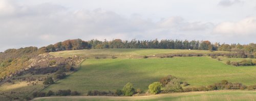
| Fosbury camp is the site of an Iron Age bivallate hill fort. It Would have commanded great views in all directions but is now heavily wooded on the northern side. It is still an impressive looking site and the picture does not do it justice. |
27th October 2009ce Edited 27th October 2009ce |
Folklore |
|
|
During one of the later outbreaks of plague in the 1660's, the Rector of nearby Vernham Dene, convinced all the villagers suffering from plague to leave and set up camp on this nearby hill. He convinced them he would bring supplies to them. However, once they had gone he 'forgot' about them, and their makeshift camp starved to death. His ghost is now said to walk towards the top of the hill, always fading from view just before he arrives at the former campsite. |
Posted by Chance 24th April 2010ce |
Links |
|
Digital Digging - Iron Age Hillforts, WiltshireAreal view of Fosbury and the Chute causeway from the air by Digital Digging. From the project - Iron Age Hillforts, Wiltshire |
Posted by Chance 24th April 2010ce |