The Modern Antiquarian
Log in
|
Register
Home
Latest Posts
Forums
Maps
Help
Browse Sites
News
Blog
Contributors
The Books
Select
-
Belgium
Denmark
Eire
France
Germany
Greece
Italy
The Netherlands
Norway
Portugal
Republic of Malta
Spain
Sweden
Switzerland
United Kingdom
England
Southern England
Hampshire
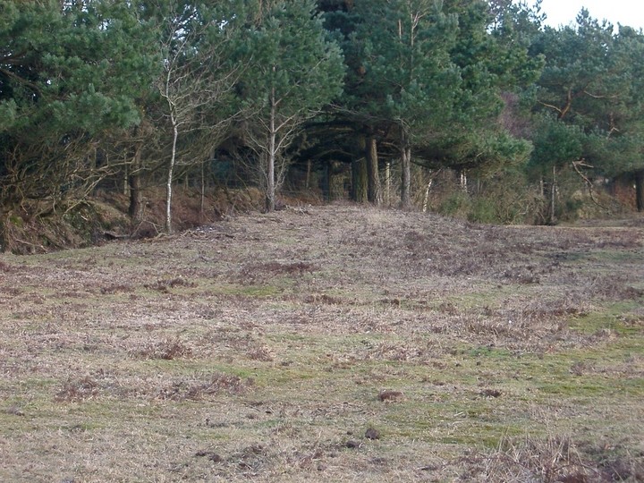
Jacob's Barrow
Round Barrow(s)
Jacob's Barrow (Golden Cross) (Round Barrow(s)) on The Modern Antiquarian, the UK & Ireland's most popular megalithic community website. 4 images, plus information on many more ancient sites nearby and across the UK & Ireland.
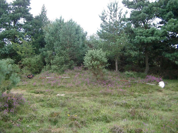
Image © MartinStraw
Also known as:
Golden Cross
Nearest Town:
Romsey (13km ENE)
OS Ref (GB):
SU213179 /
Sheet: 184
Latitude:
50° 57' 34.36" N
Longitude:
1° 41' 48.06" W
Added by
TMA Ed
Images (4)
0 discussions
Start a topic
Show |
Hide
Web searches for Jacob's Barrow
Flickr
Google
Google Images
MAGIC
The Megalithic Portal
Bing
Stone Pages
Streetmap.co.uk
Wikipedia
Show map
(inline Google Map)
- Sites within 20 km -
-
The Butts (New Forest) (2.3km SSE) (1 post)
Black Bush Plain (4.12km E) (1 post)
The Butt (Fritham) (5.13km ESE) (5 posts)
Frankenbury Camp (5.32km WSW) (2 posts)
The Giant's Chair (Downton) (6.92km WNW) (1 post)
Giant's Grave (Downton) (7.2km WNW) (2 posts)
Stagsbury Hill (7.42km E) (8 posts)
Breamore Down (7.54km W) (3 posts)
Giant's Grave (7.76km W) (6 posts)
Gorley Hill (8.19km SW) (1 post)
lbsley Common (8.35km SSW) (1 post)
Malwood Castle (8.62km ESE) (1 post)
Whitsbury Castle Ditches (8.64km W) (8 posts)
Clearbury Ring (8.82km WNW) (1 post)
Castle Piece (9.1km S) (2 posts)
Bratley Plain (9.3km SSE) (6 posts)
Money Hills (10.83km E) (2 posts)
Duck's Nest (11.13km W) (8 posts)
Whitsbury Down Long Barrow (11.15km W) (2 posts)
Dunwood Camp (11.19km ENE) (2 posts)
Knoll Camp (11.38km W) (2 posts)
Tenantry Farm (11.93km W) (2 posts)
Lockerley Camp (12.09km NE) (1 post)
Tatchbury Mount (12.17km E) (2 posts)
Grans Barrow (12.41km W) (7 posts)
Rowbarrow (Salisbury) (12.42km WNW) (1 post)
Knap Barrow (12.52km W) (7 posts)
Sarsen Stone (Martin) (12.63km W) (5 posts)
Collins Grave Bowl Barrow (13.29km SSE) (1 post)
Furze Down Barrow (14.01km W) (2 posts)
Castle Hill (Burley Street) (14.07km S) (8 posts)
Pheasant Hotel (14.3km N) (1 post)
Verwood Stone (14.33km WSW) (6 posts)
Vales Moor (14.39km S) (8 posts)
Grim's Ditch (Cranborne Chase) (14.55km W) (7 posts)
Fussell's Lodge (14.74km NNW) (6 posts)
Tidpit Common Down (14.85km W) (2 posts)
Testwood Lakes (15.02km E) (1 post)
Burnt Axon (15.16km S) (5 posts)
Long Barrow Lane (15.19km W) (7 posts)
Ashurst Lodge (15.3km ESE) (8 posts)
Creek Bottom Barrows (15.35km SSE) (1 post)
Cobhill Barrow (15.42km N) (2 posts)
Blagdon Hill (15.85km W) (6 posts)
Holman's Bottom Barrows (16km SSE) (1 post)
Slap Bottom (16.01km S) (2 posts)
Figsbury Ring (16.08km NNW) (45 posts)
Martin Down (16.38km W) (6 posts)
Wur Stone (16.54km SW) (1 post)
Old Sarum (16.62km NW) (46 posts)
The Turret (16.71km NNE) (2 posts)
Toothill Fort (16.76km ENE) (4 posts)
Whitefield Moor (16.86km SE) (2 posts)
Whiteshoot Hill (16.89km NNE) (2 posts)
Battery Hill (16.92km NNW) (1 post)
Bokerley Down (17.07km W) (17 posts)
Martin Down Camp (17.07km W) (1 post)
Pentridge 21 / IIa/b (17.18km W) (19 posts)
Dorset Cursus (North to Martins Down) (17.3km W) (12 posts)
Penbury Knoll (17.36km WSW) (6 posts)
Pentridge III (17.42km W) (3 posts)
Ashleys Copse (17.58km NNE) (2 posts)
Horse Barrow (17.62km NNW) (1 post)
Winterbourne Gunner Group (17.72km NNW) (2 posts)
Bokerley Dyke (17.86km W) (20 posts)
Vernditch Chase (17.92km W) (5 posts)
Easton Down (18km N) (2 posts)
Vernditch Chase North (18.12km W) (6 posts)
North Yew Tree Heath Barrows (18.18km E) (5 posts)
Wimborne St. Giles (18.25km WSW) (1 post)
Kitt's Grave (18.42km W) (1 post)
Knowle Hill (Broad Chalke) (18.5km W) (0 posts)
Gawen's Barrow (18.52km W) (1 post)
Yew Tree Heath (18.64km ESE) (1 post)
The Dorset Cursus (18.78km WSW) (8 posts)
Longsdale View Barrow (19.21km SE) (3 posts)
Bottlebush Down (19.44km WSW) (10 posts)
Oakley Down (19.44km WSW) (40 posts)
Marleycombe Hill (19.49km W) (3 posts)
Summerlug Hill (19.5km SW) (3 posts)
Dirty Mount (19.5km ENE) (4 posts)
Marleycombe Hill Earthwork (19.54km W) (1 post)
Marleycombe Hill Field System (19.55km W) (1 post)
Setley Plain (19.71km SE) (6 posts)
Elkham Grave Barrow (19.77km SSE) (1 post)
Berendes Beorh (19.9km WSW) (7 posts)
Chilworth Ring (19.95km E) (2 posts)
- Facilities within 20 km -
-
Salisbury and South Wi... (Museum: 13.6 km NW)
Salisbury (Youth Hostel: 13.6 km NW)
Wyndham Arms (Pub: 14.1 km NW)
The Camping and Carava... (Camping Site: 15.9 km NW)
- Add -
-
Add news
Add an image
Add fieldnotes
Add folklore
Add miscellaneous
Add a link
Add a nearby facility
Add an alternative name/spelling
Images
(click to view fullsize)
Add an image
Photographs:
Artistic / Interpretive:
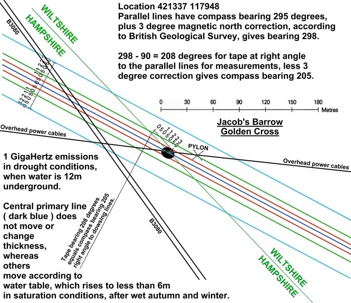
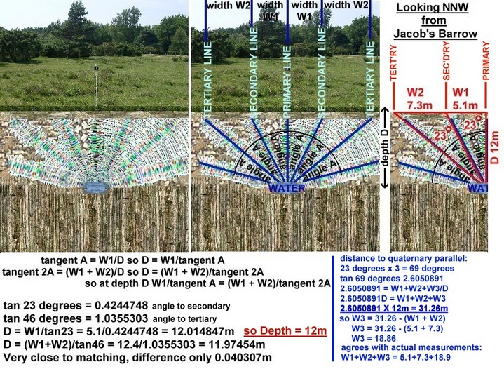
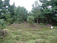 Image © MartinStraw

 Artistic / Interpretive: