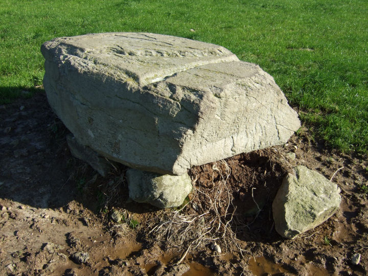
This carved and cup-marked boulder, classified by the Archaeological Inventory as a mass-rock, is raised on the north-eastern side of a shallow basin, with mid-range views to the south and west. Cup-marked rocks are not plentiful in this area but there is a light scattering along the south coast, between Clonakilty and Rosscarbery.
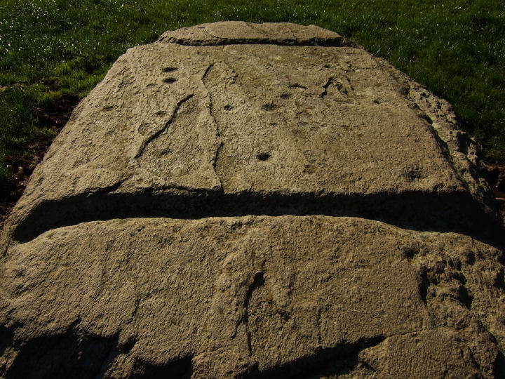
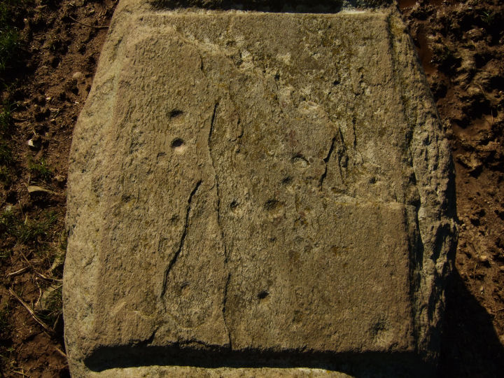
The boulder is imposing, coffin shaped; 2.08m long, 1.42m wide, 0.57m thick (measurements from Archaeological Inventory), shouldered by two blocks - each placed centrally under a flank - and what appears to be a mound of smaller stones under the north-eastern, quartz-tipped end. It is aligned, along its longer axis, NE-SW. While it looks like a possible (south-west opening) boulder-burial, its traditional reputation as a mass-rock could point to a more recent, early 18th Century origin.
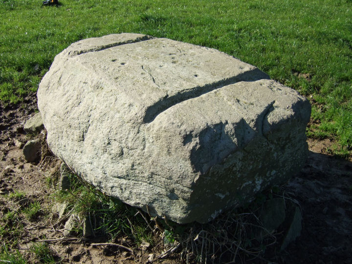
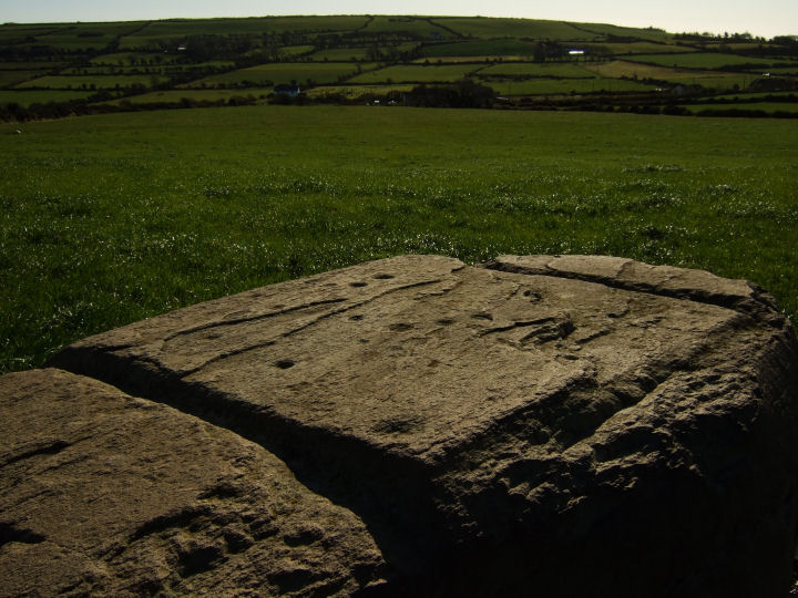
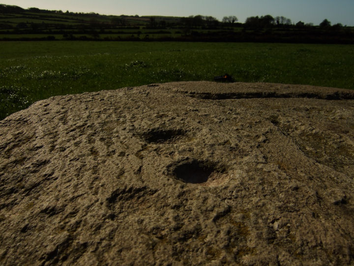
The top surface contains eleven cup marks, 3cm to 5cm in diameter and grouped on a raised shelf; part of a defined central rectangle. This shape is lightly marked on the longer sides, just inside the width of the stone, but deeply trenched where it separates from the main body; grooves 7cm wide and 3cm deep, 1.1m apart and parallel. The exterior of the rectangle is 1cm lower that the interior.
While tempting to imagine the entire assemblage as some prehistoric magnum opus, it seems more likely that the outline carving was done at a later date, possibly as an altar elaboration in penal times. The cup marks, gracefully curve-patterned, must be part of a much older - Bronze Age, at least - design on the same feature.
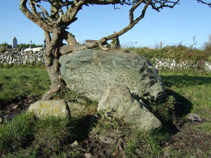
Just over 1km north-east, in the town-land of Gortnascarty and immediately to the rear of the ruins of Kilkerranmore church and graveyard, is another possible boulder-burial - classified in the Inventory as a "megalithic structure" (W36351 38865). No support stones are visible underneath. Two jagged upright slabs, perhaps the remnants of a NE-SW alignment or, less likely, part of a kerbing arrangement, lead from the south-eastern end of the monument. Given the proximity of the graveyard, these could be ancient grave-markers but, if so, they would have been placed unusually close to its side.
The boulder at Coorleigh South is not marked on the OS map so it may be best to just plot these GPS coordinates and look out for it on the south side of the road. The very obliging landowners live in the farm-buildings on the same side of the road, on the rise to the east.


 Posted by gjrk