The Modern Antiquarian. Stone Circles, Ancient Sites, Neolithic Monuments, Ancient Monuments, Prehistoric Sites, Megalithic MysteriesThe Modern Antiquarian


Carningli South

Ancient Village / Settlement / Misc. Earthwork

<b>Carningli South</b>Posted by mountainmanImage © mountainman
Nearest Town:Fishguard (10km WSW)
OS Ref (GB):   SN063370 / Sheet: 145
Latitude:51° 59' 49.62" N
Longitude:   4° 49' 18.85" W

Added by mountainman


Discussion Topics0 discussions
Start a topic


Show map   (inline Google Map)

Images (click to view fullsize)

Add an image Add an image
<b>Carningli South</b>Posted by mountainman

Fieldnotes

Add fieldnotes Add fieldnotes
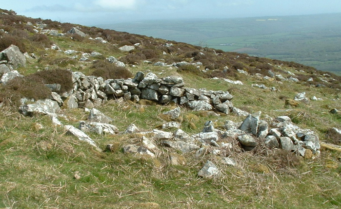
Shown on some versions of the OS maps, and clearly visible on the new Google satellite imagery, this little round house base is easily accessible and close to the footpath from Carningli Lodge up onto Carningli Common. It's almost certainly a farmstead -- it is associated with small storage structures, at least one larger rectangular hut, and a "lane" leading up to various enclosures / paddocks higher up the slope. It's very similar to the other Bronze Age huts and associated features on the N flank of the mountain. News report here:
http://www.brianjohn.f2s.com/carningli3.html
and some linked photos here:
http://www.brianjohn.f2s.com/carningli2.html
Posted by mountainman
30th May 2008ce
Edited 30th May 2008ce