The Modern Antiquarian
Log in
|
Register
Home
Latest Posts
Forums
Maps
Help
Browse Sites
News
Blog
Contributors
The Books
Select
-
Belgium
Denmark
Eire
France
Germany
Greece
Italy
The Netherlands
Norway
Portugal
Republic of Malta
Spain
Sweden
Switzerland
United Kingdom
County Laois
Clopook
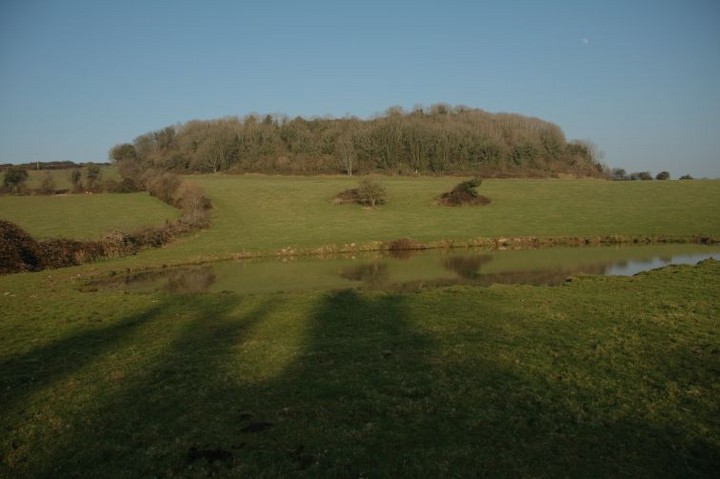
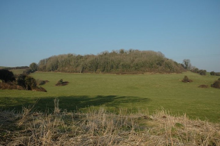
Hillfort
Clopook (Hillfort) on The Modern Antiquarian, the UK & Ireland's most popular megalithic community website. 2 images, plus information on many more ancient sites nearby and across the UK & Ireland.
Image © ryaner
Nearest Town:
Ballynan (6km E)
OS Ref (IE):
S584907 /
Sheet: 55
Latitude:
52° 57' 50.21" N
Longitude:
7° 7' 50.77" W
Added by
ryaner
Images (2)
0 discussions
Start a topic
Show |
Hide
Web searches for Clopook
Flickr
Google
Google Images
The Megalithic Portal
Bing
Stone Pages
Wikipedia
Show map
(inline Google Map)
- Sites within 20 km -
-
Clogh Leachdain (0.8km ENE) (0 posts)
Manger (3.76km SE) (5 posts)
Boley (5.37km ESE) (0 posts)
Kylenabehy (7.5km S) (0 posts)
Kylenabehy (7.68km S) (0 posts)
Stone 2 (7.75km SW) (0 posts)
Slatt Lower (8.01km S) (0 posts)
Knockbaun (8.41km SW) (0 posts)
Rock of Dunamaise (9.3km WNW) (5 posts)
Killone (11.59km NW) (3 posts)
Morett (13.26km NW) (3 posts)
Blackhill Wood (16.86km WSW) (1 post)
Mullamast Rath (19.34km ENE) (6 posts)
Mullamast Barrows (19.41km ENE) (2 posts)
Mullamast Long Stone (19.55km ENE) (5 posts)
Bolton Hill (19.55km E) (7 posts)
- Add -
-
Add news
Add an image
Add fieldnotes
Add folklore
Add miscellaneous
Add a link
-
Add a site
Add a nearby facility
Add an alternative name/spelling
Images
(click to view fullsize)
Add an image
 Image © ryaner