The Modern Antiquarian
Log in
|
Register
Home
Latest Posts
Forums
Maps
Help
Browse Sites
News
Blog
Contributors
The Books
Select
-
Belgium
Denmark
Eire
France
Germany
Greece
Italy
The Netherlands
Norway
Portugal
Republic of Malta
Spain
Sweden
Switzerland
United Kingdom
County Tipperary
Knockcurraghbola Crowlands
Knockcurraghbola Crowlands
Standing Stone / Menhir
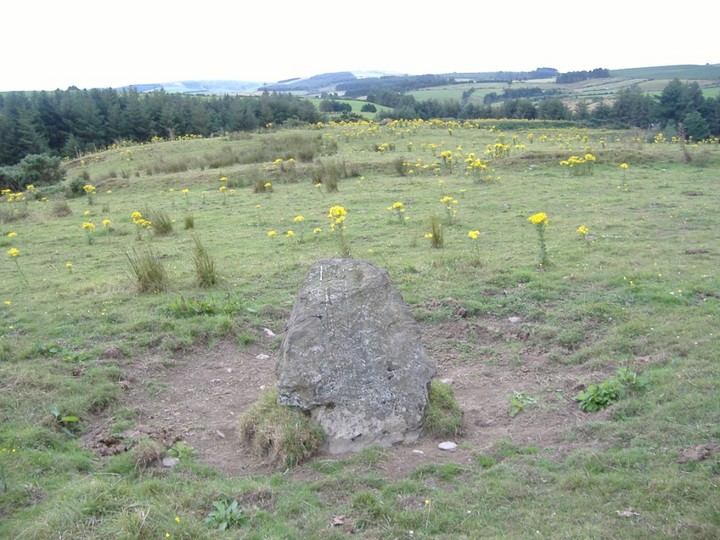
Knockcurraghbola Crowlands (Standing Stone / Menhir) on The Modern Antiquarian, the UK & Ireland's most popular megalithic community website. 1 image, plus information on many more ancient sites nearby and across the UK & Ireland.
Image © Bawn79
Nearest Town:
Borrisoleigh (11km NE)
OS Ref (IE):
R943594 /
Sheet: 66
Latitude:
52° 41' 8.91" N
Longitude:
8° 5' 3.47" W
Added by
FourWinds
Images (1)
0 discussions
Start a topic
Show |
Hide
Web searches for Knockcurraghbola Crowlands
Flickr
Google
Google Images
The Megalithic Portal
Bing
Stone Pages
Wikipedia
Show map
(inline Google Map)
- Sites within 20 km -
-
Knockcurraghbola Crowlands (east) (0.1km SSE) (2 posts)
Knockcurraghbola Crowlands (central) (0.22km W) (2 posts)
Knockcurraghbola Crowlands standing stone (0.22km ENE) (3 posts)
Knockcurraghbola Crowlands (west) (0.32km W) (8 posts)
Graniera (1.08km E) (3 posts)
Knockmaroe (1.74km W) (3 posts)
Knockcurraghbola Commons (1.83km NNE) (22 posts)
Shevry (2.5km ENE) (8 posts)
Shevry (2.51km ENE) (1 post)
Knocknabansha (3.13km W) (5 posts)
Reisk (3.17km W) (1 post)
Toorfiba (3.32km NNE) (3 posts)
Loughbrack (3.59km WSW) (11 posts)
Cooga (3.7km ENE) (4 posts)
Cooga (3.7km ENE) (2 posts)
Glastrigan (4.03km N) (13 posts)
Blackstairs (4.88km SSW) (4 posts)
Blackstairs (4.88km SSW) (3 posts)
Garracummer (5.79km SW) (8 posts)
Aughsullish NW (6.75km WSW) (1 post)
Knockshanbrittas (A) (6.75km WSW) (6 posts)
Aughsullish SW (6.87km WSW) (6 posts)
Glencarbry (6.89km SSE) (1 post)
Mauherslieve (7.31km W) (6 posts)
Mauherslieve (7.31km W) (1 post)
Goulmore (8.2km W) (4 posts)
Foilycleara (8.34km WSW) (3 posts)
Cureeny Commons (8.5km WNW) (17 posts)
Cooneen (8.58km NW) (3 posts)
Foilnamuck (8.91km NW) (5 posts)
Foilaclug (9.03km SSW) (3 posts)
Pallas Upper (9.2km ENE) (4 posts)
Baurnadomeeny (9.53km W) (4 posts)
Foilnamuck (9.57km NW) (10 posts)
Baurnadomeeny (9.58km W) (38 posts)
Baurnadomeeny (9.7km W) (6 posts)
Cooneen (9.74km NW) (8 posts)
Shanballyedmond (10.09km WSW) (17 posts)
Ballinacurra (10.54km NNW) (1 post)
Reardnogy More (10.59km W) (3 posts)
Gortnageragh (11.11km SW) (2 posts)
Lackanagoneeny (12.1km WSW) (4 posts)
Garrangrena Lower (12.32km NE) (2 posts)
Knockanora (13.54km NNE) (4 posts)
Bauraglanna (13.73km WNW) (9 posts)
Cahernahallia (13.99km SW) (1 post)
Cahernahallia (13.99km SW) (2 posts)
Kilmoylan Upper (14.41km SW) (3 posts)
Ballinlough (16.07km NNE) (1 post)
Ballinlough (16.07km NNE) (2 posts)
Ardmayle (17.42km ESE) (6 posts)
Donaskeagh (18.6km SSE) (2 posts)
Killawardy (18.84km NE) (3 posts)
Devilsbit Mountain (18.88km NE) (6 posts)
Garranbane (19.44km WSW) (5 posts)
Clonalough (19.48km W) (2 posts)
Scraggeen (19.53km WSW) (2 posts)
Knockalton Lower (19.76km NW) (1 post)
Ballinree (19.76km ESE) (2 posts)
Ballinree (19.76km ESE) (3 posts)
Ballinree (19.88km ESE) (1 post)
- Add -
-
Add news
Add an image
Add fieldnotes
Add folklore
Add miscellaneous
Add a link
-
Add a site
Add a nearby facility
Add an alternative name/spelling
Images
(click to view fullsize)
Add an image
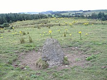 Image © Bawn79