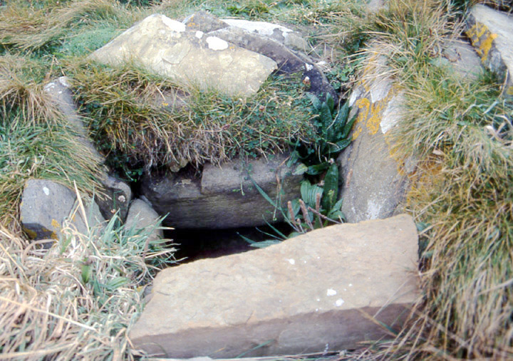
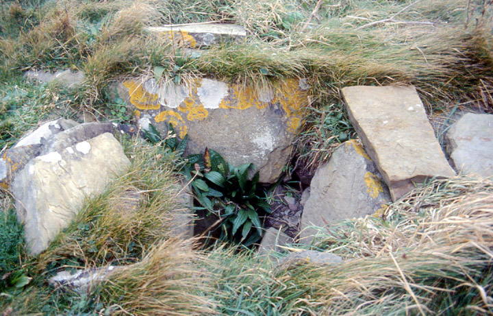
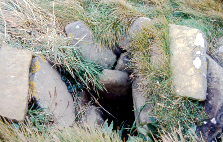
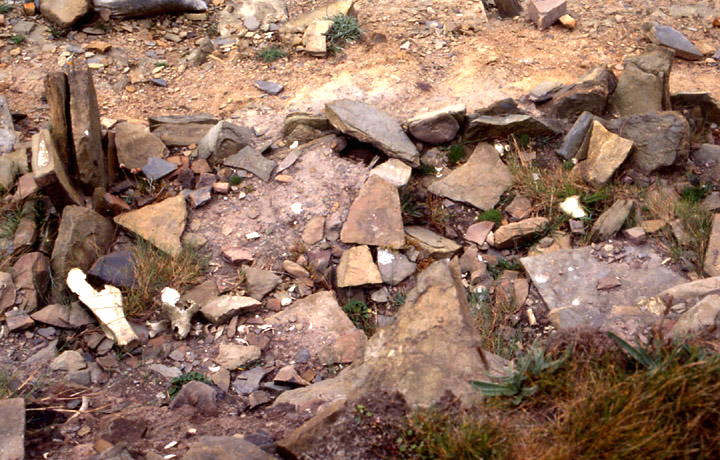
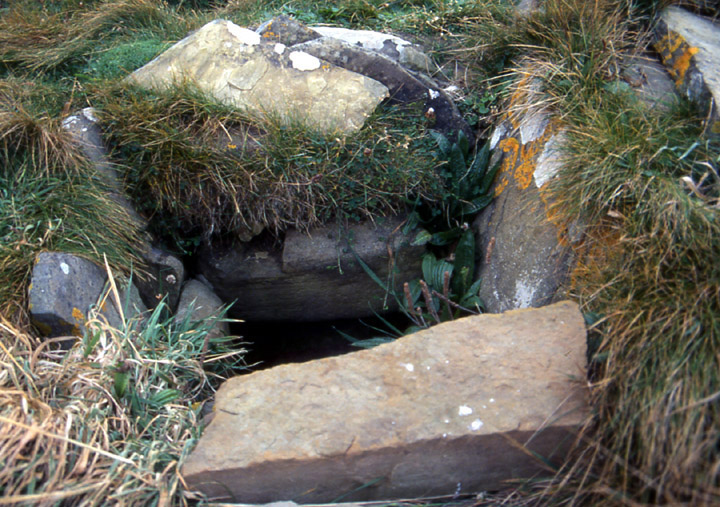
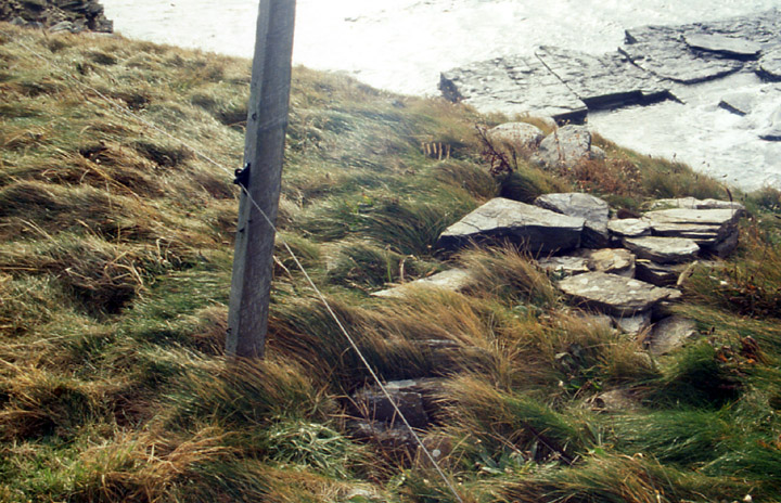
September 28th my objective was to measure and more fully photograph the pit I found before. Now I observed more closely the hole is most probably two spaces, one above the other (a twin 'cupboard' ??), and I'm not sure they are fullly box-like. But it is still a thing in itself rather than simply a result of collapsed medial walling (though there is possibly a collapse about one edge at least, where a slab appears to back onto earth). At right angles a jumbled line of stones head towards the excavated area of coastal erosion, specifically to one of the structures. Trying to make sense of my measurements of individual stones in terms of the whole before my film is done and back is not as easy as I thought ! Approximately 0.4-0.7m by 0.3m, the first space overlapping the second a little at the coastward end, and both seemingly 0.3m deep.
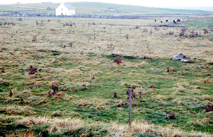
Coming down from the mound there are stones poking out of the ground about 15m away. On my last visit I'd seen them as exposed parts of a rocky outcrop but now it looked more like the remains of a (slightly curving ?) man-made line. From where I was it went in the direction of the RH end of the gateway behind which lay my putative stone arrangement one way and off to the coast the other. It stopped being intermittent 4.5m from the cliff edge, then after maybe half-a-metre became the remains of a fairly substantial wall that at the coast turned a right angle left and continued another 7.7m virtually straight. At 0.9m across this looked like the outer wall of some structure. Back home CANMAP showed a line near here that went from a field to the coast and then went on a zig-zag course. Did this show the modern fence line and an idealised boundary or was it this structure (so HY23081980 to 23061976 and ultimately to 23141973) and the intermittent boundary wall I saw further along ? It could be argued that it is simply the large foundation for a vanished drystane wall, but it had a depth to it and the other bits did not go straight, instead hugging the cliff edge sinuously (unlike my 'corner'). For what it's worth, a few days later I saw similar lines on CANMAP by the Grimsay Wheelhouse..
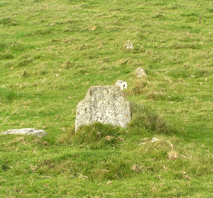
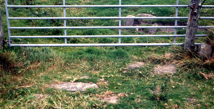
Going towards Skaill Church a tiny stretch of very minor road leaves the B9056 to continue following the coast before a track leads you into the fields to the Knowe of Verron. The track fades away soon but it's easy going. Don't mind the cows. I came across a tumbled line of stones going to the coast. A little too spread for a plain wall it seemed to me, and if it had been a curve (it could have been a very slight one I suppose) I would have taken it for part of the boundary of ? a ness-taking or a promontory fort.
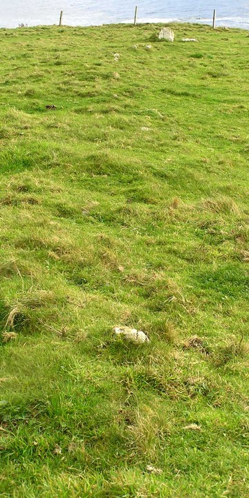
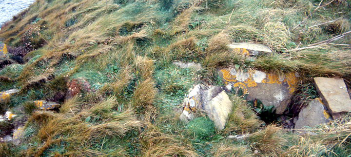
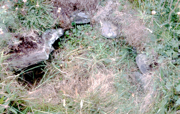
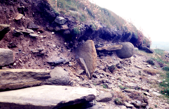
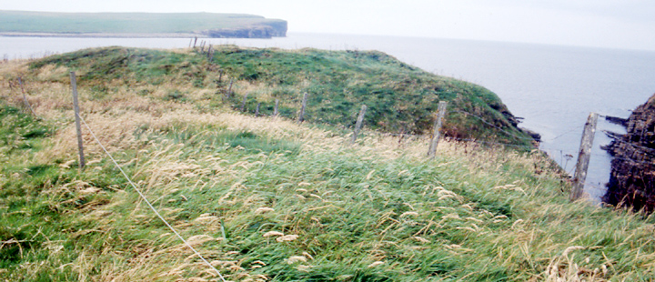
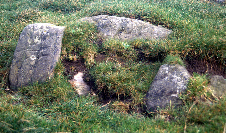
Of course the Knowe of Verron HY231198 is a broch, though I harboured slight doubts when I was there. It is in a similarly precarious position to the Broch of Borwick at Yesnaby but without the wall height to keep you out. As I came to the broch remains all I saw was a short grass mound, and in the modern-times excavated cliff edge I could see a gallery wall sticking out. The 'back' of the site is well protected by a sharp deep sea inlet to the cliffs, calling to mind the Brough of Bigging in Yesnaby. There are traces of early diggings when you are on the broch (even on the grassy top I was careful). This I found out about back home but this doesn't tell you about the square pit there, so could it have been revealed not long ago ? Smallish relatively deep slab-lined square pit and stones surrounding the top. Exquisite. [RCAHMS agree a cist is low down the list and suggest that it all could be collapsed medial walling]. Nearer the cliff edge there are other areas of stone I could make nothing of, could find not even the slightest viewpoint to make them worth a photo.
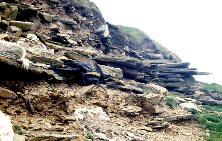
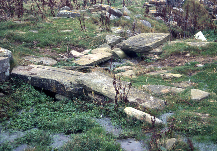
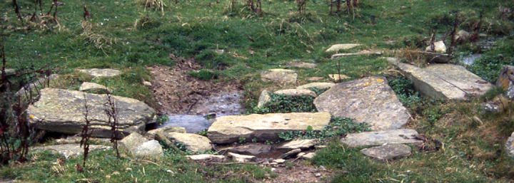
Looking over the cliff at the recorded excavation is a vicarious thrill. I could see the slabs of a rectangular structure and I thought there was something alongside. I could also see the edges of black material coming through the cut, placed there after the exploratory excavation of the eroding section. The weather still being fine and dry I gingerly crept down onto the cliff exposure using some of the bigger stones as lightly as possible in order to disturb nothing. I had hoped from down here that the nondescript stone scatters above might show something but still no. You can still see some of the midden material on the 'floor'. Looking from left to right there's the slab-sided structure, the seeming outline only of another structure, some of the gallery wall sticking out (as is often the case with these cliff-eroding sites) and then further up the cliff face a couple of spaced small protruding boulders (including a well-rounded ovoid) that gave the appearance of being the ends of a 'cupboard' or niche.
RCAHMS NMRS record no. HY21NW 22 is a probable broch 66' NS x75' EW x5'8"high, the top excavated early. Built over a midden containing broch-style pottery. Two structures were found in the coastal exposure, the later one poorly preserved. The earlier one was sub-rectangular or oval with a flagged floor, internal fittings and a large hearth. It was in the later one, with its paved floor and probable flue, that peat ash and metalworking remains were found - the vitrified base of a possible furnace was stolen before the limited 2001 dig.
Interesting to note that the present excavation of the Castle of Snusgar (HY236196) has uncovered a large area of Viking Age metalworking [http://www.conted.ox.ac.uk/research/projects/birsay-skaill/index.php].