|
|

|
|
Michael Moorey's HumpRound Barrow(s)
|
||||||||||||||||||||||||
|
|
|
Images (click to view fullsize) |
|
|
Fieldnotes |
|
|
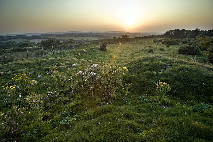
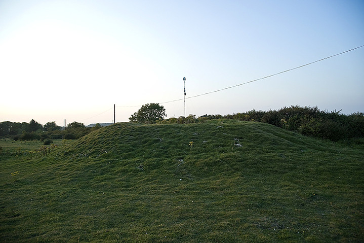
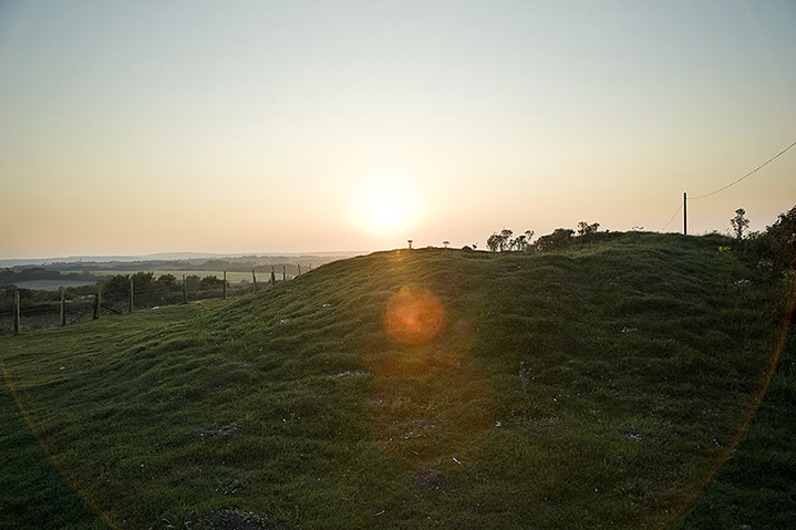
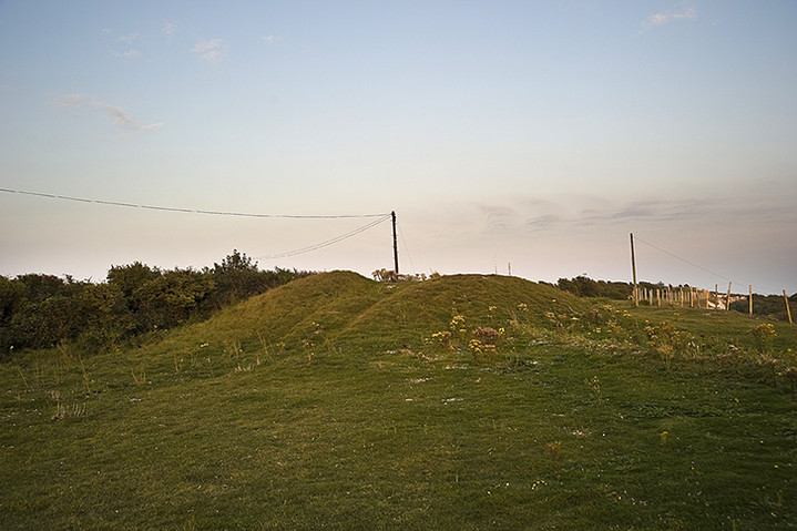
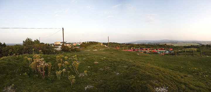
Micheal moreys hump is a bronze age barrow commanding stunning views of the east end of the island. It has contained bodies from the bronze age and also secondary burials of anglo-saxon origin. The mound was excavated in the early 19th century when the Turnpike Commision disturbed the mound whilst carrying out road improvements. A local antiquary recorded the excavation in which seven skeletons were unearthed along with an iron knife. These remains belong to both the bronze age and anglo-saxon period. The builders also removed the stone gibbet socket at this time. An adjacent but less obvious barrow was scientifically excavated in 1956, which revealed important early bronze age burials and wooden structures. |
Posted by bert 22nd September 2004ce |
Folklore |
|
|
Local folklore would have us believe that a local man murdered his grandson in a nearby cottage and then set fire to the building in order to hide the evidence. He was later captured in a nearby cave and hung on the downs above. The gibbet was constructed on top of the ancient burial mound where he was left to decompose then buried in the mound. Those amongst you brave enough should visit the mound at midnight, circling it twelve times before calling "Michael Morey" three times, after which his ghost should appear. The true story is far more gruesome as he lured the boy to a local wood where he cut off his head with a billhook, then hacked off his arms and legs before stuffing the remains jnto some old saddle bags and concealing them in the undergrowth.He was later captured and taken for trial in Winchester where he was found guilty and hung. His body was returned to the island to be hung in chains as a deterrent to others. The gibbet post which was erected on the burial mound can supposedly still be seen in the local pub (the 'Hare and Hounds' at Downend) along with a skull, which for many years was said to be Michael Moreys, recent evidence suggests that it is more likely to belong to one of the original prehistoric burials. Information was taken from"For Rooks and Ravens" by Kenneth S. Phillips |
Posted by bert 22nd September 2004ce Edited 13th February 2012ce |
Miscellaneous |
|
|
Details of Barrow on Pastscape A Bronze Age bowl barrow on Gallows Hill, Arreton Down. The barrow was originally part of a barrow group of three barrows, but is now the only one surviving as an earthwork (For details of the other two barrows see HOB UID 461309 - NMR SZ 58 NW 24 and HOB UID 1458695 NMR SZ 58 NW 105). It measures 24 metres east-west by 19 metres north-south and has a maximum high of 3 metres. Excavations in 1990 located the barrow ditch which was 0.5 metres deep. The mound is truncated on the northeast side by the road. A Highway Commission barrier was constructed in 1815 abutting the barrow. This served as a road block and is visible as a mound about 4 metres wide and 0.5 metres high, at the base of the barrow on the southwest side. The barrow was excavated in 1815 by Thomas Cooke and found to contain seven extended inhumation. All were orientated with the heads to the west. Grave goods associated with the inhumations included knives, buckles, a comb, and a spearhead were also found. The grave goods suggest an Early or Middle Saxon date for the burials. The stone socket of the gibbet, erected in 1730, for Michael Morey, who killed his grandson was found at the centre of the mound. The barrow was re-excavated in 1956 and human remains, probably of these excavated in 1815 were found. (This record was originally recorded as Barrow A in HOB UID 461309 NMR - SZ 58 NW 24) SZ 53568744 - Tumuli (O.E.) (1) A barrow surviving as an earthwork 20 paces in diameter and 6.5 feet high. (2) The barrow was excavated in 1815 by Thomas Cooke. In the barrow seven extended skeletons were found including those of a child of about 9 years old and another of about 2 years old. All were orientated with the heads roughly to the west. Near each skeleton, generally under the back, was an iron knife blade. Two circular brass buckles, a bone comb, and a spearhead were also found. The human remains were reburied near the centre. The stone socket of the gibbett, erected 1730, for Michael Morey, who killed his grandson was found at the centre. (3) The 1815 excavations are the earliest known discovery of Anglo-Saxon or Jutish antiquities in the Isle of Wight. (4) Full excavation report. (5) A bowl barrow, 22 metres in diameter by 2 metres in height, mutilated on the north by a road. Published 1/2500 revised. (6) History of excavations. Description of Cemetery. Catalogue of graves and grave-goods. (7) The barrow survives as an earthwork measuring 24 metres east-west by 19 metres north-south and has a maximum high of 3 metres. Excavations in 1990 located the barrow ditch which was 0.5 metres deep. The mound is truncated on the northeast side by the road. A Highway Commission barrier was constructed in 1815 abutting the barrow. This served as a road block and is visible as a mound about 4 metres wide and 0.5 metres high, at the base of the barrow on the southwest side. (8) The grave goods suggest an Early or Middle Saxon date for the burials. The barrow was re-excavated in 1956 and human remains, probably of these excavated in 1815 were found. (9) -------------------------------------------------------------------------------- SOURCE TEXT -------------------------------------------------------------------------------- ( 1) Ordnance Survey Map (Scale / Date) OS 6" 1908 ( 2) Proceedings of the Isle of Wight Natural History and Archaeological Society 3 (3) 1940 Page(s)188, 207 ( 3) Journal of the British Archaeological Association 5, 1850 Page(s)365-7 ( 4) edited by H. Arthur Doubleday, F.R.G.S. 1900 A history of Hampshire and the Isle of Wight, volume one The Victoria history of the counties of England Page(s)387 ( 5) Proceedings of the Isle of Wight Natural History and Archaeological Society 5, 1957 Page(s)188, 189, 251 ( 6) Field Investigators Comments F1 FGA 19-SEP-1967 ( 7) by C J Arnold 1982 The Anglo-Saxon cemeteries of the Isle of Wight Page(s)75-77 ( 8) Scheduled Monument Notification 28-FEB-1995 ( 9) Gazetteer of Early Medieval Sites (unpublished thesis, 2006 by Dr A.K Cherryson)) Page(s)92 |
 Posted by Chance
10th July 2012ce |