|
|

|
|
Gorsey BigburyHenge
|
||||||||||||||||||||||||
|
|
|
Images (click to view fullsize) |
|
|
Fieldnotes |
|
|
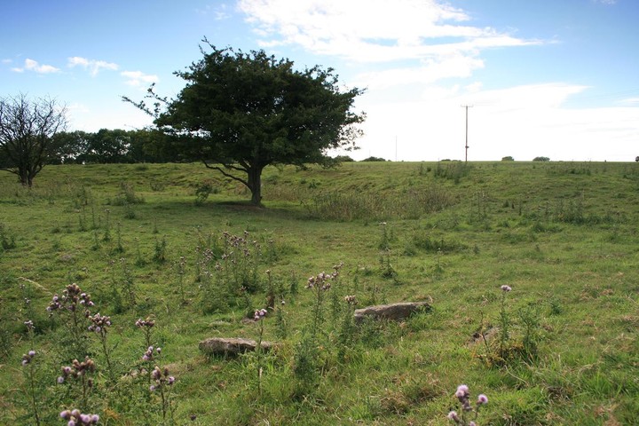
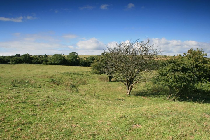
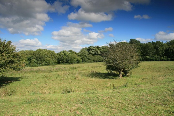
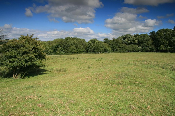
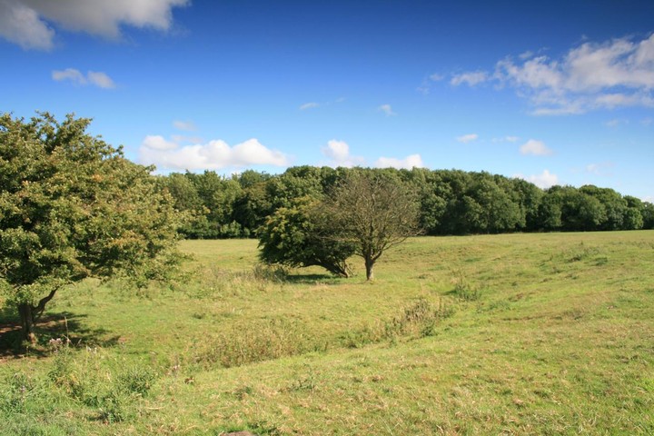
Why has a Henge gone unvisited for seven years? Jimits almost fieldnotes then nothing, It was time to set things right. Situated on the northern slopes of the Mendips near the intriguingly named velvet bottom, Gorsey bigbury henge lies beween two farms by what looks like a very minor road on the map, its very overgrown, no car has passed this way for years but it is now a very pleasureable walk. We appraoched first from the east and attempted a parking at Lower farm, strictly private no parking sent us scurrying back to the road, we then tried the western farm, the way was clear so I knocked at the door and took a half hearted look around the farm but couldnt find anyone, I turned back but then spotted a women changing out of her caving gear, I asked her if the owners were around she said they were in the house so I knocked again but still no answer, hmmmm what to do? I ethically parked the car next to the cavers van hoping permission would rub off and onto me, issued instructions to wife and daughter on what to do if confronted by farmer whilst me and Eric were off hengeing. The overgrown old farm track leads almost directly to the henge, cows watched us pass them by, unconcerned by us they continued chewing the cud, despite some slight nettleing we made it down the fenced off nature trail to the point where we had to jump the fence to gain acess to the henge field, Eric shimmied under the barbed wire, and I expertly vaulted over it. We could see the earthwork from a distance allaying my fears that the place was too flattened out to be able to appreciate it properly, the Hawthorn trees (one now dead) also marked its position. Some small stones are visible on its northern side I dont think they're part of anything original probably dumped there by farmers past, the place seemed lost and unknown, a few standing stones and thered be a visitor centre over the road or a regular ferry service, as it is I couldnt think of a more pleasant place, the sunshine was only interupted by fluffy white clouds, the cows left us in peace, complete lack of other people, no all obscuring vegatation and Eric had much to say as usuall and not all about the henge either. The walk back to the car was once again nettleing but otherwise uneventful, I'm off to Stanton Drew now and there is nothing and I mean nothing that I would rather do. |
 Posted by postman
1st August 2010ce |
|
Class 1 henge monument of single causeway type consisting of a circular rock-cut ditch with an external rampart of earth and stones, enclosing a flat central area without any form of upright. The causeway is to the N. The ditch varied in width from 12ft to 21ft and 4-9ft deep. The NE and SW segments yielded evidence of Beaker occupation. This was separated from the ditch bottom by a barren yellow clay silt layer. In two places a platform of closely packed stones was interposed between the clay and beaker deposit, which consisted of dirty rubble, charcoal, hearths etc. Finds from this deposit included 4,000 flint flakes and implements, pottery of A-C beaker type (including rusticated ware) representing at least 100+ beakers, a few sherds of Neolithic "B" ware and large quantities of animal bones, mainly domestic. No evidence was found of stone or post holes, walling or any other structural remains. Two hypotheses can be suggested - the monument may be attributed to the grooved ware or "B" beaker group, or the A.C. beaker folk for whom the ditch held no significance. {1} The beaker burial and occupation deposits had radio-carbon date centring on 1900-1700bc. {6} The henge is set on a gentle E-facing slope to the W of Long Wood, in improved pasture. Condition is generally good except for three hawthorn trees growing in the ditch. {7} The majority of the archives and finds were destroyed in the Second World War. {8} The monument is in a generally satisfactory condition with no evidence of damage by grazing cattle. {9} References: 1 Excavation report - PUBSS Jones, S.J 1935 "...Excavations at Gorsey Bigbury..." vol. 4(3), 174-8 2 Excavation report - PUBSS Jones, S.J et al 1938 "The Excavation of Gorsey Bigbury" vol. 5(1), 3-56 3 Excavation report - PUBSS ApSimon A.M 1951 "Gorsey Bigbury: The Second Report" vol. 6(2), 186-200 4 Detailed records - Ordnance Survey Archaeology Division 1966 ST45NE15 SCPD 5 Excavation report - PUBSS Tratman, E.K 1966 "Gorsey Bigbury...Third Report" vol. 11, 25-30 6 Description - PUBSS ApSimon A.M 1976 "Gorsey Bigbury...dating..." vol. 14(2), 155-183 7 Personal communication - Burrow, I SCPD (13.09.82) 8 Archive - UBSSM 9 Detailed records - Field Monument Warden's report (22.4.1998) in HER files Record created by: Ian Burrow in September 1982 © Copyright Somerset County Council 2003 (Edited) With thanks to the Somerset Museums Service for their help. |
 Posted by jimit
29th November 2003ce |
Miscellaneous |
|
|
Details of henge on Pastscape A Neolithic henge surviving as earthworks and located on a limestone spur of the Mendips. The site has seen excavation on three occasions - trial trenching in 1928 was followed by 5 seasons of excavation between 1931 and 1935. The entrance area was re-examined in 1965. The site is defined by an irregular sub-circular ditch cut into the limestone and surrounded by an earth and rubble bank. Overall diameter of the enclosure is circa 46 metres. A single entrance causewayed entrance is located on the northern side. Excavation showed the presence of two post holes on either side of the entrance, just outside the ditch but between the terminals of the bank. The interior seems to have been devoid of features. The ditch contained the bulk of the finds, including a disturbed cist burial in the northwest sector, close to the causeway, and containing the disturbed remains of at least two individuals. Further human remains were found nearby, and two skull fragments were found on the other, eastern side of the causeway. Substantial deposits of charcoal, flints, pottery and animal bones were recovered from the ditch. At least 4000 flints were recovered, and the potsherds - almost all Beaker, have been estimated to represent 100 to 120 vessels. Some later material (bucket urn sherds, probably Early Bronze Age) was also present. Other periods represented by odd finds include Mesolithic microliths and a Roman glass bead. In the 1970s, 6 radiocarbon dates were obtained on material recovered from earlier excavations. All are concentrated in the early 2nd millennium bc (uncalibrated). |
 Posted by Chance
28th May 2014ce |