|
|

|
|
Pen-y-WyrlodLong Cairn
|
|
|
|
Images (click to view fullsize) |
|

|
Fieldnotes |
|
|
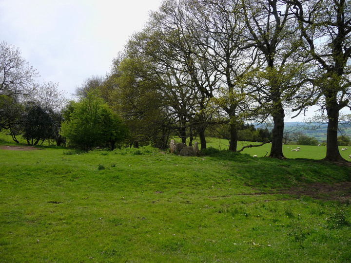
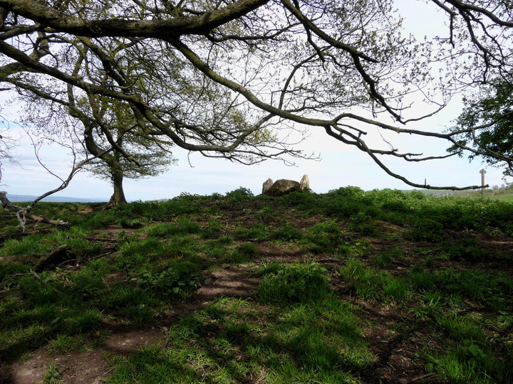
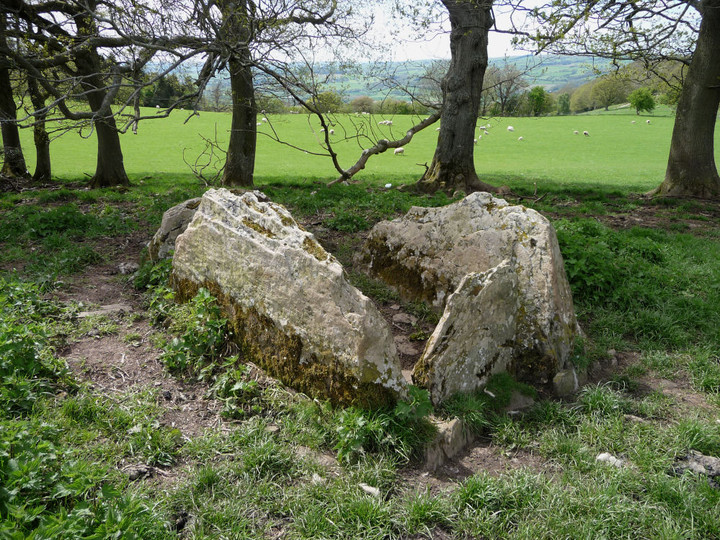
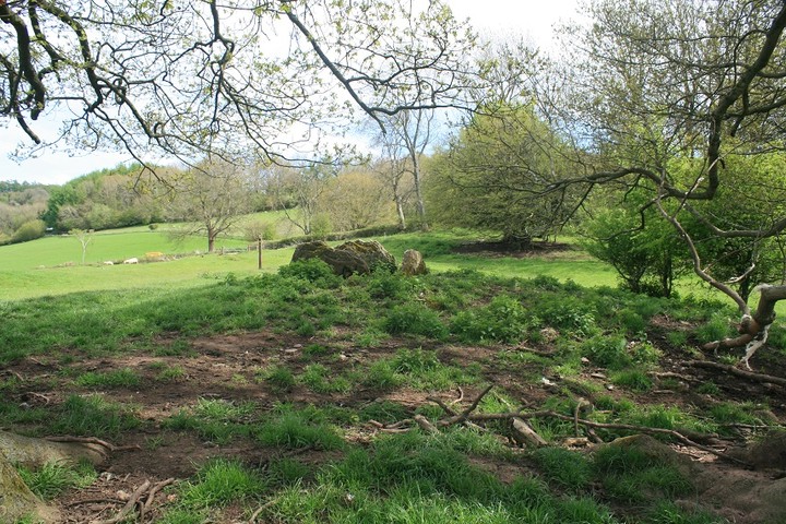
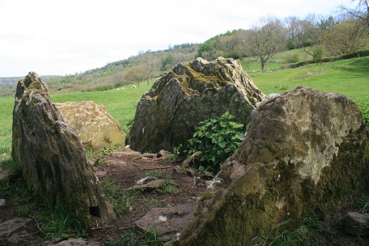
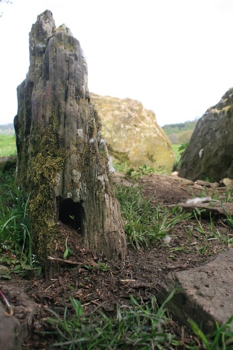
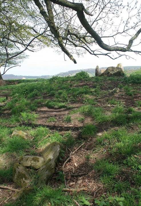
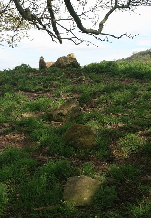
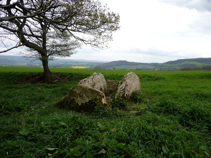
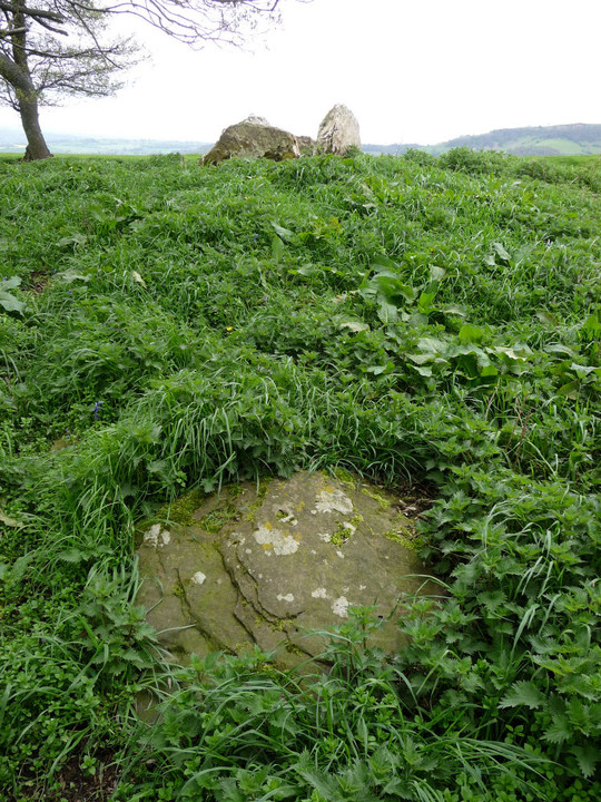
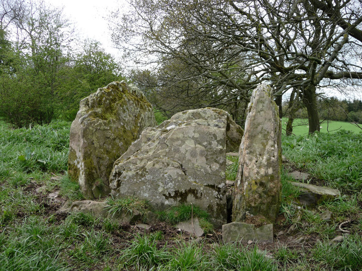
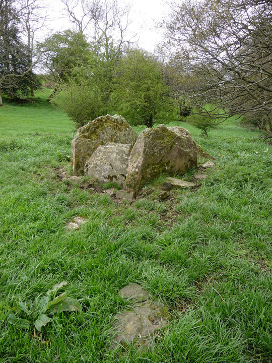
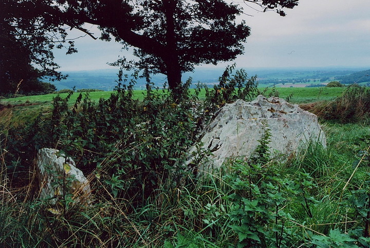
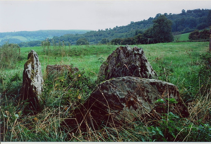
This was perhaps the last of today's long cairns, barring Arthur's stone, and it may just perhaps have been the least as well. But it is still well worth the minimal effort involved in getting here. Getting here involves a few minor roads, but having a sweetcheat to do the navigating helps a lot. Dubious parking for one by the gate/stile and its just a few yards to the long cairn. Simples. The cairn itself is fairly ruinous but the chamber is a good one and pays for itself. Other stones protrude from the ruined cairn, one in particular looks to have been part of a cist or small chamber. One of the longer side stones in the chamber has a squarish hole at the bottom which I feel could have served some function. A very nice place to sit and ponder and while away some loose time. |
 Posted by postman
24th May 2013ce |
|
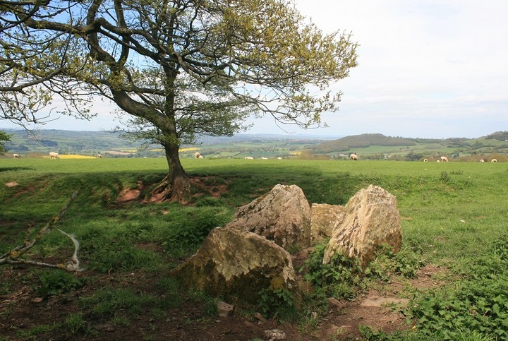
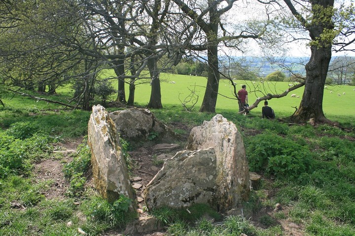
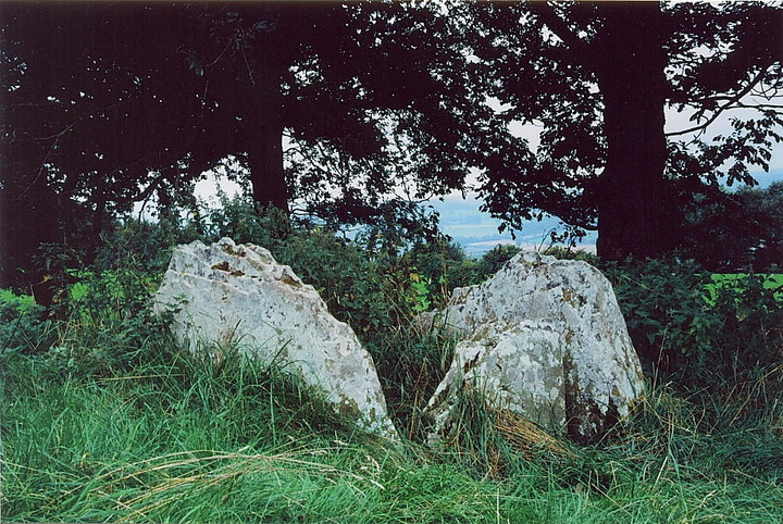
Visited 1.4.12 It had been quite a frustrating day with me unable to find a couple of stones I was looking for. However, it was certainly a case of keeping the best till last. I had previously looked for this site but been given wrong directions by a farmer. This time I came armed with an O/S map so there would be no such mistake! For directions follow the advice given by Elderford but please note you need to take a right TURN not a fork in the road to the right. Also, ignore the first footpath sign you will see on the right – you need to stop at the next public footpath a bit further along the lane which is not signposted but it is easy to spot as there is a place to pull in at the field gate. The Long Barrow is visible from the gate near some trees. Sophie was asleep so Karen stayed in the car whilst myself and Dafydd did some exploring. Having practiced his stile climbing skills earlier in the day Dafydd was keen to go solo. Despite some early nerves he managed to get over safely. I also showed Dafydd the correct way to climb over a gate if needed (hinges end of course!) We strolled over to the Long Barrow (marked long cairn on the O/S map) It was a beautiful day, the sun was shining, not a cloud in the sky, with only bird song and the bleating of nearby lambs to break the silence. I sat on one of the four remaining stones and looked down the valley. Simply wonderful. I felt at peace with the world. I looked up into the blue sky and pointed out the moon and the white trails from aeroplanes criss-crossing like a giant version of noughts and crosses. I pondered on who may have been buried here and what a shame it was that they hadn’t been left in peace. They deserved better. I could have stayed for hours. Peace shattered :– ‘Daaaaaaaaaaaaaaaad!! – the stingies have got me!’ I looked up to see Dafydd hopping on one leg whilst frantically rubbing the ankle of his other leg! I told him he should have been more careful near the nettles when wearing shorts and that his mother had some cream in the car. He put his new stile climbing skills into action for the first time as he quickly headed back to the car and the comfort of his mother. I ambled behind, reluctant to leave such a peaceful place. Needless to say this site is well worth a visit when in the area although it can be a bit tricky to find. |
Posted by CARL 3rd April 2012ce |
|
Easy to get to - NOT! - but Elderford's directions will do the trick for the determined/obsessed. The site is just off a public footpath, although it seemed the gate had not been opened for ages. Due to the 'out of the way' nature of the site I guess this wasn't entirely unexpected, but nevertheless welcome all the same for the Mam Cymru and I. Four rather handsome slabs, running with those peculiar long-legged arachnids and overgrown with nettles, lie unobtrusively beneath trees overlooking Hay-on-Wye, together with the remnants of a long cairn. Not a bad location, one might say. I gave the nettles a bit of a seeing too, but rest assured they'll be back. And then some....... And that, my friends, is about that. Save the wonderful ambience and sense of place which money simply cannot buy. A simple site which punches far above its weight..... |
 Posted by GLADMAN
23rd September 2009ce |
|
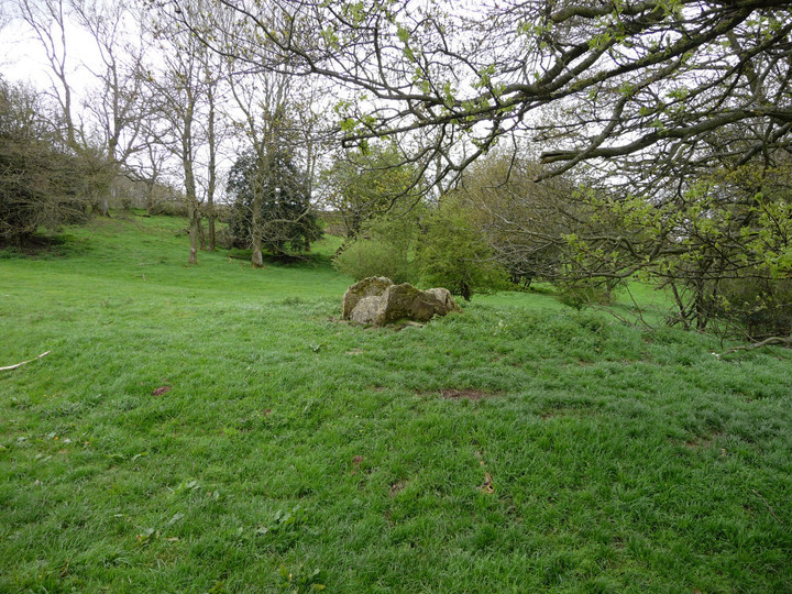
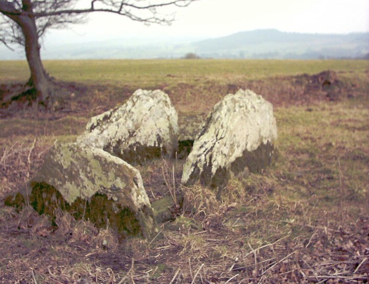
Chamber Long Cairn Part of the Black Mountains Group of Tombs OS map required In Hay on Wye head west on the B4350, look out for a turning on the left signposted: Capel y Ffin. Take this turning. Shortly afterwards when the road forks: take the right fork. Proceed for about 3km until a footpath sign is visible on the righthand side of the road. (After this the road goes sharply to the left and up hill to the nearby Penyrhenallt farm. If you reach the farm you have gone too far). Cross over the stile, keep to edge of field and monument is ahead 100m, visible from road. Almost, if not on, a public right of way. At first all that seems to remain is the long box like chambered created by the four upright stones, but if you do visit in the summer when the nettles are high, it is worth having a look around the mound as there are other stones still in situ. Excavated in 1920-21. Main Chamber of four uprights, is about 2m long by 1m across. All four stones are a little less than 1m in height. There is no capstone. Packing stones visible. Mound: described as pear shaped of approximately 18.5m in length. When visiting it, the monument is now closely bounded in by field boundaries and nettles abound so it was difficult to pace it out as the mound is also now low in height. Orientated southeast-northwest. There is the remains of a small chamber towrds the north-eastern end of the mound. Three low stones (less than 0.3m) arranged in right angles to form the plan of three sides of a rectangle. Many smaller stones lay jumbled around them. |
Posted by elderford 14th August 2003ce |