|
|

|
|
Old RayneStone Circle
|
||||||||||||||||||||||||
|
|
|
Images (click to view fullsize) |
|


|
Fieldnotes |
|
|
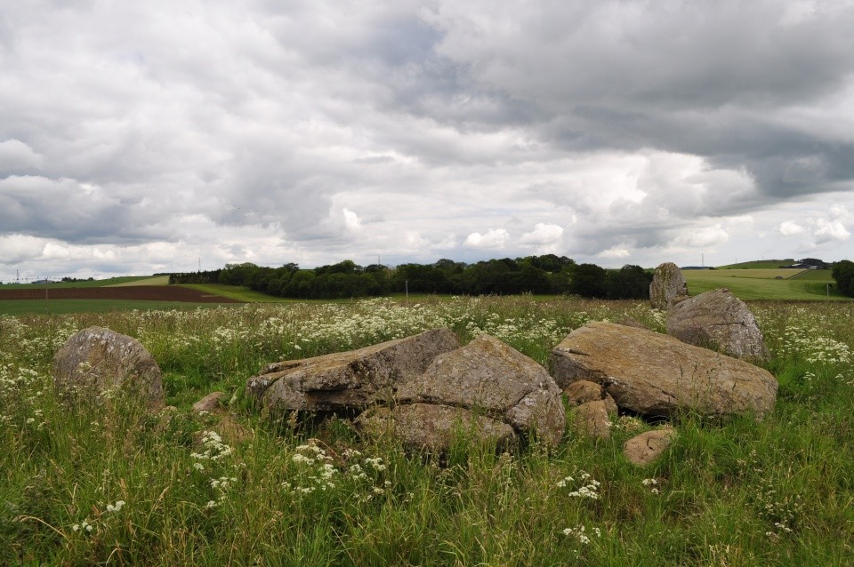
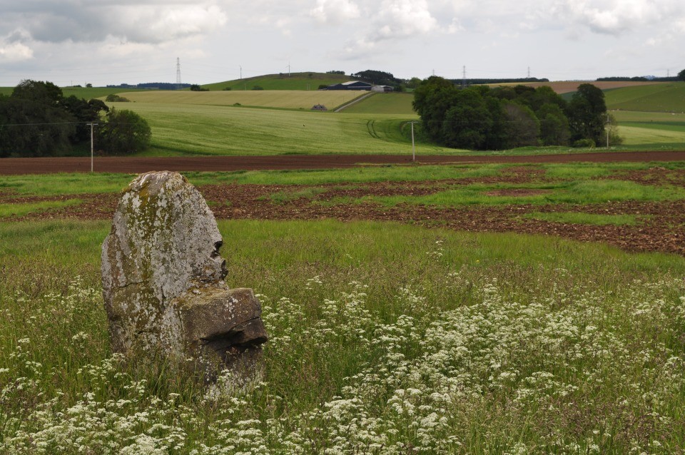
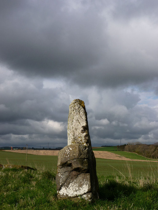
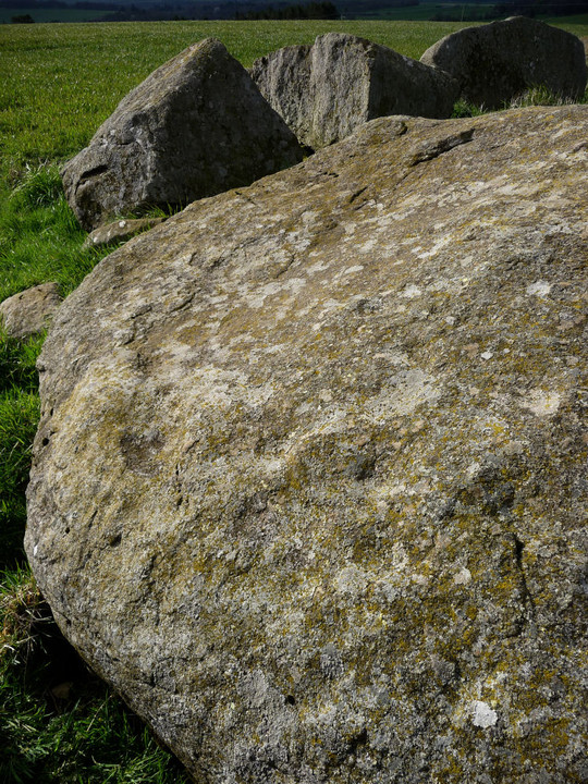
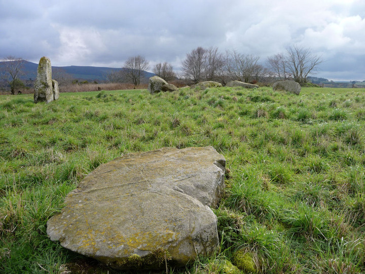
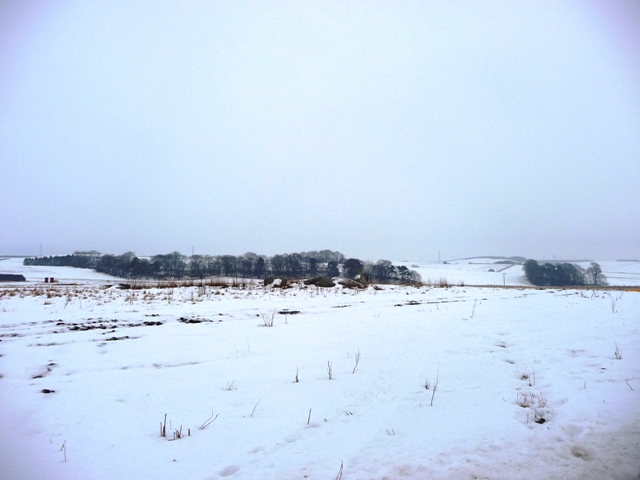
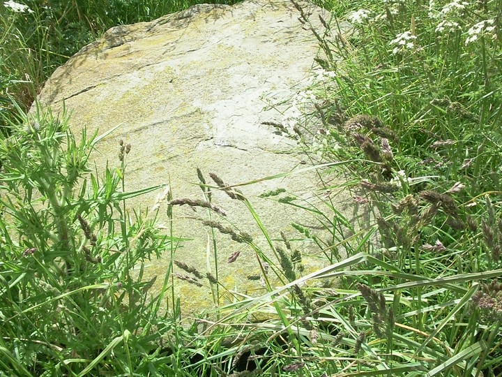
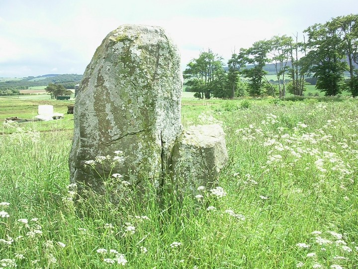
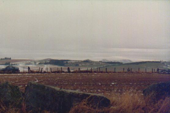
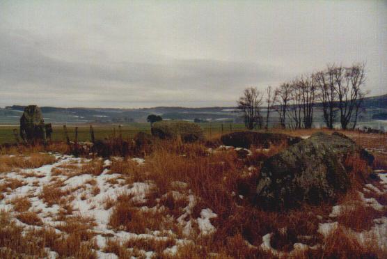
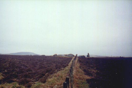
Since Greywether's visit in 05 several changes have happened. My first visit included walking past a pig farm with all kinds of....dodgy stuff to walk thru. The second time, the place had been churned up by tractors making the place a mud bath. However on this occasion the site was animal and mud free. Old Rayne is found by leaving the A96 at Pitmachie. Go past the hotel, sadly now closed, and leave the village at the Market Cross. The circle is less than a mile in a field to the left. One stone remains upright with the rest fallen. This circle is more commonly known as Candle Hill and this is a common feature in the area. RSC's at Ardoyne and near Insch are built on hills with the same name. Visited 21/06/09. |
22nd June 2009ce |
|
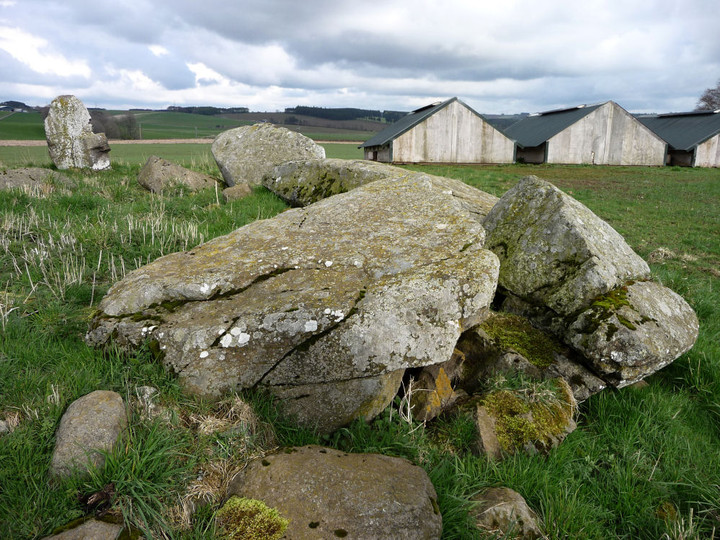
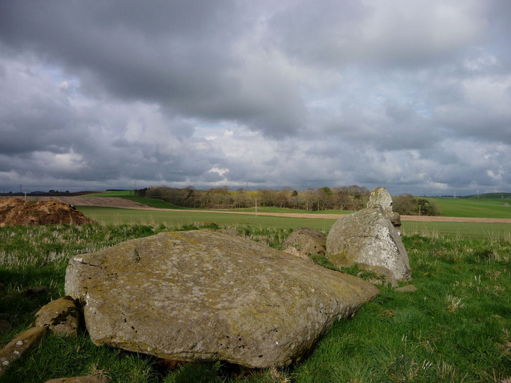
The field boundary and fence mentioned in previous posts have now gone - making it more difficult, presumably, to get access when the field is in crop. Visited 18 October 2005 |
 Posted by greywether
25th October 2005ce |
|
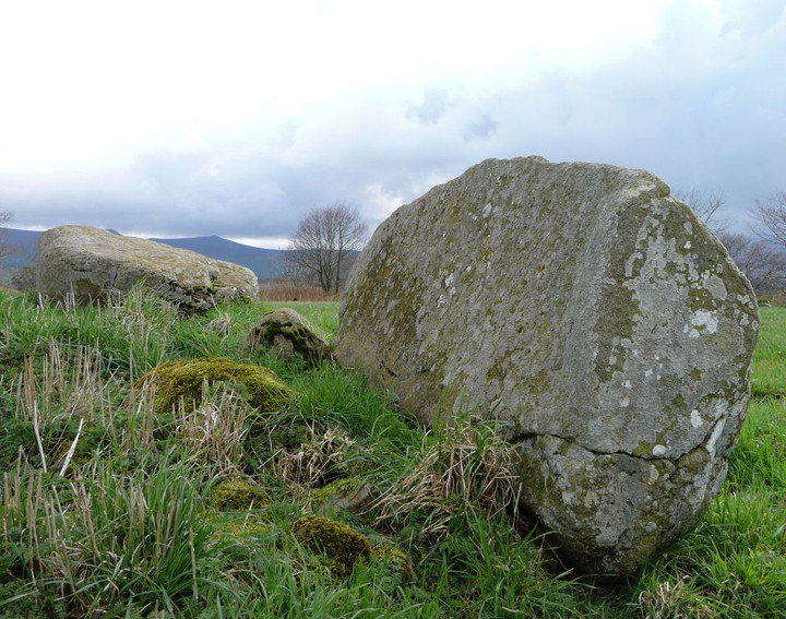
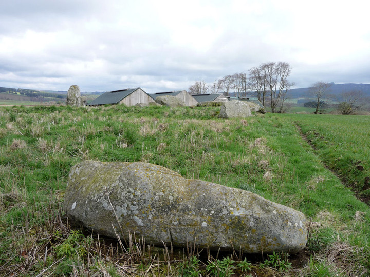
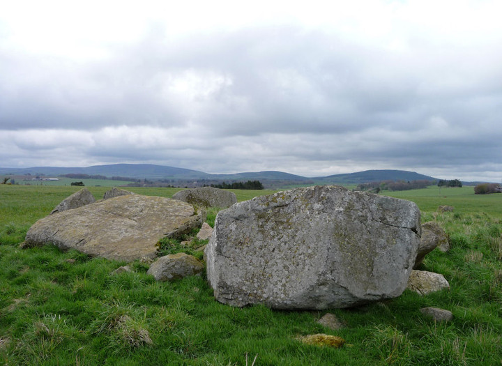
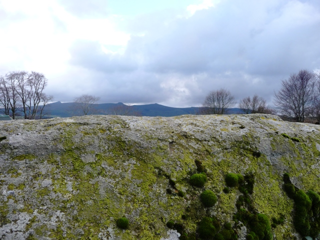
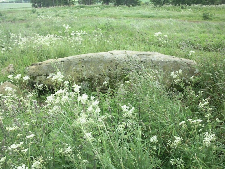
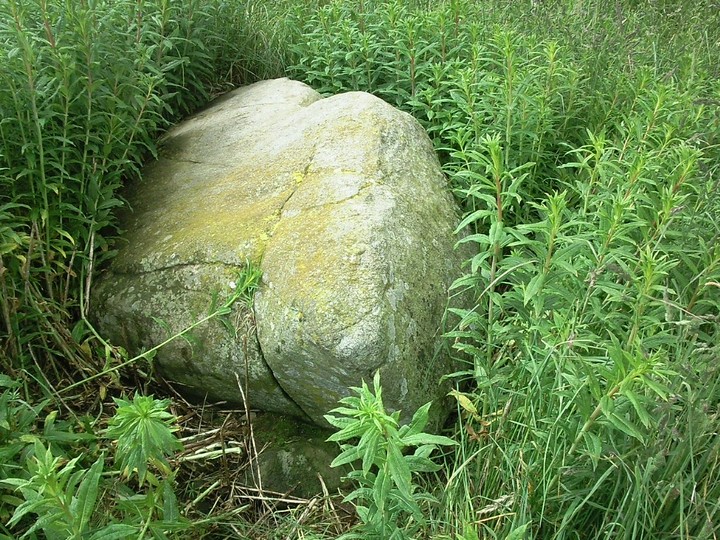
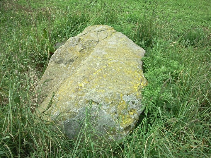
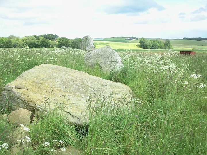
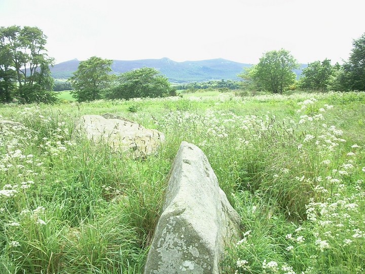
The Modern Antiquarian's mindbender map of the Aberdeenshire landscape (pages 100 & 101) marks Old Rayne as a 'destroyed' stone circle, but the OS map marks it as just 'Stone Circle' (without the '(rems of)' suffix they give destroyed ones). As we drove out from the village a single upright stone appeared in the raised field on our left. When we got to the fence the mighty but toppled stones became visible. There's a field boundary of wire fence running through the remains of the circle, separating the single remaining upright and one fallen stone from the rest. The OS map marks five dots, and these denote the stander, three fallen and a pile that includes the easily discernible recumbent and flankers, several small stones and a pile of stones that could be cairn remains or could be just farmers field clearance. The stones are pretty large, not quite as big as Loanhead, but perhaps a bit bigger than Sunhoney. The fallen recumbent sticks up at 40 degrees, making it seem absolutely huge. As you stand in the circle facing south, the left flanker's fallen to the left, the right has fallen inwards and broken in two, and the recumbent has fallen inwards too. The flankers are grey granite, but the flat topped and bottomed recumbent is brown. The recumbent faces a flat horizon of hilltops, and if your eye follows it to the east then it drops down to reveal Mither Tap behind. To the west the top of Dunnideer is clearly visible with another similar shaped peak to the left making as fine a pair of taps as can be. Modern Antiquarian says Tap O'Noth is visible from here, but it's not a clear day today and I don't think we can see that far. I think the other peak might be Hill of Christ's Kirk. Still, the fact that Tap O'Noth is generally visible from here means this site is phenomenally positioned on the landscape. The ground inside the circle slopes up to the recumbent, as at Balgorkar, but whether this is part of the original design, or the result of cairn building and/or field clearance is not obvious to me. Either way, the effect is dramatic, accentuating the belittling feeling of standing at the smallest stone (or rather the site of the smallest stone). The poking up of Mither Tap and Dunnideer to the same degree as each other coupled with the flat horizon at the south-west gives this RSC a feeling of perfection. (visited 1 July 00) |
Posted by Merrick 7th August 2000ce |
Miscellaneous |
|
|
To pad-out Rhiannon's post "A number of circles used formerly to be called "Law Stones," probably because law courts were accustomed to be held near them. The suggestion receives some support from the case of the Standingstones of Rayne, a circle at which, in 1349, a court was held to settle a dispute between the Bishop of Aberdeen and William of St Michael concerning the ownership of certain lands in the neighbourhood". Source Folklore of the Aberdeen Stone Circles and Standing Stones by James Ritchie Proceedings of The Society of Antiquities of Scotland. Vol LX.20 May 10 1926 |
 Posted by fitzcoraldo
15th October 2004ce |
|
Apparently the remains of this circle were used for the site of a court in 1349. The King's Justiciar was present to explain the seizure of some church property. How common was this, to use a stone circle? And was the site chosen just to rub the nose of the church in the situation? Has anyone more information? (Mentioned in Grinsell's 'Folklore of Prehistoric Sites in Britain') Canmore's record includes the following: "A recumbent stone circle, previously known as Tap o' Mast. Before Dalrymple's excavation moved them in 1856-7, there were twelve stones forming a circle nearly 60ft (18.3m) in diameter, with the recumbent, its two pillars, and a fourth slab arranged to form two sides of a parallelogram, whose other two sides had traditionally been dry stone walls. This arrangement may have been caused by the district Head Courts held here in medieval times. All that remained in 1902 were the prostrate recumbent stone, the two broken and displaced flankers, and six other blocks, only one of which was in situ." |
 Posted by Rhiannon
2nd June 2004ce Edited 1st July 2005ce |
Links |
|
RCAHMSWe found the cup marks. |
25th April 2012ce |
Extreme Stonefeelers' World of Hard Rock & Standing StonesPics of Old Rayne stone circle |
 Posted by new abbey
11th April 2010ce |