The Modern Antiquarian
Log in
|
Register
Home
Latest Posts
Forums
Maps
Help
Browse Sites
News
Blog
Contributors
The Books
Select
-
Belgium
Denmark
Eire
France
Germany
Greece
Italy
The Netherlands
Norway
Portugal
Republic of Malta
Spain
Sweden
Switzerland
United Kingdom
County Wicklow
Ballyduff
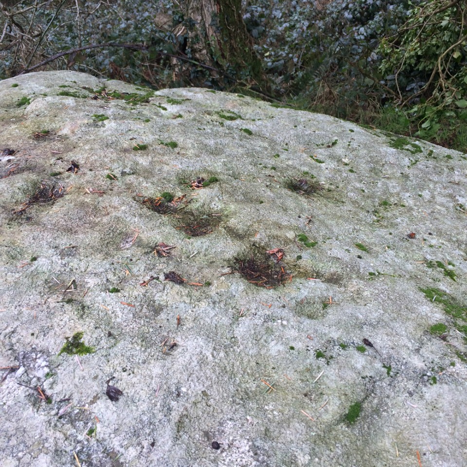
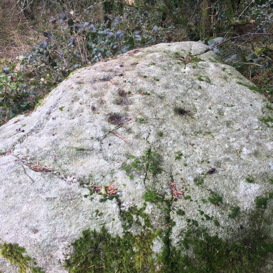
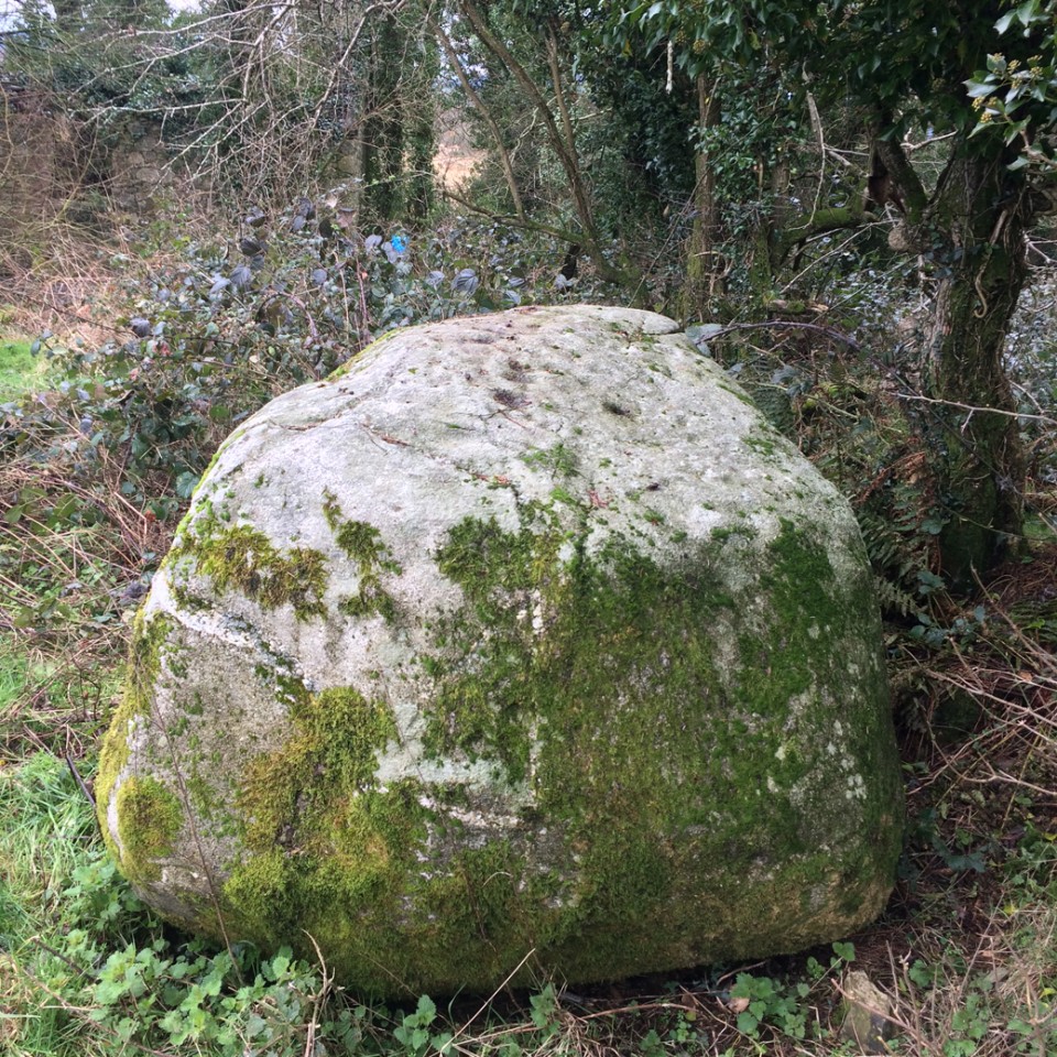
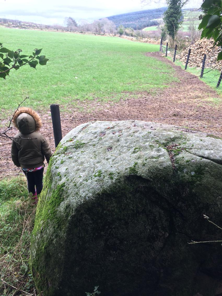
Cup Marked Stone
Ballyduff (Cup Marked Stone) on The Modern Antiquarian, the UK & Ireland's most popular megalithic community website. 5 images, plus information on many more ancient sites nearby and across the UK & Ireland.
Image © Ken Williams
Nearest Town:
Newtown Mt Kennedy (6km NNE)
OS Ref (IE):
O238012 /
Sheet: 56
Latitude:
53° 2' 49.74" N
Longitude:
6° 9' 13.45" W
Added by
ryaner
Images (5)
0 discussions
Start a topic
Show |
Hide
Web searches for Ballyduff
Flickr
Google
Google Images
The Megalithic Portal
Bing
Stone Pages
Wikipedia
Show map
(inline Google Map)
- Sites within 20 km -
-
Moorstown (Newcastle By.) (3.19km E) (2 posts)
Knocktemple II (3.57km W) (5 posts)
Knocktemple (3.65km W) (3 posts)
Roundwood (5.08km W) (4 posts)
Baltynanima (5.17km W) (2 posts)
Derrylossary Church (5.48km W) (8 posts)
Parkmore (5.71km SSW) (6 posts)
Parkmore Cairn (5.85km SSW) (5 posts)
Lickeen (6.57km SW) (3 posts)
Leabeg Lower (7.28km NE) (5 posts)
Sleanaglogh (7.42km SSW) (2 posts)
Trooperstown (8.11km SW) (3 posts)
Downshill (8.19km N) (3 posts)
Drummin I (8.23km WSW) (4 posts)
Drummin (8.24km WSW) (4 posts)
Trooperstown II (8.26km SW) (4 posts)
Drummin II (8.33km WSW) (0 posts)
Drummin III (8.4km WSW) (1 post)
Drummin IV (8.4km WSW) (2 posts)
The Witch's Stone (8.48km W) (5 posts)
Glasnamullen Holy Well (8.73km NW) (1 post)
Carrigeenduff (8.97km W) (2 posts)
Downs Hill (8.99km N) (0 posts)
Kilcoole (9.16km NE) (6 posts)
Cloghoge (9.3km W) (4 posts)
Carrigeenduff (9.34km W) (3 posts)
Ballard (9.56km WSW) (9 posts)
The Gossan Stones (9.57km WSW) (6 posts)
Downshill 2 (10.14km NE) (0 posts)
Kilmurry South (10.64km N) (2 posts)
The Coffin Stone (Djouce) (10.96km WNW) (0 posts)
Long Hill (11.34km NNW) (0 posts)
Ballyremon Commons (11.34km NNW) (4 posts)
Brockagh II (12.07km WSW) (8 posts)
St. Kevin's Cathedral (12.17km WSW) (3 posts)
Brockagh (12.2km WSW) (8 posts)
The Seven Fonts (12.2km WSW) (10 posts)
Glendasan River (12.23km WSW) (5 posts)
Sevenchurches (12.23km WSW) (5 posts)
St. Kevin's Kitchen (12.27km WSW) (2 posts)
Glencap Commons Upper (12.28km N) (8 posts)
Sevenchurches or Camaderry (12.29km WSW) (2 posts)
Glendalough Cottage (12.29km WSW) (4 posts)
The Deer Stone (12.3km WSW) (5 posts)
Glendalough (12.3km WSW) (0 posts)
Kilmacanoge South (12.8km N) (3 posts)
Rocky Valley (13.19km NNW) (0 posts)
Kilbeg (13.58km W) (14 posts)
Stone II (14km WSW) (1 post)
St. Kevin's Bed (Glendalough) (14.23km WSW) (1 post)
Onagh (14.56km NW) (8 posts)
Stone I (14.63km WSW) (1 post)
Giltspur (14.84km N) (7 posts)
Springfarm (14.93km SSE) (1 post)
Springfarm 2 (15.2km SSE) (5 posts)
Cullen Upper (15.36km SE) (4 posts)
Springfarm 3 (15.5km SSE) (2 posts)
Kilcroney (15.88km N) (1 post)
Daw (16.07km WNW) (0 posts)
Enniskerry (16.4km NNW) (0 posts)
Parknasilogue (16.55km NNW) (7 posts)
Castletimon (16.78km SE) (5 posts)
Castletimon (16.92km SE) (4 posts)
Kingston (16.93km SSW) (3 posts)
Brittas (17.15km SE) (4 posts)
Raven's Rock (17.33km NW) (3 posts)
Annacrivey (17.43km NW) (8 posts)
Fananierin (18.07km SW) (5 posts)
The Motte Stone (18.15km S) (3 posts)
Prince William's Seat (18.22km NW) (4 posts)
Ballinagee (18.37km W) (1 post)
Carrickgollogan (18.57km N) (7 posts)
Bahana (Whaley) (18.67km SSW) (4 posts)
Meetings (18.79km SSW) (4 posts)
Knocknagun (18.83km NW) (6 posts)
Barnaslingan (19.17km NNW) (0 posts)
Shankhill (19.37km N) (0 posts)
Ballybetagh (19.39km NNW) (6 posts)
Glencullen (19.61km NNW) (12 posts)
- Add -
-
Add news
Add an image
Add fieldnotes
Add folklore
Add miscellaneous
Add a link
-
Add a site
Add a nearby facility
Add an alternative name/spelling
Images
(click to view fullsize)
Add an image
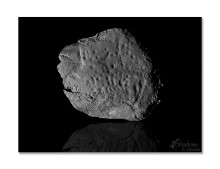 Image © Ken Williams