|
|

|
|
Prail CastlePromontory Fort
|
||||||||||||||||||||||||
|
|
|
Images (click to view fullsize) |
|
|
Fieldnotes |
|
|
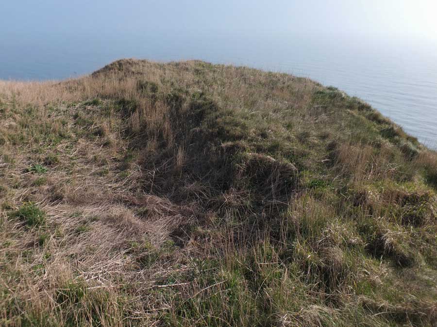
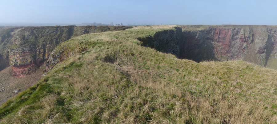
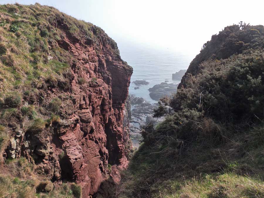
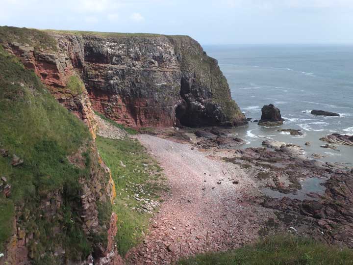
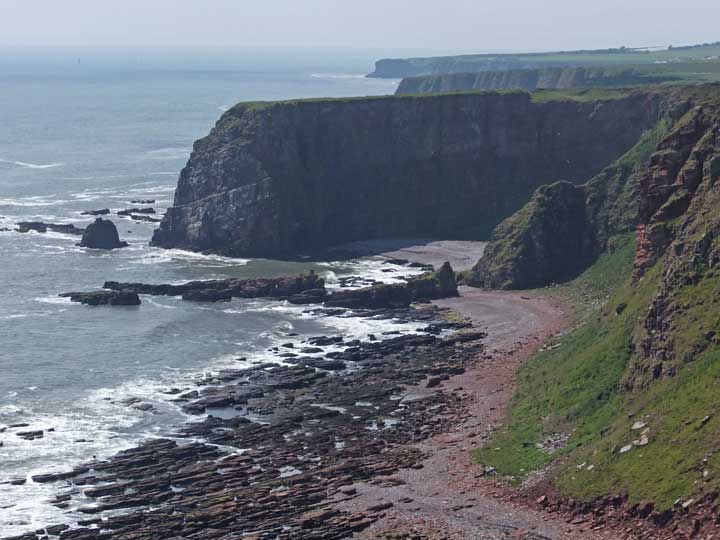
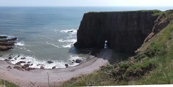
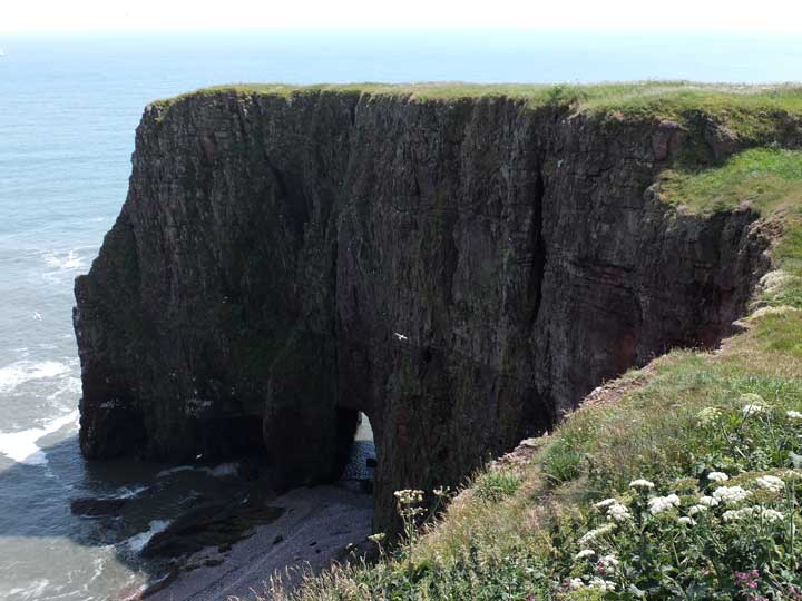
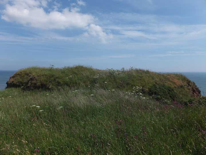
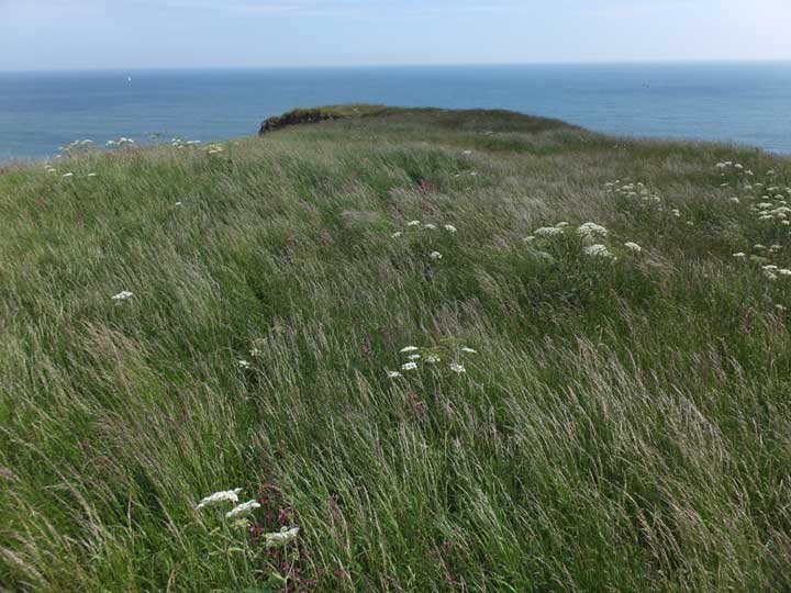
Visited: March 14, 2016 This, my second visit to Prail Castle, proved to be a much more pleasant experience. Again starting from Rumness Point, I found the walking pleasant in the spring sunshine. The adjacent fields were free from crops and the field margin was a pleasant grassy stroll. I reached my goal in well under an hour. With vegetation on the promontory of Prail Castle now short, it was clear what a superb stronghold it once must have been. After crossing the initial rampart, the grassy promontory stretched for some hundred metres, to a point where it narrowed to a width of just seven or eight metres. This is well shown on the Google map below. On both sides of the promontory, near-vertical cliffs stretch for a hundred metres, securing the site from all directions save the west. Beyond this point, the terrain rises slightly to a final platform with a pronounced hollow on its north side, the remains of a wartime Home Guard post. Looking back towards the east, the full extent of this promontory is revealed as it curves round to meet the main line of cliffs. You can read more about Prail castle at Canmore |
 Posted by LesHamilton
15th March 2016ce Edited 11th March 2023ce |
|
Visited: July 2, 2015 One of the six iron-age forts that bedeck the Angus coastline, Prail Castle sits on a long promontory located about 3½ kilometres walk south from Lunan Bay, and not far from West Mains farm. There is an interesting aerial photograph of it on the Canmore website. I chose to approach Prail Castle from Rumness Point (i.e. from the south) which, in retrospect was probably a mistake. Although the distance was only about 1½ kilometres, it took me all of two hours to attain my goal. There was no path, vegetation was rank, and the neighbouring field of mature oilseed rape was impenetrable. The easiest option was to stick close to the well-built sandstone drystane dyke that marches round the cliff edge. Not knowing quite what to look for, I ended up at Red Head, a kilometre north of Prail Castle. You might think that a promontory all of 150 metres in length jutting out to sea would be hard to miss. But it isn't. For most of the approach walk, thick gorse obscures a direct view of much of the coastal scenery and, at the point where I came level with Prail Castle, a grass-covered defensive rampart completely obscured the promontory from sight. So I simply pressed on. Finally, as I started to return from Red Head, all was revealed. Views from the north were expansive and Prail Castle became an easy target. According to Canmore, 'the ditch, rampart and the foundation of the tower and other buildings are visible'. Not, alas, in July with knee-high vegetation clothing the site. A visit early in the year would surely prove more revealing. |
Posted by LesHamilton 3rd July 2015ce Edited 8th April 2018ce |