|
|

|
|
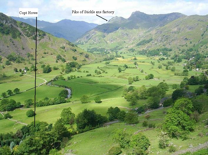
Copt HoweCup and Ring Marks / Rock Art
|
|
|
|
News |
|
Concerns Over Climbing on Rock CarvingsFrom an article by David Prudames, published on www.24hourmuseum.org.uk on 21st September 2004: Experts have voiced their concerns about the future of prehistoric rock carvings on a boulder being used by climbers in the north of England... continues... |
 Posted by Kammer
22nd September 2004ce Edited 22nd September 2004ce |
Images (click to view fullsize) |
|
Photographs:


 Maps / Plans / Diagrams:
 Artistic / Interpretive:
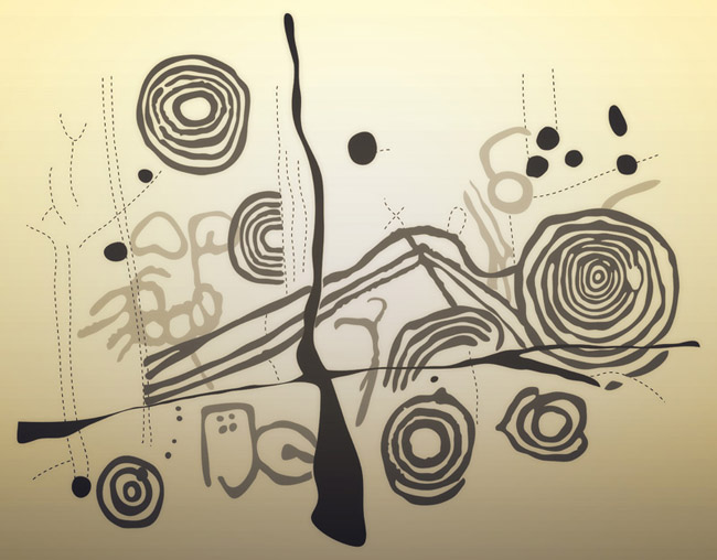

|
Fieldnotes |
|
|
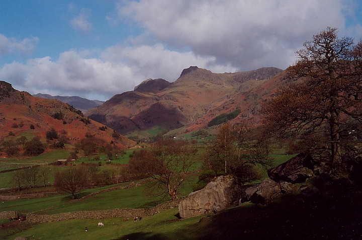
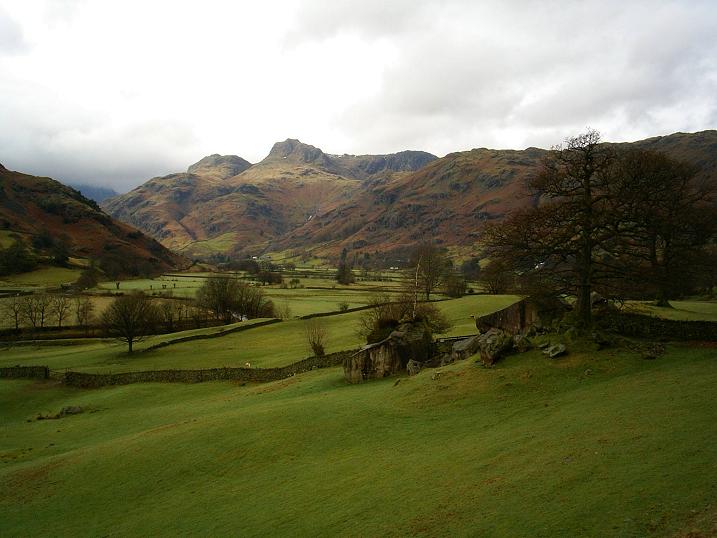
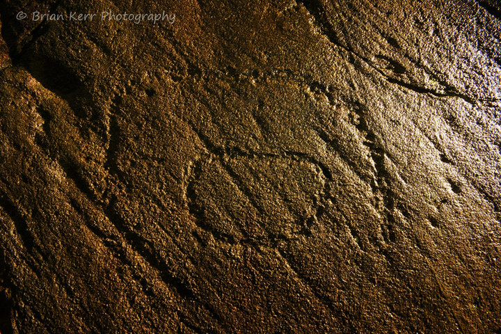
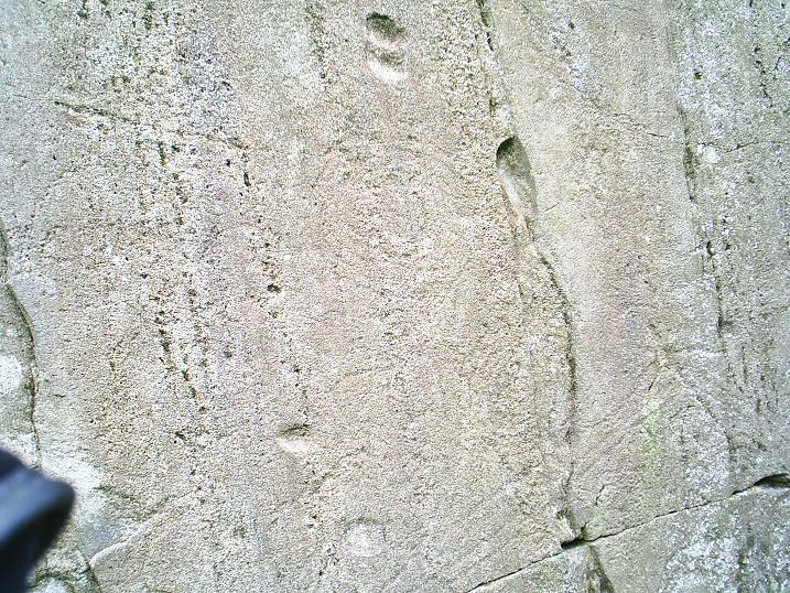
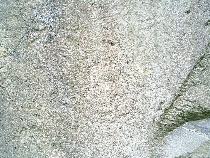
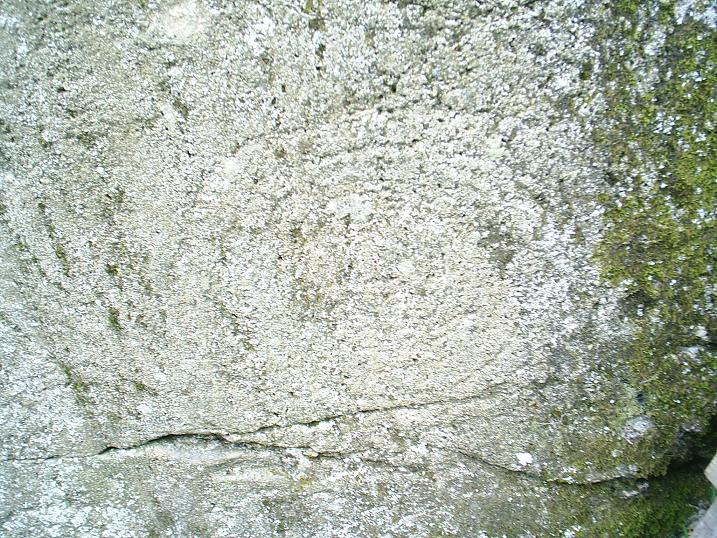
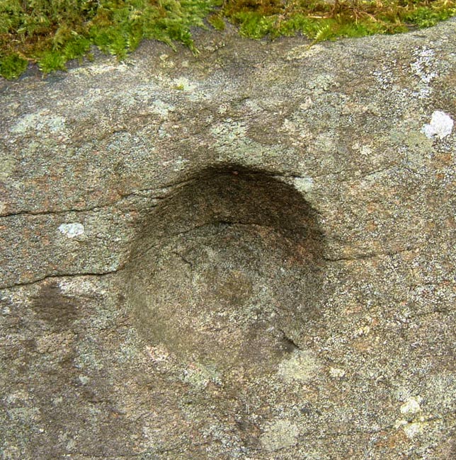
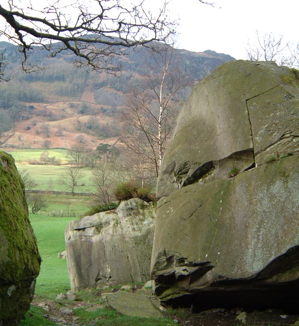
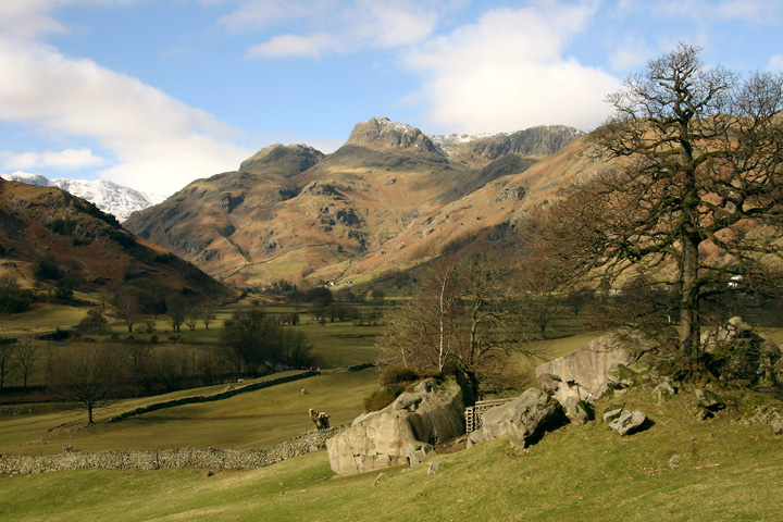
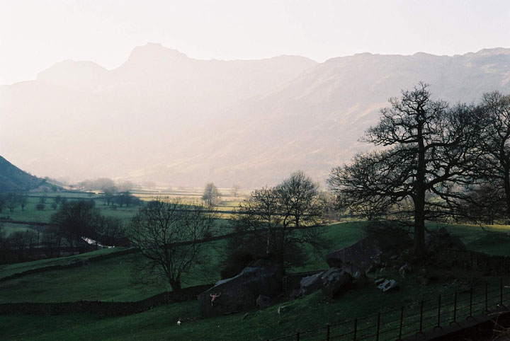
We got there about four in the afternoon on the day of the Autumnal equinox, it was a Sunday. There was already half a dozen cars parked in the vicinity but there was room for one more at the end, I squeezed it in effortlessly, as I'm a professional driver. Despite the number of cars parked on the side of the road there was only a young couple there, so we gave them some time to themselves and consumed out butties and pop. Yum. They were gone soon enough so Eric set about exploring the boulders, not that one I told him, that ones off limits, then I sat in front of the rock art after perusing the information board and tried hard to see everything that was on the picture. The triangle or love heart of pecked bumps was impossible to see until right up next to it, the longer I sat there staring the more I could see. Over the now very rickety and slightly dangerous stile I found more. Concentric circles surrounding a natural ? depression, two cartouche type shapes and two weird cup marks with bumps in the middle, that's not the technical term but I lack the vocabulary. I wonder why it is all done with the big axe factory mountain out of view. I also wonder why it's only on one boulder, perhaps it lends credence to the map theory. But I still don't buy it, why would you need a map, surely anyone here would know where they are going, and if they don't then they've got no business being here. Not anyone could go up there and knock out their own axes could they ? But one thing is for sure and completely undeniable, this is a sublime position for anything, rock art a stone circle a single standing stone, heck I'd come here if there was nowt at all. The grass is greener, the sky bluer, the clouds fluffier and the mountains, well, they are the best in England, rockier, higher and more inviting than anywhere else. Come now before they get too eroded for surely one day they will be no more than big grassy hills. |
 Posted by postman
25th September 2013ce Edited 25th September 2013ce |
|
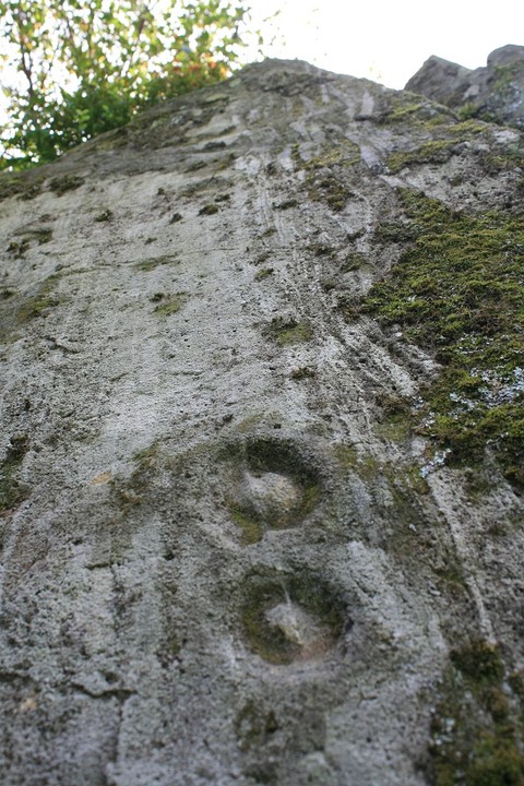
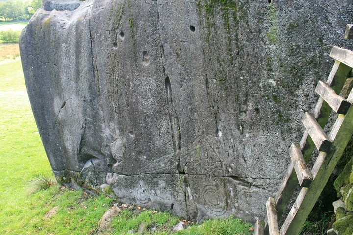
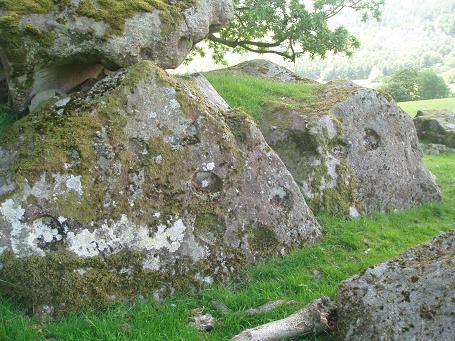
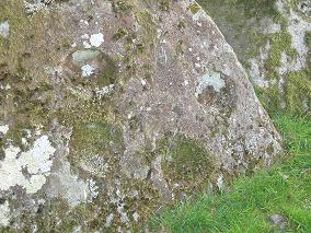
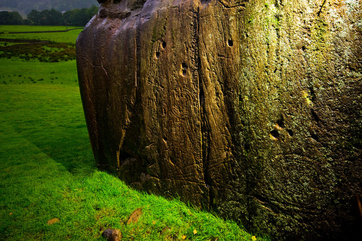
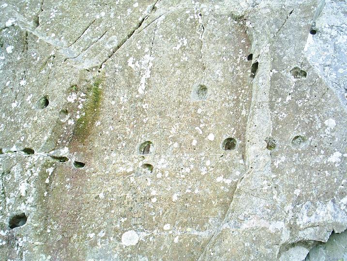
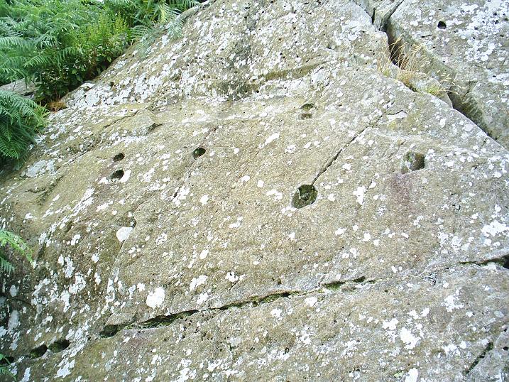
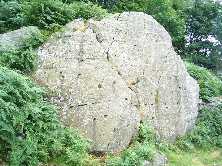
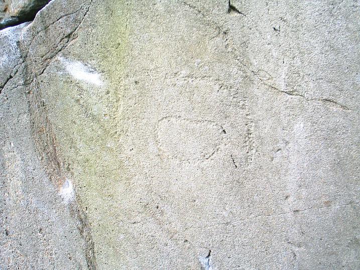
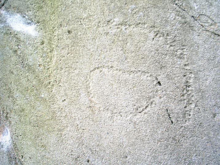
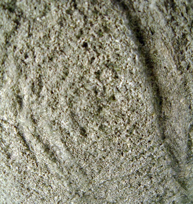
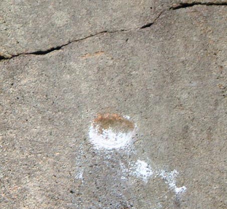
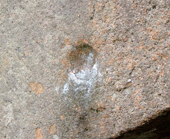
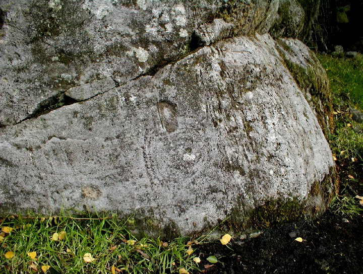
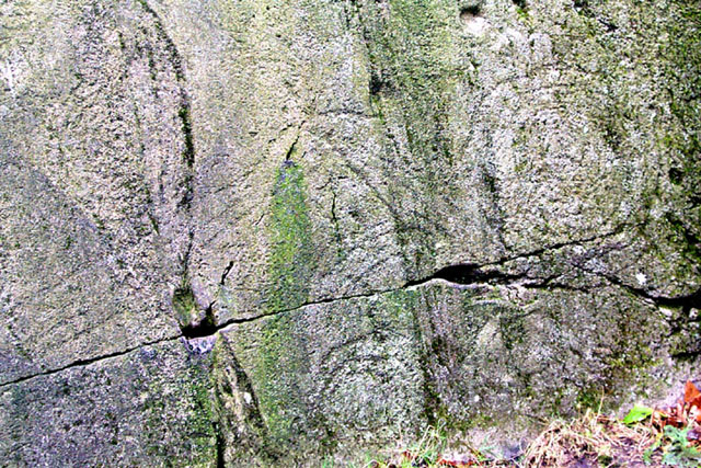
Been past these rocks all my life, but the rock art stuff was only discovered fairly recently. It's all pecked stuff, and harder to see close up. Low, slanting sunlight shows it up best, when shadows are cast. Unfortunately, I've never had a camera with me then. The photos I've posted were taken at 9:00am on 10th June 2005, when the sun was too high to provide decent shadow. Alright, it's my fault for having a bit too much vino collapso the night before, preventing me from getting up early enough. As for the cup marks, I'm certain they're natural - gas bubbles when the rock formed. My reason for saying this? The rocks all over the fellsides around here exhibit the same characteristics. On the same day I found the same "cup marks" on the fellside directly above Copt Howe on many rocks, on the Blea Tarn road, on Silver How, Blea Rigg, Pavey Ark, Harrison Stickle, and back near the Old Dungeon Ghyll. Also, I know these features are common on Pike o' Blisco. |
 Posted by The Eternal
11th June 2005ce Edited 26th June 2005ce |
|
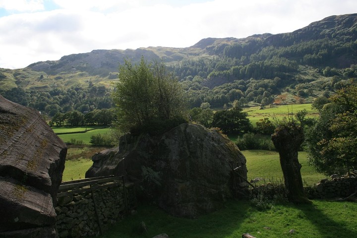
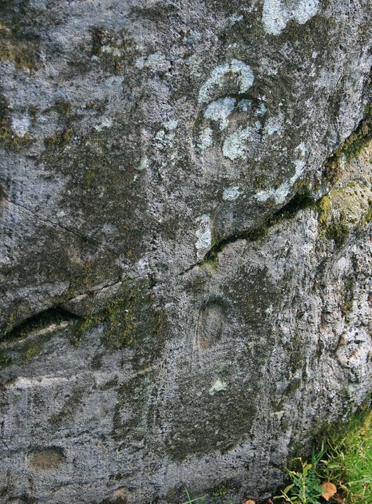
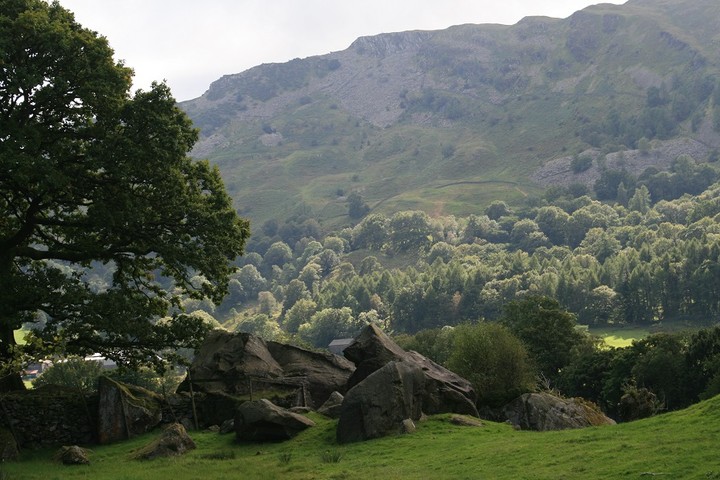
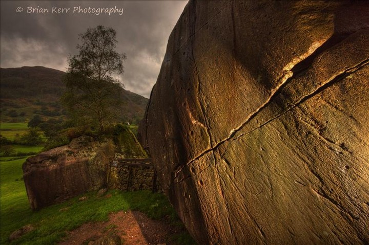
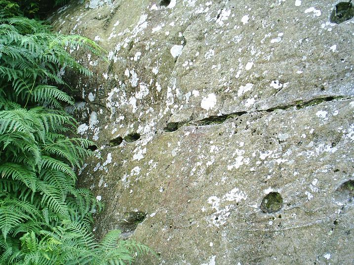
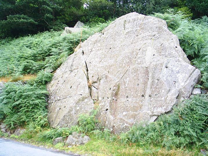
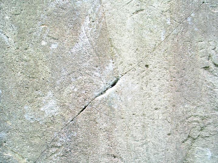
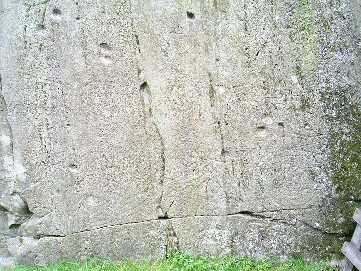
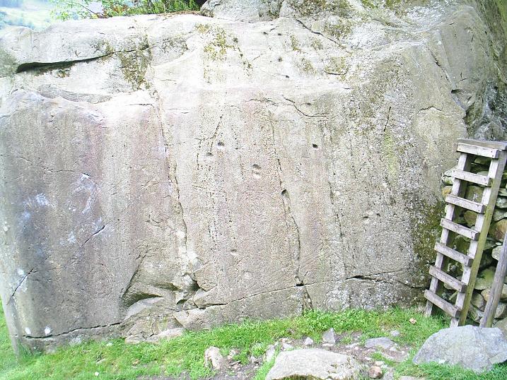
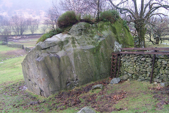
Caught a glimpse of the boulders on the way to the Old Dungeon Ghyll. I made small 'eek'ing noises in anticipation. Then stopped off on the way back, having realised that there is just enough space for a vehicle or two, directly opposite the boulders, but it's standard Lake District 'narrow roads with fast cars', so beware. The boulders themselves are very nice. The view up to Pike o'Stickle stunning in morning sunlight. It was quite slippy underfoot, and there hadn't been rain for a couple of days, so if it's wet, again, beware. There are other cupmarks in the vicinity, but apparently the jury is still out regarding whether they are natural 'vesicles' or artificial carvings. Being me, I suspect the latter, I didn't notice 'vesicles' elsewhere, only in the vicinity of Chapel Stile. The carvings were quite visible, though being on volcanic stone, they are fainter than is usually the case with motifs on sandstone. But at the same time, they are not so eroded, so the peckmarks are discernable. What was depressing though, was that there are still people climbing over the carved face. The issue of climbing caused a minor stir, which the British Mountineering Council claimed was needless, as guidebooks would be altered, and a voluntary, self imposed ban would be enforced by climbers. Whilst this may well be the case with most climbers, the Fell and Rock Climbing Club of the Lake district for exmple, flag up the existance of the carvings, and point out that English Heritage ask that climbers refrain from climbing in the areas containing the markings. But the message isn't getting through to all, or so it would seem. 'Route 9', the bouldering route over the face with the main carvings, is still being used, and the evidence of this is there for all to see in the form of chalk residue, used to assist climbers in attempting this 'problem' (as it is known in climbing circles). Furthermore, close examination of the surface of the boulders shows that the cupmarks have been eroded over the years, but only on the lower lip, where one would place one's feet if one were climbing up that face of the boulder. Now this may have taken ages to happen, but the cumulative effect is there, and it won't get any the less with the increase in bouldering as a sport. Particularly as the Langdale Boulders are regarded as some of the best bouldering problems in the UK. It's unfortunate that this coincides with some of the best prehistoric rock art in the UK, surely there must be some way that both can co-exist without damage to this unique site. I hope so. This is special rock art. Axe factory rock art. There's not much of that about is there? |
 Posted by Hob
5th April 2005ce |
|
We hit this site this morning. The weather was beautiful, the Pikes had a bit of light cloud around them but apart from that the sky was empty. and the views up and down the valley were breathtaking. We had the site to ourselves, so the lads went off to explore the fields and I got down on my hunkers and got to grips with the carvings. I've found this is the only way to suss out what's really there. It's like braille for the seeing - if you know what I mean. The motif on the block to the east, which is mentioned in Stan Beckensalls "Prehistoric Rock Art in Cumbria" showed up quite well in the morning sunshine. I'm afraid I couldn't relate the carvings to the map theory, I can be a bit slow at times so maybe I need someone to talk me through it - any offers?. As we left the site we discovered a large barn owl which was sat motionless on a branch just staring at us at the same time a buzzard flew over us and lazily made it's way down the valley towards the Pikes. All in all a crackin' site, lovely rock art |
 Posted by fitzcoraldo
15th September 2003ce Edited 15th September 2003ce |
|
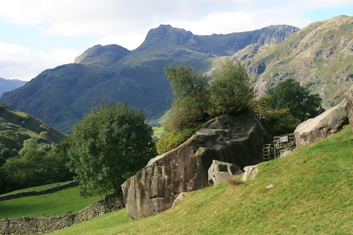
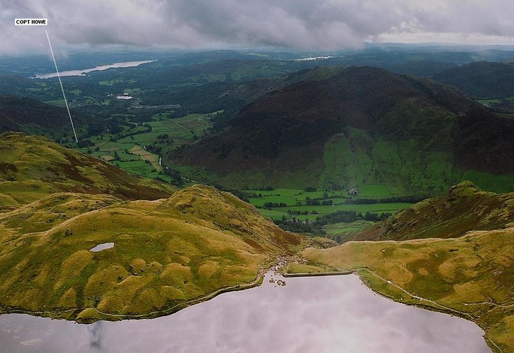
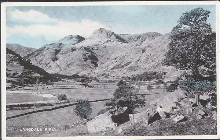
I reckon this must be the most perfectly sited work of rock art in England....the view along the valley to the Langdale Pikes is outrageous. After I thought I saw a map on The Badger Stone on Ilkley Moor I was well primed to see Ironmans map laid out on the boulder at Copt Howe.....it stands up to it well enough.....although the people I went up there with worked out another map using the heavily pecked area as the scree slopes on the Pike o' Sickle.....it has to be said the rest of the map was rather sketchy compared to Ironmans. A wonderful place............ |
27th August 2003ce Edited 27th August 2003ce |
|
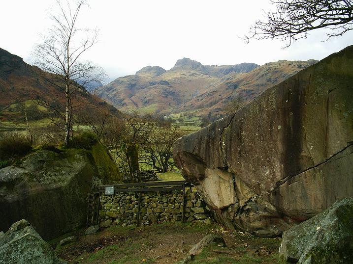
I would suggest a different parking spot to Ironman. When I got to the site there were already a few cars parked opposite the gate and talking to a climber later he said that space could often be packed during busy times. About 300-400 metres further northwest along the road there is room for several cars next to a track and footpath that lead south to Great Langdale Beck, from here it’s an easy walk back up the road to the gate. Once I’d actually got to the huge boulder I was a little disappointed that the carvings weren’t more clear, it was about 5.30pm so the sun was behind the flat east facing side with the carvings and there was no shadow to add definition to the marks. With a plan of the site it is possible to trace the position of the rings, grooves and cups and the layout slowly unfolds before your eyes, Ironman’s map theory seems particularly appealing - this valley would have made an easy route for the movement of axes. While chatting to the climber he said he was aware of the carvings but didn’t know much about them, when I showed him the plan he proved remarkably adept at finding the various parts of the carvings – better than I was. For anybody planning a visit, morning up until midday might be the best time to see the carvings, but the site is in a beautiful location and would be worth a visit at any time of the day. |
 Posted by Chris Collyer
21st August 2003ce |
|
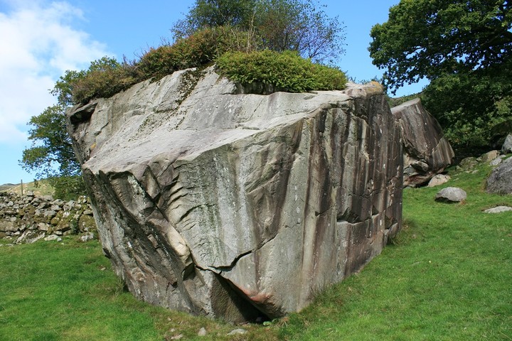
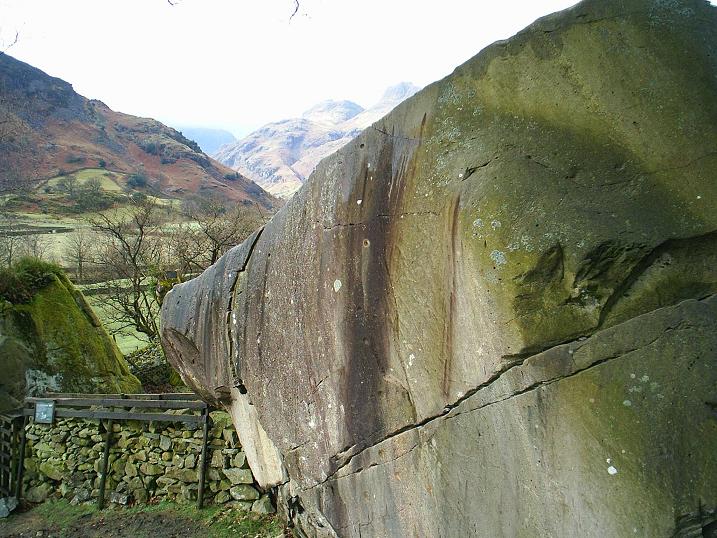
The carved boulder at Copt Howe lies just outside Chapel Stile, on the road from Ambleside to Dungeon Ghyll. Approach slowly when leaving the village, a clearing with boulders and ferns lies to the right hand side of the road - continue down until the road runs between two walls. You will see a small lay-by, room for one car only, on the opposite side of the road is a gate. Look over the gate and if you're at the right place you'll see a drystone wall intersecting two huge boulders. The far boulder is carved. This is a beautiful site. The carvings are into hard rock and are very gentle. I had been to Rombald's Moor on the previous day, with its weather worn deep recesses, Copt Howe's carving are much gentler and therefore much more elusive. In places the lines disappear and merge with the natural features. The suggestion that these carvings could in fact be a map holds ground here (see my annotated image). A couple of climbers were bouldering on the adjacent large boulder and chatted with me about the shitty weather. This is a very peaceful contemplative place, and is well worth the visit if en route to the far end of Langdale valley, site of the axe factory. |
 Posted by IronMan
18th February 2002ce Edited 19th December 2002ce |
Miscellaneous |
|
|
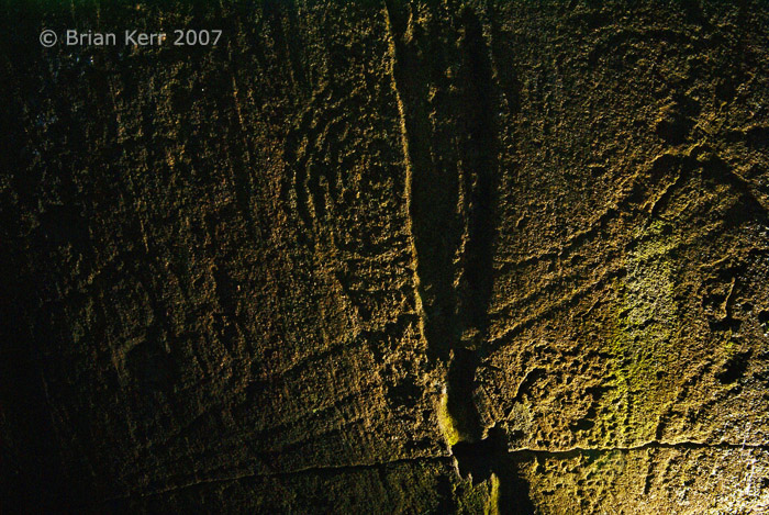
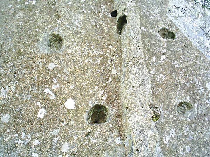
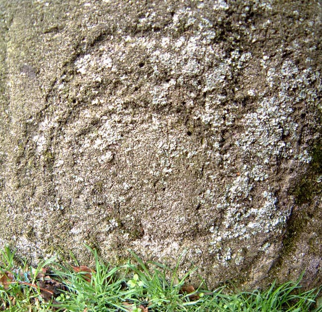
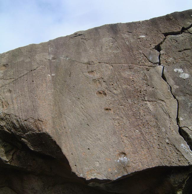
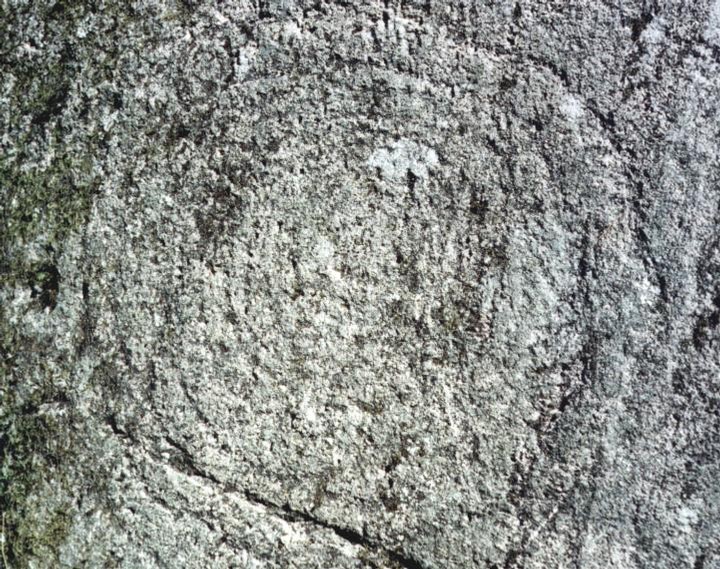
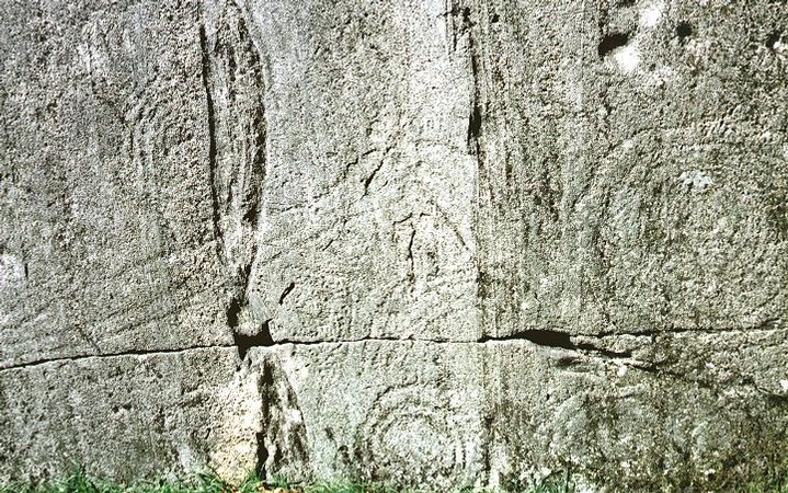
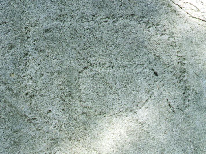
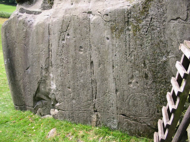
According to the SMR, there are two boulders here with rock art on them: The monument includes what are known in rock climbing circles as The Langdale Boulders, two prehistoric rock art sites in Great Langdale 250m south of Harry Place. It consists of two very large boulders of Andesitic tuff a few metres apart upon which a series of prehistoric rock carvings have been made. The boulders were in their present position when carved upon. The western of the two boulders, Boulder A, contains the most extensive carvings of the two rocks. These are found on the vertical east face of the rock and include a central unmarked `boss' and multiple concentric circles, one having up to eleven rings. A linear feature in the shape of a chevron appears to be linked to the unmarked `boss' by triple grooves which appear to have been carved upwards. Many other unusual motifs are present on the rock face. Other features include numerous `cup' marks - ie small circular hollows in the rock. Whilst some of these `cup' marks are undoubtably man made and are surrounded by rings, others appear to have been formed by the natural erosion of mineral deposits within the rock. However, many of these natural `cups' have been utilised to form part of the overall pattern and design of the rock carving. The linear and `boss' carvings on Boulder A have comparisons with carvings elsewhere, notably one found at The Glassonby cairn circle in eastern Cumbria, and Temple Wood in Argyll. The eastern boulder, Boulder B, has been partially quarried and appears to have only one carving of two uncompleted rings, together with many natural `cups' on the vertical southern face. |
 Posted by baza
19th September 2003ce |
| A map of the Mickleden end of the Langdale Valley showing the axe factory, which can be compared with Chris Collyer's diagram of the carvings. |
Posted by IronMan 22nd August 2003ce |