|
|

|
|
HirdrefaigStanding Stone / Menhir
|
||||||||||||||||||||||||
|
|
|
Images (click to view fullsize) |
|


|
Fieldnotes |
|
|
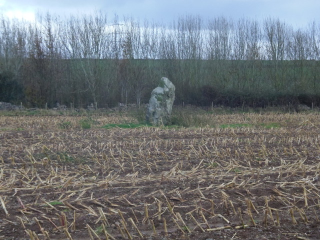
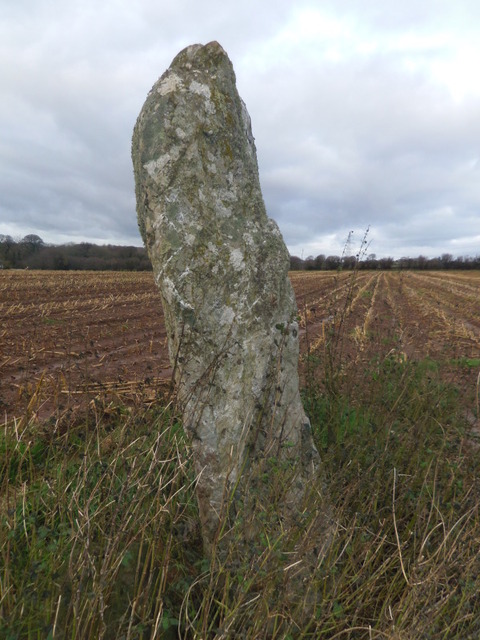
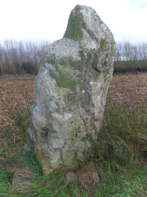
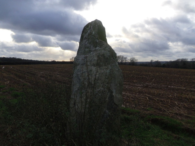
I'd come here in the summer with my daughter after visiting several other stones on the island. We parked up at the gate and as we did someone else was pulling in. The driver asked what I was doing so I explained and asked permission. He looked at my OS map and pointed to a field and said it would be ok to have a look. It was the wrong field! After walking around for ages we decided that we were in the wrong place. We felt like trespassers especially as there were CCTV camera notices everywhere. We saw some more folk walking their dogs who knew the stone and took us to the right field. They pointed to where it was but we couldn't see it because the field was full of really tall corn. We did try to find it but by this time we were hot and bothered so gave up, vowing to come back in the winter. So it's winter now and as I couldn't go with Postie and TheSweetcheat up Moel Siabod because of a nasty cold I decided to try again. Pulling in through the main gate go down the drive passing a gate house on the left. There is a very short gravel track on the left, just after the house, leading to the field where the stone is. There is room to park here. The stone can be seen straight away across the field from the gate (as long as there is no corn). It's about 7 feet tall, chunky and gnarled. There is a chunk missing from the top and the owner, Mr Postnet, has observed that the sun rises and sets in line with it at the equinoxes. This stone is mentioned in "the standing stones of north-western Wales" by Michael Senior Coflien suggest that this may be a gateway marker but both Cadw and GAT believe it to be a bronze age standing stone. |
 Posted by blossom
12th December 2011ce Edited 12th December 2011ce |
Miscellaneous |
|
|
I couldn't get the link to work for archwilio (Gwynedd archaeological trust website) So I have added what they say here: Description : Recorded 6" OS. Maen Hir, 500 SE Hirdrefaig 8 1/4' high x 4' x 1 3/4', with packing stones at base. As described by RCAHM. Published survey 25" correct. Somewhat blocky slab with a pronounced lean to W. Local igneous stone with quartz veins. Packing stones on W side. Stands on a rounded E-W ridge - ridge obscures view to EW somewhat. Visible for some distance on both sides of the ridge - most on N & NW where it is on skyline for some places. The monument comprises a large standing stone that probably dates to the Bronze Age (c.2300 - 800 BC). It is located within an enclosed field of improved pasture on an E-W aligned ridge. The standing stone measures 2.5m tall, 1.4m wide and 0.5m in depth. It is aligned N-S and has a weathered surface. The stone leans to the W. There are packing stones visible on the W side. The stone is made of a local igneous rock and is notable for its quartz veins. A standing stone of probable Bronze Age date. The stone is 2.5m tall, 1.4m wide and 0.5m deep. It is aligned north-south and has a weathered surface and rectangular profile with parallel sides that rise to a bluntly rounded point. Sources : Prehistoric Funerary and Ritual Monument Survey: West Gwynedd & Anglesey , Smith, G. , 2003 , SH47SE , Ordnance Survey , 1963 , Inventory of the Ancient Monuments of Anglesey , Royal Commission on Ancient and Historic Monuments , 1937 , SH47SE 12 , Ordnance Survey , 1970 , Prehistoric Anglesey , Lynch, F. , 1970 , Hirdre-Faig Standing Stone , Cadw , 2006 , Hirdre-Faig Standing Stone , Berry, J. , 2006 , Gwalchmai Booster to Bodffordd Link Water Main and Llangefni to Penmynydd Replacement , Evans, R. T. J. , 2008 , Events : 40758 : Gwalchmai Booster to Bodffordd Link Water Main and Llangefni to Penmynydd Replacement (year : 2008) 40526 : Prehistoric Funerary and Ritual Monument Survey: West Gwynedd/Anglesey (year : 2003) |
Posted by blossom 12th December 2011ce |