Quite an obscure one this, although paradoxically sited in a very popular tourist area.... I've driven past a number of times without a clue. But then, what's new?
The National Trust - via the ADS - have this to say about this scheduled monument:
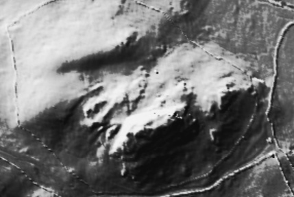
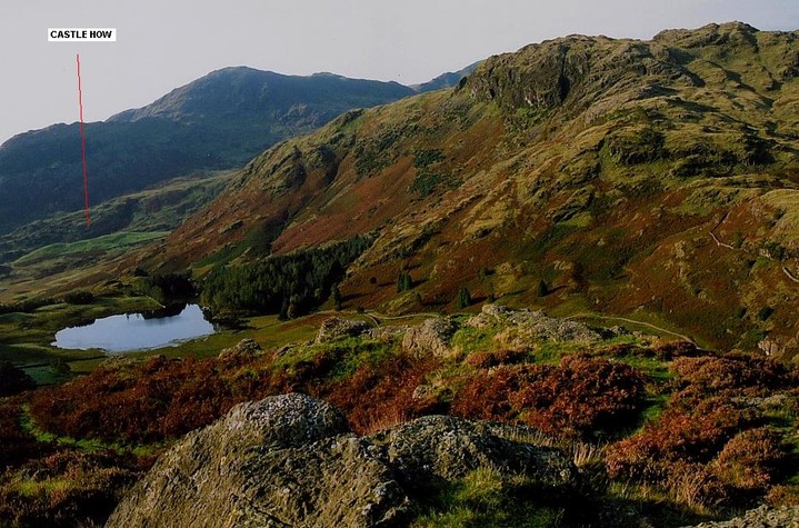
'...located on Castle Howe, an area of high ground springing abruptly from Little Langdale valley, with a rocky knoll forming the highest point. The ground falls precipitously from this knoll in all directions and access to the summit can only be gained by a steep 6m scramble up the western face. On the northern and southern sides of the knoll, just below the summit, there are rectangular levelled areas, the former measuring approximately 6m by 3m, the latter measuring approximately 8m by 5m which are interpreted as artificial hut platforms. At the base of the knoll's western face is the first of a series of four rock cut ditches dug across a spur of relatively level high ground extending towards the west; it measures approximately 4m wide by 1.3m deep. This second ditch measures approximately 5m wide by 1m deep and terminates at its northern end in a sub-rectangular rock-cut levelled area terminates at its northern end in a in a sub-rectangular rock cut levelled area measuring approximately 17m by 13m. At the northern end of this levelled area is a rock cut circular area measuring approximately 4m in diameter which is interpreted as a hut circle. A short distance to the east is a second, slightly smaller, similar feature . The third ditch measures 3m-9m wide by 1.3m deep and also terminates at it's northern end in a rectangular rock-cut levelled area measuring approximately 7m by 5m. The outer ditch on the knoll's western side measures 7m wide By 1.5m deep. At the base of the knoll's eastern face are two rock-cut ditches; the inner measures 19m wide by 0.8m deep, the outer measuring 8m wide by 1m deep. The Southern end of both these ditches connects with a rock-cut levelled area of 10 sq m. The site lies at the eastern end of Wrynose Pass. It overlooks the Roman road from Ambleside to Ravenglass and a medieval moot, or meeting place at Fell Foot.'

 Posted by GLADMAN