|
|

|
|
Old Ditch LongbarrowLong Barrow
|
||||||||||||||||||||||||
|
|
|
Images (click to view fullsize) |
|
|
Fieldnotes |
|
|
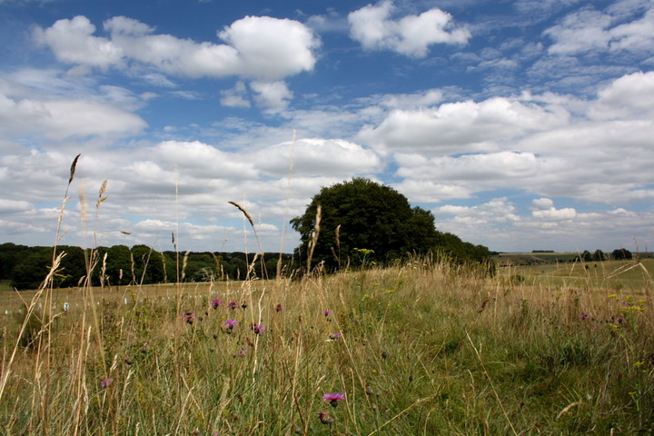
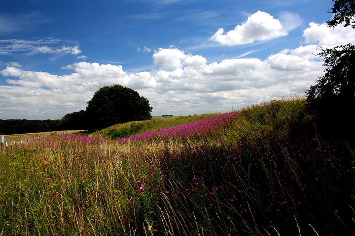
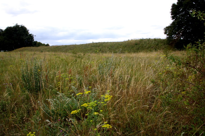
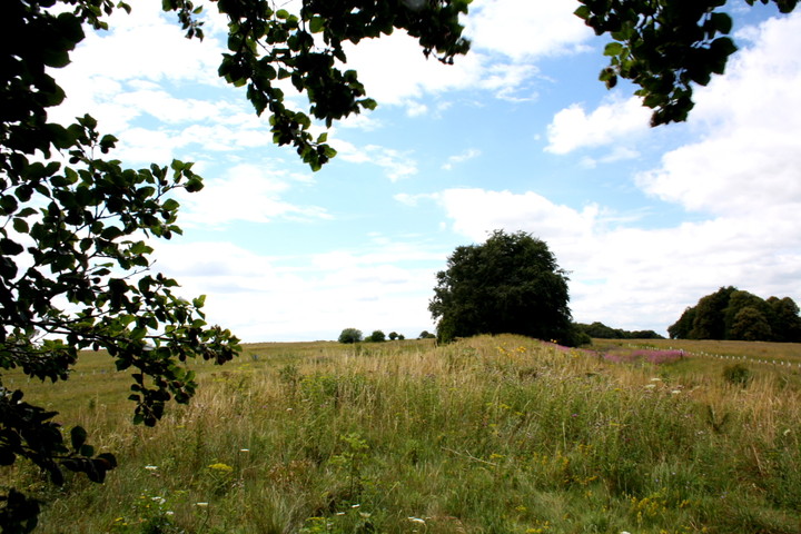
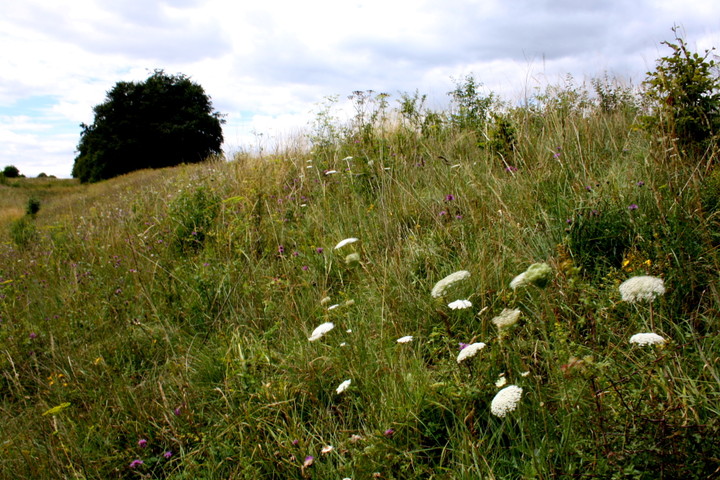
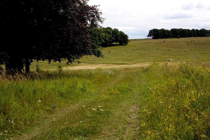
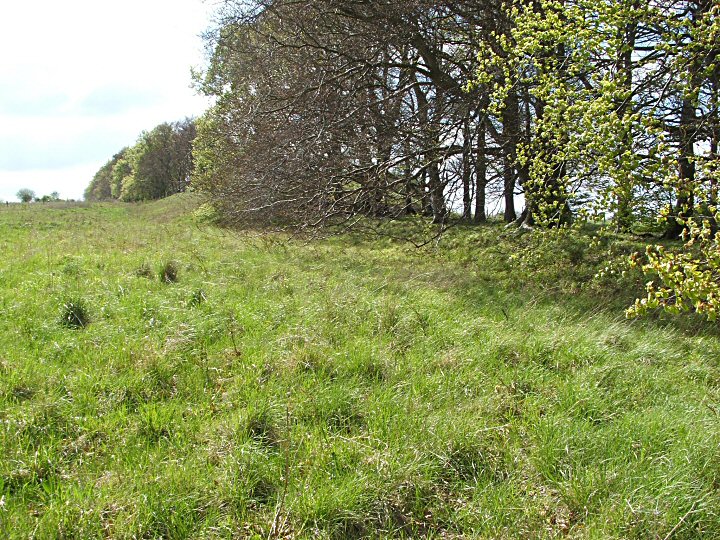
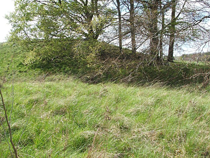
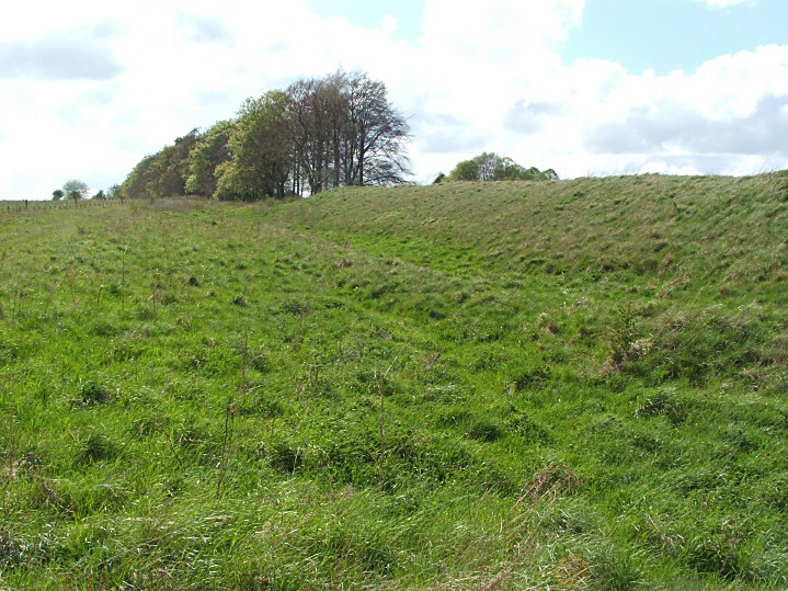
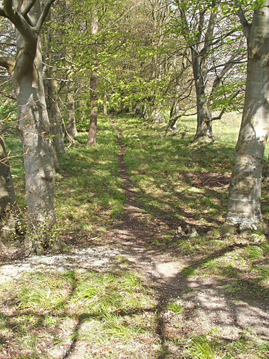
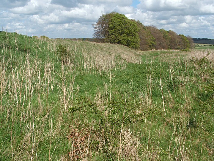
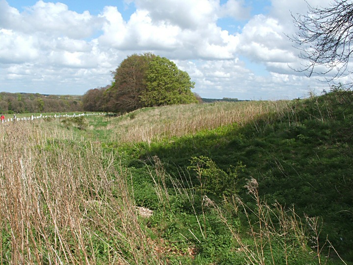
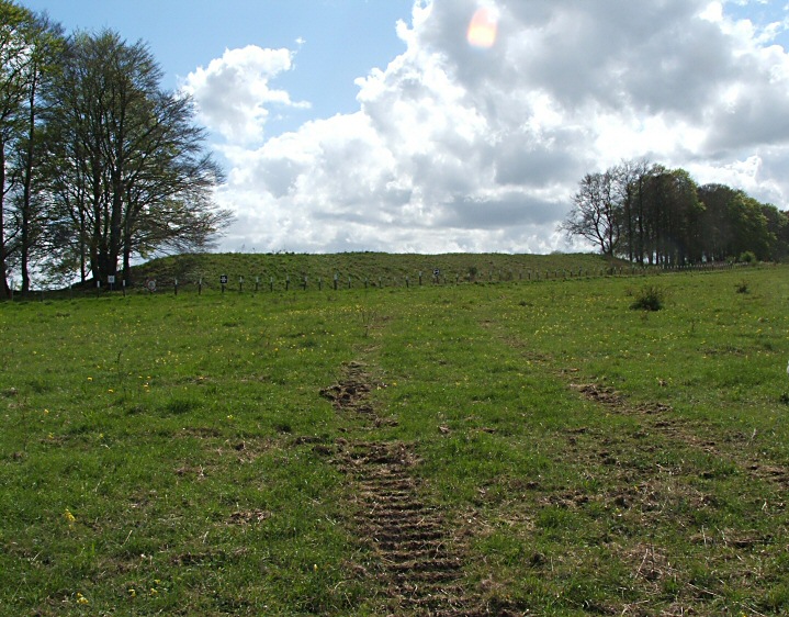
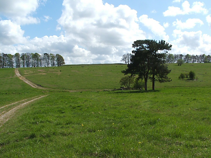
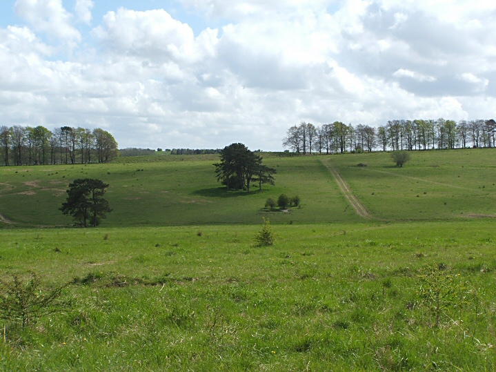
Jimit tells it like it is... this most certainly is 'an extraordinarily large and fine barrow', tucked away near the arguably much better known White Barrow. Except it's not... tucked away, that is... being clearly visible, silhouetted upon a ridge between two tree-lines, when viewed near the prominent water tower. Guess you just need to know what you are looking at, I suppose. And no doubt Neolithic people approaching the site from this direction appreciated the built-in drama of the journey. Now you see it.... now you don't. Ah, there it is. Wow! Theatrics, certainly, but there can not have been any inherent triviality here. Nothing, however, prepares me for the sheer size - both the length and height - of this fabulous monument upon arrival at close quarters. Just how it managed to survive in such an intact state with tanks previously running amok over it (as cited by Dyer) I've no idea, but it goes without saying I'm more than happy to accept such anomolies when they occur. Suffice to say soldiers have certainly been here, unless yer average Neolithic farmer used 0.303 rifle cartridges.... What's more, the barrow is flanked by pretty substantial quarry ditches along both flanks, albeit overflowing with the flowers and weeds of high summer, these somewhat disguising both form and depth. Come to think of it, aren't wild flowers and weeds one and the same? Nevertheless I'll refrain from a eulogy to the weed, however, in case some people get the wrong idea. Not my scene, that. Old Ditch Longbarrow and the neighbouring White Barrow, clearly visible to approx SE, most certainly are my scene, though. Perimeter signs warn visitors not to dig in the environs (I'm assuming rabbits can't read, then?) - or drive their tank if they happen to possess one. I'm happy to abide by both requests, but nonetheless 'dig' Old Ditch in my own way. |
 Posted by GLADMAN
27th July 2010ce Edited 29th July 2010ce |
|
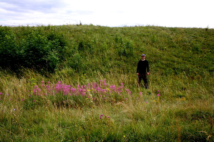
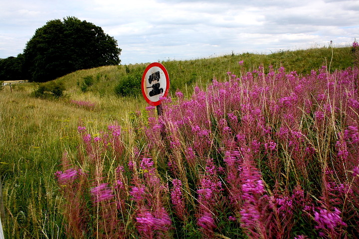
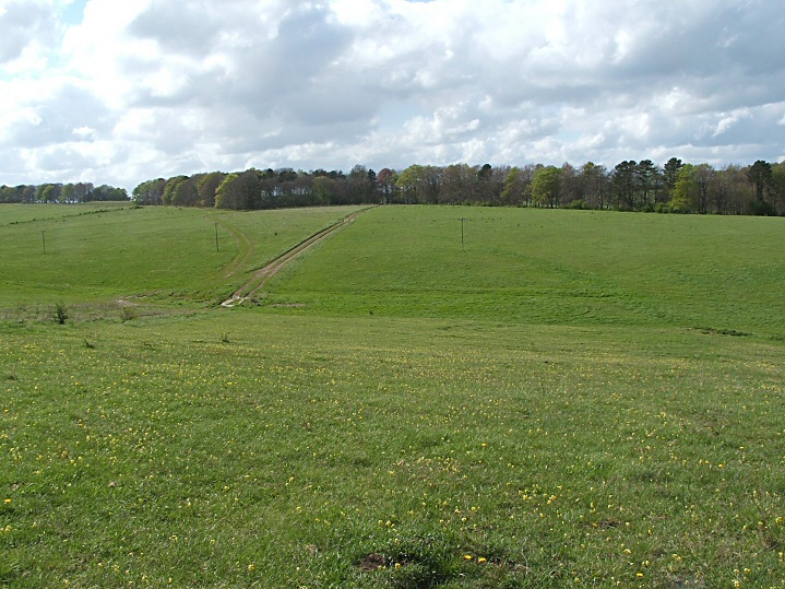
An extraordinarily large and fine barrow which seems to have survived the ravages of time (and the MOD) rather well. A great whaleback prominent on the horizon and framed by lines of trees. The crest is straight and unblemished and the large flanking ditches are equally well preserved. Roy Canham (The ex County Archaeologist of Wilts) suggested the name as the later IA boundary bank and ditches are named as such on early maps. He also mentioned that a limited Victorian excavation at the NE end found a charcoal layer which could suggest a previous wooden mortuary enclosure perhaps similar to Fussell's Lodge. The SW/NE tending IA bank and ditch does a dogleg around the NE end and the continuation NE is easily visible in the avenue of trees (less well defined SW). It is then ploughed out but is visible as cropmarks as it approaches White Barrow where it is better preserved. The somewhat park-like setting is due to the fact that this was part of the estate of Tilshead Lodge, a minor stately home, demolished in the 1950s. Access Park opposite the prominent redbrick water tower on the Tilshead to Chitterne road. Warning Although this barrow is outside the restricted MOD area, there is still a lot of military activity in the area so it is wise to keep to the paths, be alert and don't pick up any large shiny objects you might find lying around! |
 Posted by jimit
27th April 2009ce |
Miscellaneous |
|
|
I have been reading David Field's wonderful book "Earthen long Barrows" recently, which has much to say about Old Ditch. This is one of a group of long mounds around the source of the river Till. Excavated by William Cunnington on one of his early digs in 1802, apparently by putting an unsympathetic trench longitudinally along the mound, ending 26m from the east end (I suppose the significance of the eastern end had not been discovered yet). A layer of decayed turf extended out from a central mound of it, leading him to make possibly the earliest suggestion of a pre-existing circular mound later replaced by the long 'un. Three skeletons laid out in an H shape on a pavement of flints at the west (?) end confused him as he had assumed a big barrow meant lots of dead folk, probably from a battle. But there was a large number of bird bones placed in there too More intriguing to me is the classic shallow pit covered by the mound, 90cm x 50cm and 75cm deep, "cut with such exactness in the solid marl as though it had been done by a chisel" according to Cunnington. Characteristically, there was nothing in there... Later, John Thurnam came by and thought it might be worth having a peek in the east end and found a cairn of flints covering another pavement of them, on which remains of one individual had evidently been cremated then covered up. How long between this cairn and the long mound is a mystery. There were later two Bronze Age cremations placed near the surface of the mound in a shallow cist. One was examined by Cunnington but the first had been scattered by the excavators before he could get to it. No respect. And apparently this is the only rectangular long barrow on Salisbury Plain. Years of maths classes have knocked any excitement that might hold out of me... |
 Posted by UncleRob
11th June 2009ce |