|
|

|
D26 DrouwenerveldHunebed
|
||||||||||||||||||
|
|
|
Images (click to view fullsize) |
|
Photographs: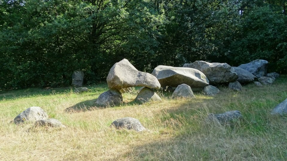
 Maps / Plans / Diagrams:
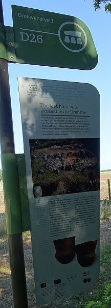
|
Fieldnotes |
|
|
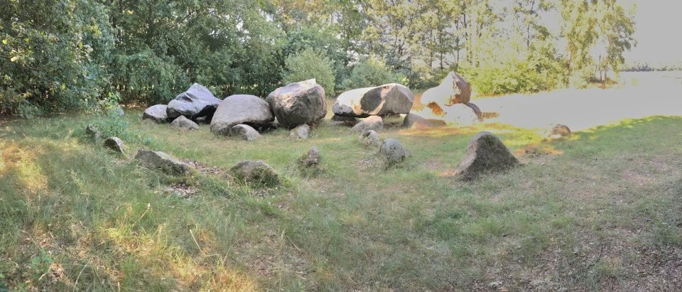
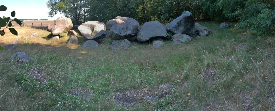
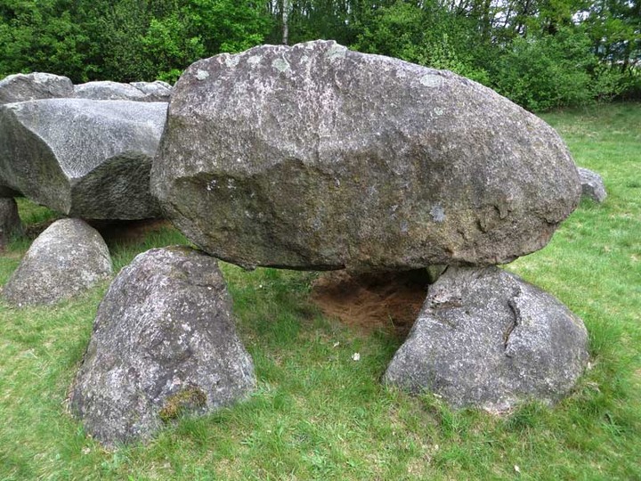
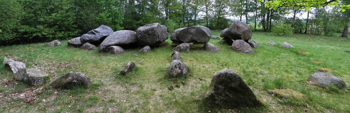
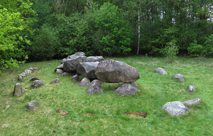
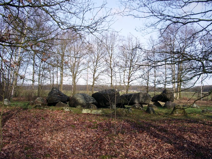
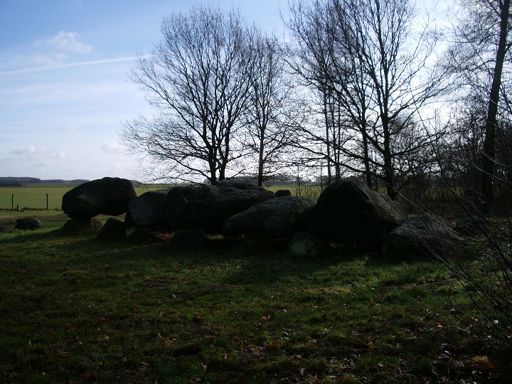
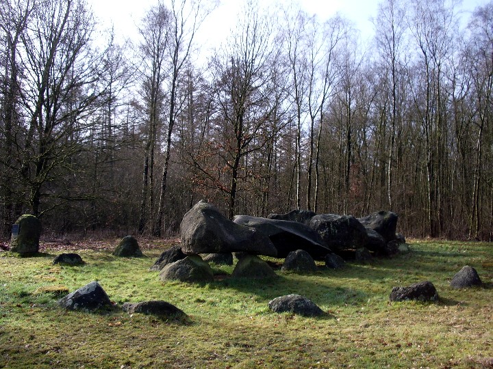
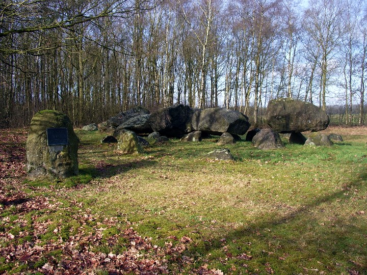
This Hunebed lies in a clearing in the northeast corner of a woodland southwest of Drouwen. East of the Hunebeds are large fields where rolled turf is cultivated. Unfortuantely during my visit a loud power generator was running, which upset the whole atmosphere. The Hunebed itself is really nice, but I must agree with Les Hamilton it is quite tricky to get good pictures, if you don't have a stick or something else to raise the camera position (which I don't have with me). There are five capstone, four entrance stone (no capstones here) and still 13 of original 27 kerbstones (there are markers for the missing kerbstone e.g. in the northwest section). It is possible to drive to the Hunebed with your car, the last 300m you have to walk. Refer to the yellow line in the satellite image in Les Hamilton's fieldnotes. Visited July 2018 |
29th July 2018ce Edited 29th July 2018ce |
|
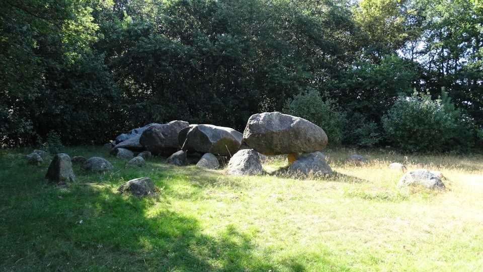
Visited May 19, 2013 Hunebed D26 Drouwenerveld is one of the more interesting of the Dutch Hunebeds, but a photograph taken from above is needed to show it at its very best. This passage grave is well preserved, with twin rows of 6 sidestones and 5 of its capstones still in place: its entrance passage is marked by two pairs of sidestones but alas without capstones. The hunebed was originally surrounded by an oval of 27 kerbstones, and though only half remain today, the positions of the 'lost' (probably robbed) stones are indicated by concrete slabs. Starting point for a visit is the village of Drouwen. You can get there by car or bike, or by taking the No 59 bus from Emmen or Borger. The hunebed lies across the main N34 highway to the west of the village. Reaching the hunebed (by walking or cycling, though you can drive a car much of the way too) is not straightforward, as this region abounds with large fields growing high quality turf. The fields are surrounded by high fences and 'keep out' notices and cannot be crossed. There is no chance of a short-cut, so you have to weave a long circuitous route between and around them. Starting from the Markeweg bus stop in Drouwen, walk a few metres south to Steenhopenweg and turn right (west) into it. After about 350 metres, you will meet signs indicating hunebeds to the left and straight ahead. Almost immediately, a clearing on the left of the road reveals the twin hunebeds D19 Drouwen and D20 Drouwen (see map below). But to reach Drouwenerveld, continue straight ahead and through the underpass beneath the N34 for another 500 metres—then turn left (south) along Veldweg. Follow this dead straight road for just over a kilometre southwards, where it turns sharply right on to the tree-lined Lunsveenweg. Another 250 metres brings you to an area of woodland. Turn right here and follow the path north along the edge of the trees for 400 metres where you will find D26 Drouwenerveld sitting in a small clearing at the northeast corner of the woodland. The Drouwenerveld hunebed was thoroughly excavated in the late 1960s, and revealed a wealth of artifacts (mainly pottery, axe-heads and beads) dating from the Funnel Beaker Era, 5000 years ago. These are on display in the Hunebed Centre at the nearby town of Borger. Note: to return from visiting the Hunebed, it is advisable to retrace your inward route. There are a number of farm tracks leading off Veldweg that appear to offer short-cuts: they don't. All terminate short of the N34 and do not lead to either a bridge or an underpass to traverse this extremely busy arterial highway. Reference: Dolmens in the Netherlands by Hans Meijer. Reference: More on D26 including a short video The link below from Nucleus fails because of a missing hyphen in its URL. This is the corrected link. |
 Posted by LesHamilton
22nd May 2013ce Edited 11th March 2023ce |
Links |
|
D26 Drouwenerveld - De hunebedden in Drenthe en Groningenwith 3d model, short video (in Dutch), pictures and further information |
25th July 2018ce |